

While San Diego County has a plethora of great hiking trails, it does not have a lot of great climbing routes. Sure, there’s some decent routes out in the desert, but realistically, no one wants to be out in the Anza Borrego desert in the dead of summer. In no particular order, some of the better places to climb in the county are on the boulders at Woodson Mountain; the summit slabs at Stonewall Peak; the final approach on Mt. Lawson; and the routes at Mission Trails Regional Park.
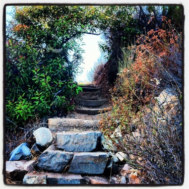
Steps, Climbers Loop Trail
While none of these routes are going to confuse anyone with say, Half Dome, El Capitan, or any other big wall on the planet, they’re great areas for learning and practicing your climbing skills that aren’t in a controlled environment (otherwise known as climbing gyms). All of these areas have great hikes leading to the climbing areas, but this hike is the shortest and steepest of the bunch.
Directions: The best way to access this trail is to park at the Mission Trails Regional Park Visitor Center, which is located in the main portion of the park off of Mission Gorge Road. Even though Cowles Mountain is not located in this part of the park, parking remains at a premium on the weekends by the Visitor Center, due to the popularity of the area, and its proximity to a number of trailheads. While there is some parking along Father Junipero Serra Trail, the road that runs through Mission Trails, these spots are usually taken as well by mid-day.
From the Visitor Center parking area, you will want to head down Father Junipero Serra for .40 miles. During this short distance, I would suggest that you take the opportunity to enjoy the paved, flat surface and stretch out any kinks you have in your legs, as the actual trail has few flat sections, and is most definitely not paved! At .40 miles, you will see the trailhead on the right (south) side of the road, along with a kiosk detailing the steep terrain on the trail, and various climbing routes present on the Western face of Kwaay Paay Peak. From this point, the trail ascends steeply for .34 miles. How steep is it? Well, it ascends 406 feet over that distance, so while it isn’t the steepest terrain imaginable, it’s not a walk in the park either. Once you have ascended the 406 feet, you will have great views of Mission Trails, Mission Gorge, and the climbing routes.

Climbing Routes, west Kwaay Paay Peak
Based on my experience, if you are climbing any of the routes on the western face – Middle Earth, Limbo, or the main wall, you will definitely be warmed up and ready to go by the time you reach the “top”. If you’re not climbing, continue on along the mostly flat section of trail leading past the climbing areas, before descending down another steep section of trail. If you are solely hiking this area, the total distance for this hike is 2.2 miles roundtrip (.4 from the parking area to the trailhead, 1.2 miles on the actual trail, and .6 from the far trailhead back to the parking area).
Tips: I personally like to run this trail on weekdays. The steep terrain is very challenging, and gives you a great workout. Unlike Cowles Mountain, it is also not as busyduring the week. Do note, however, that the trail is very steep, and what I would consider “single track” in many areas. Keep an eye out for other hikers, as well as climbers carrying gear so you do not potentially run into them. Aside from that, the routes on the western face of Kwaay Paay Peak are not that technical, so they are a great area to learn how to climb if you do not; and many companies provide lessons on a weekly basis at this location. Even if you do not wish to climb, this is a hike with some great views of the surrounding terrain, and if you’re curious about climbing, good views of climbers doing what they do: climbing.