
Along with Cowles Mountain, and innumerable other locations in San Diego County, Viejas Mountain is an interesting peak with cultural significance for the Kumeyaay people. Prior to the arrival of Europeans, the Kumeyaay people would climb the mountain to watch the sunrise on the winter solstice. Today, like Cowles Mountain, Viejas Mountain is on the list of San Diego’s “100 Peaks” - the one hundred tallest mountains that grace the confines of the county. However, unlike Cowles Mountain, Viejas Mountain features a leg-burning ascent up a steep slope, and for large parts of the year, a great deal of hiking solitude to go with the suffering.
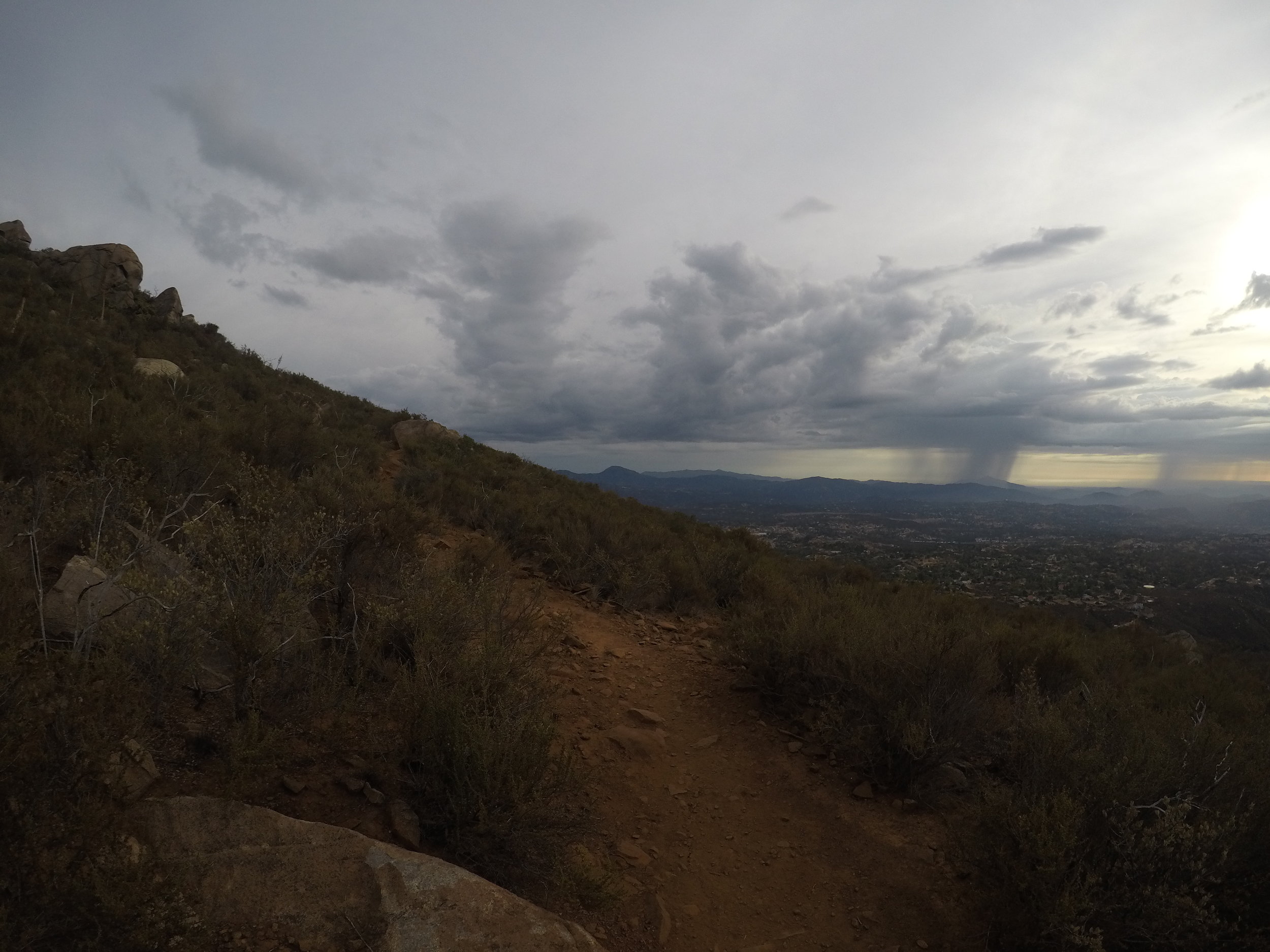
From the first steps, the trail ascends up toward the summit of Viejas Mountain.
Directions: Like many locations on the 100 Peaks list for San Diego County, the journey to the trailhead is half the fun. While Alpine is not a far distance from downtown San Diego, the location still requires most people to drive some twenty minutes or more on Interstate 8 east. Once in Alpine, hikers will want to exit Tavern Road, and head North (left). Tavern Road merges right onto Victoria Park Terrace, and passes some of the earlier homes constructed in Alpine. One will want follow Victoria Park Terrace for a mile before making a left turn onto West Victoria Drive. This turn is readily apparent as it is a T-junction that borders on the Alpine Cemetery.

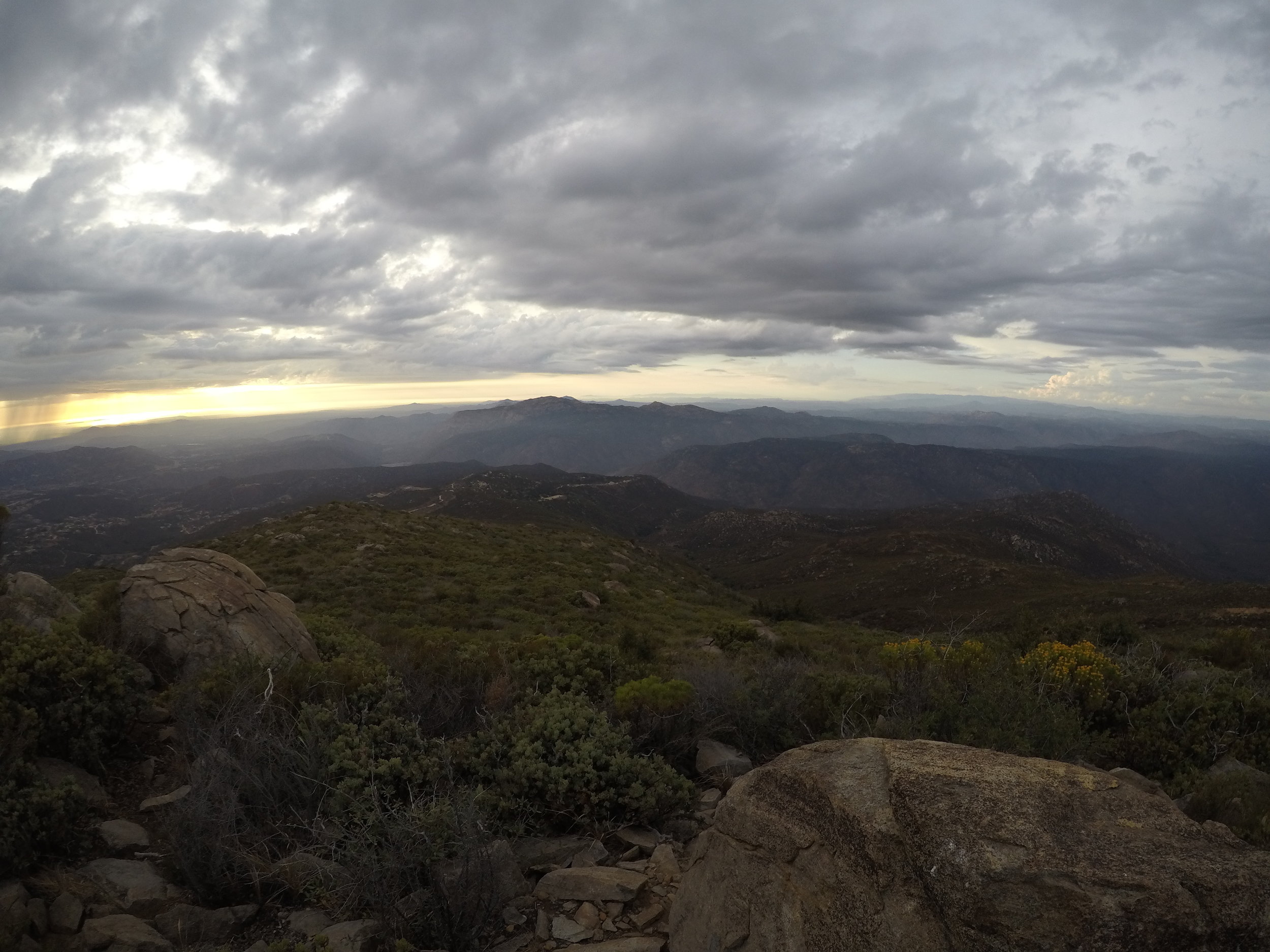
No matter what time of year one hikes Viejas Mountain, there are always great views.
Once on West Victoria drive, one will follow the road for a mile and a half before turning left (North) onto Anderson Road, which transitions into a dirt road, and then becomes the Boundary Truck Trail leading through the Cleveland National Forest. Even though this is a dirt road, it is usually flat, graded, and suitable for all vehicles to the trailhead. From West Victoria Drive, it is .9 miles to a slight dirt turnoff on the west side of the road; the trailhead for the hike is located on the east side of the road, and is readily visible. While there is not much room to park at the turnout, this is also a hike that is not usually popular; and the small amount of space there is usually sufficient.

Viejas Mountain is also one of the less trafficked peaks in the Cleveland National Forest, which provides a great deal of solitude for a hiker.
The hike starts at 2,700 feet elevation, and even before one leaves their car, there are good views of the Pacific Ocean in the distance on a moderately clear day. Once across the Boundary Truck Trail, the trail begins and continues to ascend over its one and a half miles of distance to the summit. This is a trail without shade, without many switchbacks, and without much subtlety - it goes up a fifteen to twenty degree slope for its entire distance with little regard for a hikers legs or lungs. As Viejas Mountain is 4,189 feet high, there is 1,489 feet of elevation gain. In practical terms this means a hiker will gain 100 feet of elevation every tenth of a mile. For both local hikers and visitors looking for a challenge, this short distance with steep elevation gain is a great challenge, particularly as the trail is in essence, no more than a use trail with loose rocks, sharp Yucca, and dirt ruts. The route is also straightforward, with the trail curling up and around, before traversing along a ridgeline for the last quarter mile to the summit. Near the end, the trail passes a rock shelter that was the location of the earlier sacred site for the Kumeyaay people, but today houses the summit register. At this juncture, hikers can head down to a permanent flagpole for further views, or elect to begin the descent back to the parking area.
From the summit, hikers will have views of a number of San Diego’s prominent peaks, and on a clear day, all of Southern California’s prominent mountains.
In addition to the challenging aspect of the ascent, Viejas Mountain is a great hike for two other reasons: the views, and the solitude that it provides. Either due to the drive, the elevation gain, or not having the notoriety of some of San Diego’s other hikes and mountains, Viejas Mountain rarely has a high volume of hikers, which means that hikers will have ample opportunities for reflection over the three mile roundtrip distance. While reflecting, hikers will also have ample opportunities to admire a series of high elevation views, from downtown San Diego, to the Pacific Ocean, to nearby El Cajon Mountain, and at the summit, three hundred and sixty degree views of Cuyamaca Peak, San Jacinto, and many of the other summits of San Diego’s backcountry.
Tips: While the starting elevation for Viejas Mountain is 2,700 feet, this is a hike that is exposed for its entire three mile roundtrip distance. Hikers should be prepared with plenty of water even during the fall and winter months when it is cool, and should judge the conditions accordingly during heat waves or the spring and summer months when temperatures can exceed ninety degrees.