
The bridge near the Old Pinnacles Trailhead
I’m not going to lie: I am a sucker for spelunking, or for my non-verbivore readers, “exploring caves”. What I like about spelunking is that is combines exploring, adventuring, and the unknown into one neat package. Perhaps it’s my overactive imagination, but there’s always something otherworldly about caves – there could be morlocks, there could be primeval creatures, or there could just be the unique, one-of- a-kind features that have formed over centuries. I’ve gone spelunking all over the United States, and even been fortunate enough to explore massive caves abroad as well, but as I talked about briefly in December, one of the best hidden spots on the West Coast to go spelunking and do a little hiking is at Pinnacles National Monument.

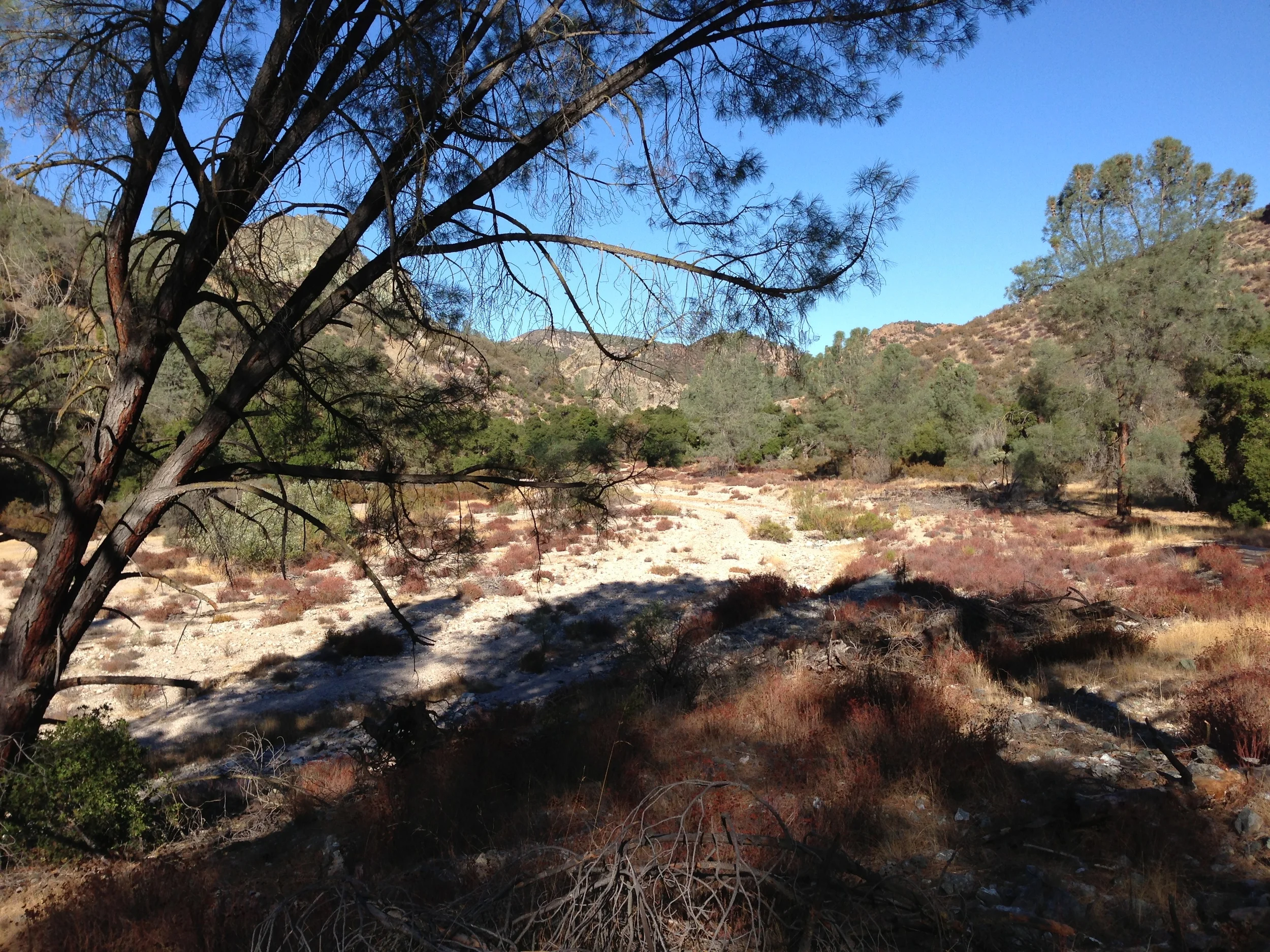
Fall Colors on the trail toward the Balconies Cave
At Pinnacles, the two main areas for spelunking are Bear Gulch, which I talked about in December, and the Balconies network of caves, which I’ll talk about today. All of the caves in Pinnacles are talus caves, which are formed over a period of time when rocks have fallen atop other rocks at the base of a cliff. In particular though, the caves at Pinnacles formed in the following manner: “…when steep, narrow canyons filled with a jumbled mass of boulders from the cliffs above. The canyons are the result of faults and fractures in the central area of volcanic rock. These shear fractures filled with gigantic toppled boulders are clear windows into the geologic wonder of the Monument.” (More information on the geology of Pinnacles here and here). In any case, both the Balconies cave and the Bear Gulch cave network provide a great spot to explore over 50 million years of geologic history over the course of a morning or afternoon.
Base of the Balconies Cliffs, near the Balconies Cave
Directions: To get to Pinnacles, you’ll want to follow my directions HERE, and it is again worth noting that during the summer, the park operates a shuttle service from the gate to the various points within the park. If you are at Pinnacles in the fall, winter, or early spring, however, you can drive into the monument and park at the various trailheads within the park. For this hike, you will want to either take the shuttle or park at the Old Pinnacles Trailhead. If you are looking for a challenge, it is possible to hike from the Visitor Center to the cave, which will be 9.4 miles roundtrip. When I was there with my group of explorers, we elected to park at the trailhead, which is only 5.3 miles roundtrip. In my opinion, this was a great leisurely hike that is accessible for pretty much any level of hiker from beginner on up. (Do note that it can be a strenuous hike in the summer when it is hot, as described here.)
The trail leaves directly from the parking area, and it is well marked and maintained. There is negligible elevation gain or loss throughout the 2.5 miles it takes to get to the Balconies Cave, but there are great views along the trail. After approximately a quarter mile (1/4), the trail heads over a wooden bridge that spans a seasonal creek. When I was there in the fall, there was no flowing water, but there were plenty of seasonal colors along the trail. From that point, there is plenty of coverage over the trail by California Buckeyes and other trees, but I could also see it being fairly hot along the trail during the summer as it is flat and exposed in several spots. Like the Bear Gulch Trail, the Balconies Cave Trail provides great views of the surrounding formations at Pinnacles, especially the Machete Ridge and the Balconies Cliffs.

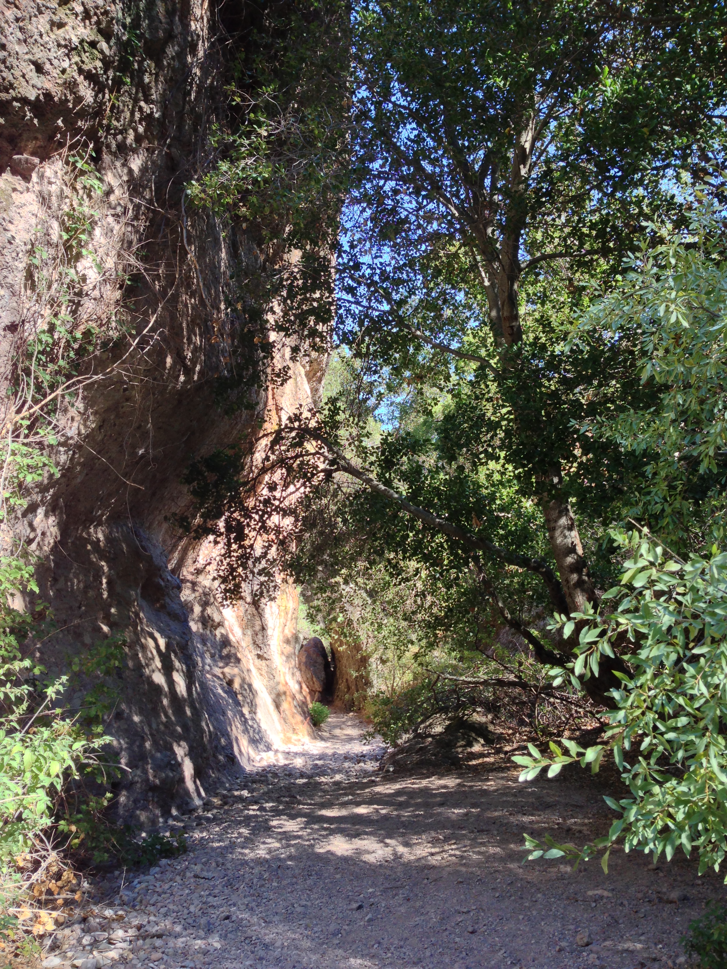
Passageway, Balconies Cave
After two and a half miles (2.5), the trail passes alongside a rock wall that is shaded by a number of trees, before angling up alongside the Balconies cliff. At this point, there is a small amount of routefinding that is needed, but realistically, it is fairly obvious where the trail heads through a number of boulders, before ending at the entrance of the cave. Now, as for the cave: it is not as large as the Bear Gulch Cave network; but, this does not mean that it is boring. While the cave itself probably could be explored in twenty minutes or less, it is fun to linger in the underground passages, first to see if you can see any of the Townsend’s big-eared bats; and second to allow your imagination to wander, as I discussed above.
My favorite portion of the Balconies Cave network was the lengthy passage at the end of the cave. This “passageway” is about 100 feet long, and is comprised of a number of fallen boulders, which really emphasize the nature of what a talus cave is. This area is about two to three feet wide, or less in spots, and in places, you will have to duck to fit under some of these boulders. Further, as an amateur photographer, the light in this area was really interesting to me – while it was all natural, it has a definite unusual tint to it. This is definitely an area that’s worth examining at your leisure. At the end of the passageway, there is a metal gate which signifies the end of the cave, and at this point, you can either turn around for the roundtrip distance described above, or head onward to see more of the park. The NPS rates this as a 3-5 hour roundtrip hike; which is possible, but my group took a little less than three hours, and we were moving at a leisurely pace.
Tips: As discussed before, caves are dark, and you will want to have a flashlight or headlamp for sure. Also, if you are claustrophobic, chances are that these caves or any caves are not for you. Finally, like the Bear Gulch Caves, you will want to review the NPS website to ensure that the Balconies Cave is open, as closures do occur, and you can check that information HERE.
Interested in some more thoughts as to these caves? Check out my friend Paulina's trip report here!