A short video of the view of the Monteverde Cloud Forest from the suspension bridge.
When Christopher Columbus explored Costa Rica’s eastern Coast in 1502, he re-named the area Costa Rica – or “rich coast” because he believed the area contained large amounts of valuable minerals. Although Europeans never found the large amounts of valuable minerals that they had envisioned, today Costa Rica lives up to its name because of the large – and rich amount of biodiversity present in the country. While there are many areas of Costa Rica that have incredible amounts of biodiversity, and great hiking, the area with the most biodiversity – and accessible biodiversity is the Monteverde Cloud Forest Reserve.
Trail to "La Ventana" Viewpoint, Monteverde Cloud Forest Reserve
The Monteverde Cloud Forest Reserve is also located in a unique area of Costa Rica, the Monteverde region. The town of Monteverde (“Green Mountain”) was founded in 1951 by a number of Quakers who had emigrated to the area to avoid the draft for the Korean War. In 1972, under the direction of George Powell and Adelaida Chaverri, the reserve was founded with 810 acres of land. Today, the reserve comprises some 26,000 acres of land, and is one of the most popular, if not the most popular parks in all of Costa Rica. Even though the Monteverde Cloud Forest Reserve is popular in Costa Rica, it is also well known world-wide as it currently possesses the largest collection of diverse orchids in the world, with over five hundred different types of orchid. In addition to the orchids, the Reserve also has over one hundred different species of mammals; and over four hundred different species of birds. As a result of all of these unique species, the Reserve possesses a stunning 2.5% of the world’s biodiversity. If the history of the region, the biodiversity of the region, and the natural beauty weren’t enough to entice one to visit the region, the park also sits astride the Continental Divide, meaning that it is possible to have one foot on the Caribbean side of Central America, and one foot on the Pacific side of Central America.
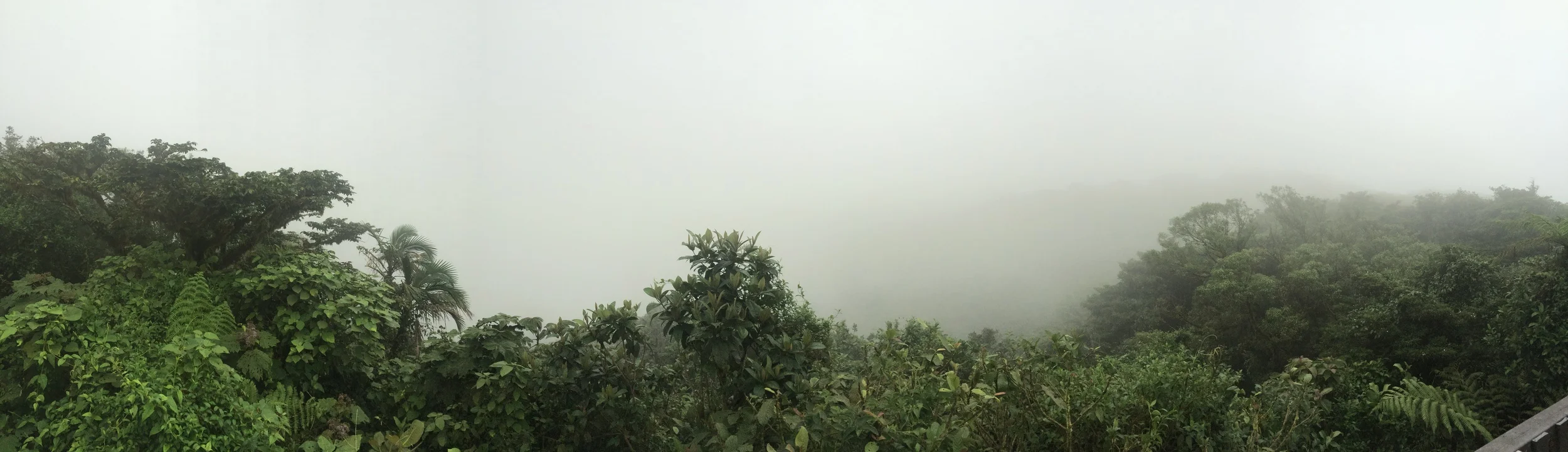
Clouds whipping up and over the ridgeline at the point of La Ventana in the Monteverde Cloud Forest Reserve, Costa Rica.
Directions: The Monteverde Cloud Forest Reserve is located slightly outside of the town of Monteverde. While there are many ways to get to Monteverde, it is worth noting that unlike most of Costa Rica, the majority of roads leading into Monteverde are unpaved and quite narrow. The rationale for this is that the original Quaker community did not want the region to become overwhelmed with tourists. In theory by not paving the roads – or participating in region wide road improvements, the area would remain somewhat pristine. Unfortunately, in 2015, the region is a popular area, and is well-visited by tourists world-wide (the secret is out). At this juncture the unpaved roads are really more of an inconvenience than an actual barrier. Moreover, in 2015, various roads leading into Monteverde are being paved at long last. Having said that, the roads as of the time of my visit – and of this blog are unpaved.
Monteverde Cloud Forest, August 2015
While some of the roads are more rutted out than others leading into Monteverde, overall, all of the roads are accessible to standard wheel drive cars, especially as these roads are traveled by busses and trucks. Visitors to the region, however, should allow additional time to travel what is relatively a short distance from various portions of the country into Monteverde, especially during the rainy season (October). While portions of the downtown proper of Monteverde are paved, the road to the Cloud Reserve is also unpaved. From the capital, San Jose, it is roughly a three to four hour drive to Monteverde, depending on conditions, and the traffic on the access roads leading in and out of town. The Cloud Forest Reserve is roughly six kilometers from downtown Monteverde, and is roughly a twenty minute drive based on the conditions.


Permits: As of 2015, the Reserve charges $20.00 USD for non-Costa Rican adults to enter the reserve. Similarly, for non-Costa Rican children, the Reserve charges $10.00 to enter the reserve. These fees are collected at the entrance station, which is located at the end of the road. As I mentioned above, the reserve is one of the most popular parks in Costa Rica, and has over 70,000 visitors per year. As there is not a large parking area at the entrance, visitors should be aware that during the peak season, the best way to get to and from the reserve is by bus. The reserve is open from 8:00 a.m. to 5 p.m. daily, and unlike American National Parks, the park requires visitors to be outside of the boundaries by the closing time.
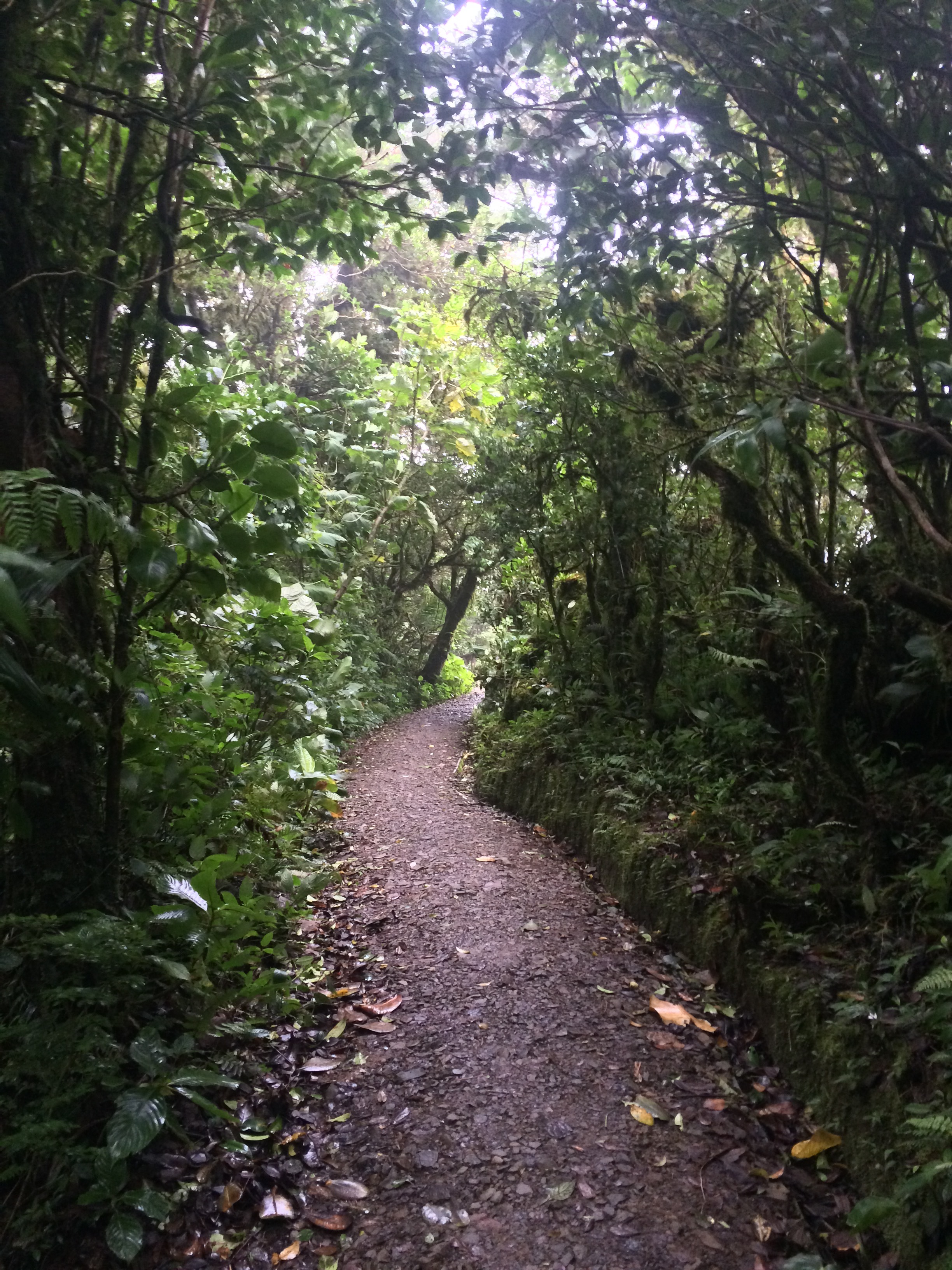
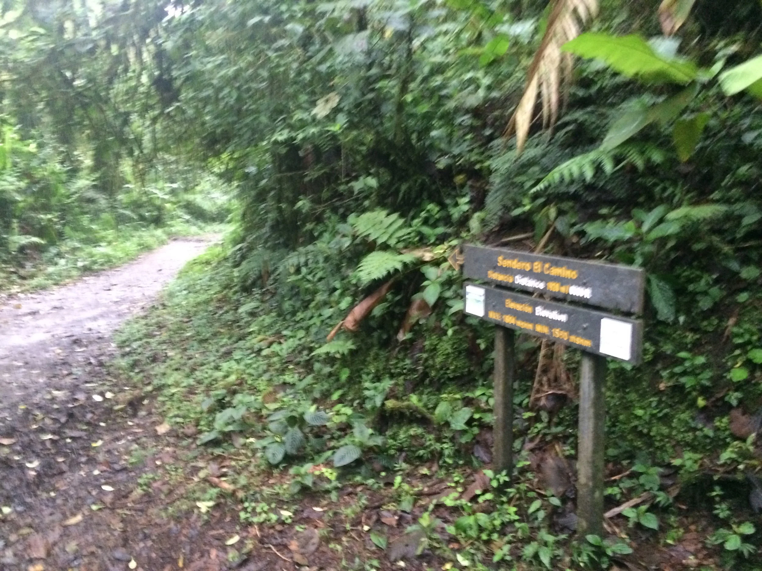
Sendero Camino, Monteverde Cloud Forest Reserve, August 2015
Trails: While the park has over 26,000 acres of land, only 3% of that amount is accessible to the public. This means that the majority of the park is accessible in a day, as there are only 13 kilometers (8 miles) of total hiking trails. Aside from the George Powell Loop, all of the trails interconnect in the park, which allows a visitor to explore all of the regions in a series of loops or out-and-back experiences. As of August 2015, the Sendero Pantanoso, and portions of the Sendero Chomongo and Sendero Rio trails were under construction, which further limited the areas that could be explored. The four main trails that were open as of 2015 were the George Powell, the Sendero Nuboso, the Sendero Wilford Guindon, and the Sendero Camino.
Sendero Wilford Guindon, Monteverde Cloud Forest Reserve, August 2015
George Powell: At only .1 miles in length, the George Powell trail is the reserve’s most accessible trail to all visitors. From the lodge, which is the primary trailhead for the park, the trail winds through a small section of the reserve, allowing visitors to experience a small portion of the massive growth of the Cloud Forest.
Sendero Nuboso (A/B): This trail is the southernmost trail in the reserve, and like the George Powell, departs from the lodge. At 1.2 miles in total one way length, the trail is divided into two sections – the “A” and “B”. The division is marked by the spur trail at .6 miles to the Sendero Camino. While there is 213 feet of total elevation gain on the trail, the trail is overall mostly flat with great scenic views. Outside of the Sendero Camino, this is one of the park’s most popular trails. At the end of the trail, visitors have the option to walk to the viewpoint known as “La Ventana” which is located on the Continental Divide, and has great views of the area on a clear day. From the viewpoint, visitors can return along the Sendero Nuboso trail for an out and back trip, or can return on the Sendero Camino for a loop trip.
A quick run over one of the park's best features.
Sendero Camino: This trail is the reserve’s widest trail, and most popular trail. At 1.2 miles in distance, it is the same length as the Sendero Nuboso trail, but with less elevation gain (121 feet). As it is the park’s widest trail, more sunlight can penetrate the tree canopy, which allows for the potential of better bird and animal watching. This trail also connects with the Sendero Wilford Guindon, the Sendero Puente, the Sendero Chomongo, and the Sendero Pantanoso.
Sendero Wilford Guindon: Unlike the Sendero Nuboso and the Sendero Camino, this trail winds up and down through the forest, over the .8 mile one way distance, which gives the visitor a feeling of solitude. The trail also connects to the only suspension bridge in the park, which stretches across the tops of the trees, and provides great views and great opportunities for wildlife viewing.
Tips: Although the Cloud Forest Reserve has a reputation for being chock full of people, I did not see any visitors during my time in the reserve. In terms of full disclosure, I ended up at the reserve towards the end of the day on a rainy weekday, but in my opinion, the rain and fog added to the ambiance of the reserve. Having said that, I could see how the reserve could become crowded, as the trail network is somewhat small. My suggestion would therefore be to visit toward the beginning or end of the day, if possible, during the off-season. In terms of the trail conditions, the reserve’s trails are well-marked and delineated. Visitors should be aware that while rain, fog, and wind are common occurrences in the reserve, no special footwear other than trail runners or boots are required to hike the area.
While I thought the whole park was amazing – and spectacular in its own right, I thought that the two must visit locations were the “La Ventana” viewpoint and the Suspension Bridge. While I had poor visibility at the viewpoint, it was still fascinating to watch the clouds whip up and over the Continental Divide. Similarly, the views from the Suspension Bridge were amazing, and while I did not see many animals (other than birds), the views of the forest were simply stunning. Even though I had limited time, I felt that I had ample time to explore the trails described above, and more. Birders, or individuals who have never experienced a forest like this should allot more time to walk the short distances, as it is very unique scenery. Finally, after visiting the Reserve, visitors should stop at the Monteverde Cheese Factory, which is located directly off the route to and from the reserve for either fresh ice cream or cheese made by the Quaker community.