
Unbeknownst to most people, California was the place where glaciers were “discovered” in the United States, atop Mount Shasta. And while the words “California” and “glacier” will never be synonymous, the state still has twenty glaciers (seven located on Mount Shasta, and thirteen are located in the Sierra Nevada). While each of California’s remaining glaciers offer their own individual logistical challenges, the Palisade Glacier is one of the easiest to visit from May to mid-October. In this case, easy is a relative term, as visitors to the Palisade Glacier will have to traverse ten miles of trail to the end of the glacier, and gain 4,000 feet of elevation, before returning back to the trailhead. From mid-October through May, the ascent to the Palisade Glacier becomes substantially more difficult, as it is over snow and ice, and requires proper preparation and navigation. However, for those willing to make the trek, the Palisade Glacier is a spectacular sight to behold; and is a relic from a long lost past that is disappearing in the modern age.


Directions: The main route to the glacier is along the North Fork of Big Pine Creek, and can be hiked as either a long day trip (twenty miles roundtrip); or as part of a multi-day backpack through the lakes of the Big Pine basin. Visitors opting for the latter will need a permit from the National Forest service, which during the high season, are somewhat difficult to come by. Multi-day visitors will also need a bear canister to properly store their food and waste from the region’s black bears. From the trailhead, the trail ascends past First and Second Falls to Lon Chaney’s cabin, before slightly leveling out and gradually ascending to First Lake, Second Lake, and Third Lake. Slightly past Third Lake (6.5 miles from the trailhead), the trail begins to ascend in a slightly steeper fashion, and at the seven mile mark, splits into two trails; one of which heads to the Palisade Glacier and Sam Mack Meadow (southwest); and one that heads towards Lakes Four, Five, Six, and Seven. This junction is well marked and signed by the Forest Service.
Palisade Glacier
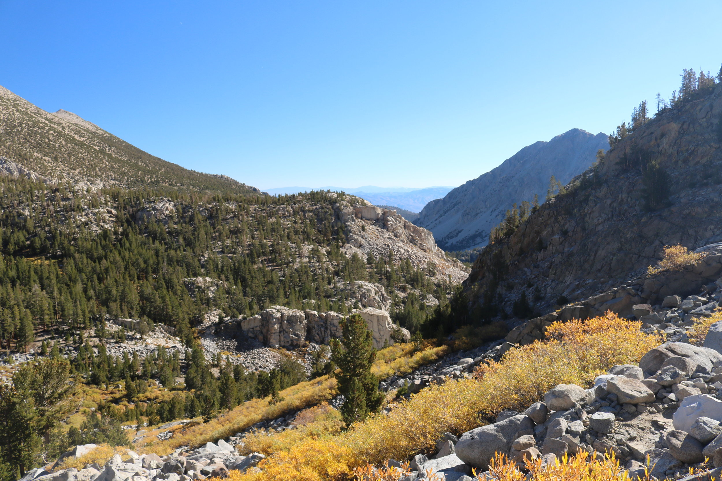
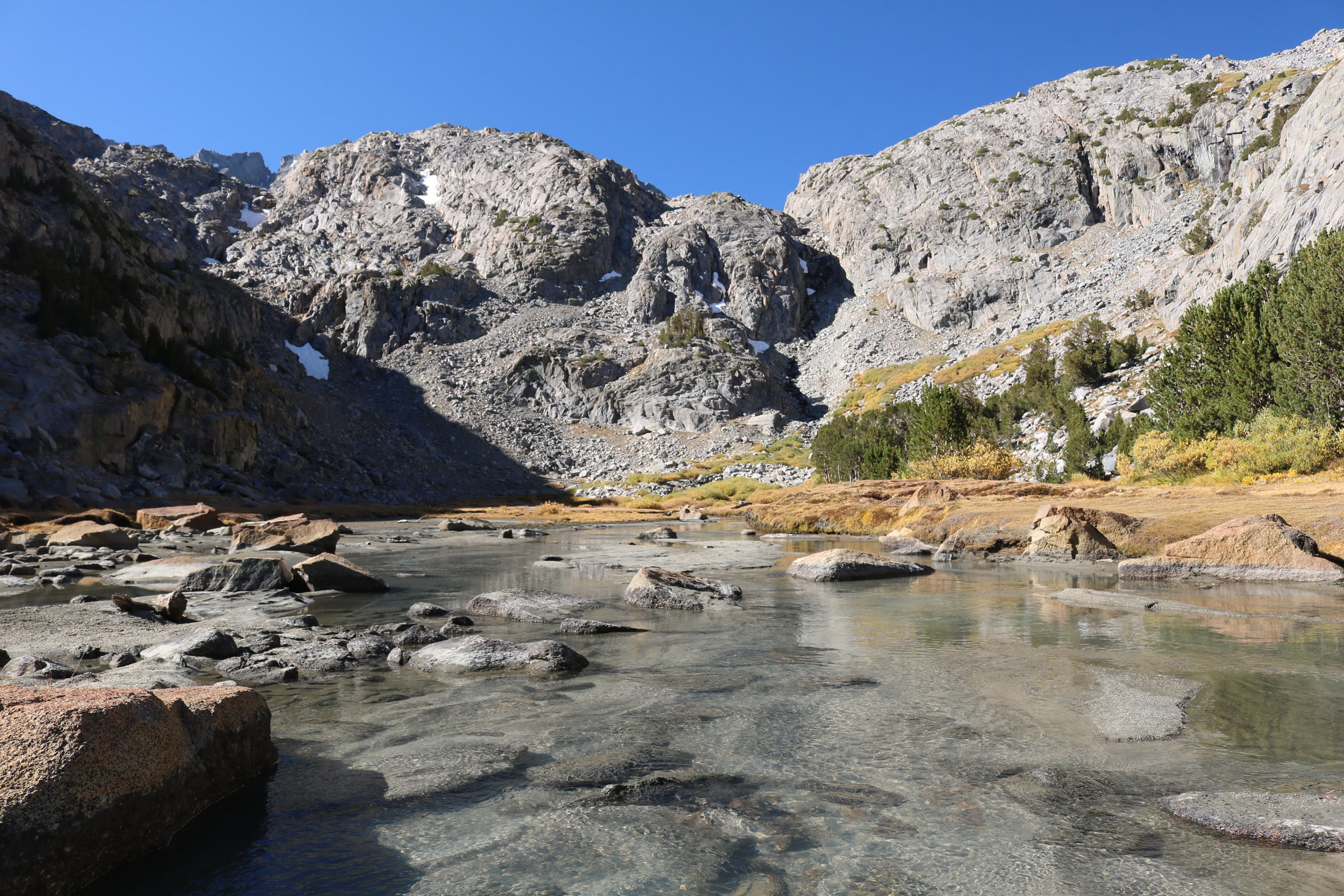
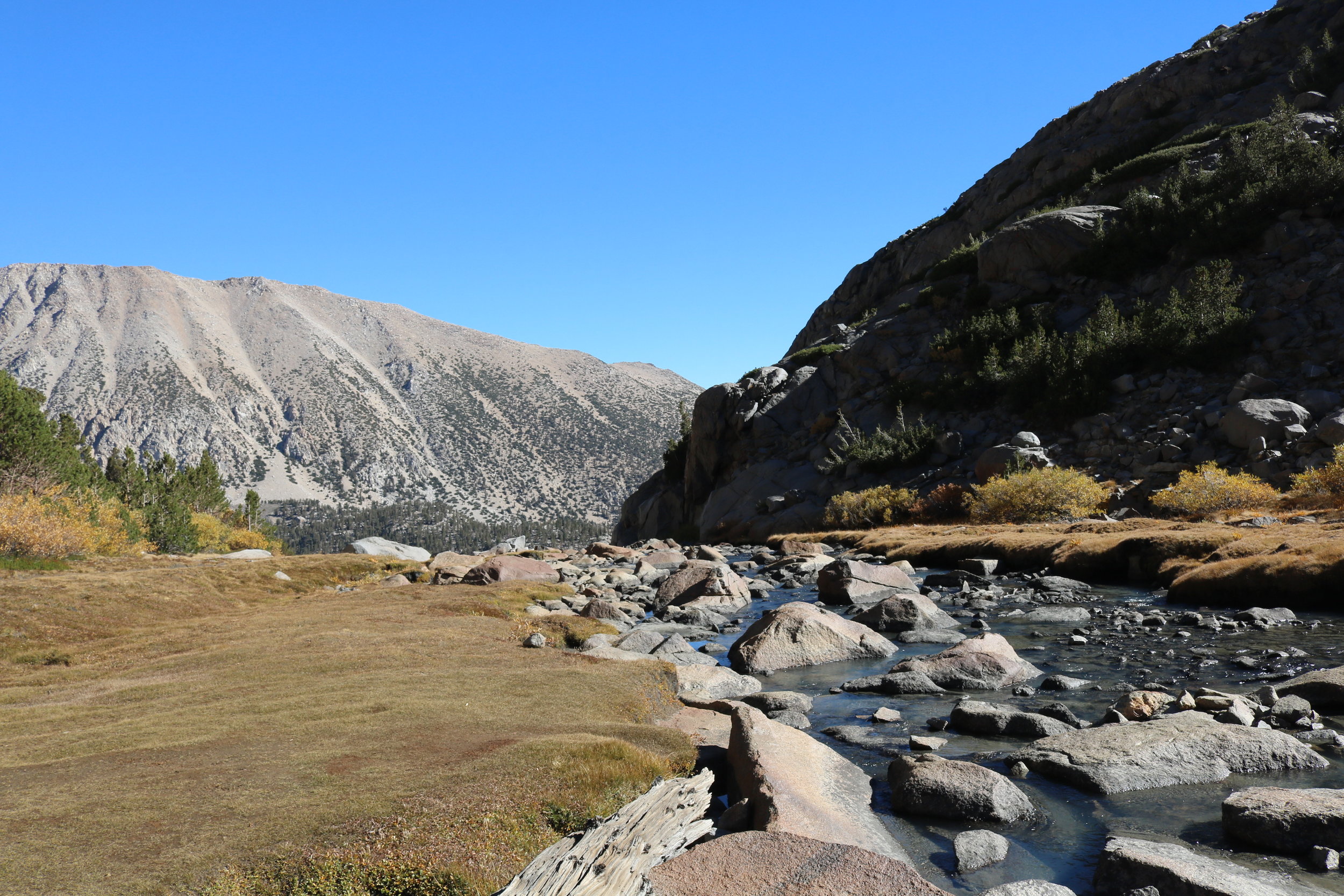
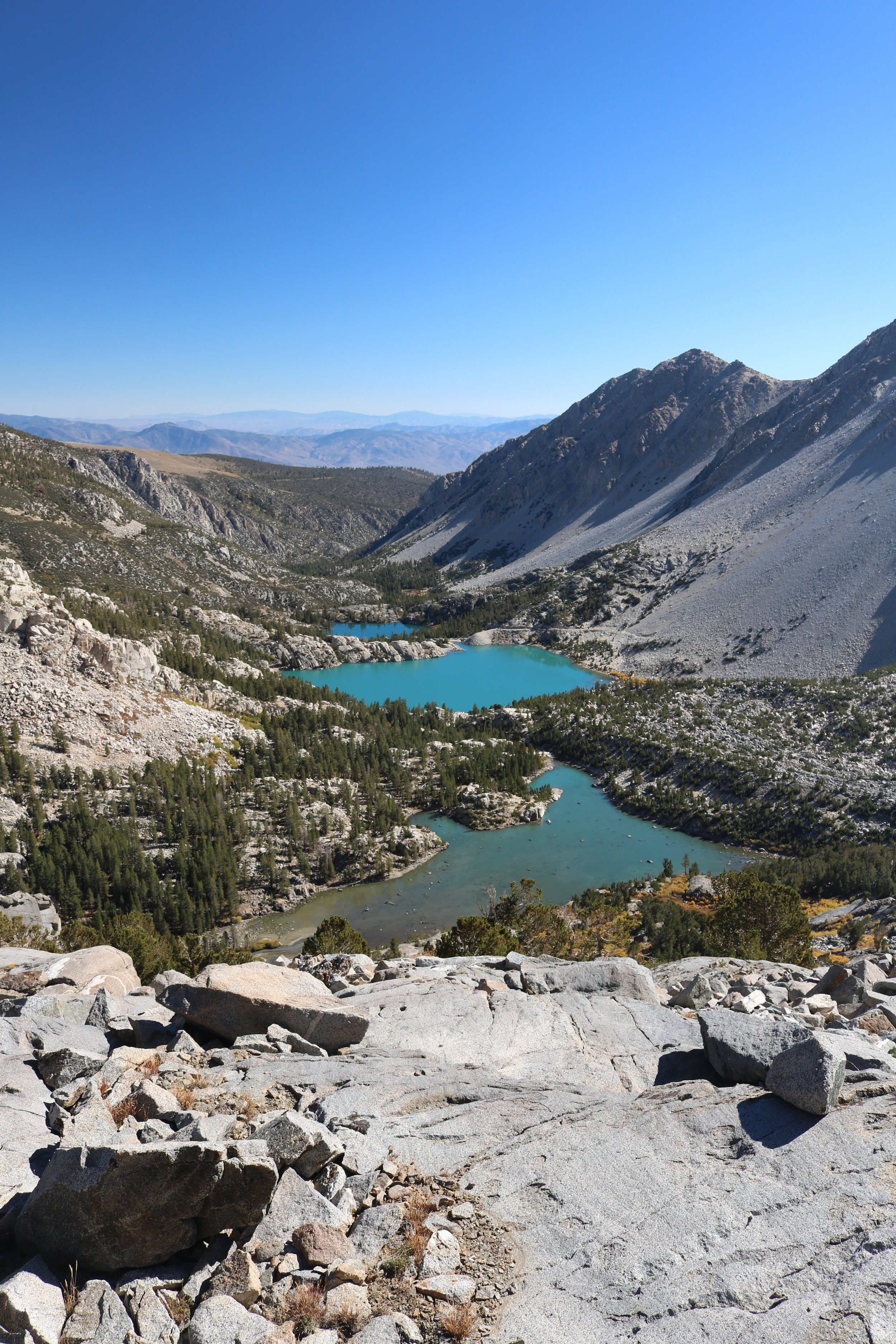
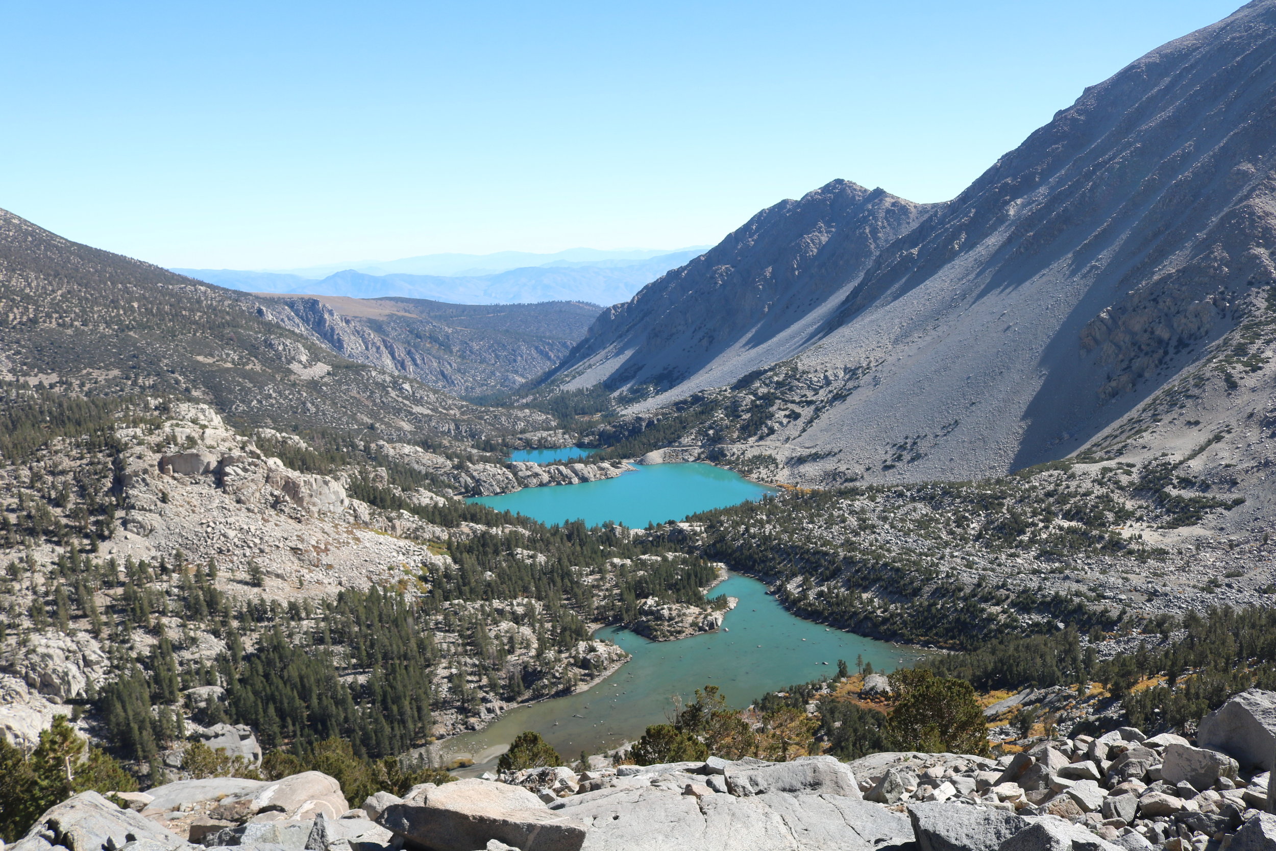
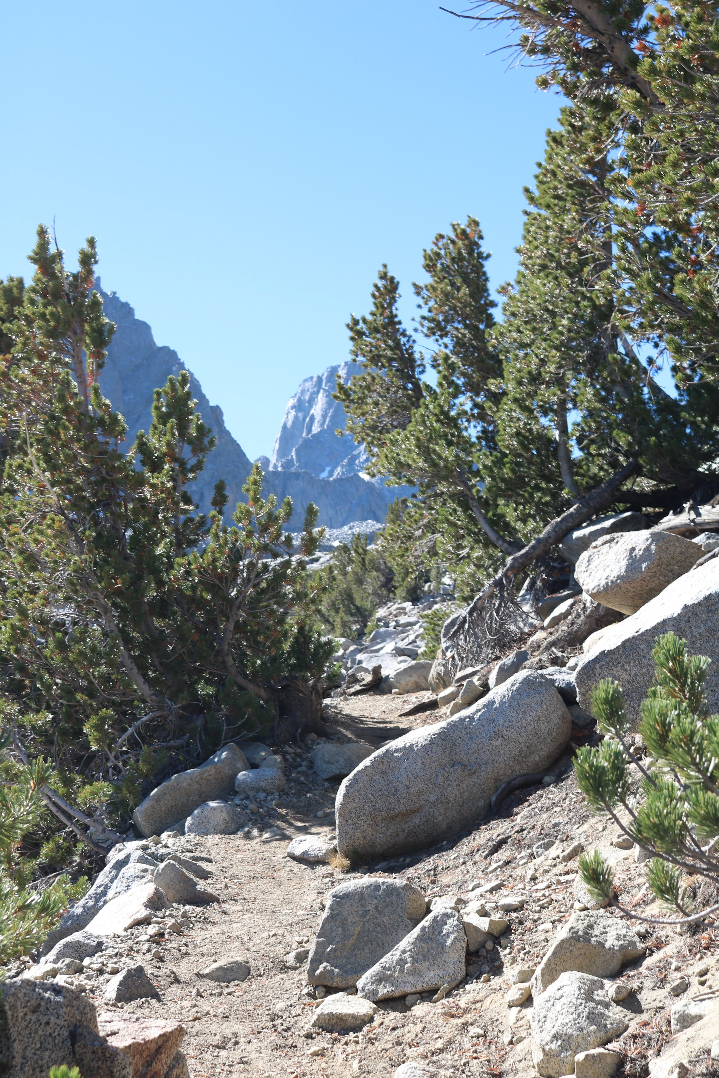
From the junction, the trail then descends into a picturesque high alpine meadow with a creek crossing. Toward the East, one can catch glimpses of Third and Second Lake, but better views await the persistent hiker further up trail. After the meadow, the trail switchbacks up through a slight stand of trees, before clearing the treeline, and then leveling out in Sam Mack Meadow. Long regarded as one of the premier alpine meadows in California, Sam Mack Meadow is a beautiful spot, with a wide stream, and ample expanses to admire the high peaks of the region from. Sam Mack Meadow is also the last place where climbers can filter water on their final push to the glacier or beyond. From the entrance of Sam Mack Meadow, climbers will want to cross the stream to the East near a large boulder in the middle of the meadow, and begin ascending up a foot trail. While the trail to Sam Mack Meadow is well-marked, and visible, from Sam Mack Meadow on, the trail becomes harder to find during certain times of the year. Climbers should be sure to have a map, GPS, or knowledge of the area if they are proceeding past Sam Mack Meadow.
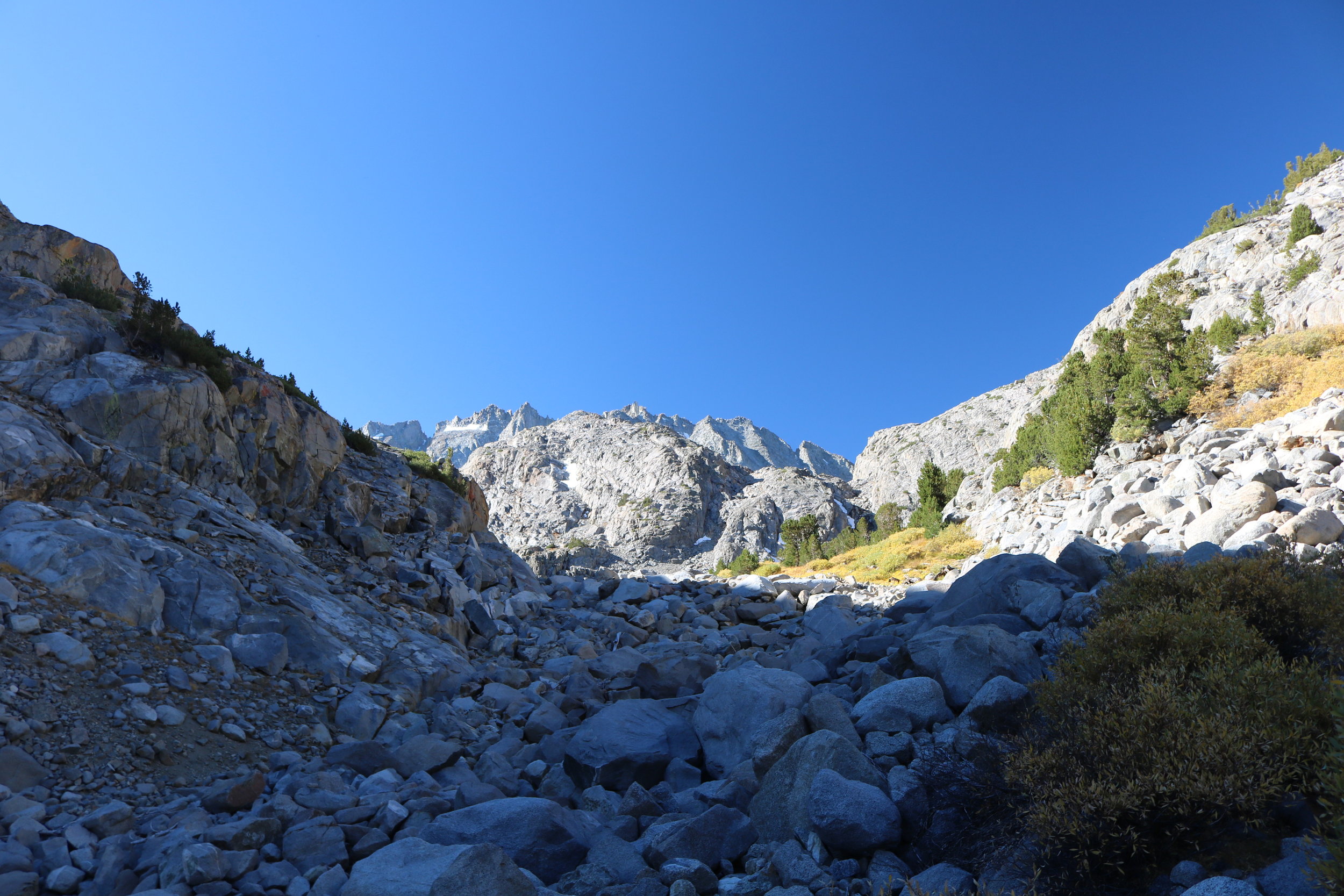
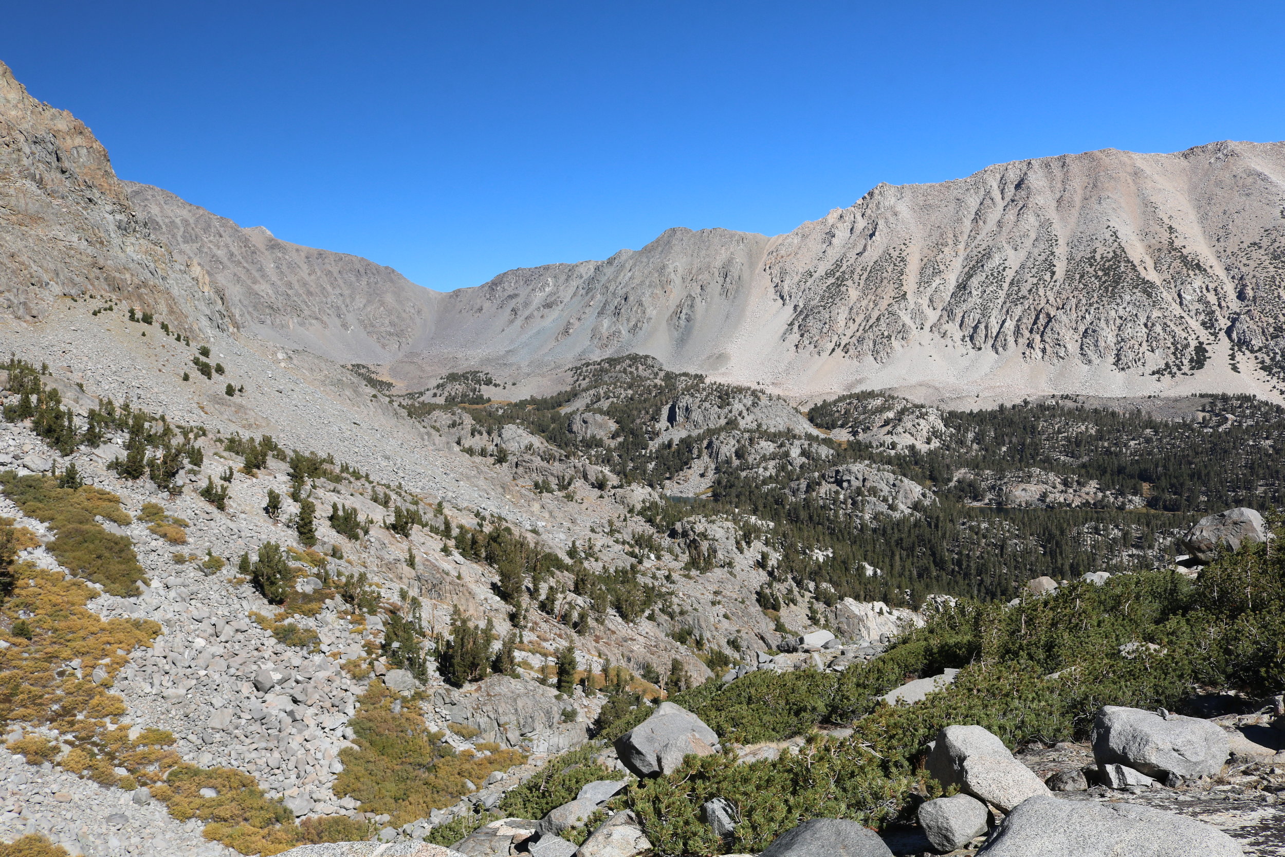
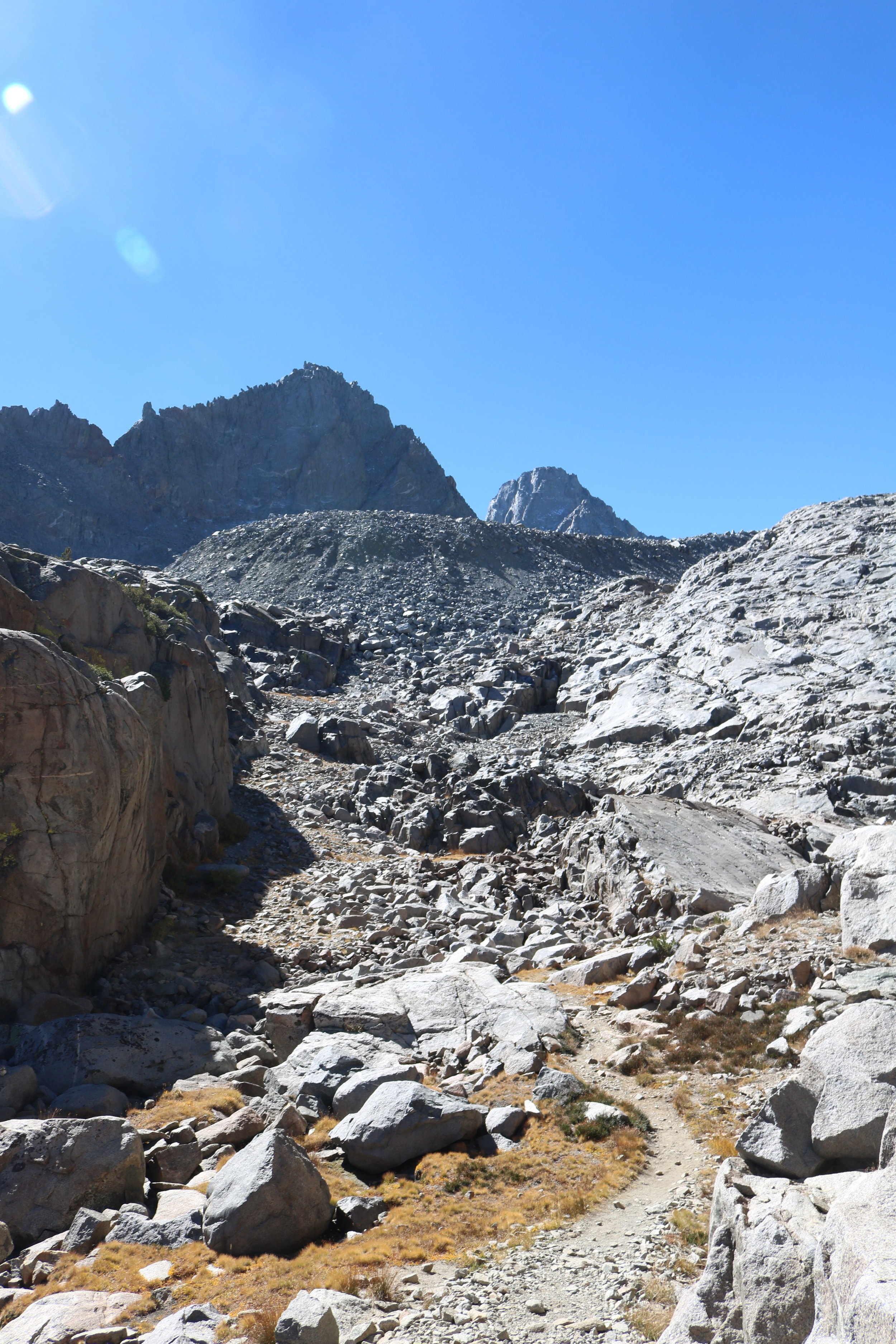
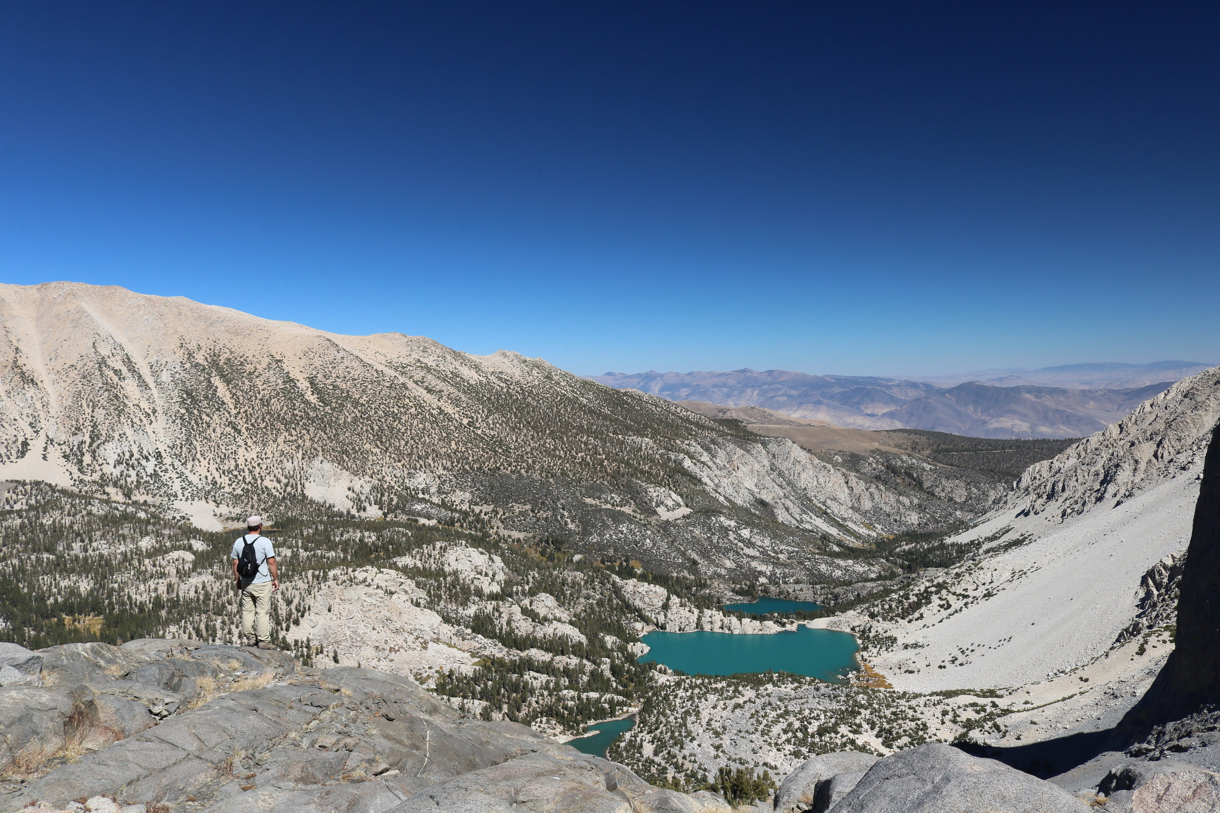
After a quick section that ascends steeply out of the meadow, the trail curves around and onto a rocky ridgeline that provides excellent views of both First through Third Lakes to the East; and the Palisades and the Sierra Nevada range to the West. At this juncture, the terrain shifts from gradual, sloping alpine valleys and rock to steep talus fields and sharp cliffs. Three miles from Third Lake, the trail descends slightly into a narrow valley that is boxed in by boulders and talus on three sides. The astute hiker or climber will notice a steep, talus covered slope directly in front of their field of view (to the South); but while that ridge can be climbed, it is more efficient to follow the “trail” to the East (left) around the base of this ridge. I note that this is the “trail” because at this juncture, there is no established trail, so hikers, climbers, and mountaineers are left to either route-find on their own, or follow the route demarcated by a series of intermittent cairns around the ridge as I have just described.
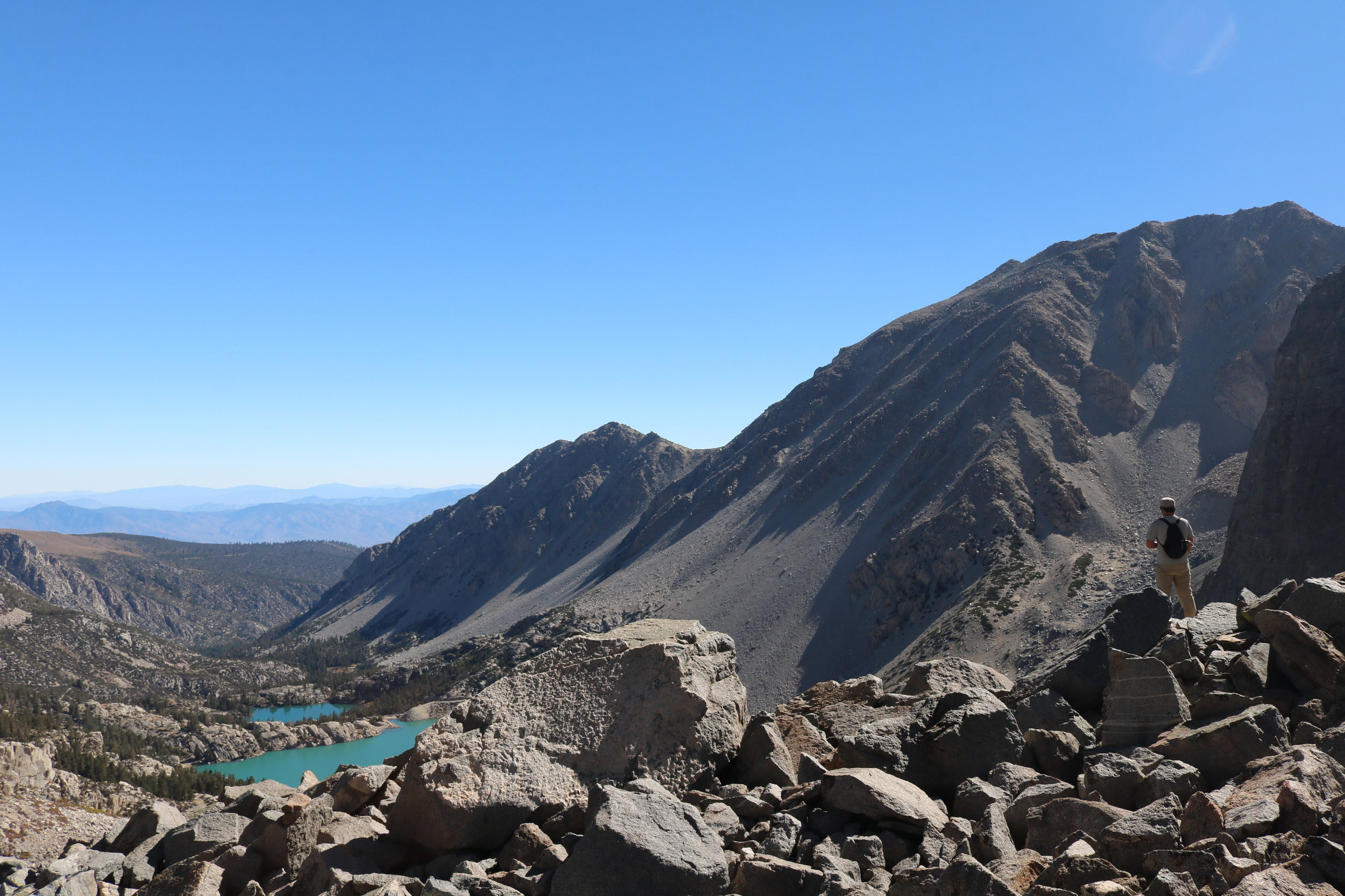
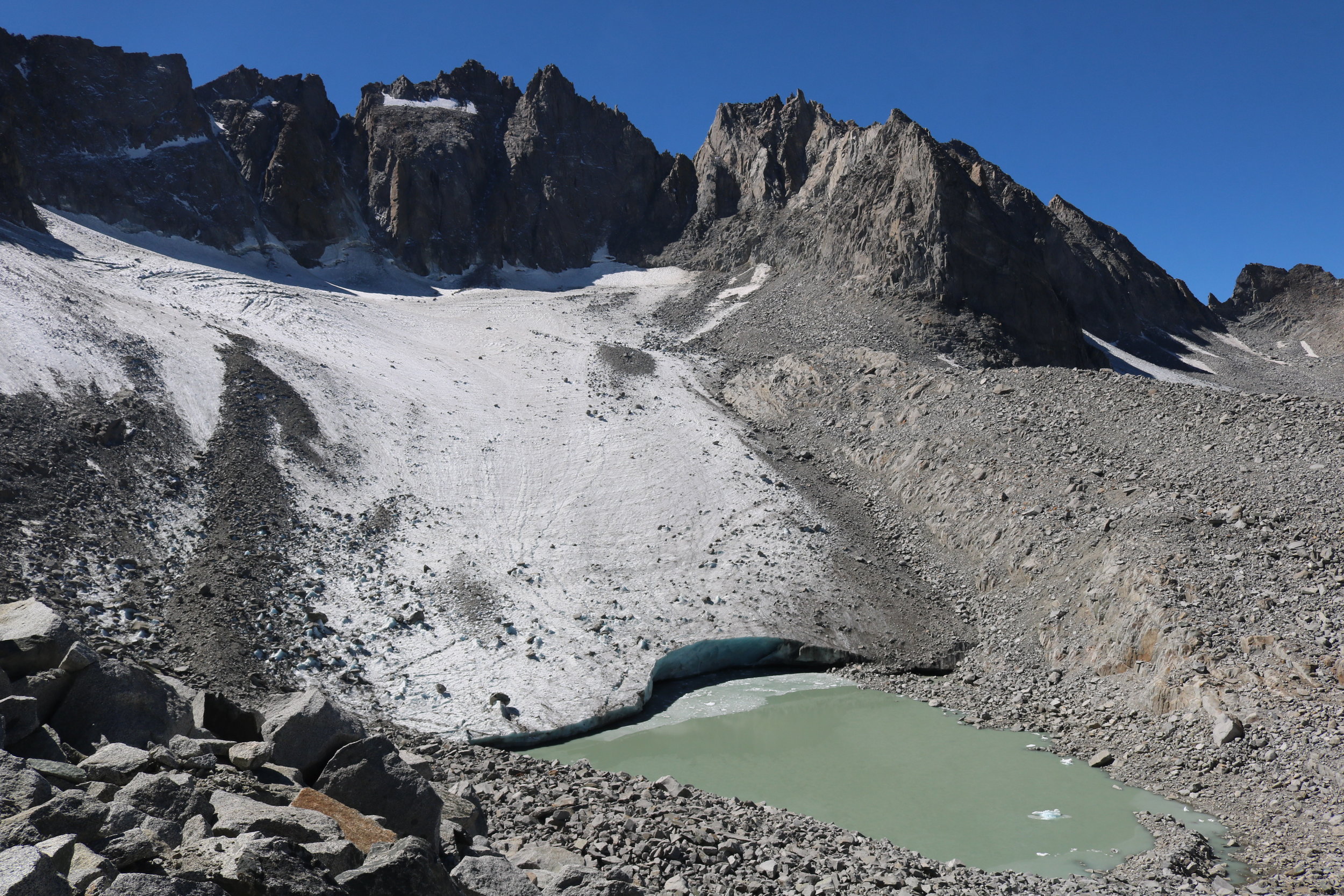
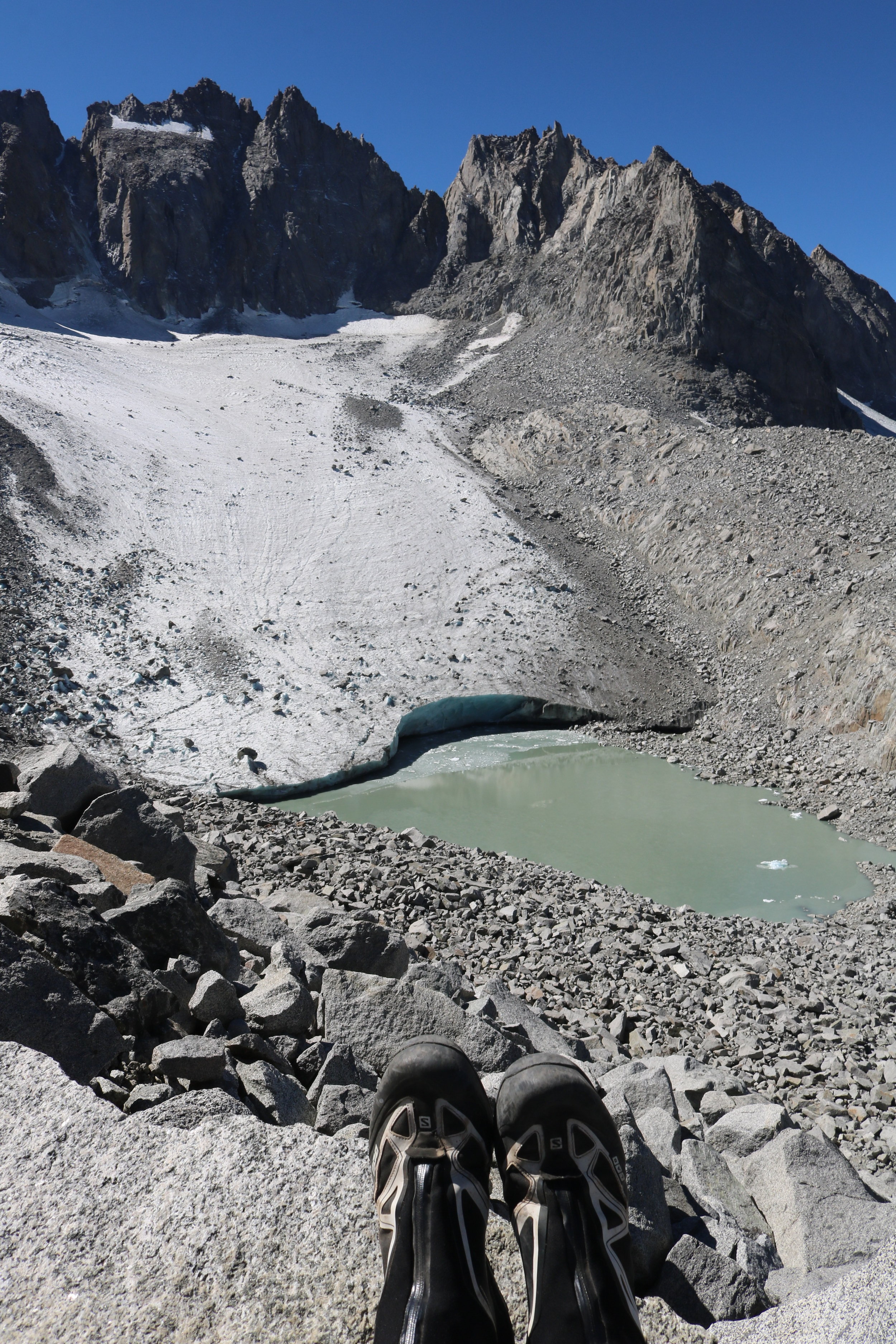
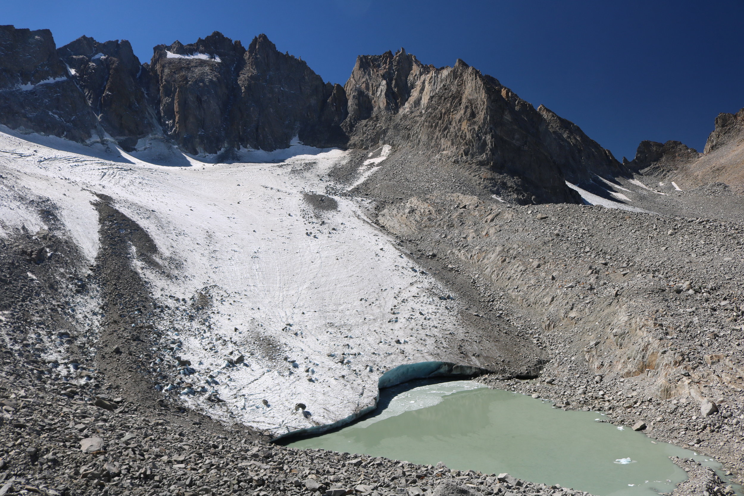
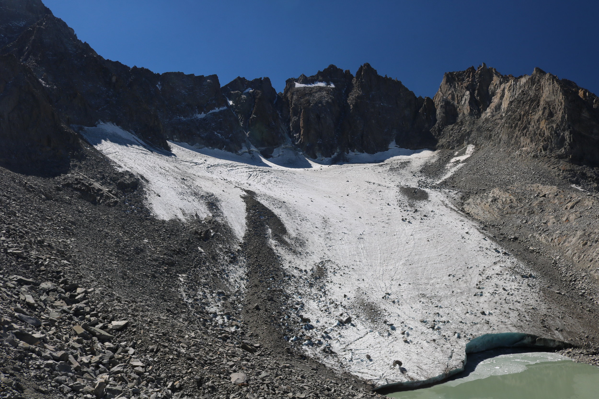
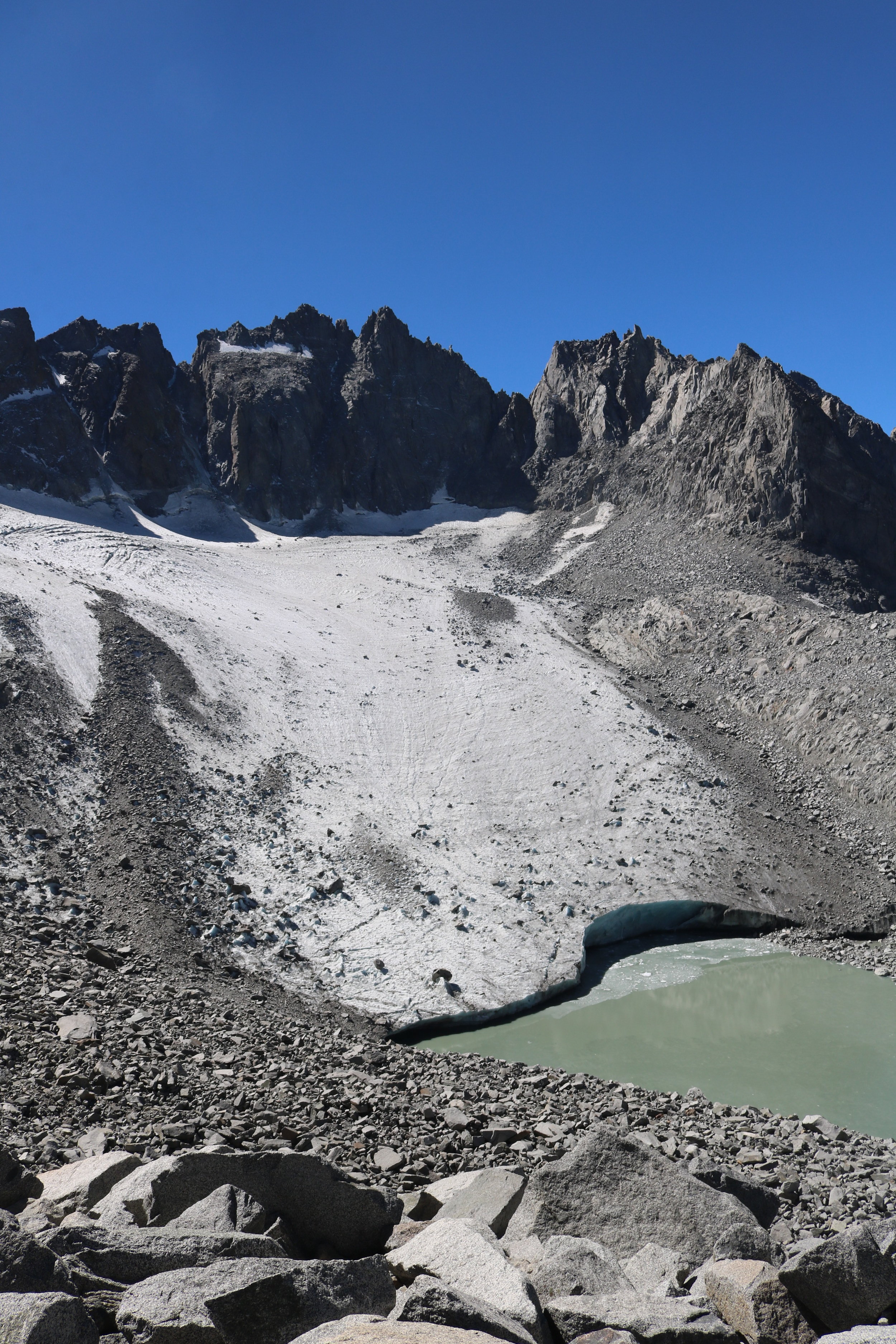
Either way, from this point, progress toward the glacier becomes incredibly slow as one has to ascend through a variety of large boulderfields and talus slopes. In following the “trail”, climbers will follow along the base of the ridge, which has some minor exposed sections with drop-offs, before ascending up a rocky valley to the southern end of the ridgeline. At the top of the ridgeline, hikers and climbers will have a choice – either to enjoy the view of the receding glacier from where they stand, or to descend off-trail down to the terminus end of the glacier and lake via an equally steep talus and boulder slope. For most people, the view of the glacier at this point will be enough, and the return is back on the same route for a roundtrip hike of slightly over twenty miles of distance. For those with more gas in their tanks, or who have traveled a shorter distance, the glacier is something that can be explored.
Tips: While twenty miles roundtrip (or slightly over or under) is not an insurmountable distance and the elevation gain is less than ascending Mount Whitney in one-day, in my opinion only experienced hikers should attempt this route as a day trip. I say this because the section of the route both ascending and descending from the glacier requires concentration and time, and is not something that can be done quickly. Separately, hikers, climbers, and backpackers should have plenty of water available if attempting this route as it is at elevation, and it is mostly exposed for the duration of the climb.