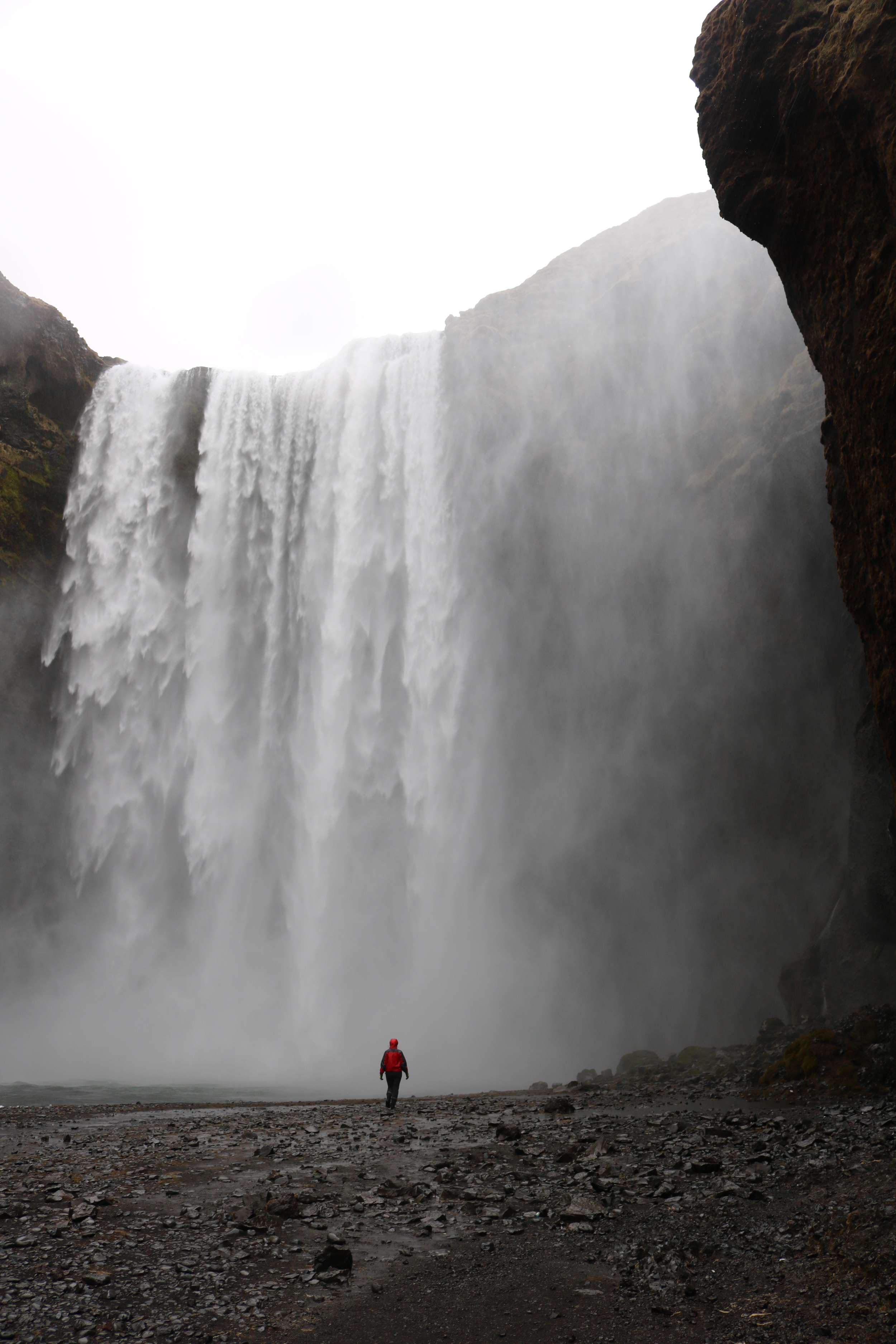
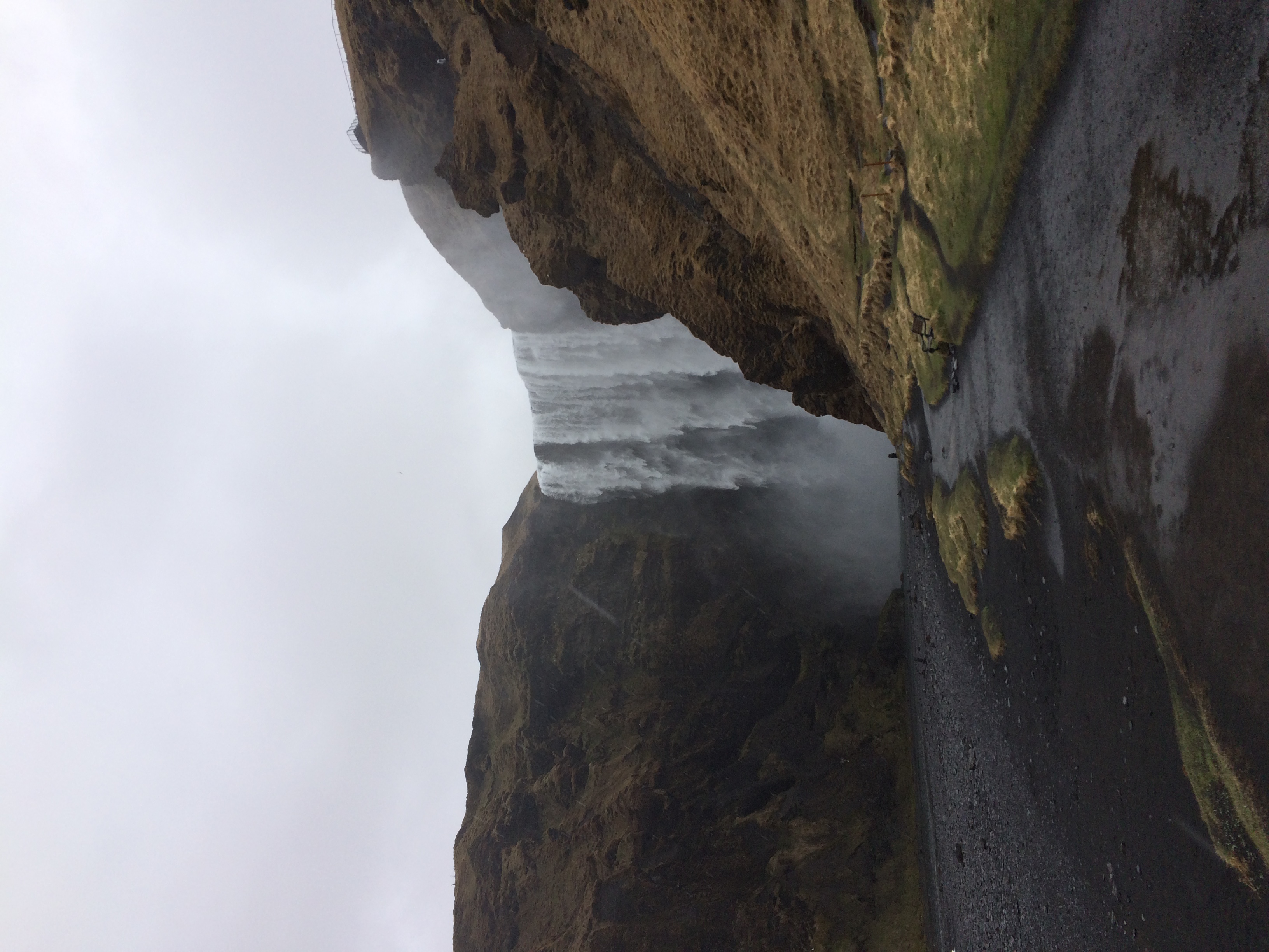
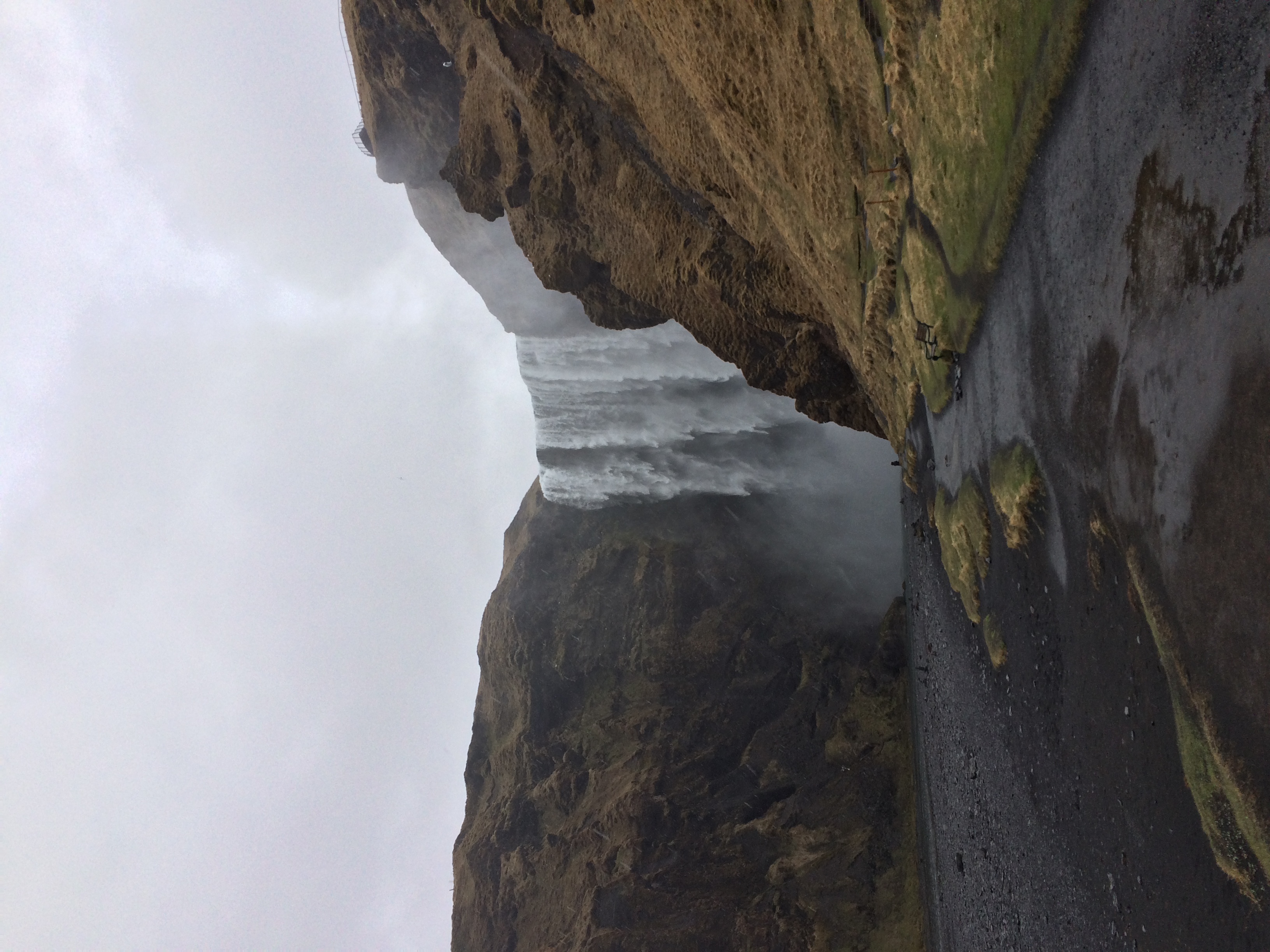
Footage from the base of Skogafoss, May 2015
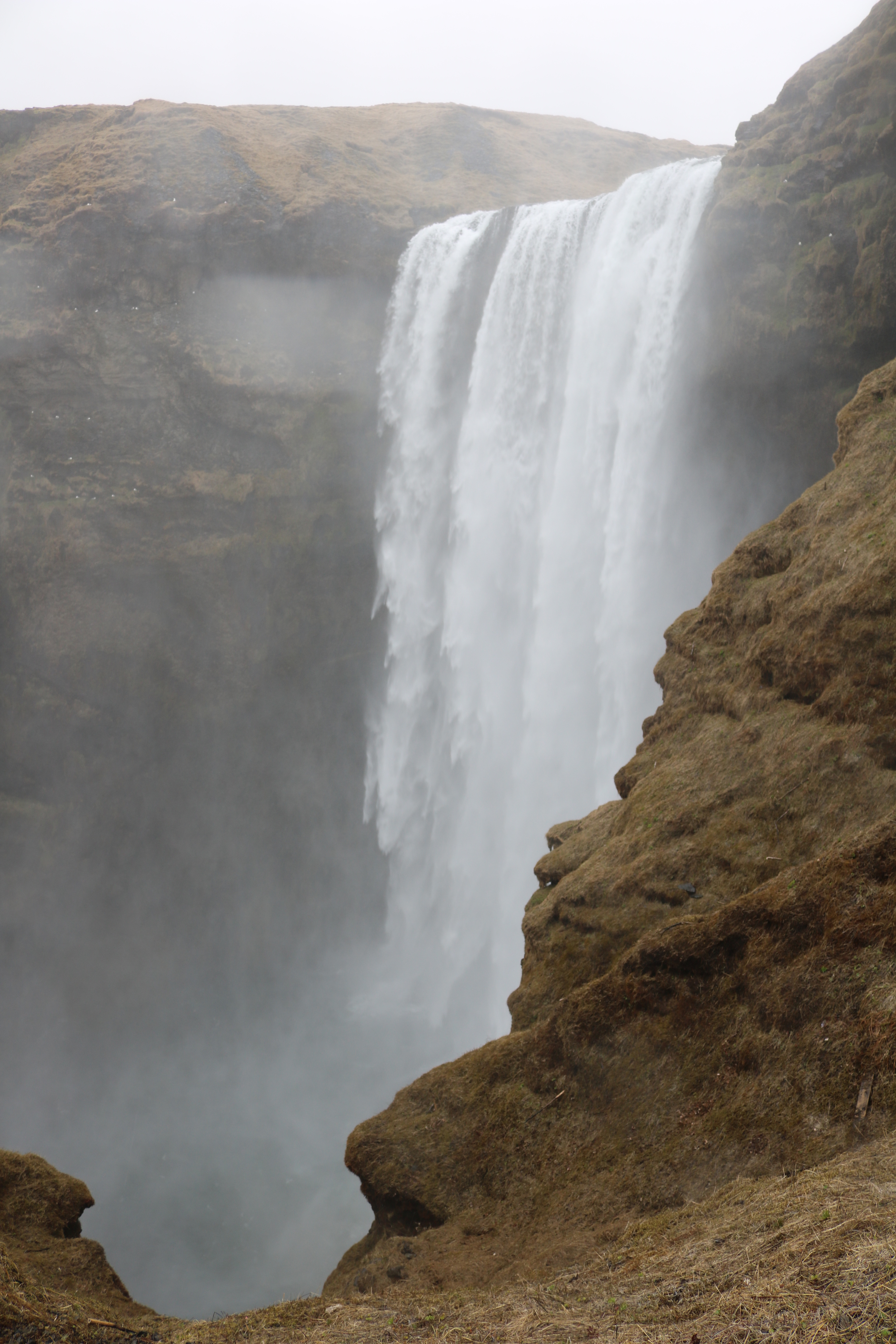
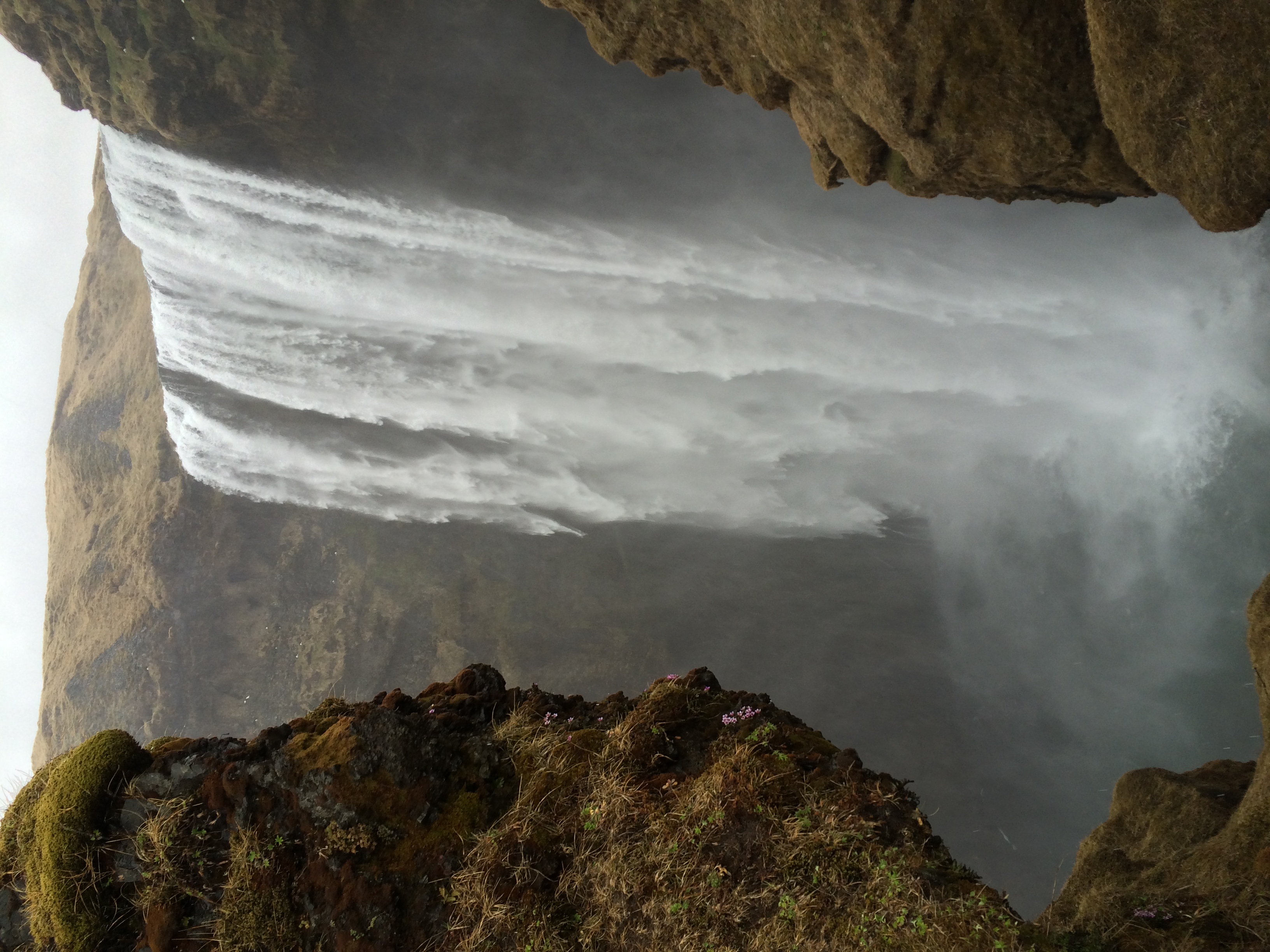
In addition to its myths and legends, Iceland is also the land of spectacular waterfalls. These waterfalls are some of Europe’s most powerful because of the precipitation that the island receives along with seasonal glacial and snow melt. One of the largest and most powerful of these falls is Skogafoss, which is located slightly outside of the town of Skogar in Southeast Iceland. Skogafoss means “forest waterfall” in Icelandic; and while there are no trees around the waterfall today, the waterfall itself is a spectacular classic rectangular waterfall that cascades down the former sea cliffs. At twenty five meters wide (75 feet) and sixty meters (180 feet) in height, the fall is an impressive sight that can be seen from a far distance.

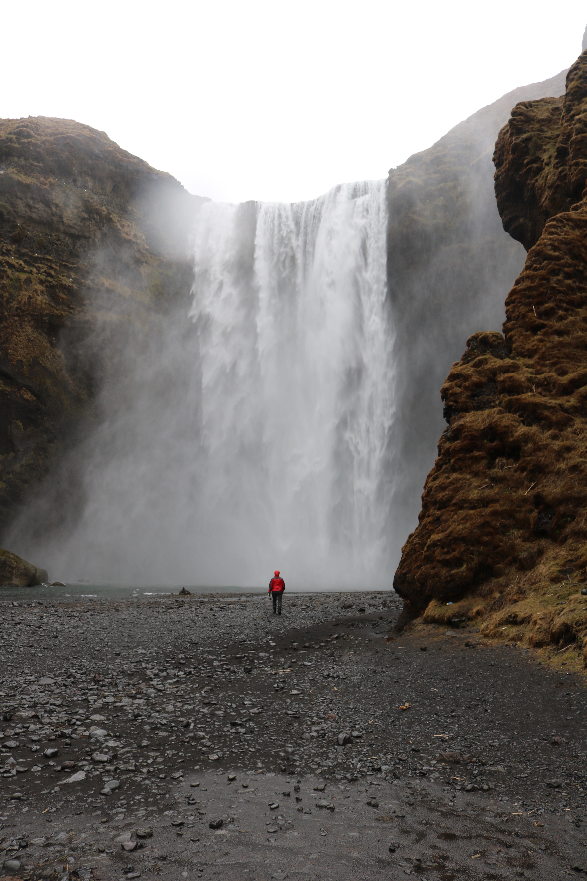
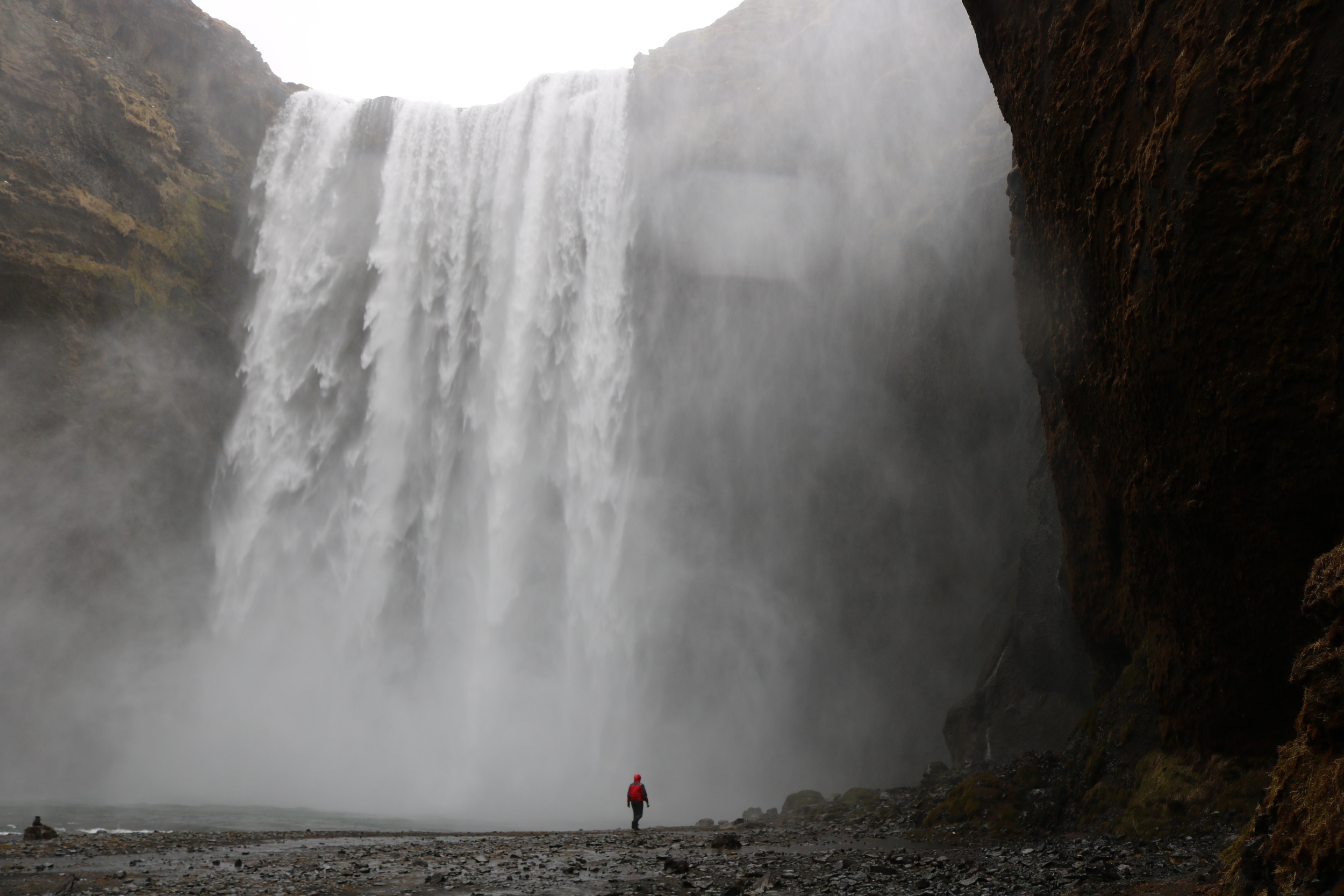
Like many places in Iceland, Skogafoss also has its own interesting myth. Legend has it that the first Viking settler in the area, Þrasi Þórólfsson, placed a treasure chest in a cave behind the waterfall, which was found many years later by locals from the nearby town of Skogar. When the locals attempted to remove the chest from the cave with all of their force, they were only able to pull one of the chest’s rings off before the chest itself disappeared again. The locals took the ring and placed it on the local church door in Skogar, but the door (and the ring) are now located in a museum. As Skogafoss is easily accessible, visitors can look for the missing chest (and presumably treasure) with a small amount of effort.
Footage from midway up the Skogafoss Waterfall, May 2015
Directions: Skogafoss is located directly off of Iceland’s Route 1, otherwise known as the Ring Road in the Southeastern portion of the country. From Reykjavík in the North, Skogafoss is located 155 kilometers to the South on Route 1, and from Vik, in the South, Skogafoss is located 34 kilometers to the North, again off Route 1. The waterfall and the town of Skogar are well-signed on both sides of Route 1, and as I noted above, the waterfall itself can be seen from the road, which is approximately five kilometers from the parking area and trailhead.
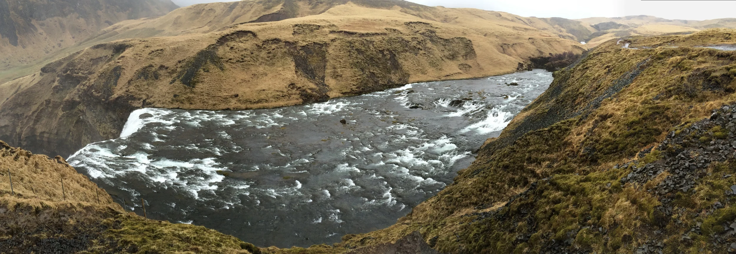
Skoga River, May 2015, near Skogafoss
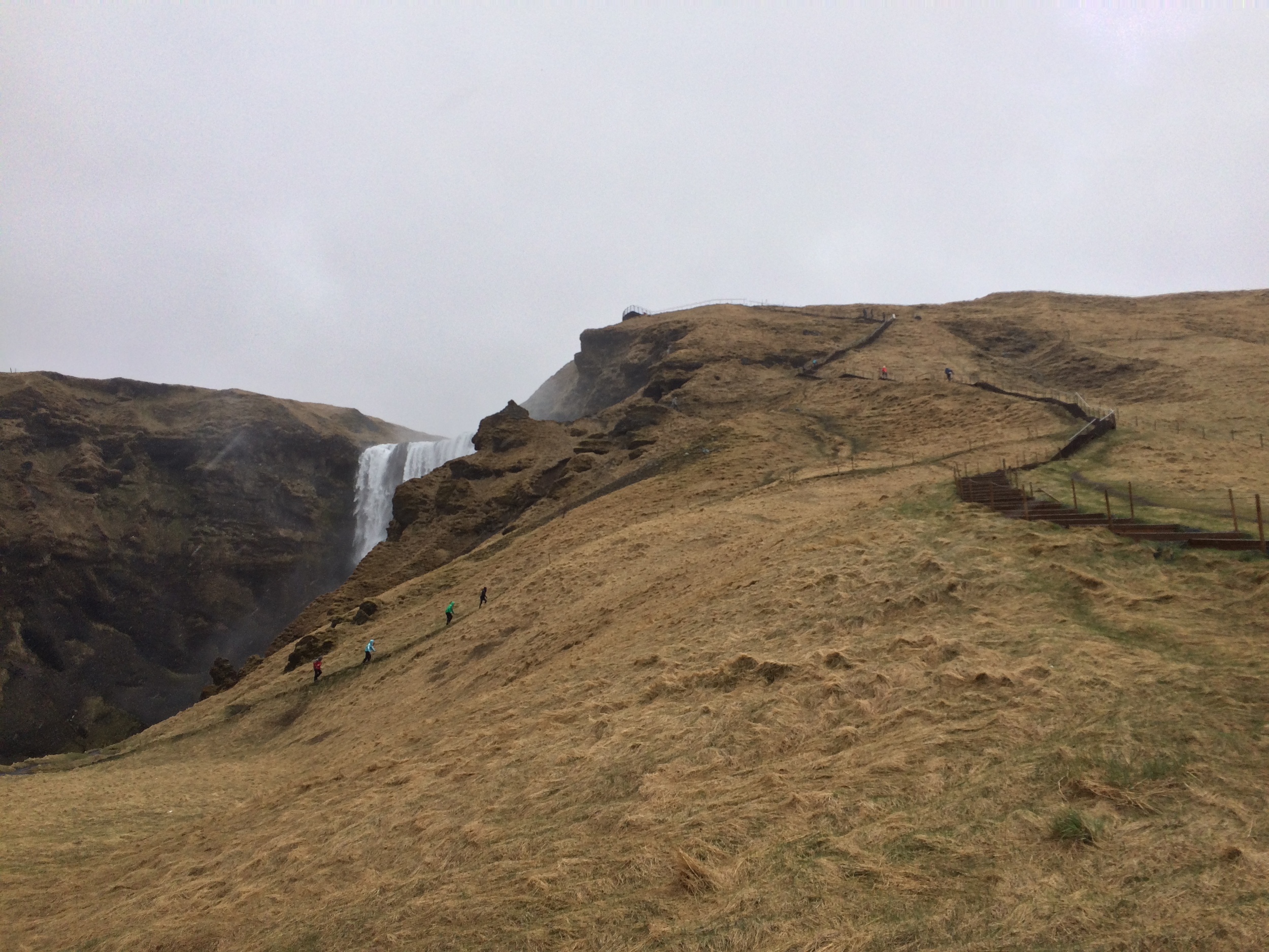
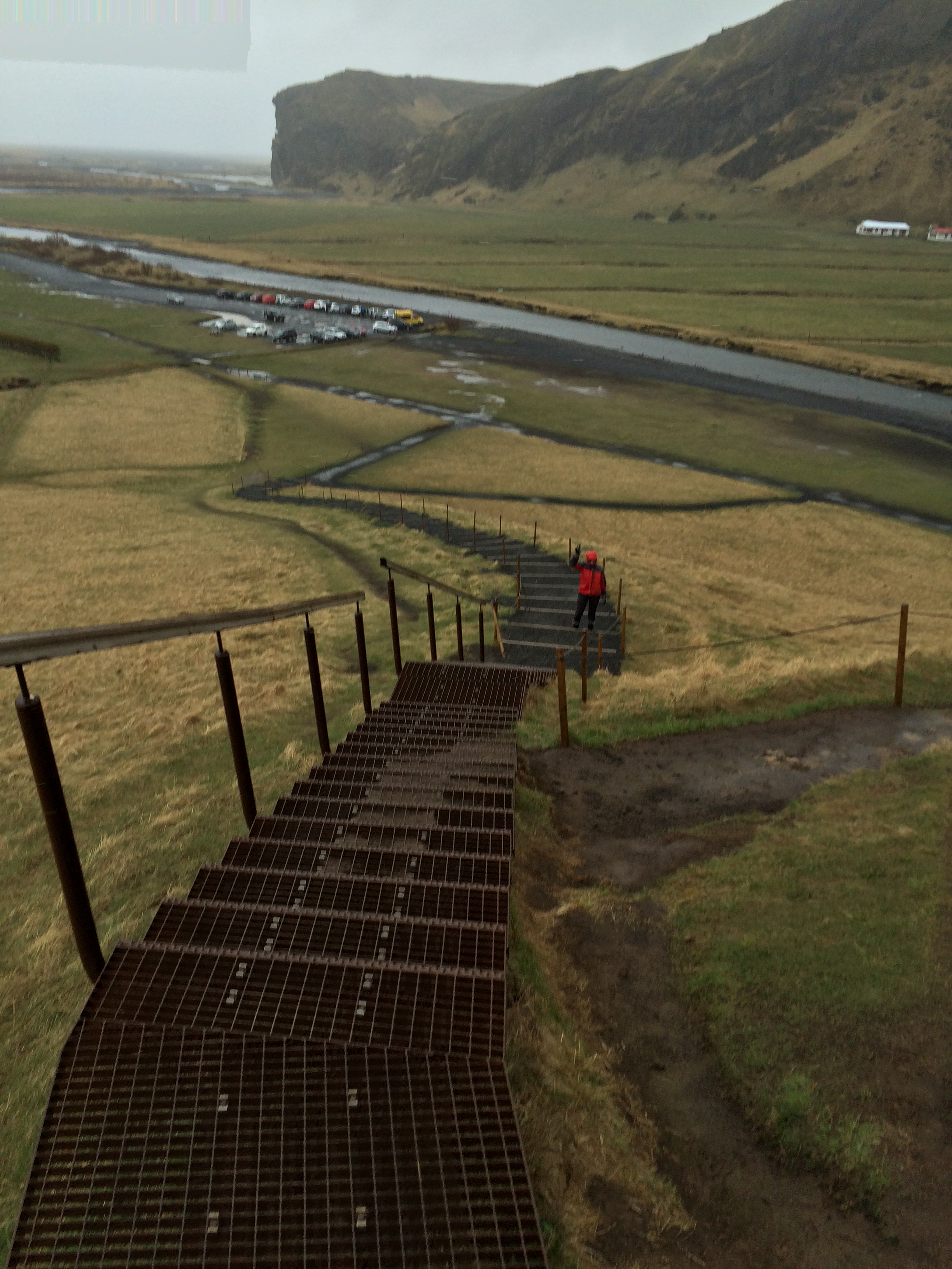
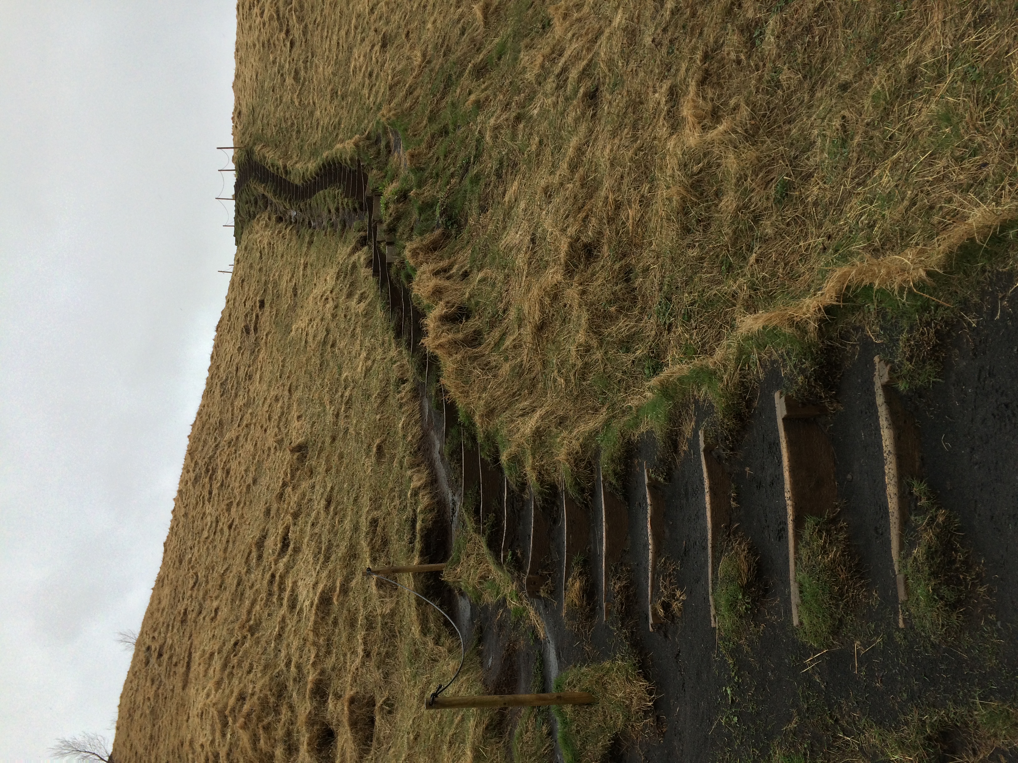
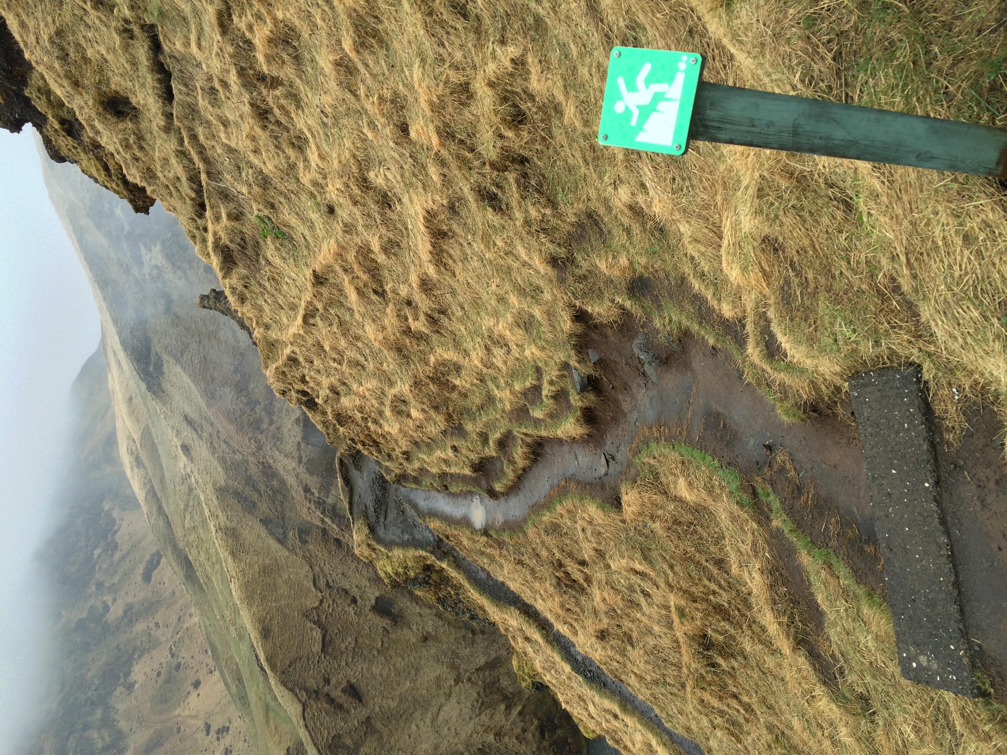
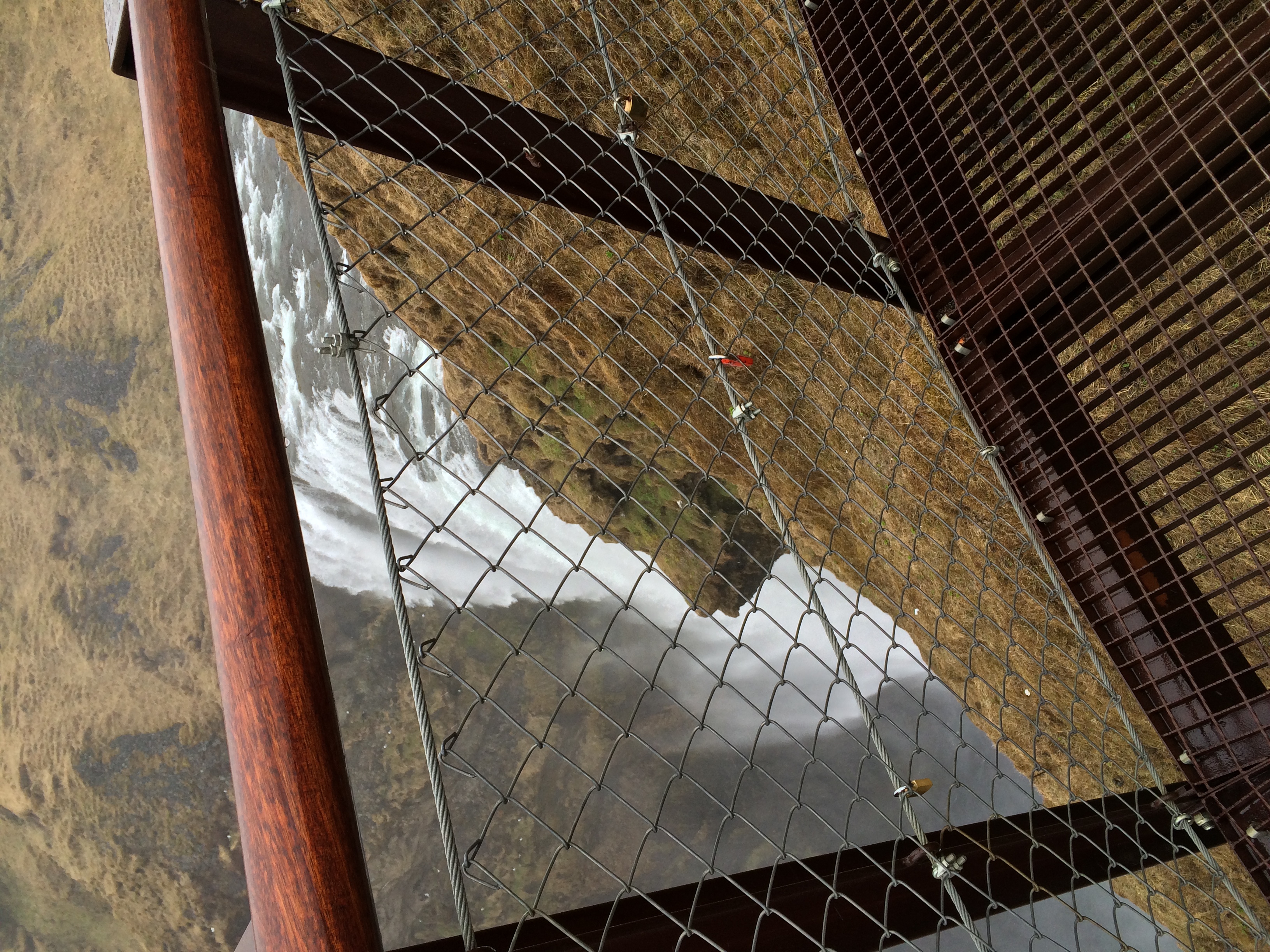
From the parking area/trailhead, visitors can walk along the Skoga River to the base of the waterfall along a flat route that is about a half a kilometer one way. From the base of the fall, visitors can marvel at the power of the fall, and if they are daring enough, look for the mythical treasure. If one is not interested in getting wet, but would like a better view of the fall itself, there is a trail that ascends alongside the fall to a viewpoint at the top. This trail leaves directly from the parking lot, and is readily visible as it is somewhat steep with over 450 steps. Along this trail, there is a turnout mid-way that provides some great views of the fall; however, this out-and-back spur is not for everyone, as it terminates in a spot with steep drop offs on both sides.
The main trail for Skogafoss terminates at a semi-suspended viewing platform which is above the falls, and provides great views of the Skoga River, and on a clear day, the coastline of Iceland and the Atlantic Ocean. From here, the trail continues along the Skoga River and is the start of Iceland’s famous Laugavegur track, which continues on for over fifty five kilometers over mountain passes and past some of Iceland’s glaciers.
Tips: Because of the power of the fall, Skogafoss is reputed to have a famous rainbow – or double rainbow on sunny days. As you can see from my photos, the weather did not cooperate for me, so I did not see the rainbow(s), but even on a cloudy day, it is an amazing hike. Skogafoss is also close to the wrecked DC-3, so visitors can pair these two adventures together for a great single day of exploration.