2011 Geminid Meteor Shower, December 13-15th

Astronomers, sky-watchers, and x-files fans, rejoice! The year is ending with a lot of celestial activity! As you know, last weekend was the total lunar eclipse, and this week we will have the annual Geminid Meteor shower from December 13-15th. From what I'm reading, December 13 and the 14th will be the peak viewing days. This is one of the best meteor showers yearly, and despite the bright moon, should still be pretty amazing. You can be sure that despite it being a worknight, I will be out to see what I can see. As always for stargazing or celestial object watching, the farther away you can get from city lights, or any light pollution, the better. After that, just look around, and you should see something! 

Ten Tips for Watching it Here: http://earthsky.org/astronomy-essentials/ten-tips-for-watching-the-geminid-meteor-shower

A super neat app for smartphone users watching here (I'm definitely going to try it out): http://itunes.apple.com/us/app/meteor-counter/id466896415

And...even more information here: http://science.nasa.gov/science-news/science-at-nasa/2011/13dec_geminids/, http://shadowandsubstance.com/, http://latimesblogs.latimes.com/nationnow/2011/12/geminid-meteor-shower-to-peak-on-tuesday.html

Keep an eye on the sky!

The Mist Trail to Vernal Falls (Staying Dry)

Vernal Falls, 2009

In my previous post (http://lastadventurer.com/last-adventurers-fieldnotes/2011/12/12/the-mist-trail-to-vernal-falls-winter.html), I might have mentioned that should you elect to head up the last .5 miles on the Mist Trail, you will get wet. I did, however, leave myself a slight out by saying that should you manage to time it right, you can walk aside the falls and still stay dry. Should you head up the trail in late fall, shortly before the first snows of the year, you will likely find it like I did in 2009 when I shot these pictures.

Vernal Falls, 2009 

Note the discrepancy between the water (and snow/ice) levels in these shots from the pictures taken in the previous post – these photos were taken almost exactly a year apart from 2009 to 2010, give or take a couple days. If it’s a late winter, you probably can expect to have conditions like this on the trail into mid-to-late November, but if it’s an early winter, you can expect conditions like the 2010 shots before. It should go without saying, but keep an eye on the conditions prior to your trip, because you never know what you will occur weather wise in the mountains.

In my experience, you can also find the falls at low flow like this at times in winter, when they are iced over, and sometimes in early spring before the snowpack up in the Sierras begins to melt. But, if you want to stay dry without risking ice and or snow, late fall is your best bet, and also a great time to do the hike, as the trees will be changing colors and losing their leaves.


Directions: Same as the post before. (http://lastadventurer.com/last-adventurers-fieldnotes/2011/12/12/the-mist-trail-to-vernal-falls-winter.html)


See you on the trail! 

The Mist Trail to Vernal Falls (Winter)

Looking towards Illouette, Mist Trail 2010

There is one trailhead, and one trailhead only in Yosemite. At least, that is what you would think if you ever read anything about Yosemite, heard anything about Yosemite, or watched the hordes of people either walking or riding park shuttles to this spot. That spot, and that trailhead is, and can only be one place: Happy Isles. That is the trailhead that takes you to a number of stunning places, but most importantly, it takes you to the two most visited destinations in the park: the Mist Trail , and Half Dome. Astute readers of this blog will stop at this point and think, “Wait a minute. So-and-so said the Mist Trail was the best hike they’d ever been on. How can that be, if he just said that it’s one of the most visited trails in the park? Can that be right?”

To those astute readers, I have sad news. The Mist Trail is the most popular trail in the park, bar none.

On a hot summer day, the trail is always chock full of people just as Los Angeles freeways are always chock full of cars. I guarantee it. Even more damning (to some people), the trail is – wait for it – partially paved. Now, if these two things are deal breakers for you, read no further, but at least look at the pretty pictures I’ve attached, because the scenery is beautiful. For the rest of us, let me tell you this: yes, the Mist Trail is the most popular trail. Yes, you may be surrounded by people, and yes, that can be difficult at times. But the hike is still stunning. It is a chance to walk directly next to, and under Vernal Falls, alongside the Merced River, and to the top of the falls, where great views of Yosemite Valley, Liberty Cap, along with other portions of the park. It is the most popular trail, and hike: but it is that way for a reason. You should not not hike it just because it is popular, as this is one of those situations where the masses are right.

Snowmelt on the Mist Trail, 2010

Directions: Well, you’re going to leave from the Happy Isles trailhead. I believe I mentioned that somewhere, but in case I didn’t, you’re going to take the Happy Isles trailhead. You can either take the free park shuttle to that location (Stop Number 16), or you can potentially find parking at Curry Village, and walk from there (if you walk from Curry Village, add an extra .75 miles distance each way, for a roundtrip distance bonus of 1.5 miles). From the trailhead, follow the paved portion uphill (believe me, you will not get lost, as you will be around many people, and there are no turnouts) for .75 miles to the bridge crossing the Merced River. From the bridge, you can see Vernal Fall, and if you’re feeling it, this is a great place to stop and watch the Merced and the waterfall.

For the hiking purists, from this point, the trail is not paved. Once you are across the bridge, you will continue to follow the trail up, and you will pass the John Muir Trail (“JMT”) junction on your right (.2 miles from the bridge). Do not take the JMT unless you are going to Nevada Falls, or other destinations that are further away, such as Mt. Whitney. Once you pass the JMT junction, you will come upon a gate for the Mist Trail that is closed in winter. This is the actual portion of the Mist trail, and from this point, you will get wet.

Heading up the Mist Trail in 2010The last section of the trail traverses alongside the Merced River, and is right next to and under Vernal Falls. This section of trail is constantly deluged/soaked/drenched with water from the falls. Unless it is a drought year, or a part of the year where the falls are not raging, you, your gear, and everything on you, will get wet. Watch your step as you head up the 600 or so steps up the remaining .5 miles to the top of the waterfall. Once you are at the top, you will have a great view of the Merced from the edge of the waterfall. From there, you can either proceed up to Nevada Falls, and Little Yosemite Valley, or you can return back to Happy Isles the way you came.

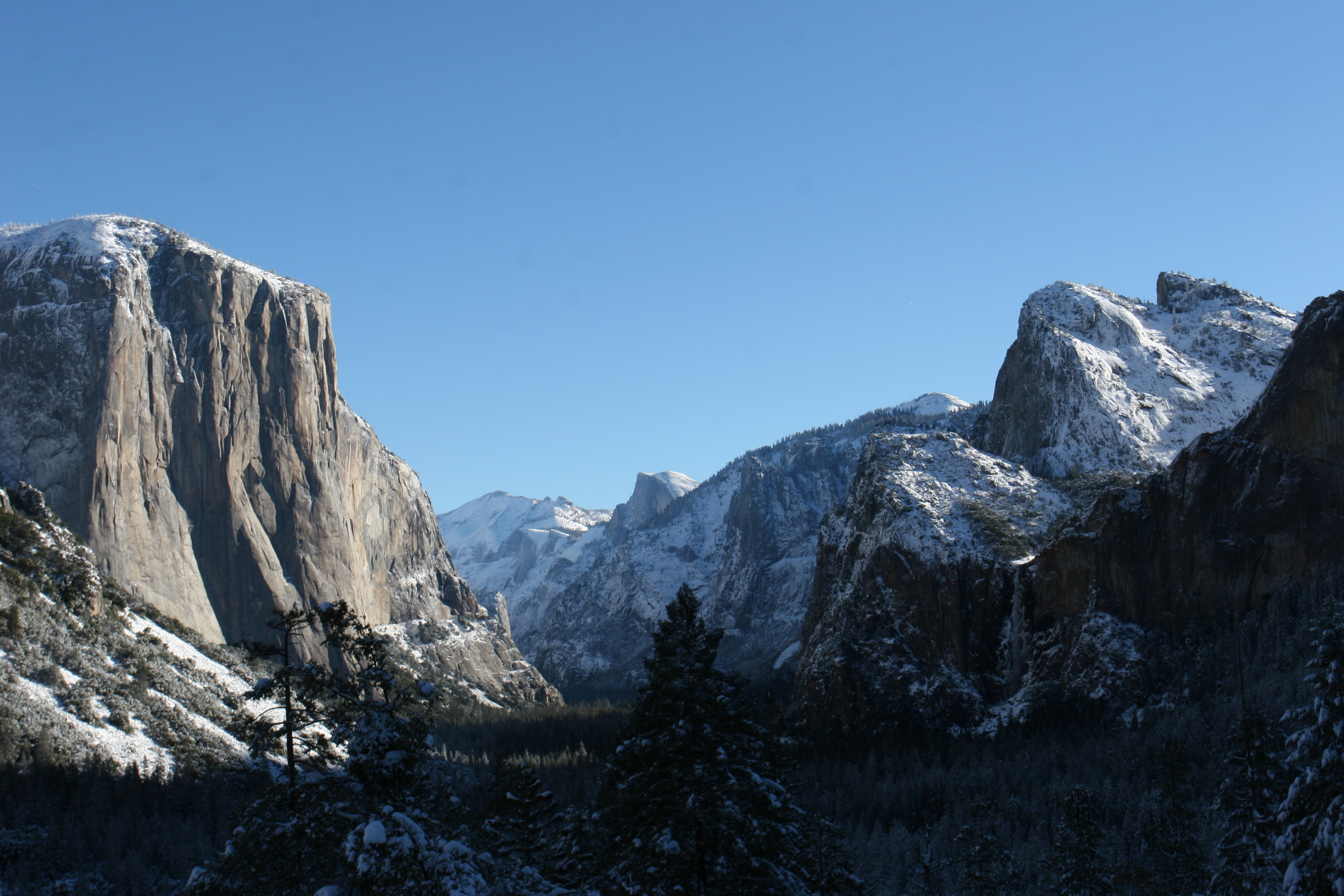
My Tip: As this is the most popular hike in the park, and is beyond well known, I’d suggest that you do this hike during the off-season if you can. If you are in the park in late spring, fall, or early winter, you will find the trail mostly empty. Moreover, at these times, you will find that you enjoy this hike more than being stuck with hordes of people on the trail in the summer. In 2010, I hiked up the Mist Trail in late November, a week after a fresh snowfall, and had an amazing experience. As you can see from the absence of people in these photos, in those conditions, it did not look like the most popular trail in the park, but it did look like a winter wonderland.


Disclaimer: The National Park Service closes the last .5 miles of the Mist Trail in the dead of winter as it is a treacherous ascent with ice and snow. I would not recommend you proceed in these conditions as there is little to no room for error. However, if you feel like you are up to the task, bring the proper gear, know that you are on your own, and watch this video here: http://youtu.be/ybrDF3wCdMU

Vernal Fall, Winter 2010

Other Facts:  The hike is 3 miles roundtrip, plus or minus any distance you add from hiking from Curry Village or other destinations. You will gain 1,000 feet of elevation from the valley floor to the top of the falls, and you will likely have an excellent time! (http://www.nps.gov/yose/planyourvisit/valleyhikes.htm)

See you on the trail!

 Hiking Superhighway? Not in winter!

More Information: http://www.yosemitehikes.com/yosemite-valley/mist-trail/mist-trail.htm,  http://timberlinetrails.net/YosemiteMistTrail.html, http://en.wikipedia.org/wiki/File:Happy-Isles-topo-map.jpg, http://en.wikipedia.org/wiki/Mist_Trail

Total Lunar Eclipse, December 10, 2011

If you're like me and you like stargazing, and looking for other rare astral phenomena, you are in for a treat tonight (assuming you're on the right part of the planet!). In the early hours of December 10, 2011, there will be a total lunar eclipse, and if that wasn't cool enough, it will be the last total lunar eclipse for the next three years. So, if you're in spot where you can see it, and the weather is just right, get out there, and don't miss it!

See you on the dark side of the moon!

Great Info here: http://shadowandsubstance.com/

More Info Herehttp://en.wikipedia.org/wiki/December_2011_lunar_eclipsehttp://www.space.com/13856-total-lunar-eclipse-rare-senelion.html, http://eclipse.gsfc.nasa.gov/OH/OHfigures/OH2011-Fig06.pdf

Sentinel Dome, Yosemite National Park

After John Muir, Ansel Adams is probably the next famous name that people think of when they think of Yosemite. While Ansel Adams has many stunning shots of the park, perhaps one of his most famous shots was that of the lone Jeffrey Pine atop Sentinel Dome. If you haven’t seen the shot because you’ve been living on the moon, it looks like this: http://www.anseladams.com/ProductDetails.asp?ProductCode=5010114-u. This shot inspired thousands, if not tens of thousands of people to make the trek up to Sentinel Dome and to take their own pictures of the lone Jeffrey Pine at a variety of angles, either seeking to emulate the master, or to try and provide a new iconic shot. (http://www.flickr.com/photos/46457020@N00/224779782/). Sadly, the tree died in 1976, and ultimately collapsed in 2003. (http://en.wikipedia.org/wiki/Sentinel_Dome). 

At this point, you may think, “Well, now that the tree is gone, there’s no reason to go there.” To this assertion, I merely say this: “Au contrere, my friend, au contrere”. While the tree was special, magical, and amazing (I would know, I spent a night under it while it still stood, and despite the four feet of snow atop the dome and around me, had a spectacular night of stargazing and discussion), the Dome is also pretty interesting on its own. For starters, it’s the second highest peak in the valley at 8,122 feet, coming in a close second to that other well-traveled mountain – Half Dome. Second, it is easily accessible from either the Four Mile Trail in the Valley, or the Sentinel Dome Trail off of Glacier Point Road. Third, it has an amazing three hundred and sixty degree view of Yosemite Valley, and the park (similar to the amazing panorama from atop Mt. Hoffman, in my opinion). And fourth, it has better views and is less croweded than the Glacier Point Overlook, in my opinion.

Either route to the top of Sentinel Dome is easy to find, and easy to follow. The Four Mile Trail from the Valley is definitely the more strenuous option, as you will be gaining over four thousand feet of elevation, and covering a distance of over ten miles round trip. The route I would recommend for most people is from the Sentinel Dome Parking area, immediately off Glacier Point Road. (http://www.nps.gov/yose/planyourvisit/glacierhikes.htm). From the parking area, it is a 1.1 mile hike to the top of the dome, and you will only gain 500 vertical feet. I’d rate the hike as easy, as it meanders over mostly flat terrain before there is a slight scramble to the top of the dome for the last tenth of a mile. At the top, there is that aforementioned three hundred and sixty degree view, the remains of the Jeffrey Pine, and the sense of accomplishment of having likely bagged your first Yosemite summit.

I was in the park in mid-November of this year, and since we’ve been having a dry winter, I was able to again summit the peak with little to no difficulty, as the trail was mostly free of snow. As it was a perfect bluebird day, I was able to shoot this panoramic video: http://www.youtube.com/user/lstad1#p/a/u/0/4X_niPQCxJY

 Tips:    Take a meal and enjoy the view! For the more adventurous, head on up on a night with no moon, and be prepared for some amazing stargazing. Or, for a change of pace, head up the dome under the Full Moon, and be ready to see the park lit up in phantasmagorical black and surreal white.

More Information: http://www.yosemitehikes.com/glacier-point-road/sentinel-dome/sentinel-dome.htm, http://gregable.com/2007/10/sentinel-dome-jeffrey-pine-in-yosemite.html

See you on the trail!

Wawona Tunnel Emergency Access

Wawona Tunnel Emergency Access

Although the Tunnel View is spectacular, its not the best view of Yosemite Valley from Highway 41. The best view from Highway 41 is hidden away from the crowds at the Tunnel View, and it is the Wawona Tunnel Emergency Access view. I discovered this spot when I was working for the National Park Service one summer.