Some of the sand-castle-like mud formations in the Arroyo Tapiado
If you’re a Southern California resident, and you’re looking for a challenge that is a little more exciting than Potato Chip Rock (a/k/a Mount Woodson), the adventure you’re looking for is the Arroyo Tapiado Mud Caves. Since I covered this area in detail back in 2011 here, I’m not going to go into excruciating detail today, because you can read the details here. The caves are located approximately two hours outside of San Diego, and are perhaps the largest network of mud caves in the world, comprising some twenty to thirty caves.
Directions: If you are coming from San Diego, take the I-8 east to the town of Ocotillo, California. Exit the freeway, and turn onto the S-2 hearing North (Left). Follow the S-2 past the brand sparkling new wind turbines, through the border checkpoint, and into Anza-Borrego State Park. Once you are in the State Park, you will want to look for Mile Marker 43, which is also marked as the “Palm Spring” turnout (no, it is not the turnout for the town, it is the turnout for the actual Palm Spring from the Butterfield Stage Line). From this point on you will be “off-roading”.

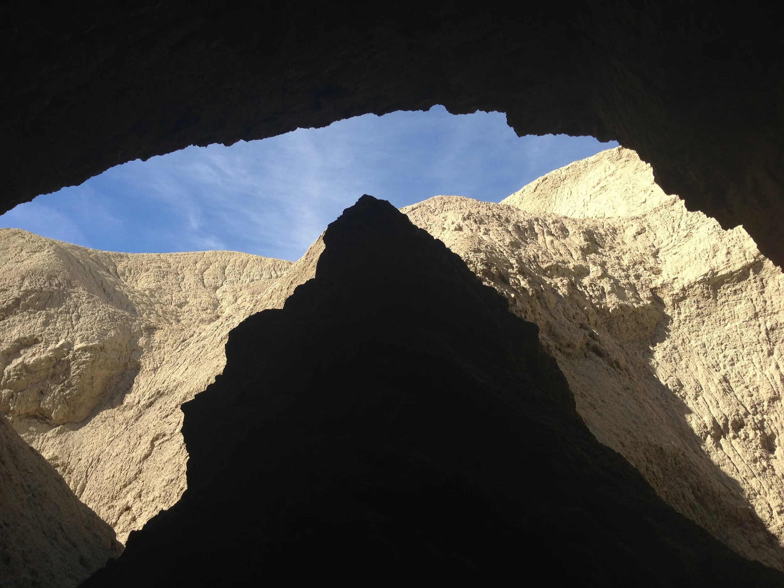
Cave Entrance/Exit, Arroyo Tapiado (2013)
I’ve placed the quotes there because while the road is not paved or graded, I have seen a number of non-AWD/4WD drive vehicles traverse the route into the canyon safely. Fair warning: there are a number of sandy spots, and if you are electing to take this route in a standard car without any off-road driving experience, there is a chance that you could become stuck. From the S-2, it is 4.5 miles to the Arroyo Tapiado Wash, which is signed by the State Park system. Once you are in the wash, it is approximately 1.2 miles to where you will find caves. Summitpost.org does a great job of providing maps and directions here to various caves, and you can also find information in my last post. From this point, I’d recommend exploring anything and everything that looks interesting.
Tips: I’m always asked about the “best times” to visit places, and in this case, the best time would be anytime from late October to mid-May, unless you like 115 degree temperatures. On this visit, my group were able to get into some of the larger caves, and some of the smaller caves, which required some serious maneuvering in places, which made me think of two things: 1) be safe; and 2) be prepared. With respect to number one, I would be remiss if I didn’t mention the solo hiker that died in 2012 when he fell in one of the caves.
This accident demonstrates the constant need for a partner when spelunking. It is easy to get lost underground even in perfect conditions and, if there was to be a cave-in, it’s always good to have someone who can hopefully go for help. Even above ground, this is an area that contains many washes, gullys, and dead-ends. If you are not experienced in desert orienteering, this is an area you could become easily lost in, as one wash looks much like another. With respect to being prepared, be sure to have flashlights, food, water, and other essential gear. Finally, be sure to have fun in observing the formations, watch your head in the caves, and be prepared to get down and dirty, because you will come out of these caves with a thick coat of dust, dirt, and mud at the end of the day.
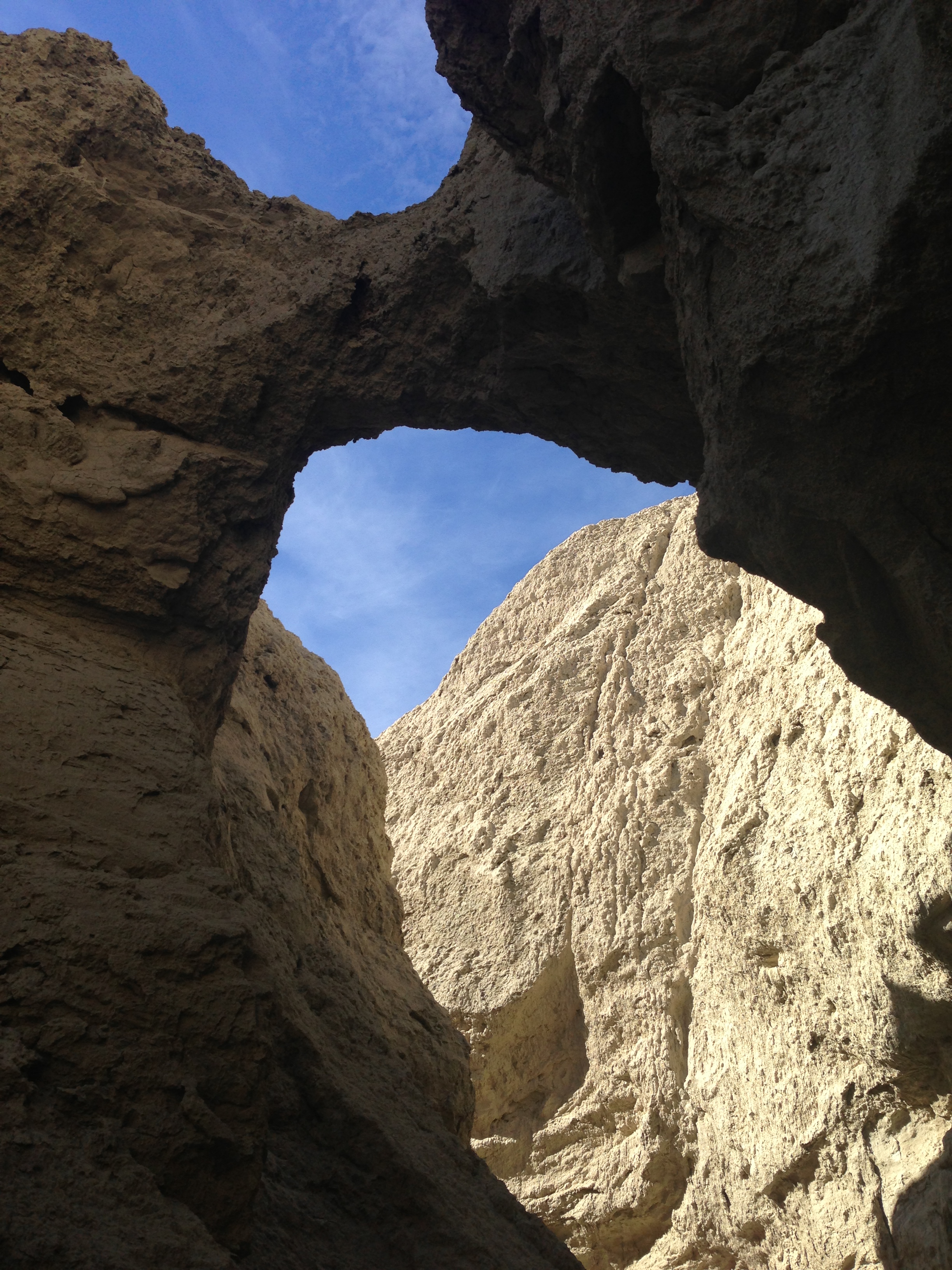
Natural Bridge, Arroyo Tapiado (2013)

Arroyo Tapiado, February 2013

Arroyo Tapiado, February 2013

Arroyo Tapiado, February 2013

Arroyo Tapiado, February 2013