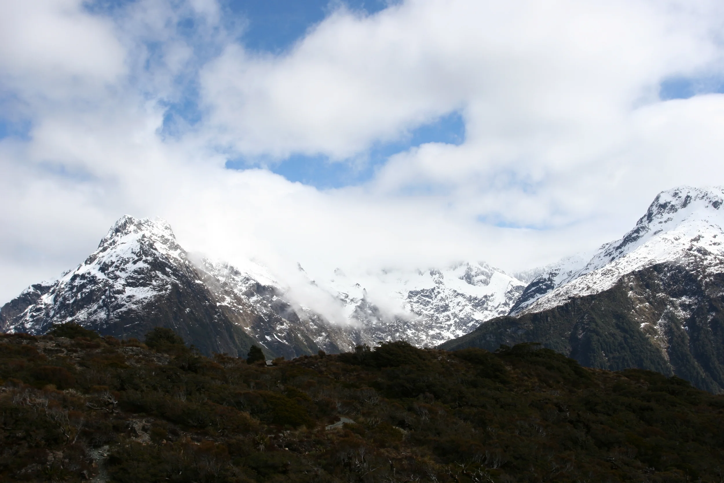
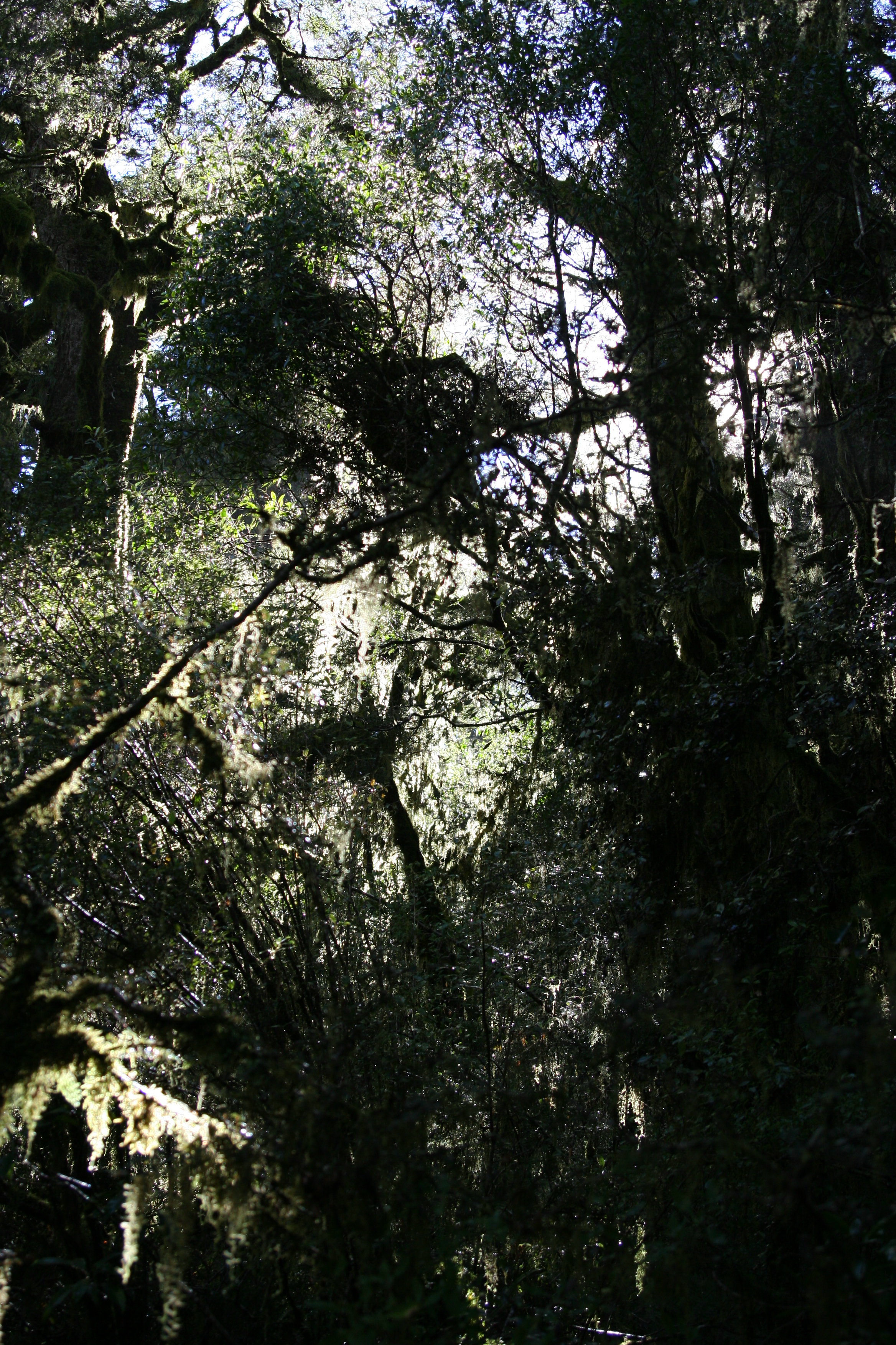
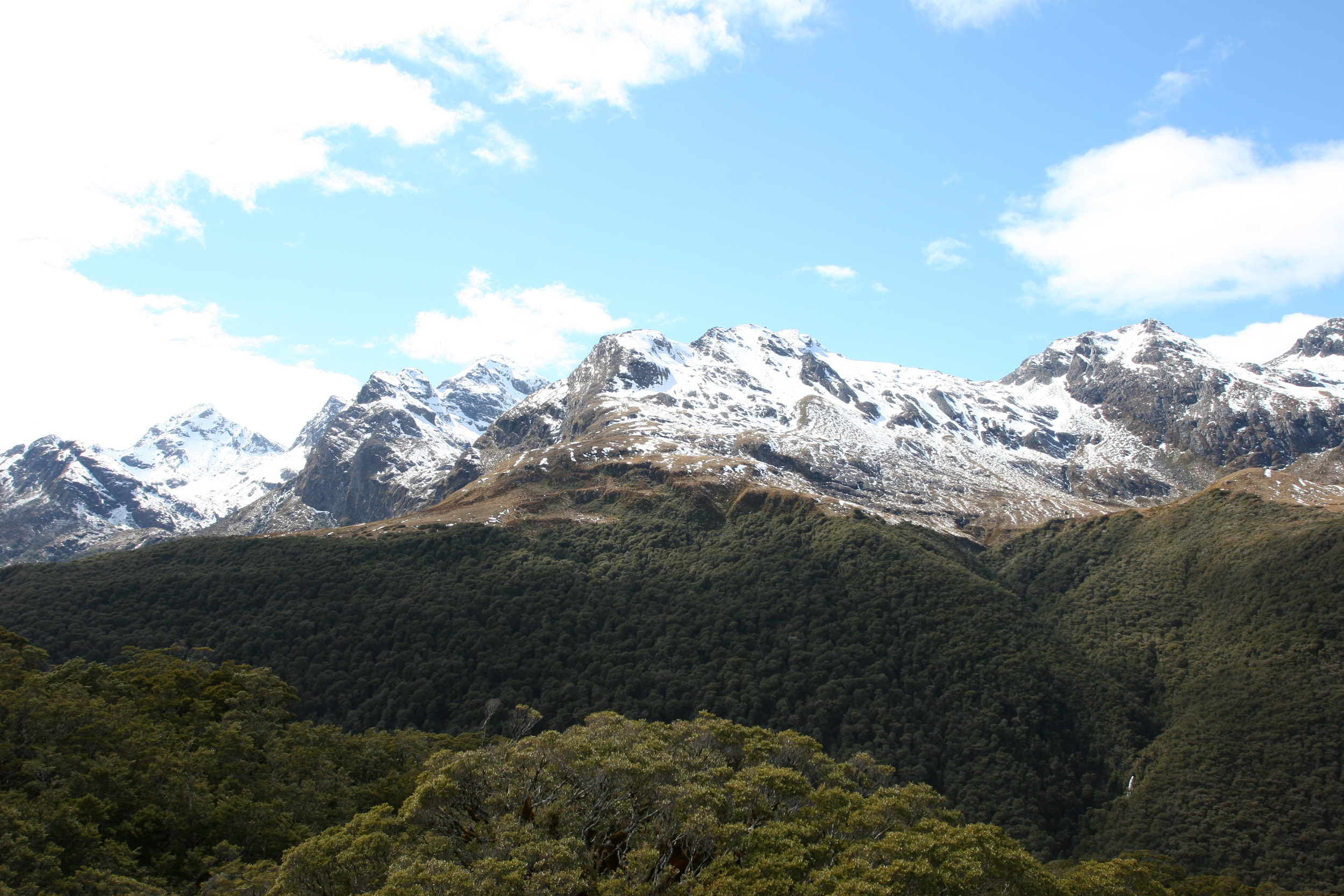
Beech Forest looking out on New Zealand's Southern Alps at the start of Routeburn Track
From the sand dunes of the Farewell Spit, to the volcanic terrain of Tongariro National Park, to the lush forests of Rakiura National Park and the tropical beaches of Abel Tasman, New Zealand has almost every type of backcountry terrain that a hiker could want. With so many picturesque and jaw dropping locations, it is hard to find first, a bad hike in all of New Zealand, and second, “the best” hike in all of New Zealand. However, if you are a person who likes superlatives and stunning alpine views, the best hike in all of the three islands of New Zealand (North, South, and Stewart) might just be Key Summit.
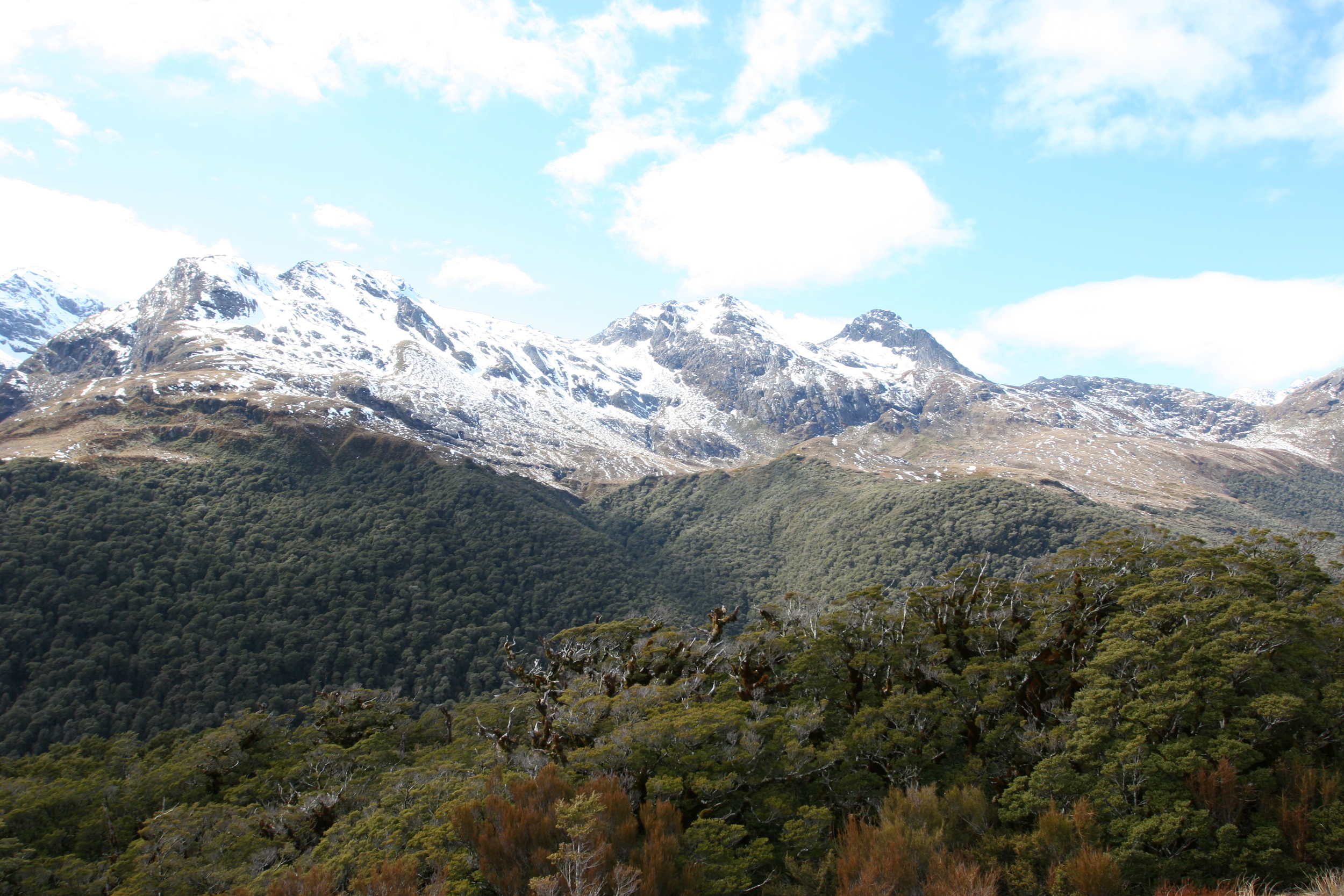
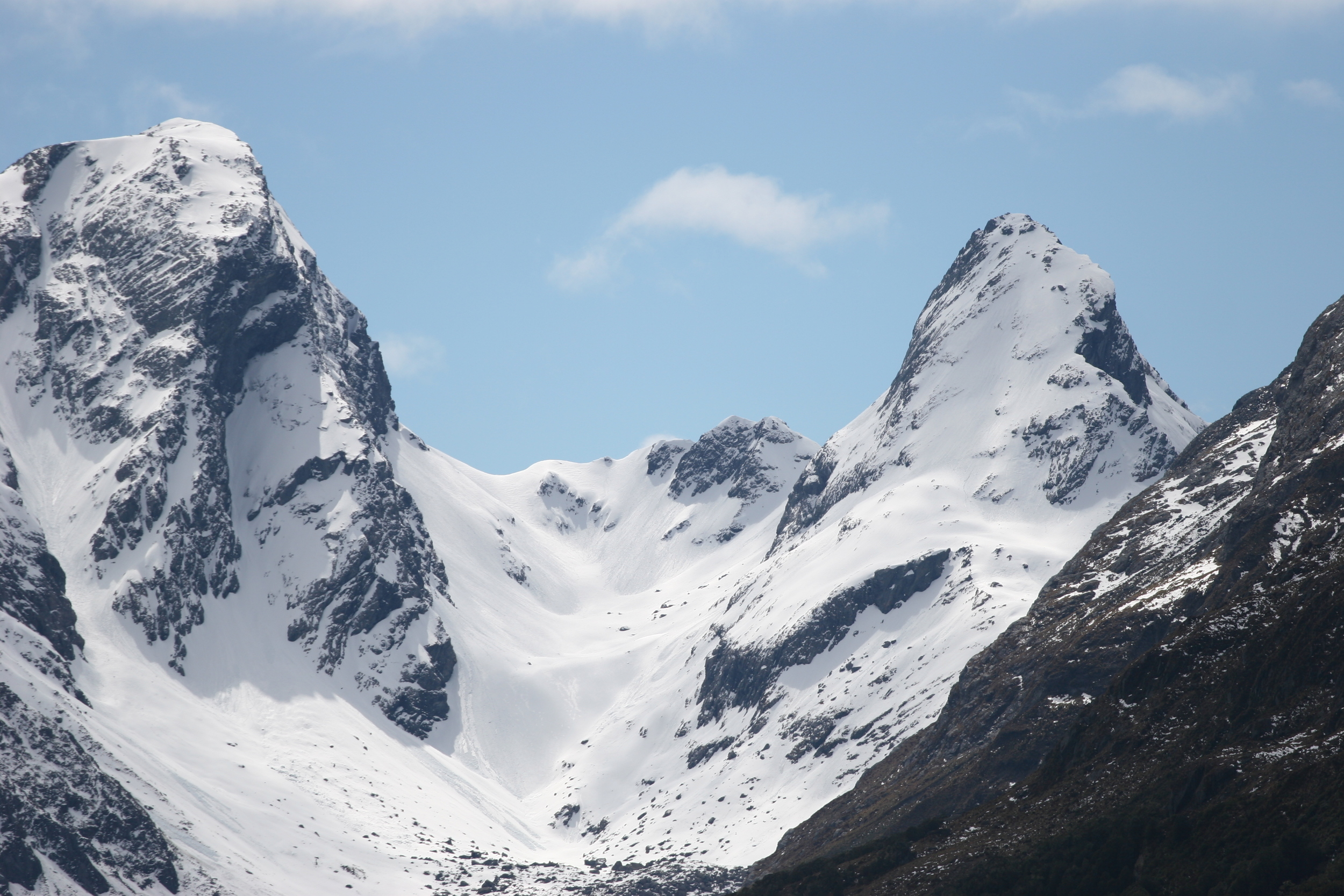
Key Summit is part of the Routeburn Track, which is one of the nine “great walks” of New Zealand. While most of the great walks of New Zealand are multi-day affairs, the Key Summit hike can be easily accomplished during part or all of a day, and is located on the first section of the Routeburn Track. Both the Routeburn Track and the Milford Track are located in Fiordland National Park, which is one of the most visually spectacular portions of New Zealand. Located on the southwest corner of the South Island, Fiordland National Park features glacier carved fjords and high peaks that are part of the Southern Alps. While the Milford Track offers great views of the park as a whole, the Routeburn Track offers stunning views of the alpine scenery of the park; and out of all these views, the best view is the one found at Key Summit, due to the complete three-hundred and sixty degree perspective of the area that the summit provides.
A short video of the panoramic views from Key Summit, just off the Routeburn Track on the South Island of New Zealand
Directions: The trailhead for the Key Summit hike starts from “The Divide”, which is a point in Fiordland National Park that is located directly off of the Milford Road (SH 94). From Te Anau, which is the nearest town, the Divide is located 85 kilometers to the South. It is worth noting that the Milford Road from Te Anau is to the Divide (and Milford Sound) is a two-lane divided highway that passes through extremely mountainous terrain with sharp curves and other hazards (including sheep). Because of this, the trip from Te Anau to the Divide can take upwards of an hour and a half. Further, if you have never been to Fiordland National Park, this drive can also quite a bit of time because the terrain alongside the road is spectacular in its own right.
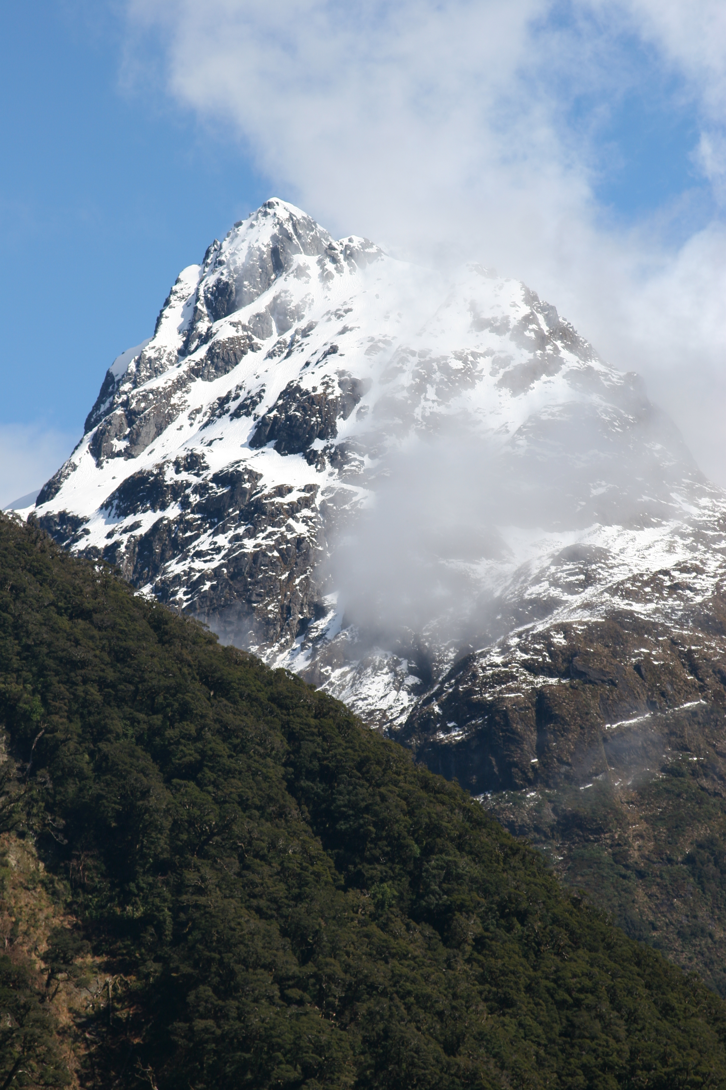
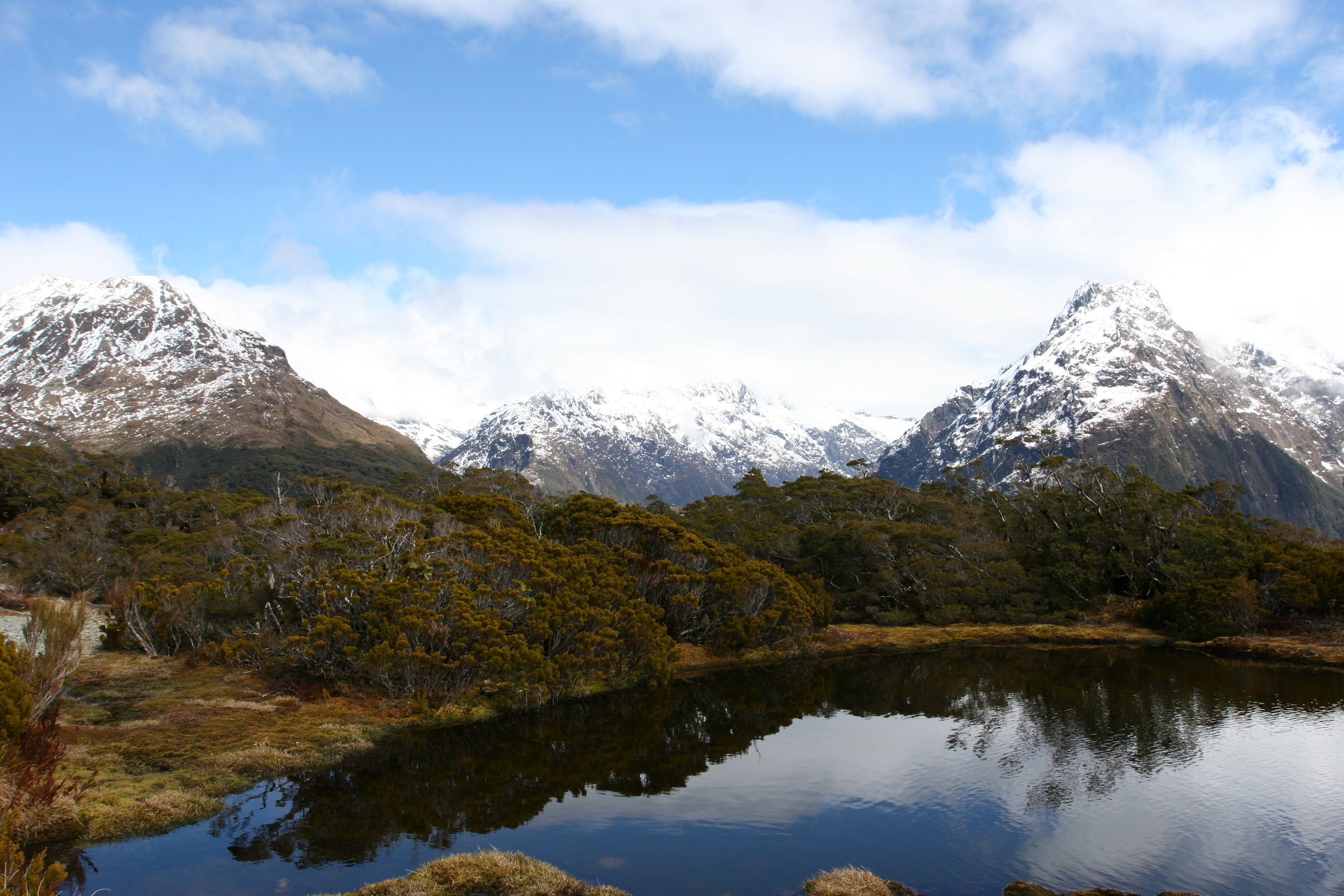
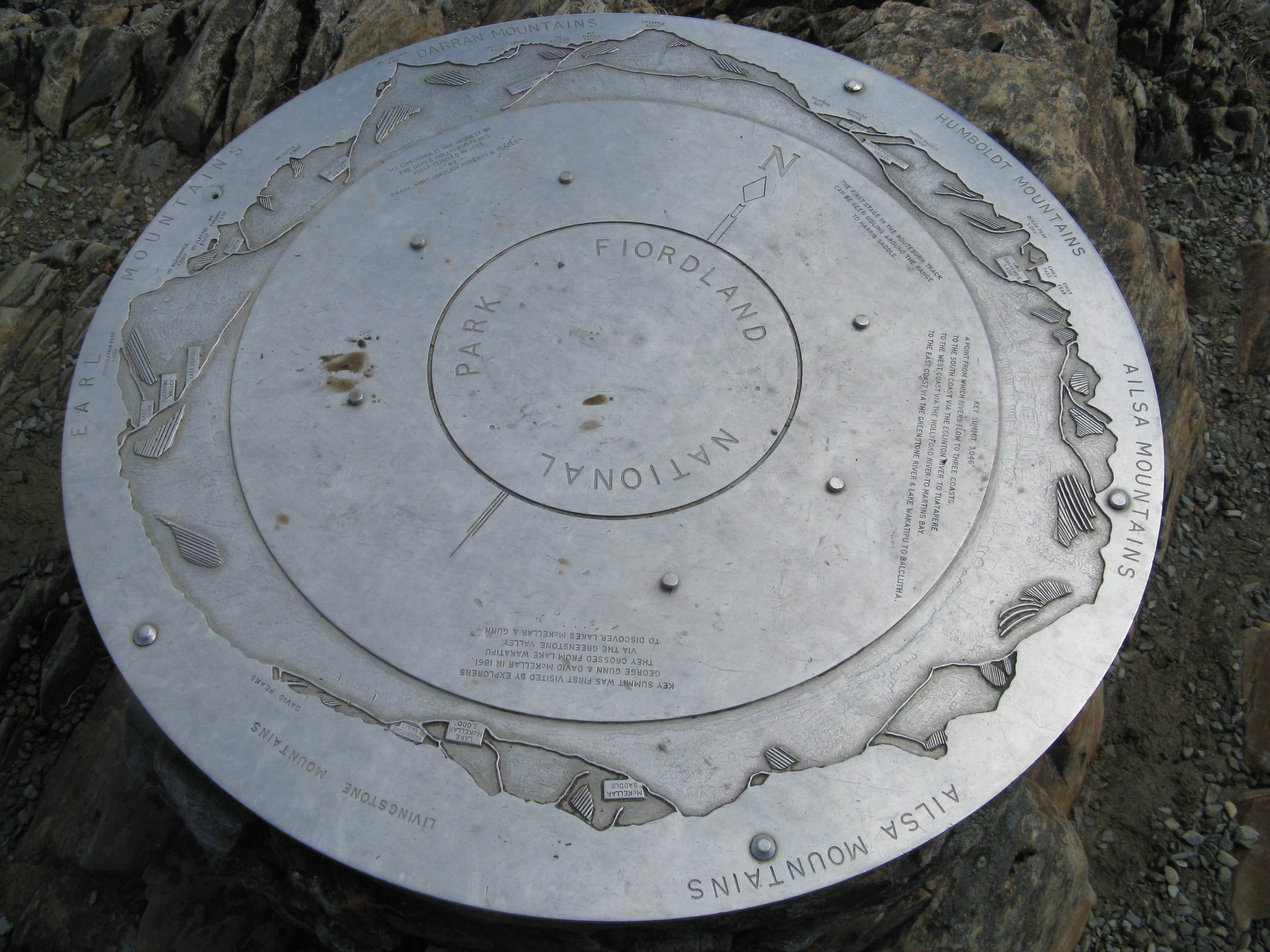
Key Summit, Fiordland National Park, New Zealand
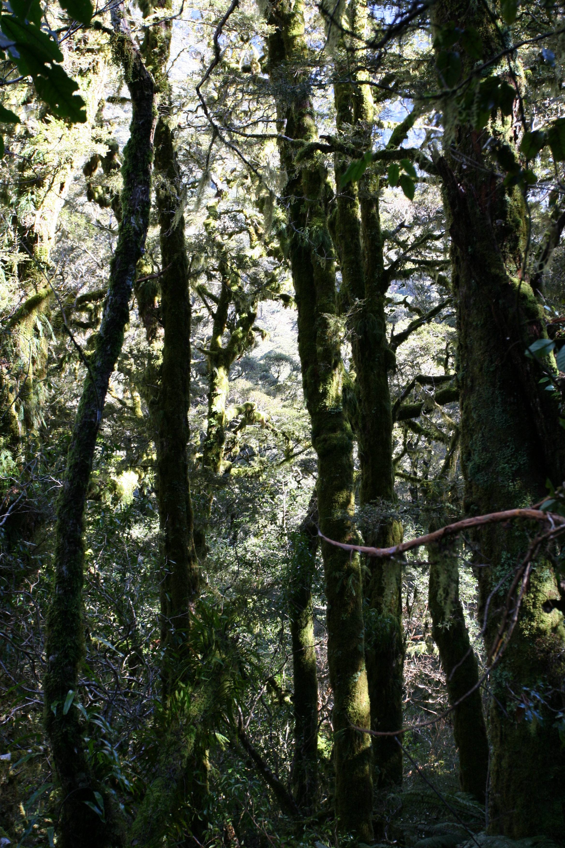
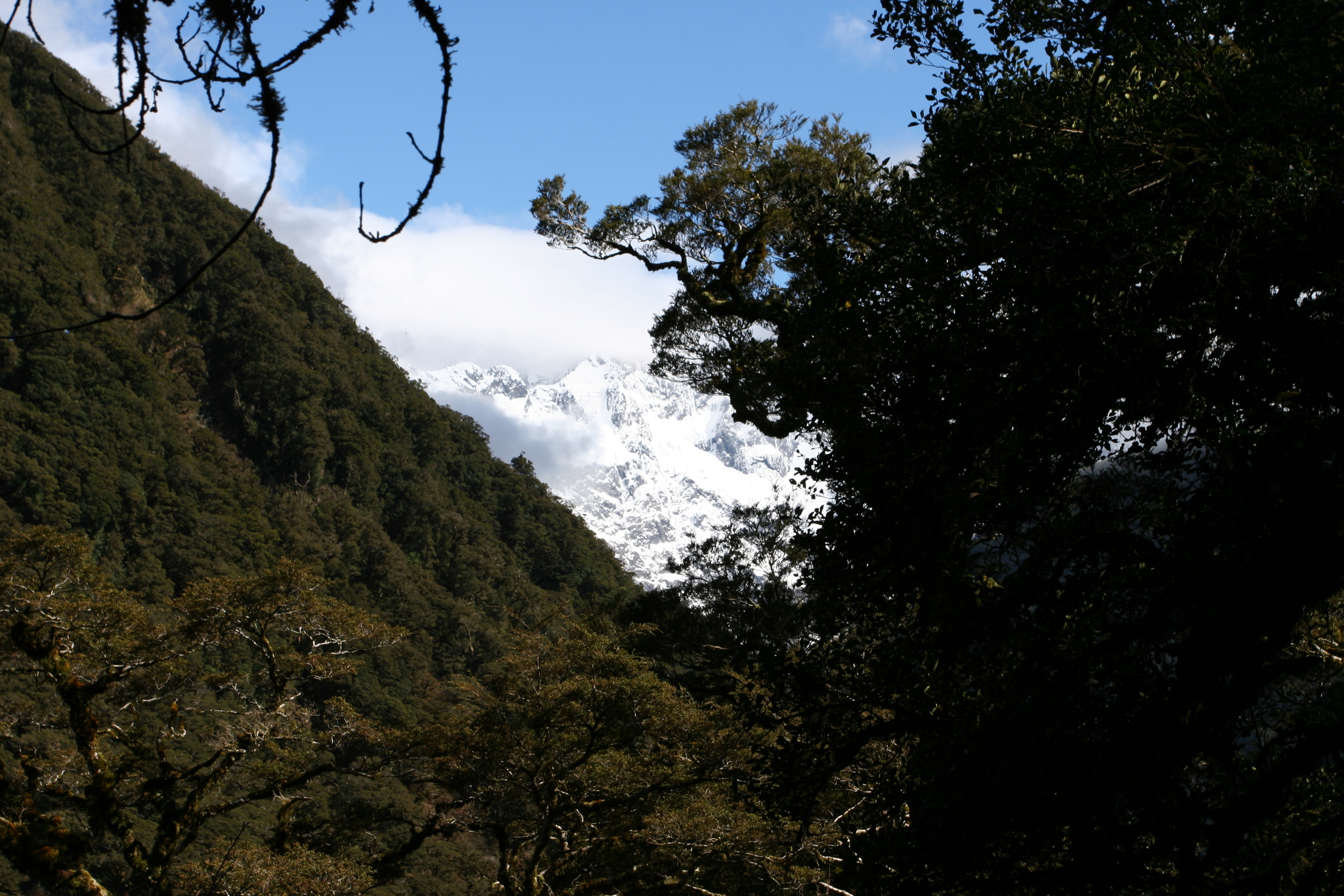
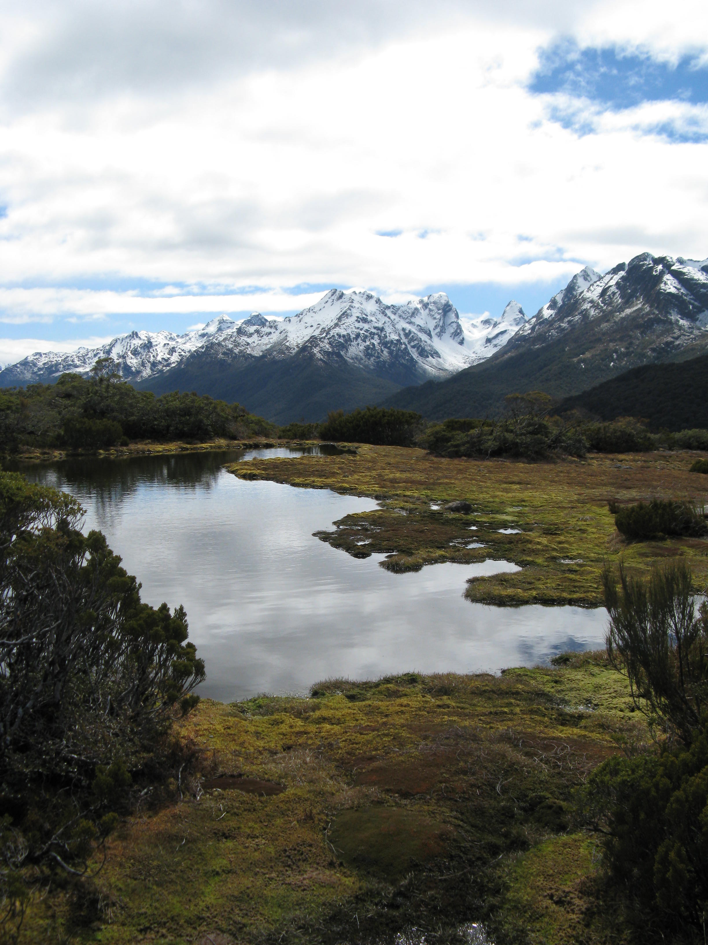
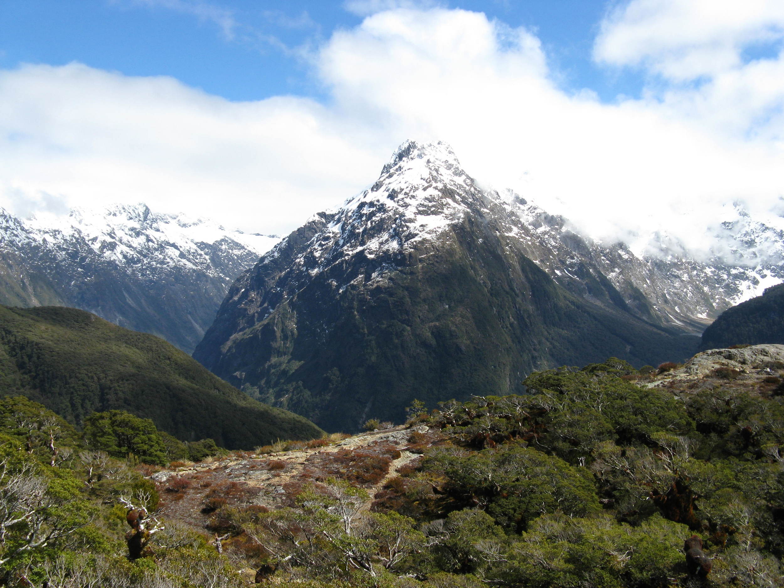
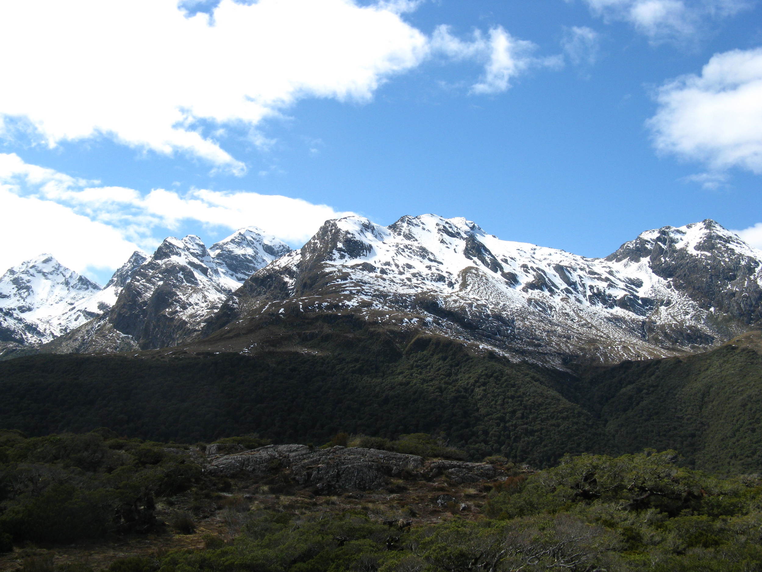
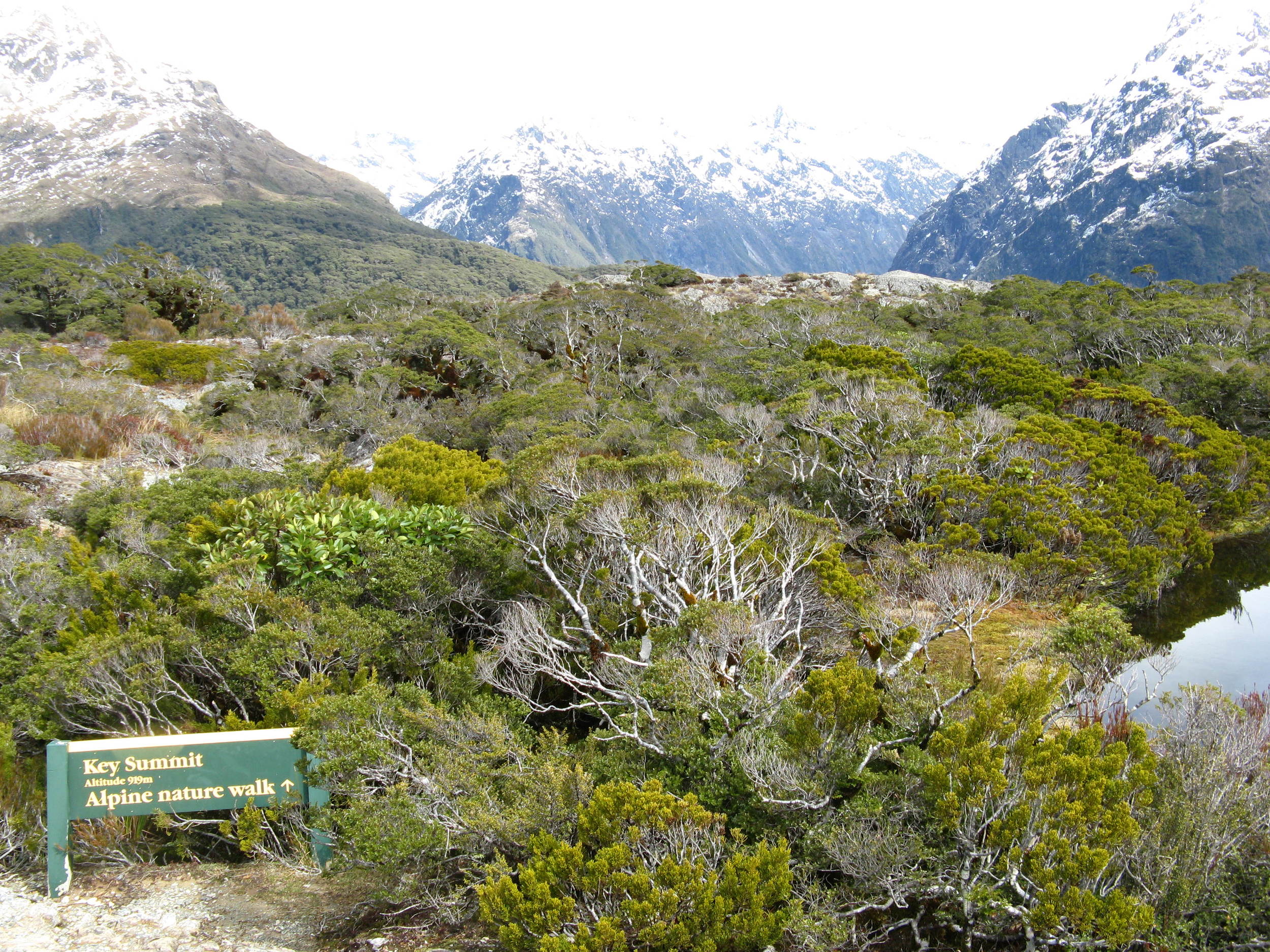
From the Divide, which is a parking area with toilets for the Routeburn Track, the trail (which is the Routeburn Track) heads up into the beech forest which surrounds the Divide. As the base elevation of the Divide is 532 meters (1,596 feet) and Key Summit is 918 meters high (2,754 feet), the route to the summit is all uphill. Although 1,158 feet of elevation gain may not seem like a lot (386 meters), it is important to keep in mind that this gain occurs over a 1.7 kilometer one way distance (1.05 miles). In layman’s terms, this means that the route to the summit is fairly steep. Having said that, the trail provides a great deal of breath-taking scenery to distract hikers from the leg-and-lung burning pain. From the initial section of the trail that passes through the forest, hikers will have ample opportunities to see some of New Zealand’s many unique native birds. In addition to the birds, hikers will also be able to catch glimpses of some of the many snowcapped peaks surrounding Key Summit from the forest.
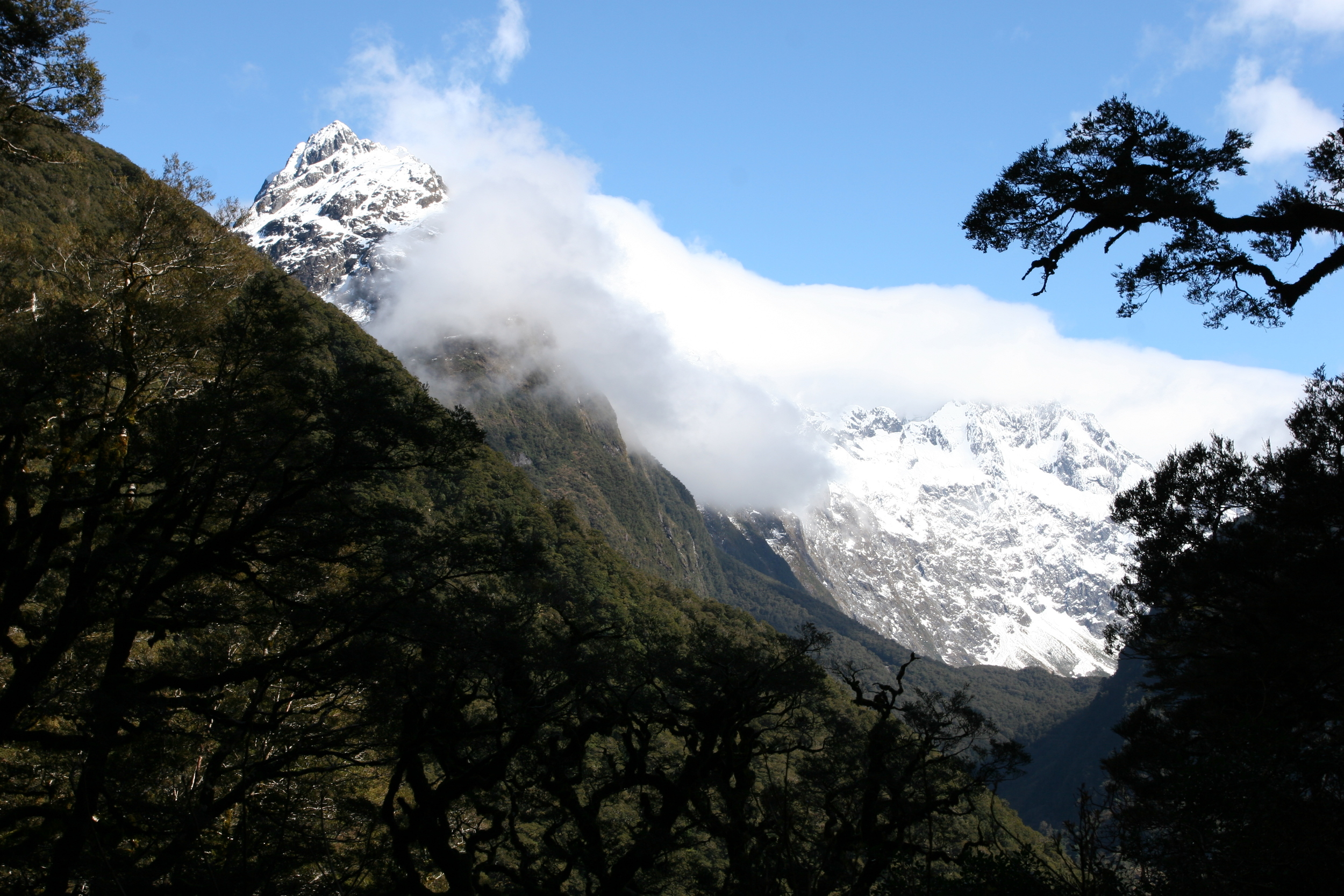
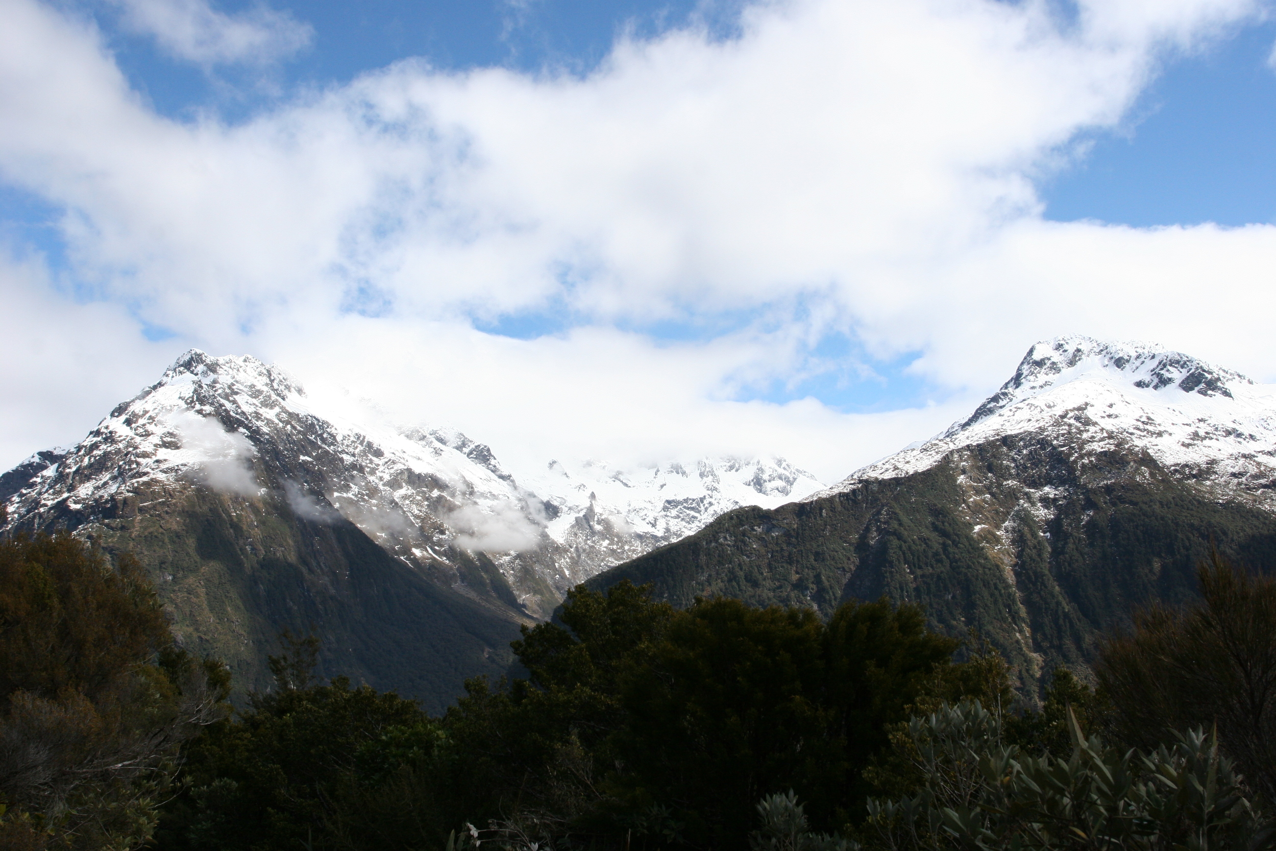
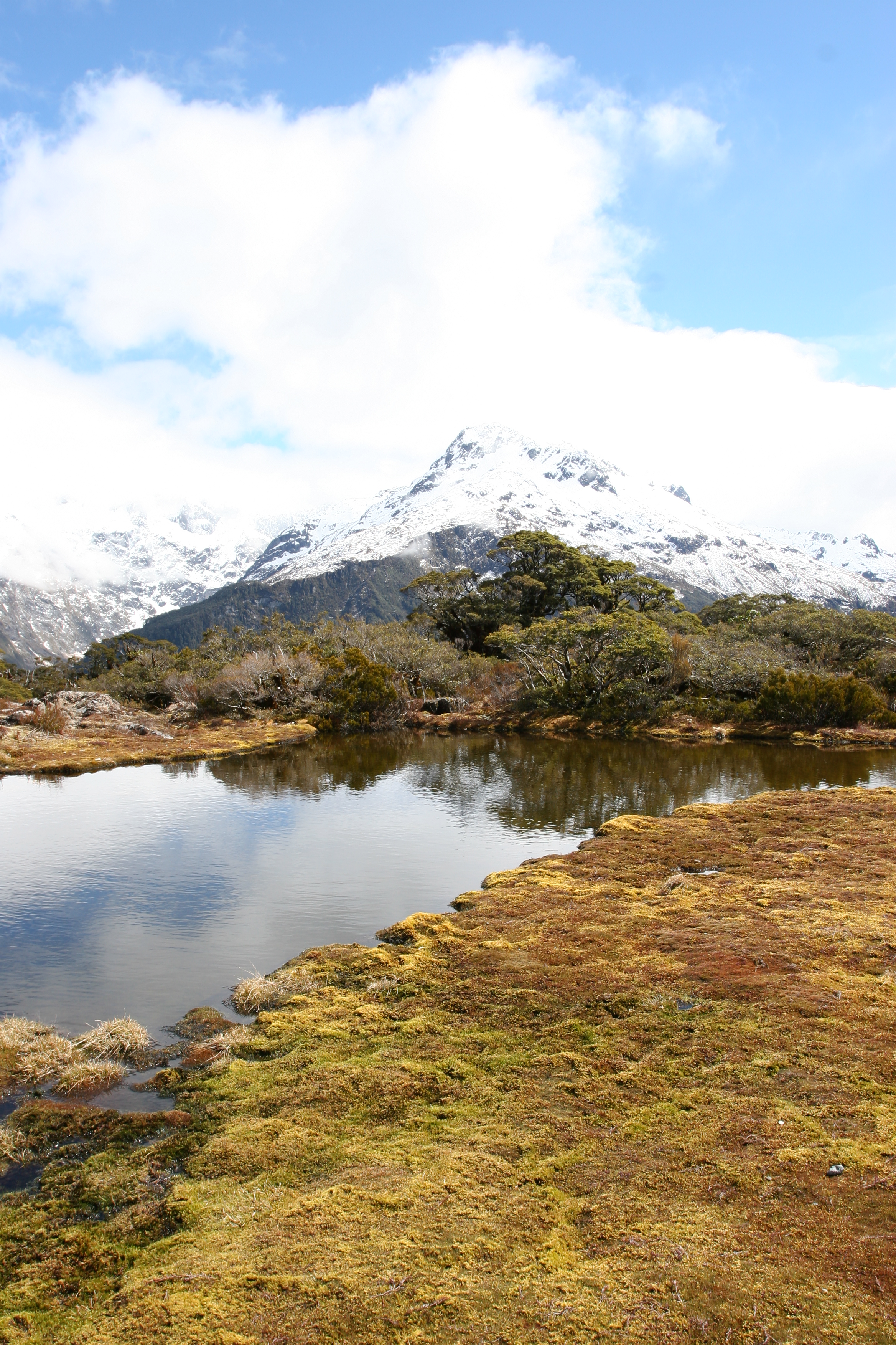
Alpine Views, Key Summit, Fiordland National Park
After 1.3 kilometers, the Routeburn Track will intersect with the Key Summit trail, which is well marked. Slightly before this junction, the beech forest will thin, and along this part of the trail, the hiker will be passing through sub-alpine shrublands. From the junction, the trail continues further upward to the named point, Key Summit. The summit is an interesting and amazing spot, with three hundred and sixty degree panoramic views of the Humboldt and Darren mountains, which will likely be covered with snow. In addition to the amazing mountain views, Key Summit also features a number of standing pools and bogs, which provides for excellent photographic opportunities. Finally, for those who are curious what points are located where, Key Summit also provides a great circular marker that identifies the mountains and other locations in the area. Once one is done admiring the views present at the summit, the return trip is an easy 1.7 kilometers back down the same trail climbed to the Divide, for a moderate roundtrip hike of 3.4 kilometers (2.1 miles).
Tips: As Key Summit is located in Fiordland National Park in an alpine region, hikers should be prepared with proper gear for the conditions, as the weather in the region can change abruptly. This hike is accessible in my opinion, to just about everyone as the track is in good condition on a year-round basis and is well-marked. As I discussed above, this is perhaps one of the best hikes in New Zealand, as it provides great views with moderate effort, and has the effect of making one feel like they are in a movie. Lastly, photography buffs should be advised that due to the location of New Zealand – far in the Southern Hemisphere, and the altitude present at the summit, a polarizer is advisable for one’s camera in order to ensure that the stellar shots available do come out looking good.
Interested in a perspective of a through hiker on the Routebourn? Check out my friend Paulina's report here!