
To me, one of the hardest things about being a twenty-first century adventurer and social media presence is determining how much information to share with you, the general public. I’ll admit that I have no trepidation sharing certain adventures with you – they exist on well defined trails in well regulated areas that are well known. For these types of adventures, I don’t worry about the information that I am divulging, as I know there are a plethora of other sources that contain the same – or identical information. These posts are easy for me write, as I can focus on providing additional insights or information to a spot that may not already be in the pool of general knowledge.
Harder are the posts that involve a degree of risk, as it is hard for me to craft a one-size-fits-all description of a route or trail for unknown parties that may have greater or lesser skill than me. The most difficult posts for me to write, however, are the posts that involve locations that are relatively unknown, or flat out unknown. It’s hard to believe that in the early 21st century, where the internet is ubiquitous, and maps can be stored on handheld devices that these black spots in the world still exist, but as I’ve seen, they most definitely do, and on many occasions, they contain amazing things.
When I do make it out to these spots, I am torn between a number of conflicting desires – the desire to protect and preserve the spot – and the desire to educate and inform people about the spot. Sometimes these desires can co-exist in my mind, because by educating people about the spot, it helps to protect what exists there. On other occasions, I look at things, and sadly realize that no amount of education on my end will preserve the spot, because it is something that is fundamentally vulnerable that lacks third party oversight. On such occasions, I’ve erred on the side of caution – and focused on protecting the site by not providing directions. In this respect, I’ve developed a basic test of whether the site would survive for my son to see it if I provided directions to the public – or if I did not. While it’s not the most perfect test in the world, it works for me, because I feel that these spots should be preserved for future generations.
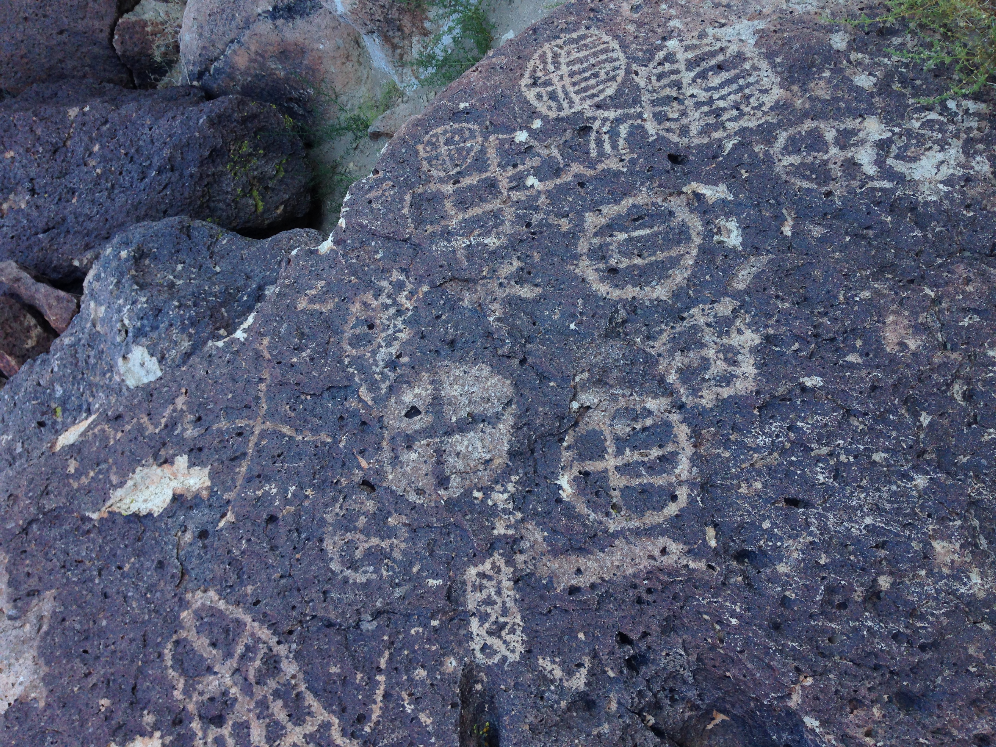
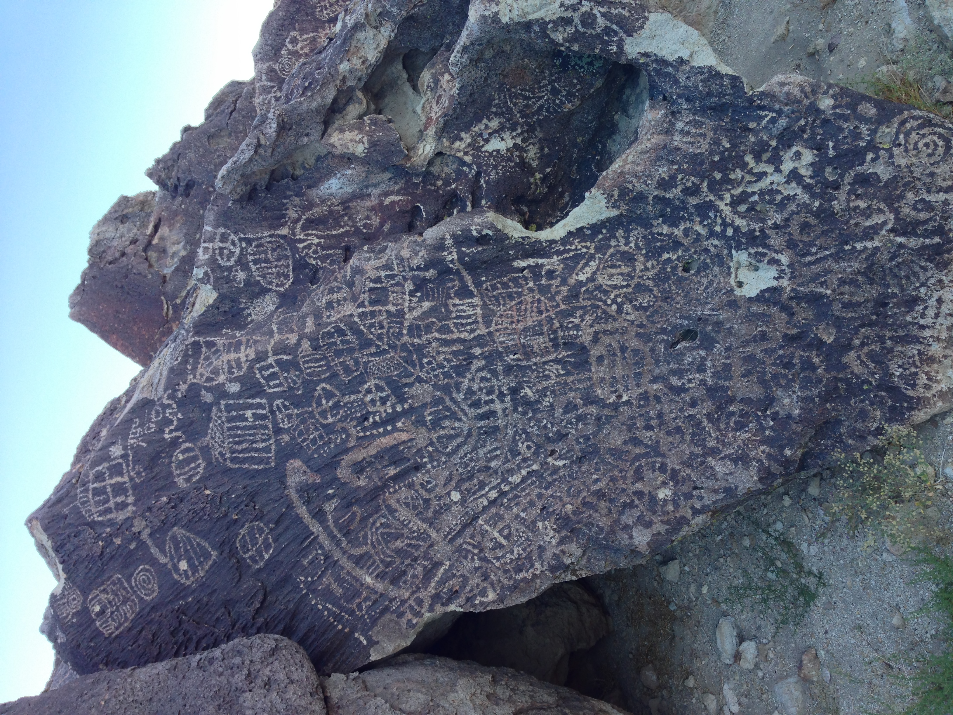
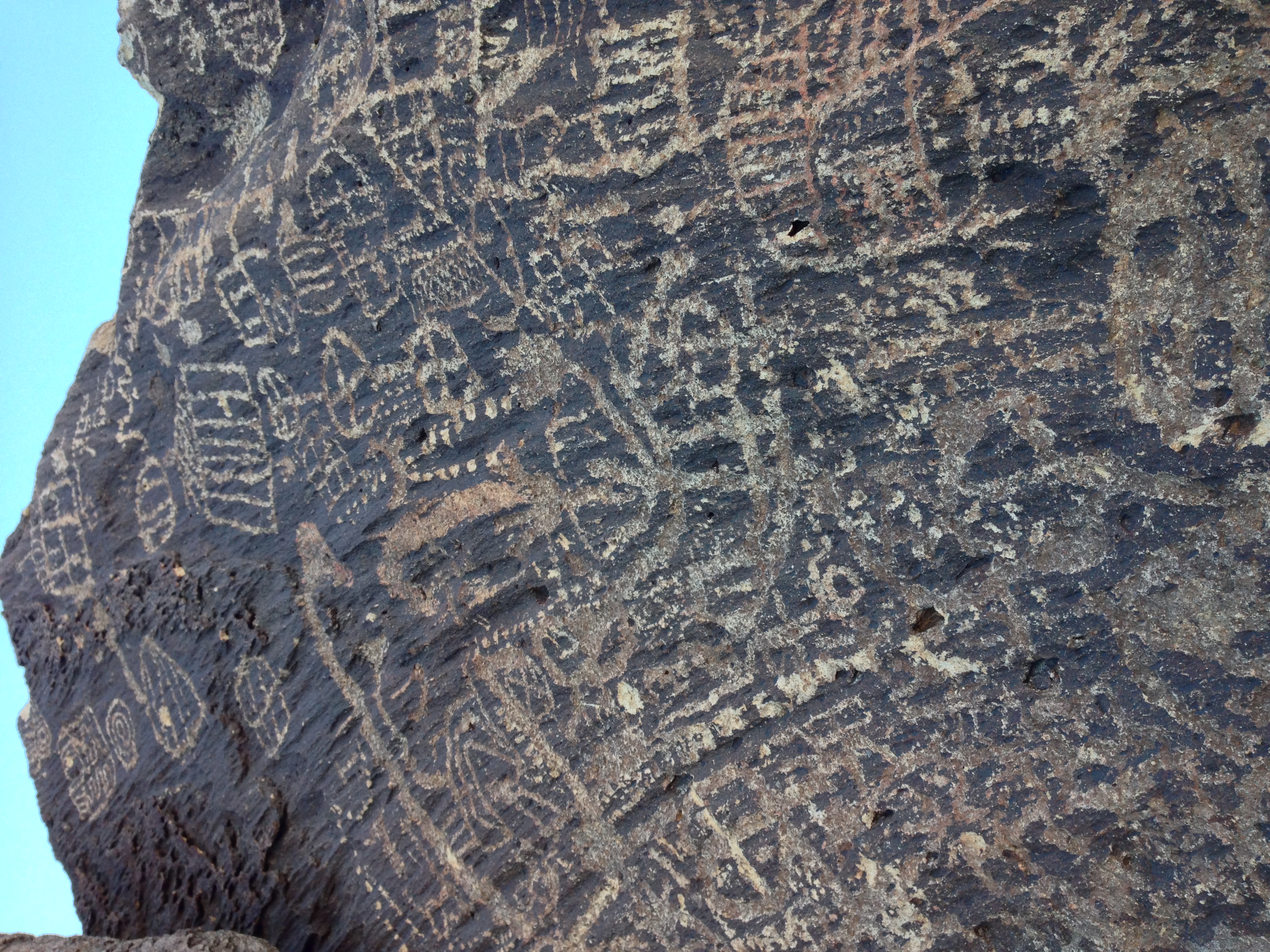
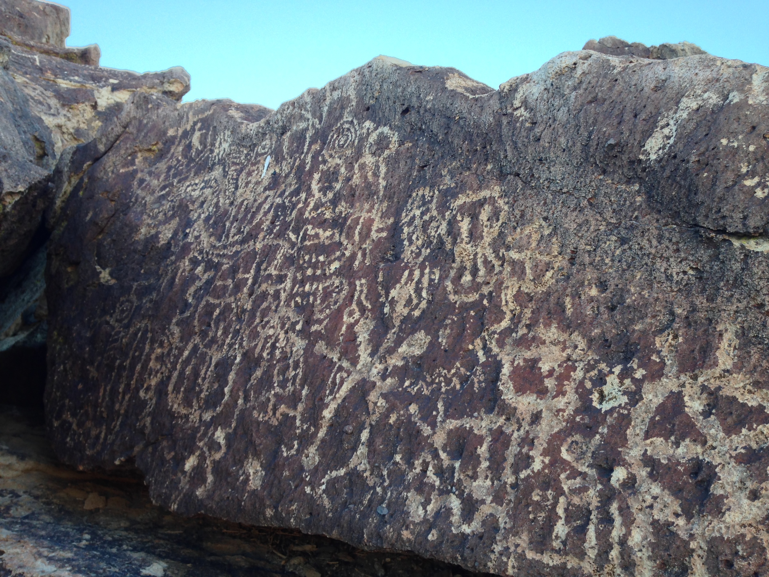
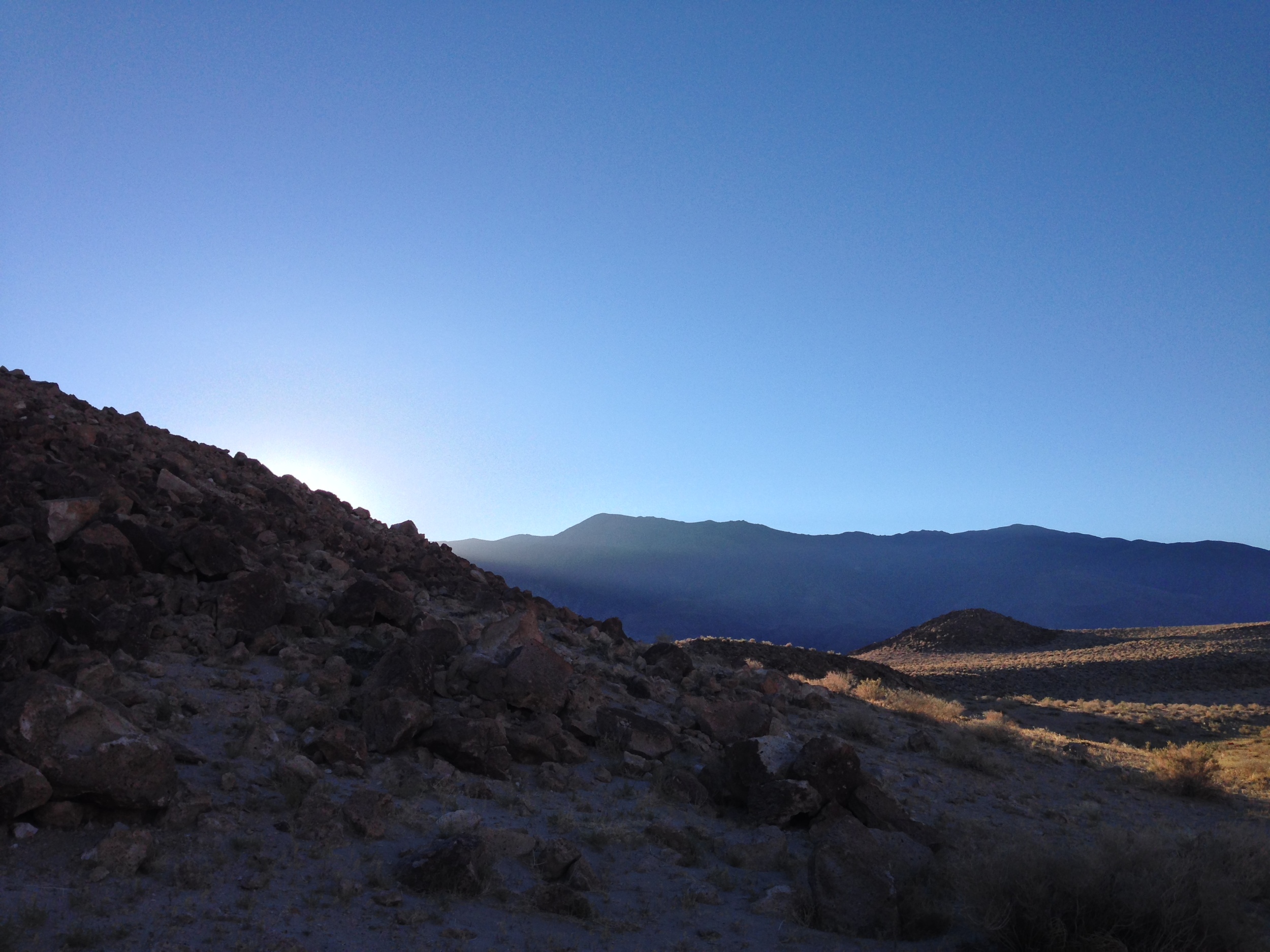
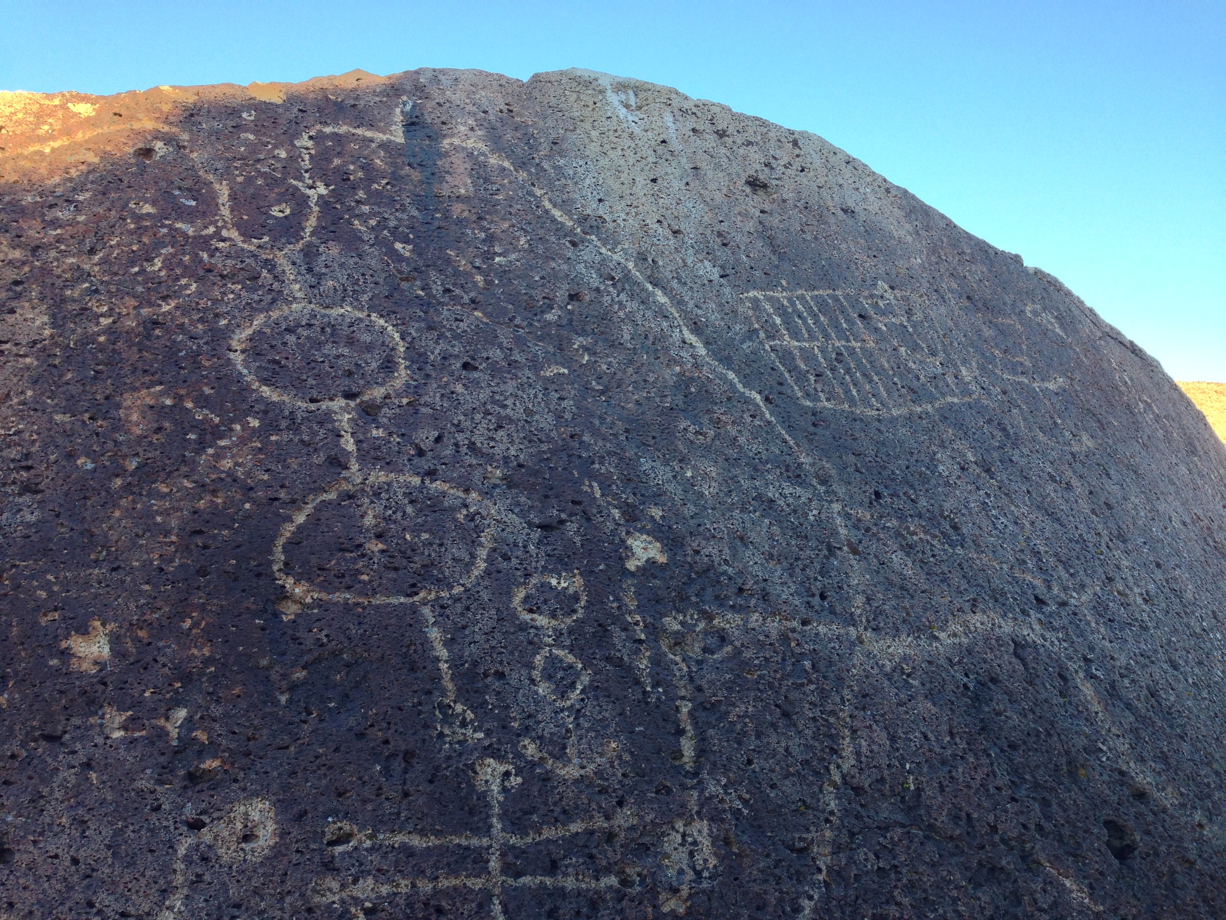
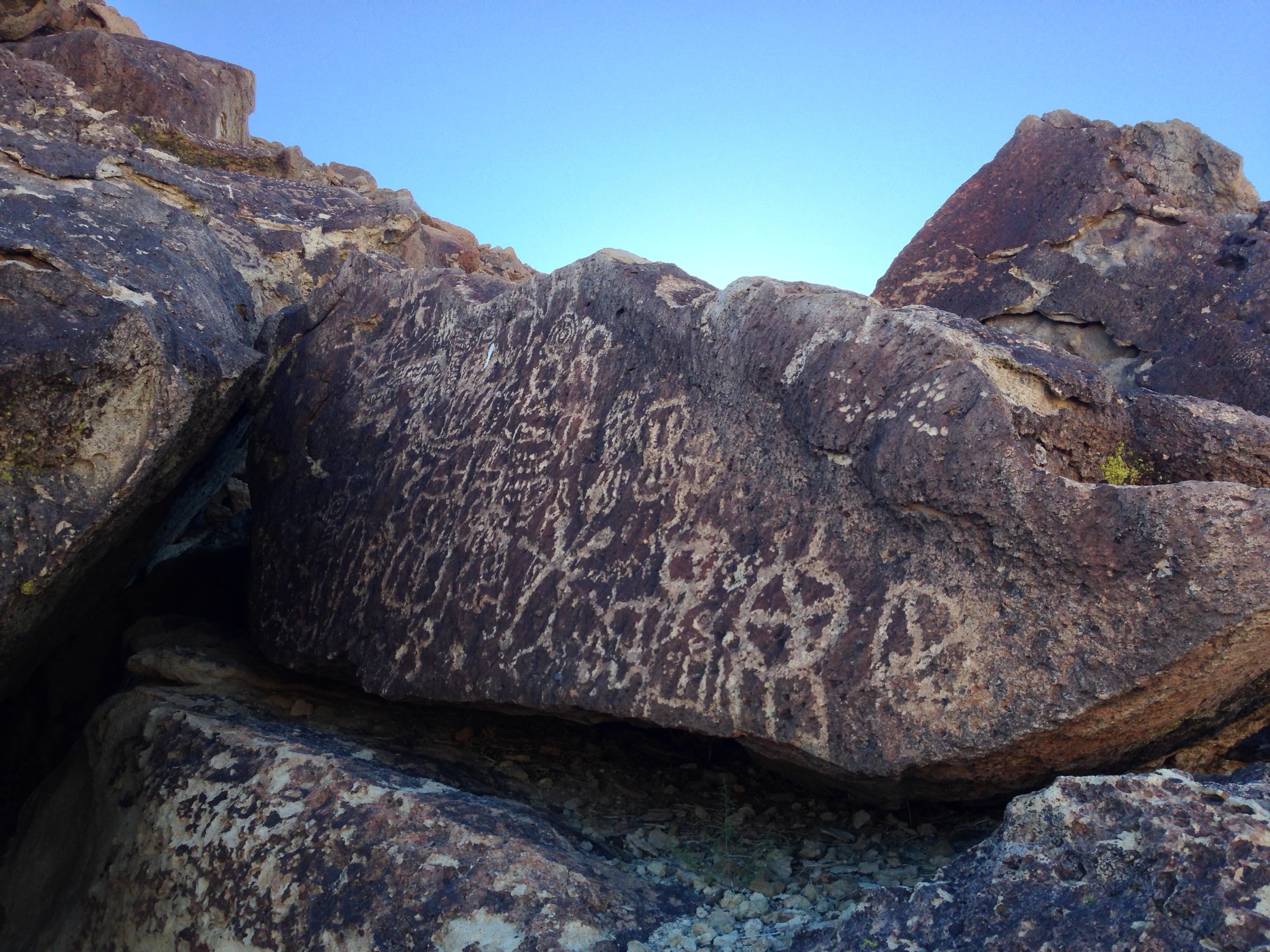
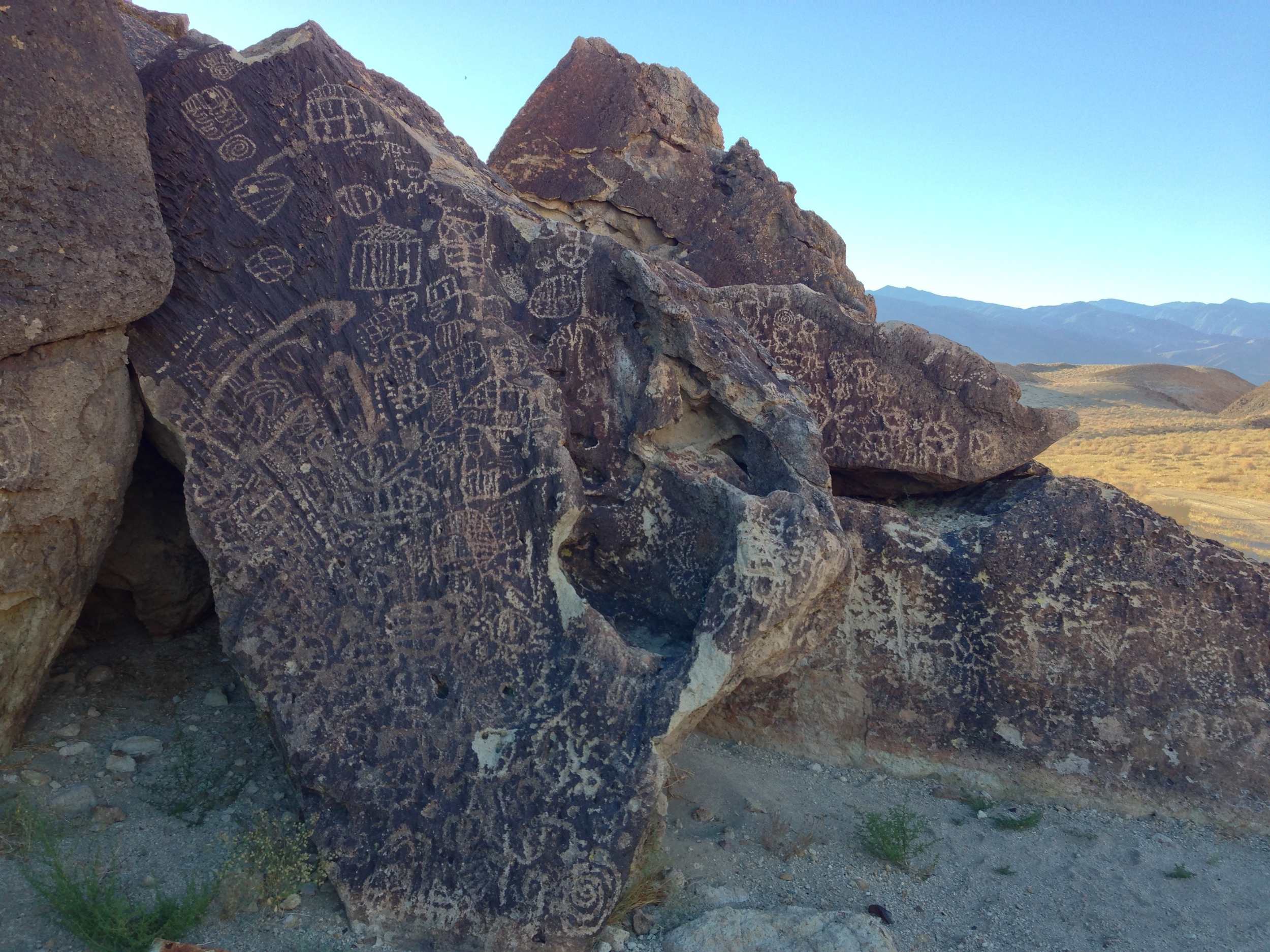
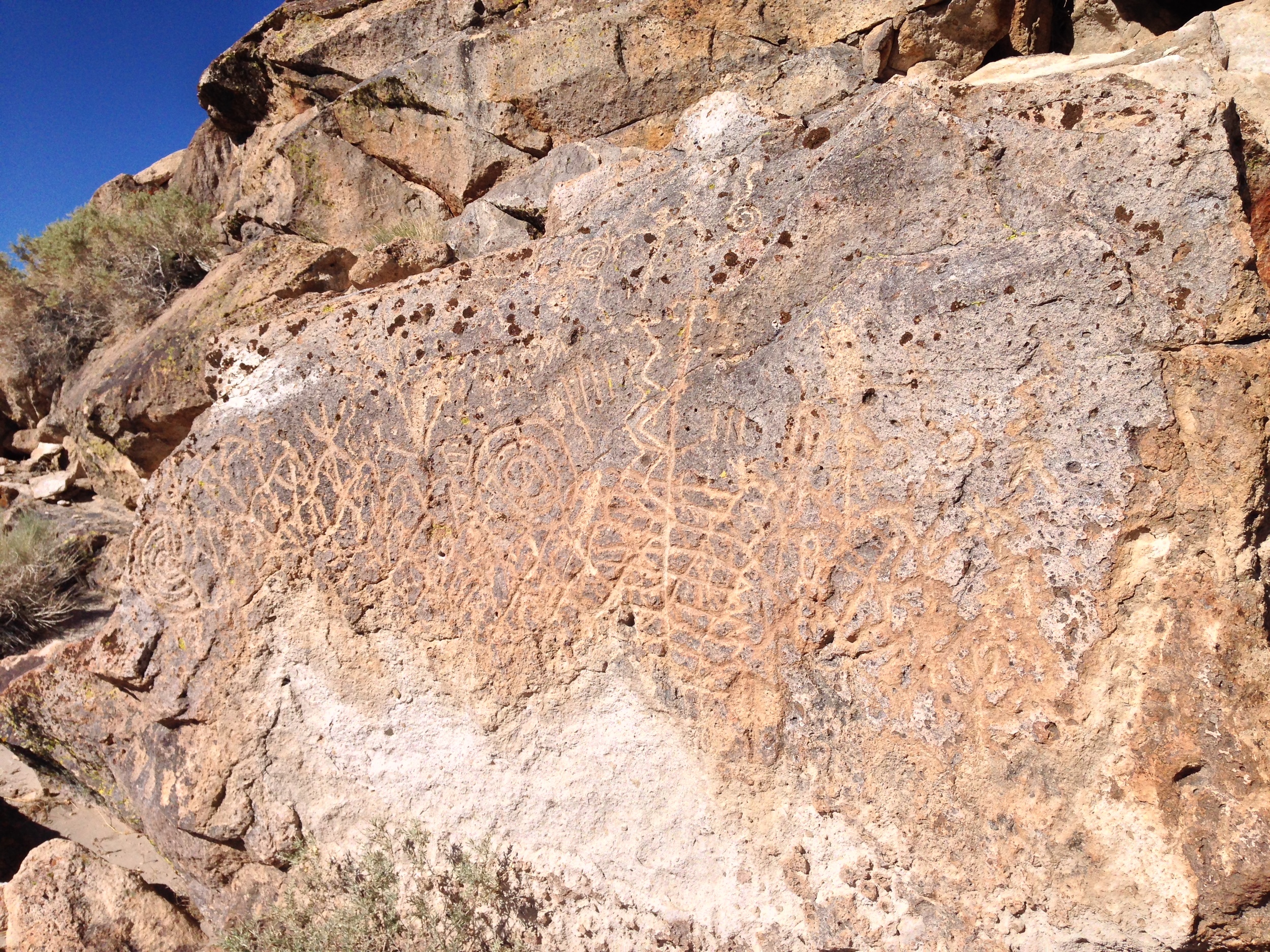
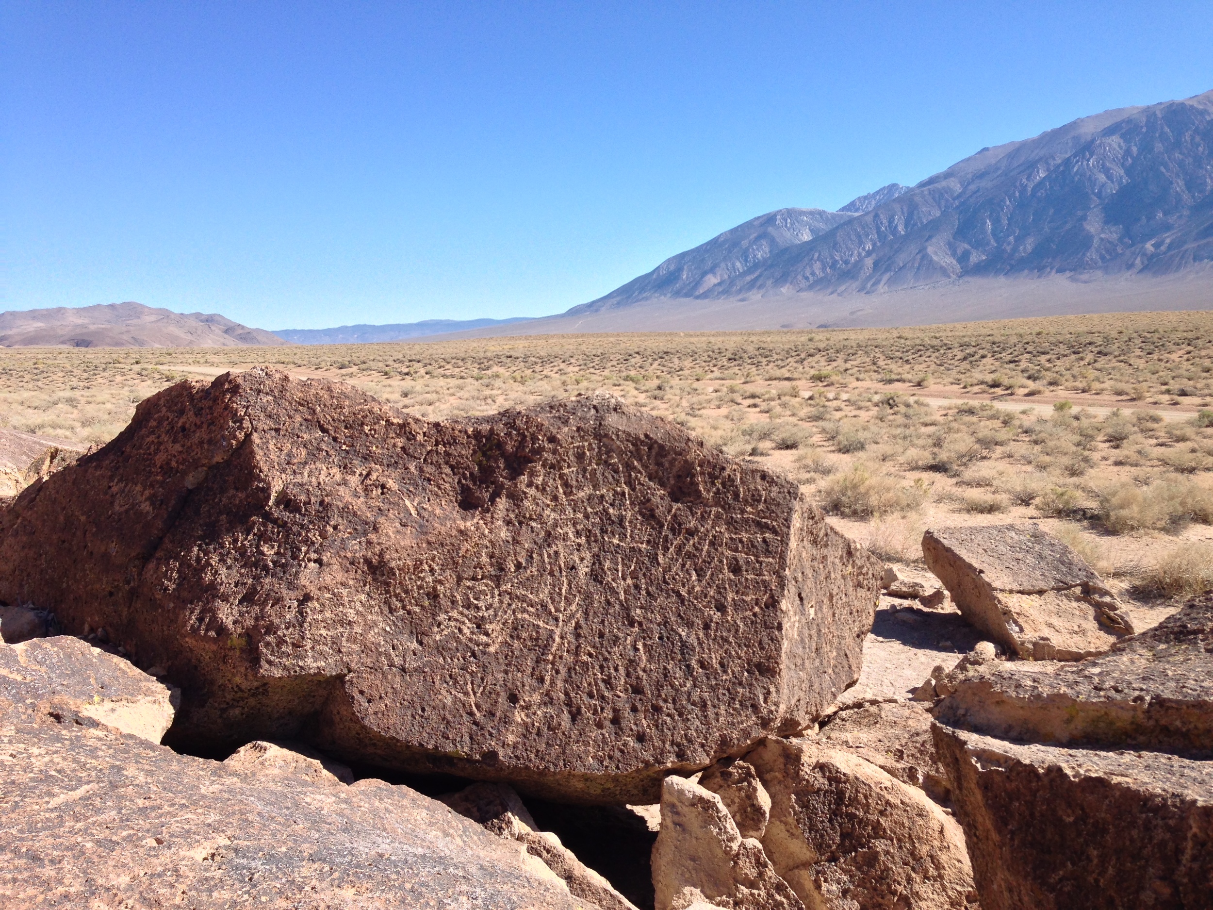
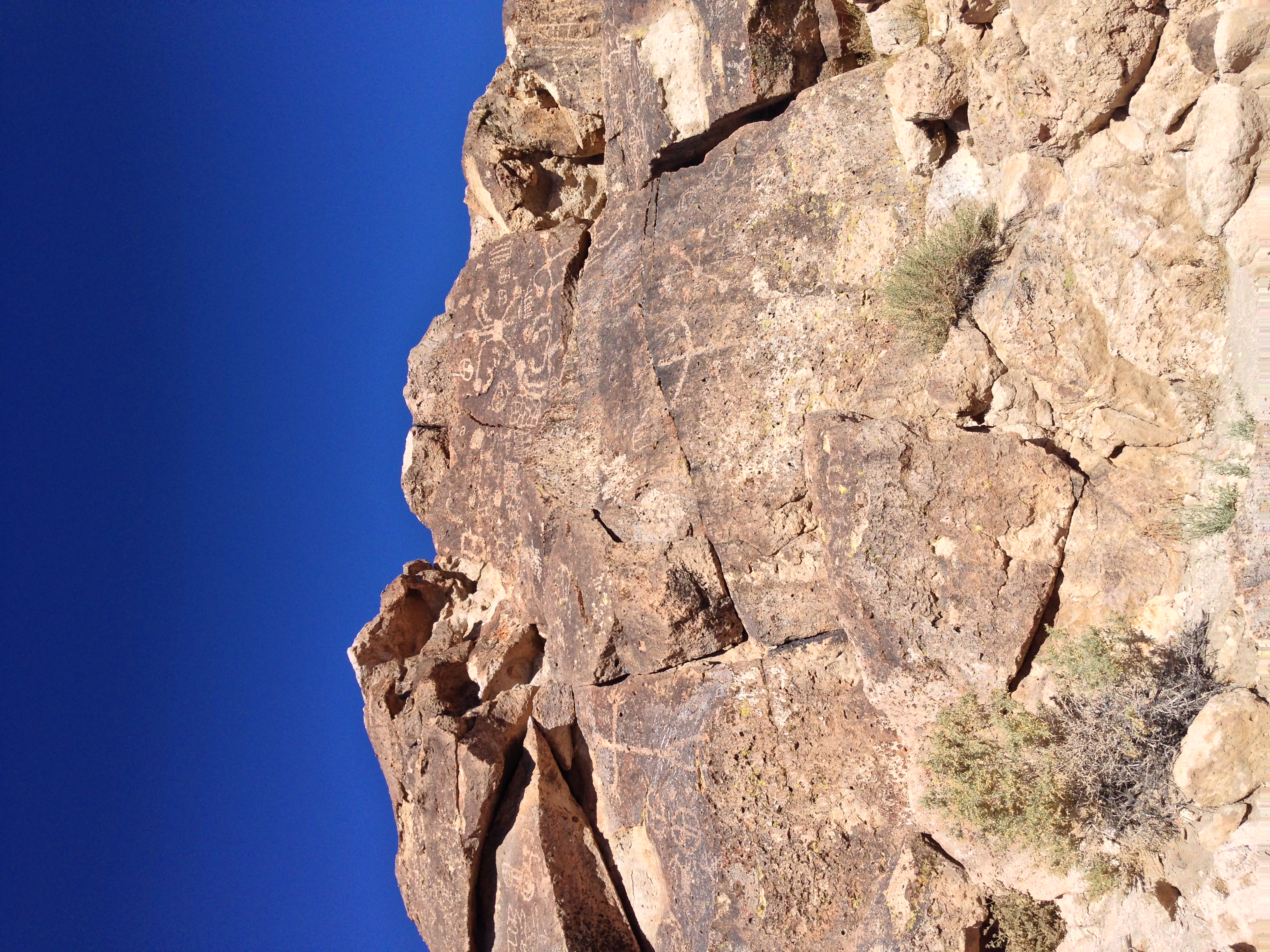
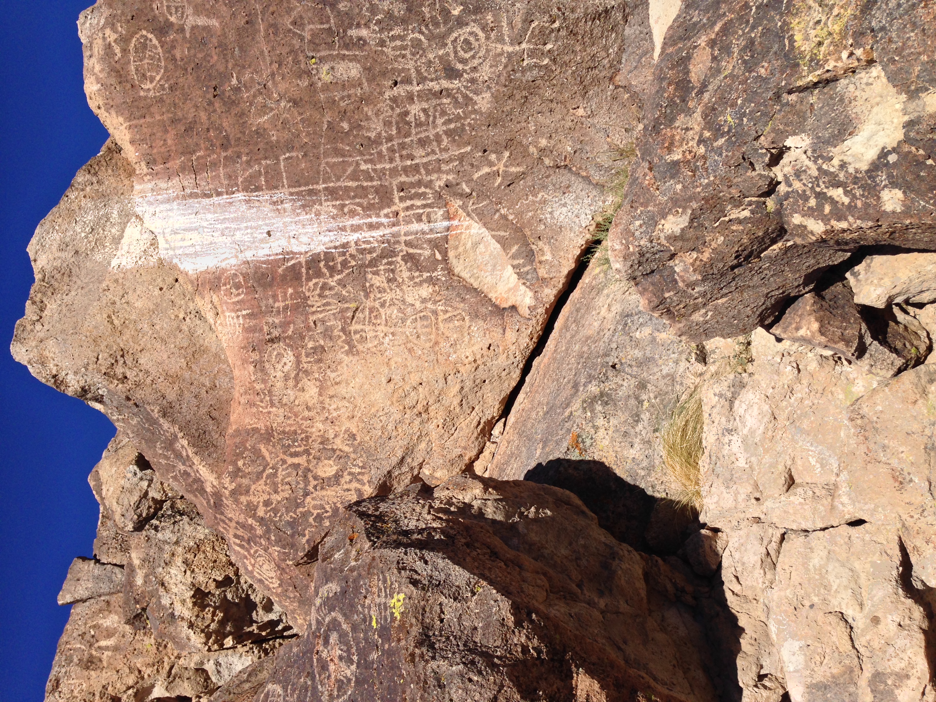
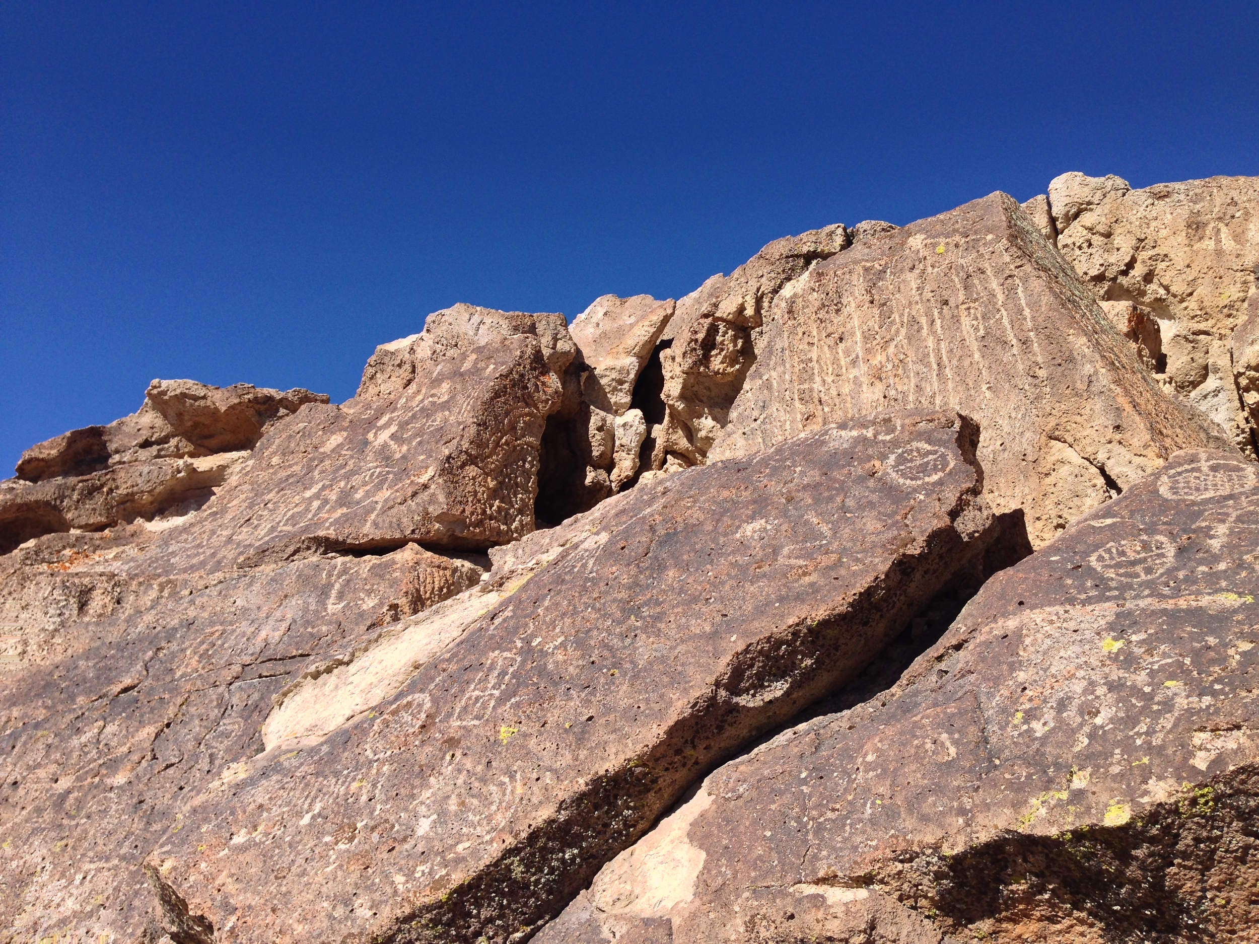
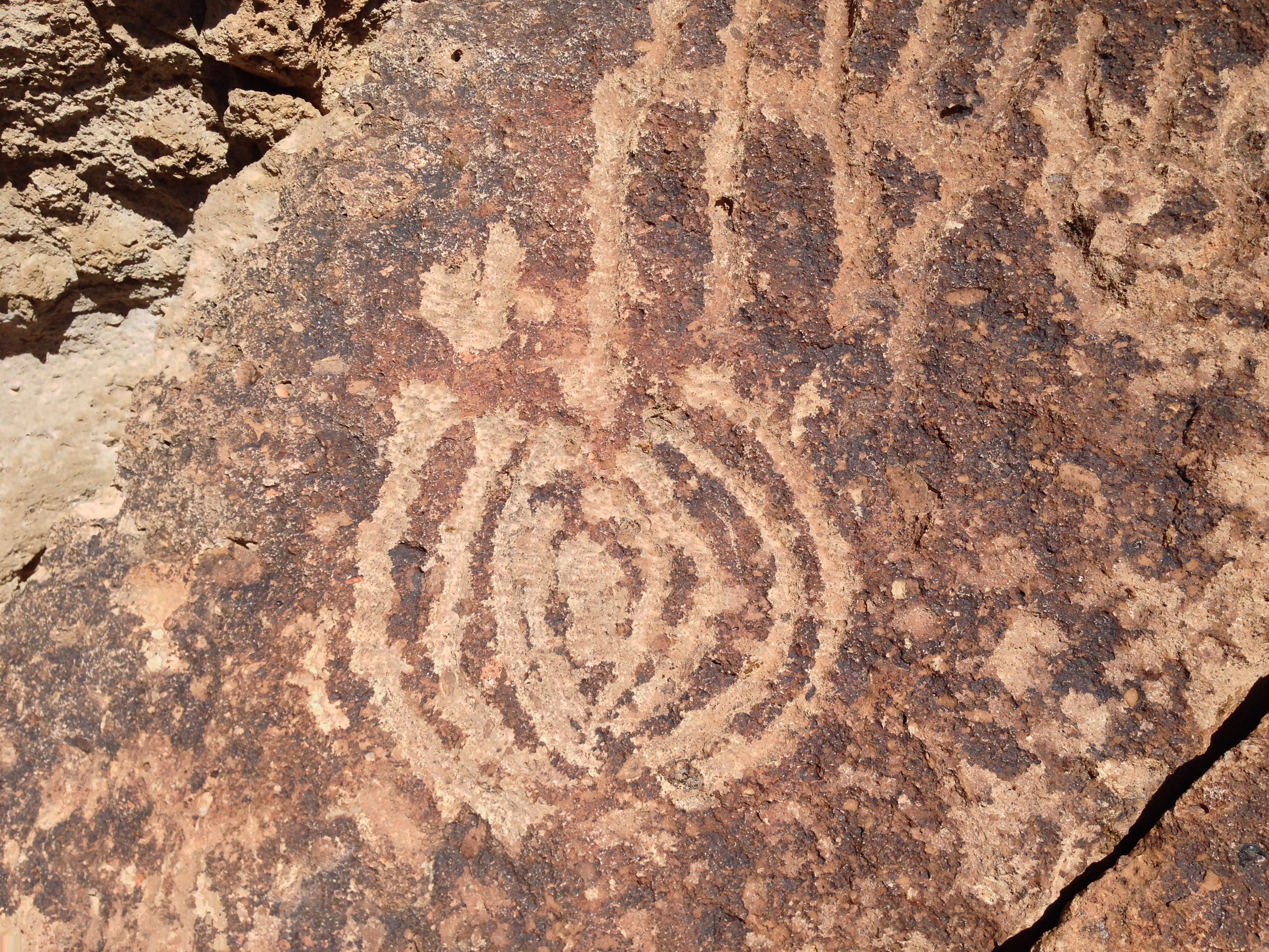
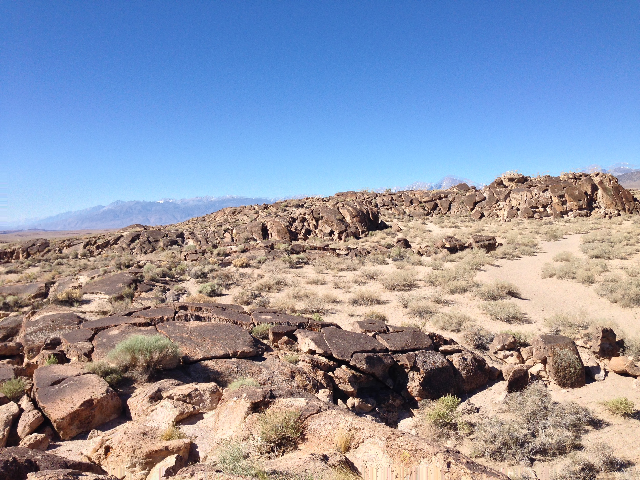
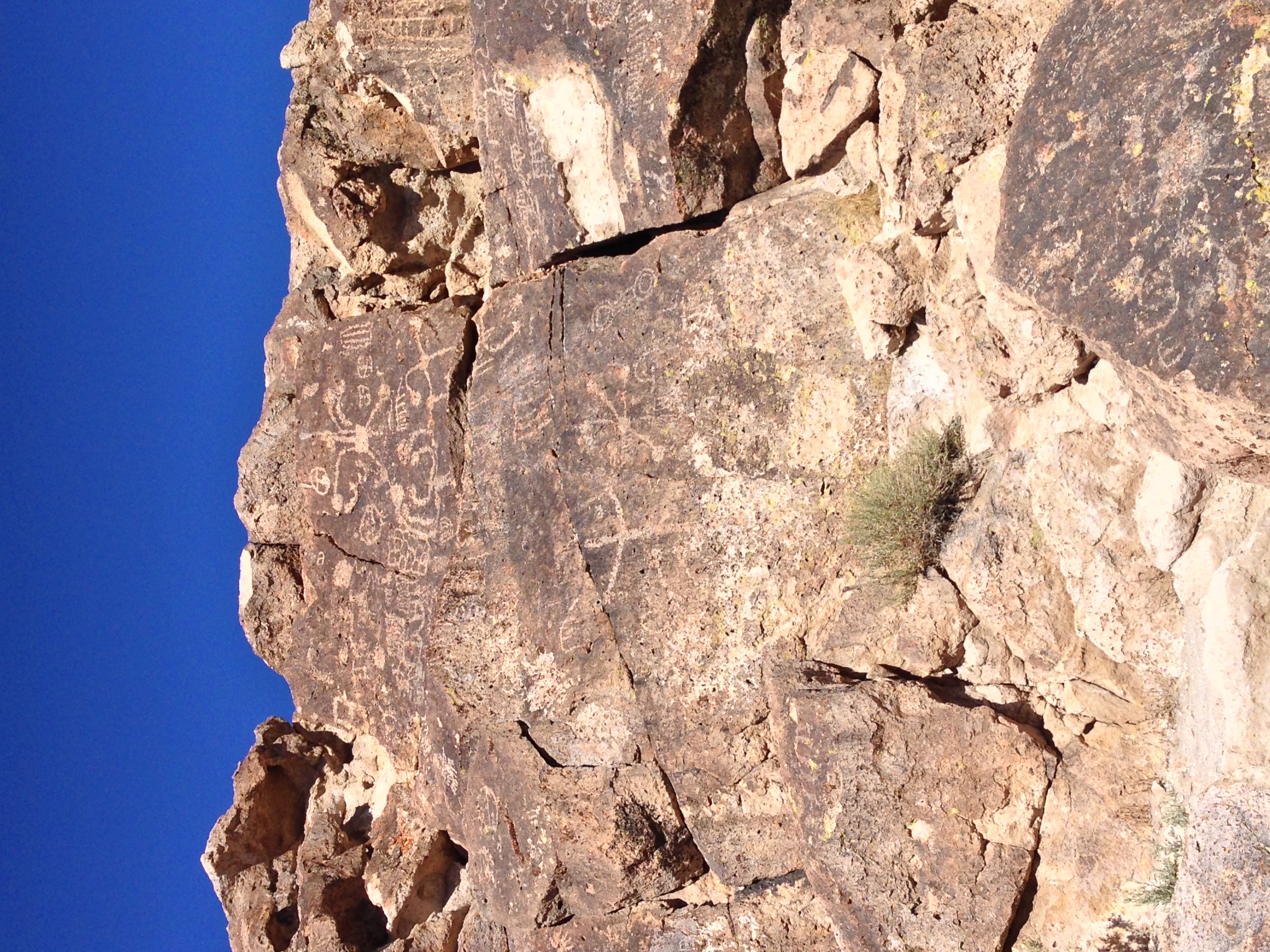
In the case of the Volcanic Tablelands petroglyphs, my decision on whether to provide directions was fairly easy. The Volcanic Tablelands are an area outside of Bishop, California that was formed over 700,000 ago by the Long Valley caldera. In more recent times, the Paiute-Shoshone Indians resided here and created a great deal of rock art – petroglyphs – throughout the Tablelands. Although there are petroglyphs throughout the area, there are a number of large – and stunning groupings in certain specific areas. Even though this land is public land – managed by the Bureau of Land Management – and a protected area, it is a large area that cannot adequately be patrolled by the BLM.
Correspondingly, over the years, as the area has become more popular, some of the art has been defaced; and in 2013, some of the art was physically cut out of the surrounding rocks. Although the panels were ultimately recovered by the BLM after a large public outcry, it is clear to me – and I think to everyone that this is a vulnerable area. While it was an area that I had visited before; I had never been to the actual main petroglyph sites. When I was recently researching how to get to the sites, it was not lost on me that the information on how to get to the sites was largely hidden from public view. Fortunately, I was lucky enough to have a great resource who provided me with directions, and based on his directions, I was able to see the sites pictured above.
I am not going to represent that getting to the sites is the most difficult task once you have directions, as it is not – which is, and has been part of the problem regarding bad conduct at the sites. What I will say is that if you are near Bishop, and you want to visit the sites, you can visit the BLM office, which generally will provide directions for this adventure after educating you about the region. If you go on the adventure, as I did, you will find a number of sites with a number of fantastically drawn figures, shapes, and other designs. For me, seeing these sites in person was an amazing experience, and one that filled me with wonder and inspiration. Hopefully, if you go, you will feel the same amazement I did, and exercise leave no trace principles at the sites, in order that they can continue to be protected and preserved for future generations.
Directions: The Public Lands Information Center for the region can be found at 798 North Main Street, Bishop, California, 93514.
Interested in more thoughts about this site? Check out my friend Paulina's thoughts about the area here!