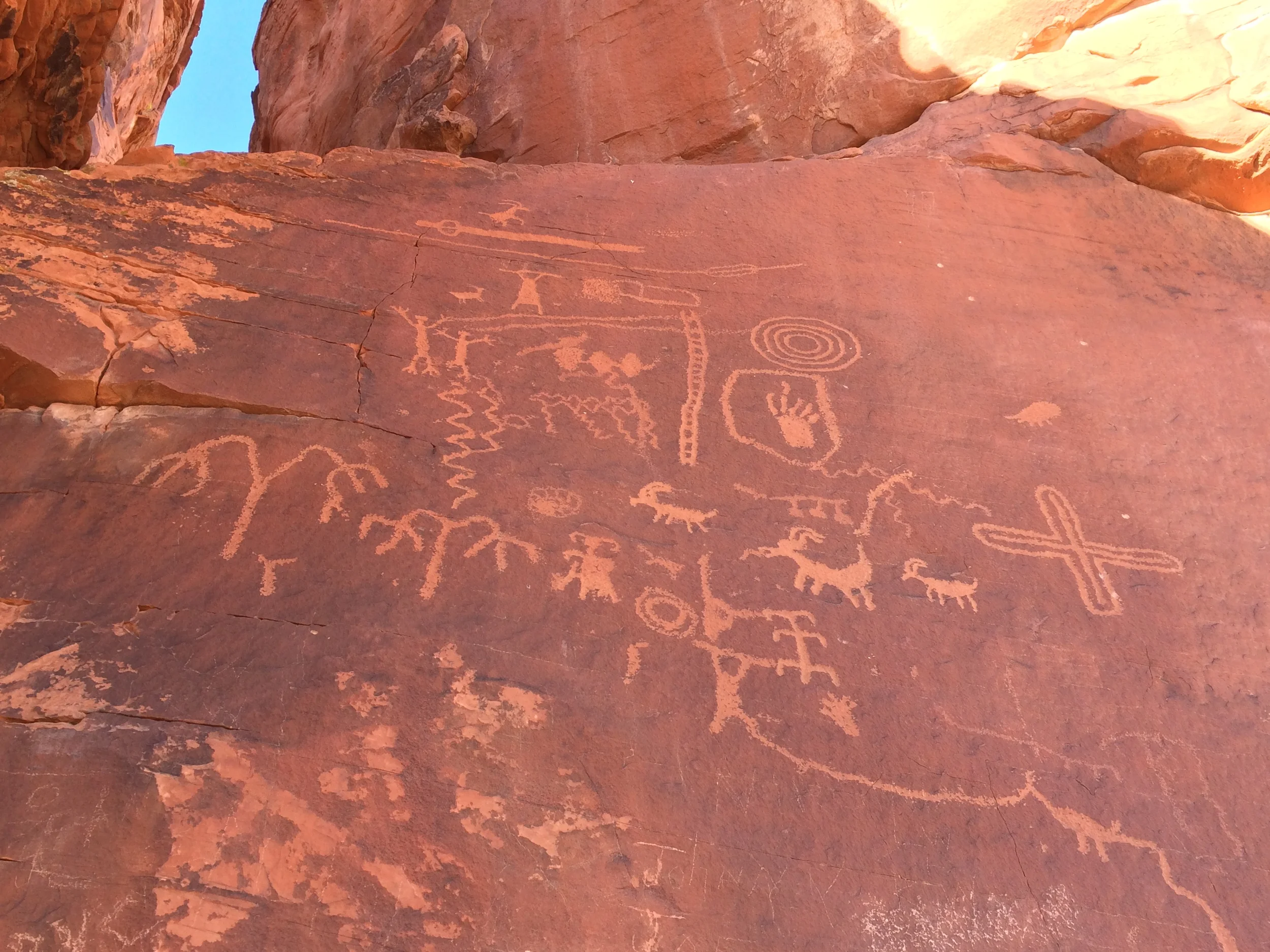
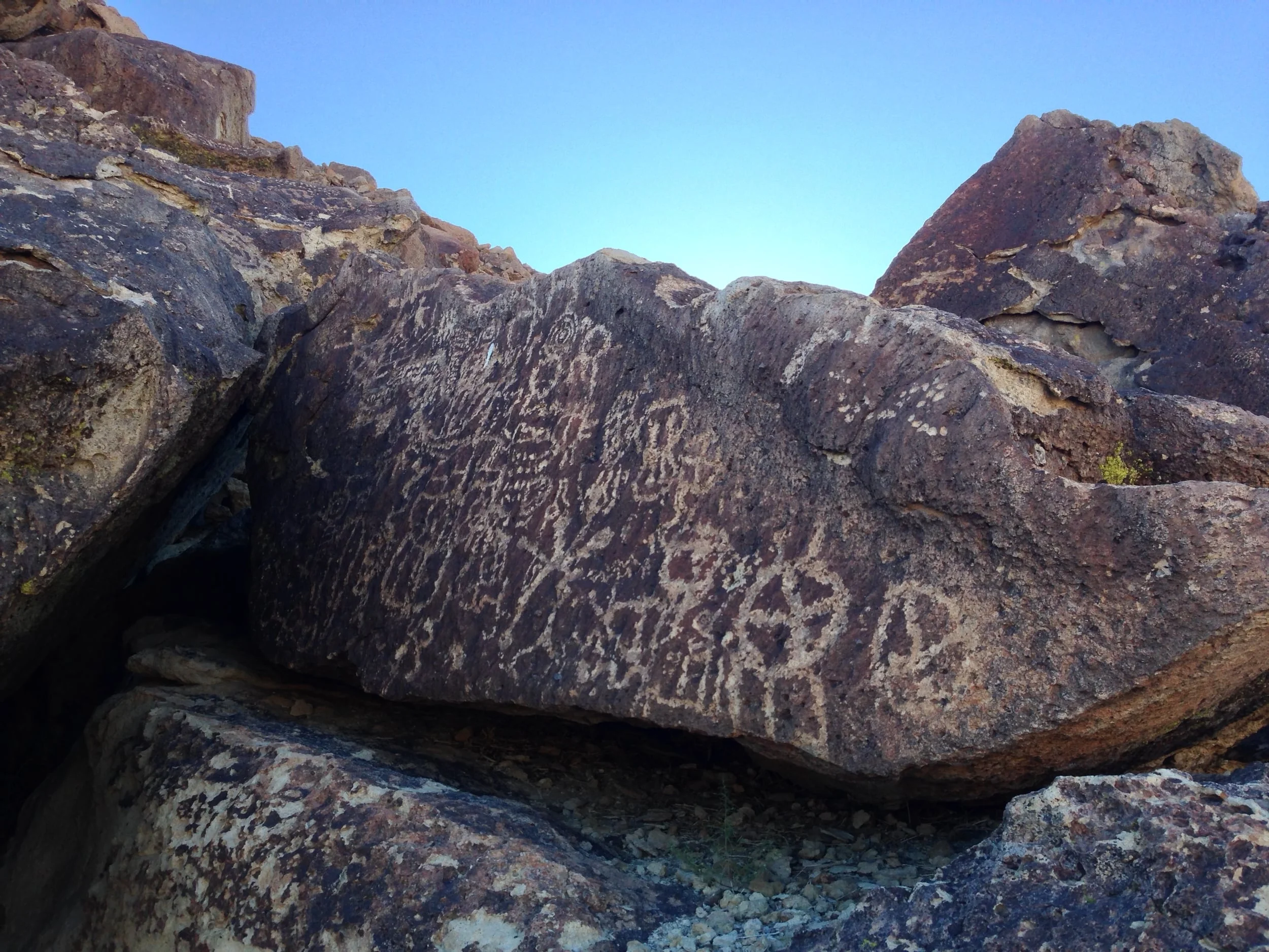
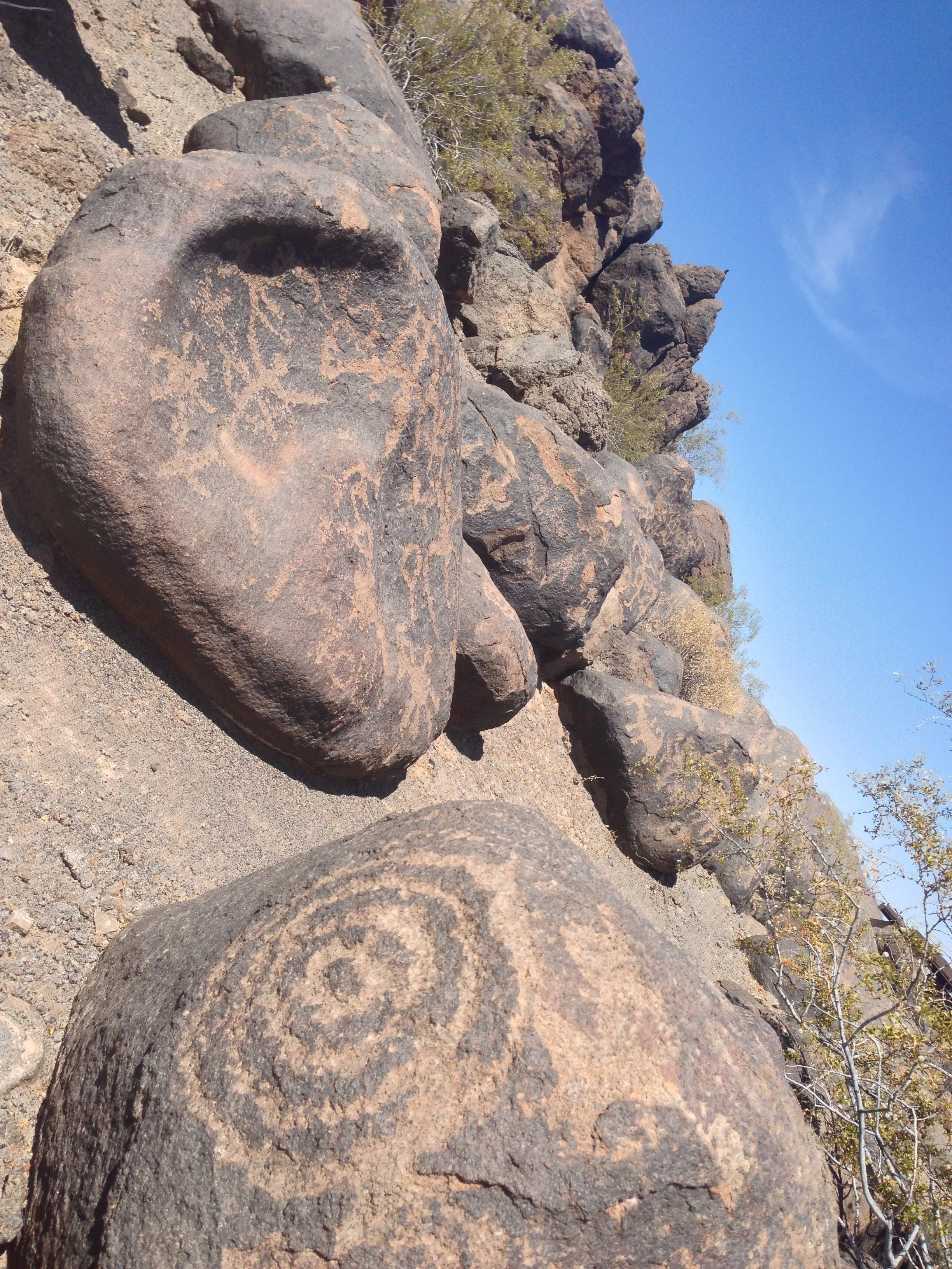
Hole-in-the-Wall Petroglyphs, Main Boulder
If I said to you, "Riddle me this, Bat-boy, which is the third largest national park/preserve in the lower forty eight states?", you'd probably pause for a minute, and respond with, "Yellowstone", "Yosemite", "Grand Canyon", or maybe if you were feeling erudite, "Big Bend". But you'd be wrong: the answer is the Mojave National Preserve. In this respect, Mojave National Preserve ("MNP") is probably the stealthist park in the National Park Service network, which is quite a feat considering how large it is! While I can't say exactly why this is - perhaps it's because it loses visitors to its more popular siblings, Joshua Tree and Death Valley, to its South and North, respectively; or perhaps its because it's in a remote area (halfway between Las Vegas and halfway between Los Angeles); what I can say for sure is that it's full of interesting items and adventures.
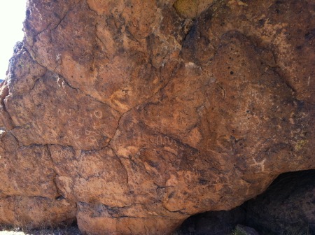
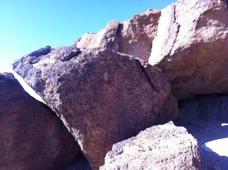
For example: the Hole-in-the-Wall Petroglyphs. These petroglyphs are located within a quarter of a mile (.25) from the Hole-in-the-Wall Visitor Center on the Ring Loop Trail, and yet, are relatively unknown, undiscovered, and even on a weekend, berefit of visitors. These petroglyphs are roughly ten to twelve thousand years old from what I've been told, and from what I saw, are in good condition, considering they are on some exposed boulders, and have likely been visited by thousands of people.
Directions: Take the Ring Loop Trail from the Hole-in-the-Wall Visitor Center. Follow the trail South/Southeast for a quarter of a mile (.25). Before the trail turns West, there will be a grouping of boulders. The petroglyphs are on the main face of a larger boulder, but smaller groupings appear on other boulders in the cluster.
Tips: The petroglyphs are faint in places, and if you are booking along, and not paying attention to your desert surroundings, you will pass them easily. Take your time, and scan the exposed rock faces as you pass by. In addition, should you want a good 360 degree view of the surrounding hole in the wall region, the hill above the boulders can be scrambled up easily for a great view! It's also worth noting that the interpretive rangers at Hole-in-the-Wall are conducting programs about the petroglyphs once a week, at this point, occurring on Saturdays (check with the Visitor Center should you visit to ensure that this is still the correct day when you visit). And, as it is the desert, do take plenty of water, and be respectful of the ancient art that exists on these rocks.