Follow Me, I Won't Get You Lost!
This form does not yet contain any fields.
    Take A Look Around...
    1 Day Hiking Mt. Whitney 10 Essentials 2Solar Eclipse 2012 Adventure Stories Aguereberry Camp Angel Share Angel's Landing Angel's Landing Trail Ansel Adams Anza Borrego Anza Borrego Desert Anza Borrego State Park Anza-Borrego Desert Arizona Arroyo Tapiado Arroyo Tapiado Mud Caves Ashford Mill Backcountry Skiing San Jacinto Backpacking Badwater Banshee Canyon Beardpocalypse 2010 Beards Beards Make One Hot Beaver Creek Benson Big Sur Black Mountain Black Mountain Community Ranch Park Black Mountains Blimps Blue Sun Cave Borrego Springs Borrego Springs Dinosaurs Borrego Springs Metal Creatures Borrego Springs Pre-Historic Creatures Bright Angel Trail Bump-And-Grind Trail Bump-N-Grind Trail CA Desert App Cabazon Cabazon Dinosaurs California Highway 1 California Horned Lizard Camping Food Canyon Loop Trail Cardiac Hill Cardiff State Beach Carlsbad Carlsbad 5000 Caverns Caving Cedar Fire Cedar Ridge Changing tires Chapel of the Holy Dove Charcoal Kilns Charcoal Kilns Death Valley Cinder Cone Natural Area Cloud's Rest Coachella Valley Cold War Consultation Lake Corte Madera Mountain Cowles Mountain Crampons Crane Flat Crest Canyon Crest Canyon Del Mar Cross Country Skiing Cross Country Skiing Yosemite Cross Country Skiing Yosemite Valley Current Trail Conditions Mt. Whitney Curtis Howe Springer Cuyamaca Lake Cuyamaca Rancho State Park Cuyamaca State Park Dantes BM Dantes Peak Death Valley Death Valley Charcoal Kilns Death Valley Driving Fail Death Valley National Park Deer Del Mar Airport Del Mar Blimps Desert Devil's Golf Course Dinny the Dinosaur Dominator Shipwreck Don't Stare at the Sun you will go blind Dos Cabezas Dos Cabezas Siding Dripping Springs Driving Fail East Side Trail Eastern Approach Woodson Mountain Eastern Sierra Interagency Vistor Center Echo Canyon Eclipse Glasses Emerald Pool Encinitas Eureka Dunes Eureka Mine Father Junipero Serra Museum Flagstaff Folly Peak Foster's Point Four Mile Trail foursquare Garnet Peak Geminid Meteor Shower Geminid Meteor Shower 2011 Geminids George Van Tassel Ghost Towns Giant Sequoia Giant Sloths Gin Flat Loop Golden Canyon Good Mountaineering Karma Goodan Ranch Gowalla Gower Gulch Grand Canyon Grand Canyon National Park Green Valley Grizzly Giant Guillermo Pino Half Beards Half Dome Happy Isles Harper's Creek Harrisburg Ghost Town Hearst Castle Hi Fi Killers Hidden Canyon Highway 120 Highway 41 Highway 67 Highway 67 Sycamore Canyon Staging Area Hiking Hole-in-the-Wall Hole-in-the-Wall Petroglyphs Horseshoe Mesa Ice Axe Indian Hill Ink Spots Inspiration Point Inyo National Forest iPhone iPhone Apps Iron Mountain Jeffrey Pine John Muir Trail Julia Pfieffer Burns State Park June Climbing Mt. Whitney Kartchner Caverns Kartchner Caverns State Park Kelbaker Road Kelso Kelso Dunes Kendrick Park Kubla Kahn La Jolla La Orilla Trail Ladders Laguna National Forest Lake Las Vegas Xterra Trail Run Lake Manly Landers Leonard Knight Little Yosemite Valley Living With the iPhone Lone Pine Long Valley Los Penasquitos Lagoon Lunar Eclipse Lunar Eclipse 2011 Lunar Eclipse December 2011 Lusardi Loop Trail Maar Volcanos MAD Mahogany Flat Malibu Creek State Park Manly Beacon Man's Best Media Mariposa Grove Merced River Mesquite Flat Sand Dunes Meteor Showers 2012 Missile Silo Mission Hills Mission Trails Regional Park Mist Trail Mog Mogfest Mogfest 2010 Mojave Desert Mojave Desert Tortoise Mojave Desert Tortoise App Mojave National Preserve Montezuma's Castle Montezuma's Castle National Monument Mosaic Breccia Mosaic Canyon Mr. Rex Mt. Badly Skiing Mt. Hoffman Mt. Laguna Mt. Lawson Mt. San Jacinto Mt. San Jacinto State Park Mt. Whitney Mt. Whitney Conditions Mt. Whitney Gear Mt. Whitney Hiking Mt. Whitney Permits Mt. Whitney summit Mt. Whitney Trail Mt. Whitney Trail Crest Mt. Woodson Mud Caves Nevada Fall Niland North Ponto Beach Nothing is the same Obselida Observation Point Oceanside Ooh-Ahh-Point Outpost Camp Painters Path Trail Palm Desert Palm Springs Tram Panamint Mountains Partial Solar Eclipse 2012 Partington Cove Trail Paso Picacho Campground PCT Penny Pines Perris Jurassic Park Petroglyphs Pima Air and Space Museum Plushgun Presidio Park Pupfish Quadrantid Quadrantid Meteor Shower Ranchita Ranchita Yeti Ranchos Palos Verdes Ravens Red Cathedral Red Tide Refrigerator Canyon Ridge Trail Ring Loop Trail Rings Climb Rogers Peak Round Valley Saber-Tooth Tigers Sahuarita Saline Pool Death Valley SALT Salt Creek Interpretive Trail Salt Pool Death Valley Salvation Mountain San Diego County Hiking San Diego Hiking Clubs San Diego Red Tide San Diego Urban Legends San Dieguito Lagoon San Eliijo Lagoon San Elijo Ecological Reserve San Gorgonio San Gorgonio Wilderness San Jacinto San Jacinto Hiking San Jacinto Summit San Jacinto Trail Scotty's Castle Scout's Lookout Sentinel Dome Sentinel Dome Parking Area Sentinel Dome Trail Sentinel Dome Yosemite National Park Sequoia National Park Sinagua People Tuzigoot Skeleton Point Slab City Snow Conditions San Jacinto Snowshoeing Solana Beach Solar Eclipse Solar Eclipse 2012 South Kaibab Trail South Ponto Beach Spelunking Sphinx Moth SS Dominator START Steampunk Stonewall Peak Stovepipe Wells Village Stowe Summer Solstice Sweetwater River Sycamore Canyon Preserve Taft Point Tarantulas Tatooine Telescope Peak Tenaya Canyon That's What She Said The Beanery The DC The Grandview Trail The Hermit Trail The Integratron The Specials Tioga Road Titan Missile Titan Missile Museum TNF Trailhead Torrey Pines State Beach Torrey Pines State Park Torrey Pines State Reserve Torrey Pines State Reserve Extension Total Lunar Eclipse Townsends Long Eared Bats Trail Camp Trail Running Trailside Meadows Transit of Venus Trona Tunnel View Yosemite Tuzigoot Tuzigoot National Monument Ubehebe Crater Unimog Utah Valley Loop Trail Venusians Verde Valley Vernal Fall Vernal Falls Virgin River Vivian Creek Vivian Creek Trail Vivian Creek Trail Mileage Wag Bag Wag Bags Wagbag Walter's Wiggles Wawona Tunnel Wawona Tunnel Emergency Access What not to do Death Valley Wheel of Kama Wheel of War Where to view the 2012 Solar Eclipse White Deer of Mission Hills Whitewater Preserve Whitney Portal Whitney Portal Message Boards Whitney Portal Store Whitney Portal Trail Wildrose Peak Winchester Mystery House Woodson Mountain Woolly Mammoths Wreck of the Dominator Xanadu Xterra Black Mountain Trail Run Xterra Malibu Trail Run Xterra Mission Gorge Trail Run Yeti Yosemite Yosemite National Park Yosemite Valley YYosemite National Park Zabriskie Point Zion Canyon Zion National Park Zzyzx
    « Wildrose Peak, Death Valley National Park | Main | Rogers Peak, Death Valley National Park »
    Thursday
    Feb232012

    Telescope Peak, Death Valley National Park

    Telescope Peak in summer

    Telescope Peak, in my mind, is a hike full of contrasts. In 2002, I solo climbed Mt. Whitney in day at the end of May, and then got in my car and drove into Death Valley to camp at Mahogany Flat. At sunrise, I was up and on the Telescope Peak trail, and after a few hours of vigorous hiking, had summited Telescope, Bennett, and Rogers well before the day was half over. On that day, it felt like the trail positively flew away under my feet. Then again, I suppose anything after Mt. Whitney the day before would seem easy. However, on a subsequent trip to Telescope Peak, the stretch of trail from Arcane Meadows to the summit seemed to me to be the longest trail ever created. Two things are clear about the Telescope Peak trail: first, that it winds up and around to the 11,331 summit of Telescope Peak, which is the highest mountain in Death Valley National Park and the Panamint Range; and second, that it has stunning views of the surrounding terrain.

     Telescope Peak in early winter (Yes, there is snow!)

    Directions: If you’re headed to Telescope Peak, you’re going to want to start from the trailhead at the Mahogany Flat Campground. Directions to Mahogany Flat are found here in my post covering Telescope’s neighboring peak, Rogers Peak: http://lastadventurer.com/last-adventurers-fieldnotes/2012/2/22/rogers-peak-death-valley-national-park.html.

    From Mahogany Flat, the trailhead is readily apparent as it starts from the parking area adjacent to the campground. You will want to sign the logbook before starting on the trail, in order to let the National Park Service know where you are headed in case you have a problem for whatever reason. From the logbook, the trail heads up along the Eastern side of Rogers Peak. Alternatively, if you want to bag Rogers, Bennett, and Telescope in a day, you can start your hike by heading up the NPS access road described in my Rogers Peak post above, before meeting up again with the main Telescope Peak trail at Arcane Meadows. At this point, let’s discuss how the trail to Telescope Peak is: if you read the NPS account, and many of the links below, as well as others, the hike is described as “strenuous”, as you gain ~3000 feet in elevation to the summit from Mahogany Flat over the course of seven miles (7) one way.

     View of the Sierra Nevadas from Arcane Meadow

    To a certain extent, I agree: any fourteen mile round-trip hike at an elevation between 8,000-11,000 feet is not easy. But strenuous? I think this depends on your physical conditioning, and whether you are acclimatized. In my opinion, if you are hiking this trail in spring, fall, or summer, when there is no snow, it is a moderate hike. During these times, your biggest concerns will be two things: dehydration and acclimatization. I find the hike during these times to be very relaxing and a moderate hike. Yes, you are experiencing substantial elevation gain; but then again, you have a long distance to do so – seven miles each way. I think the elevation gain is by and large, very gradual over the distance involved, which in conditions with no snow, makes it moderate in my book. If there is snow – which if you are going in winter, you should be prepared for with the appropriate gear – ice axes and crampons – the hike is definitely strenuous – but at that point, it’s more of a climb than a hike.

     View of Death Valley proper, from the Telescope Peak summit

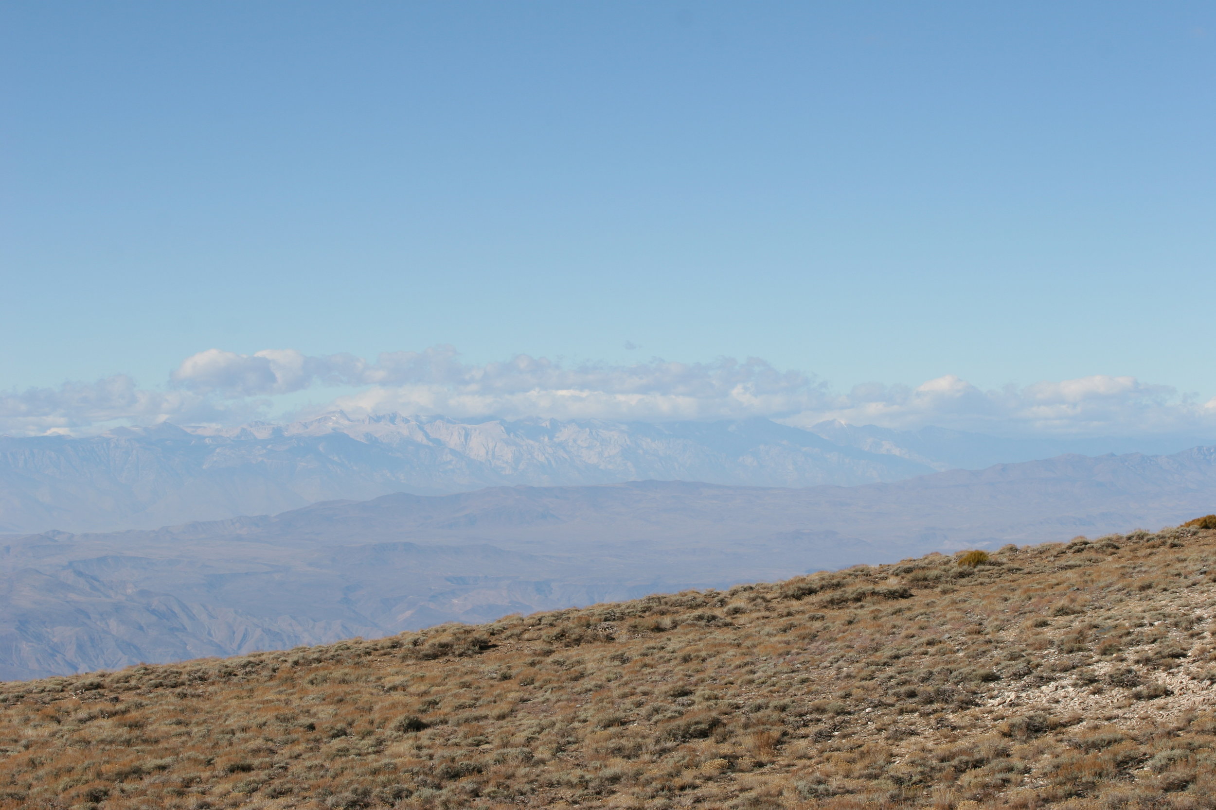
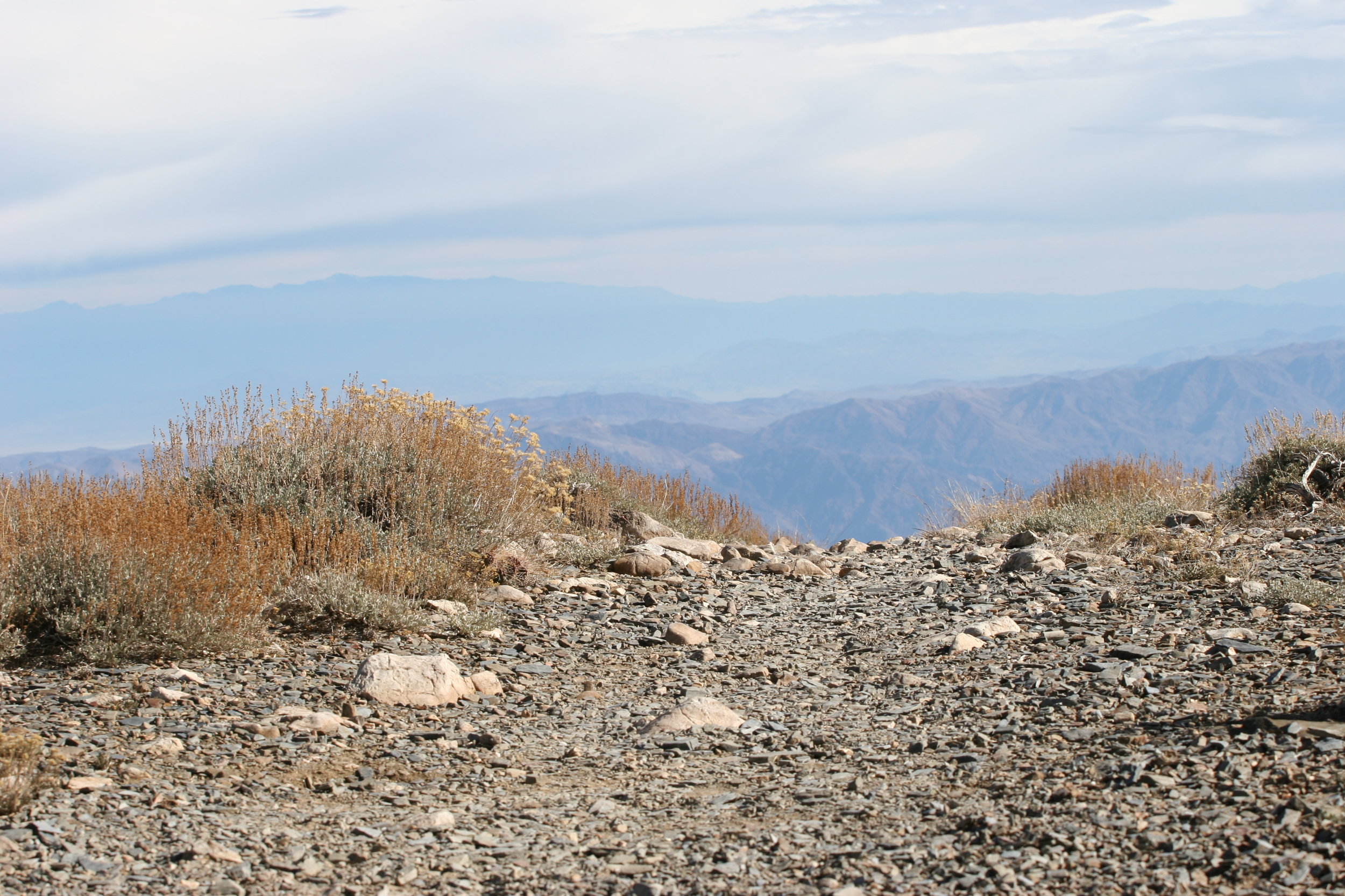
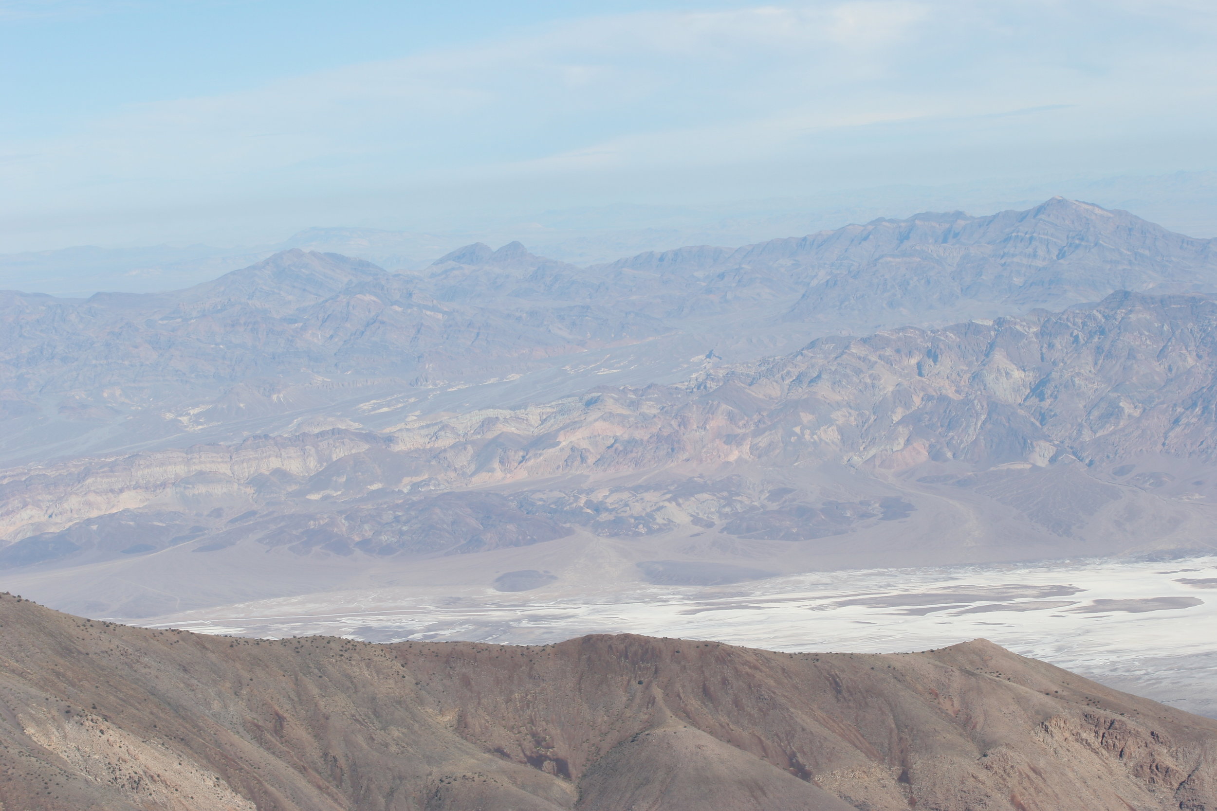
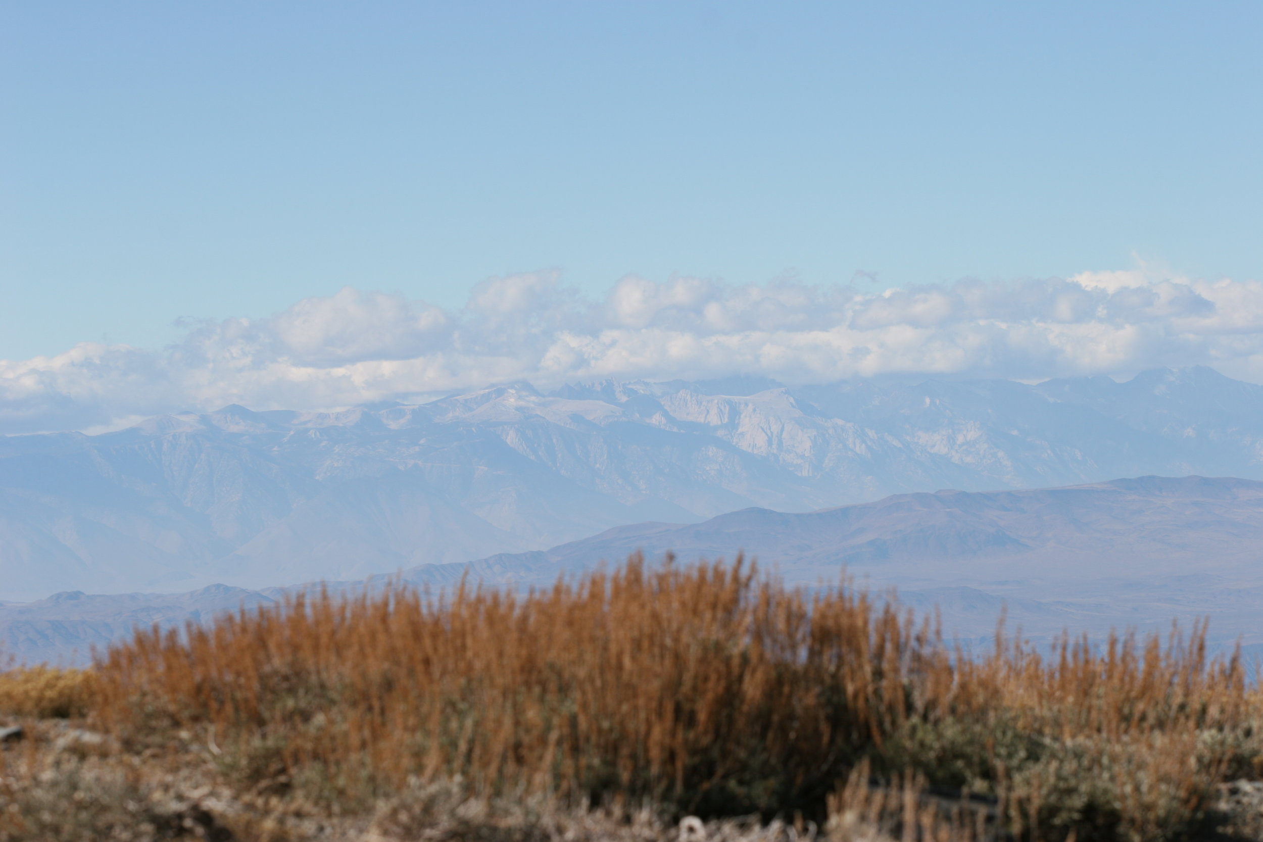
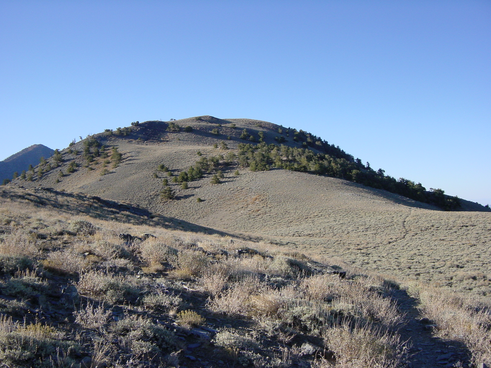
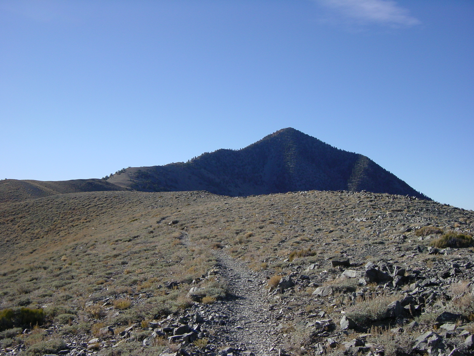
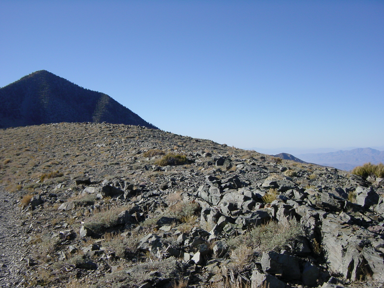
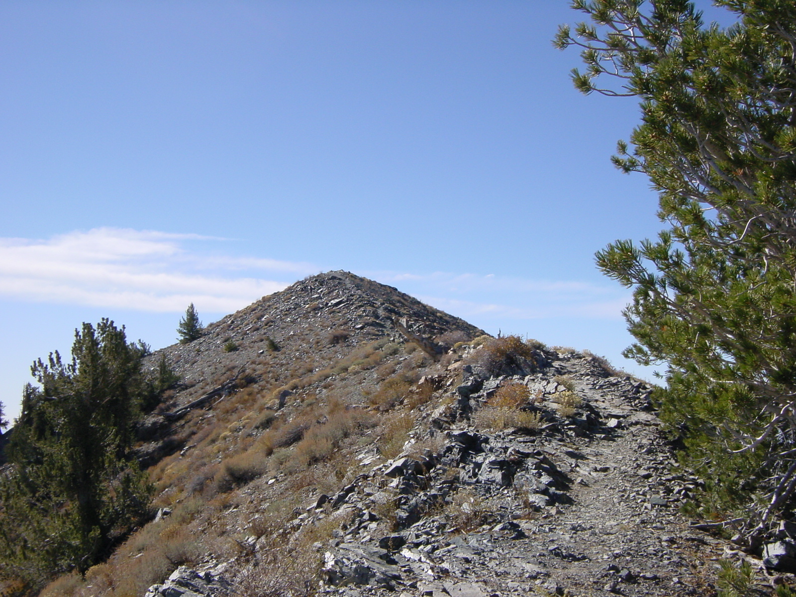
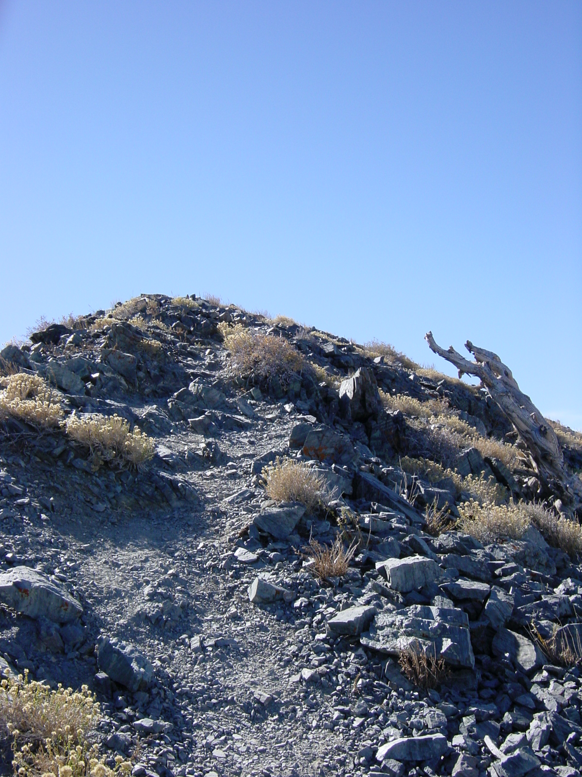
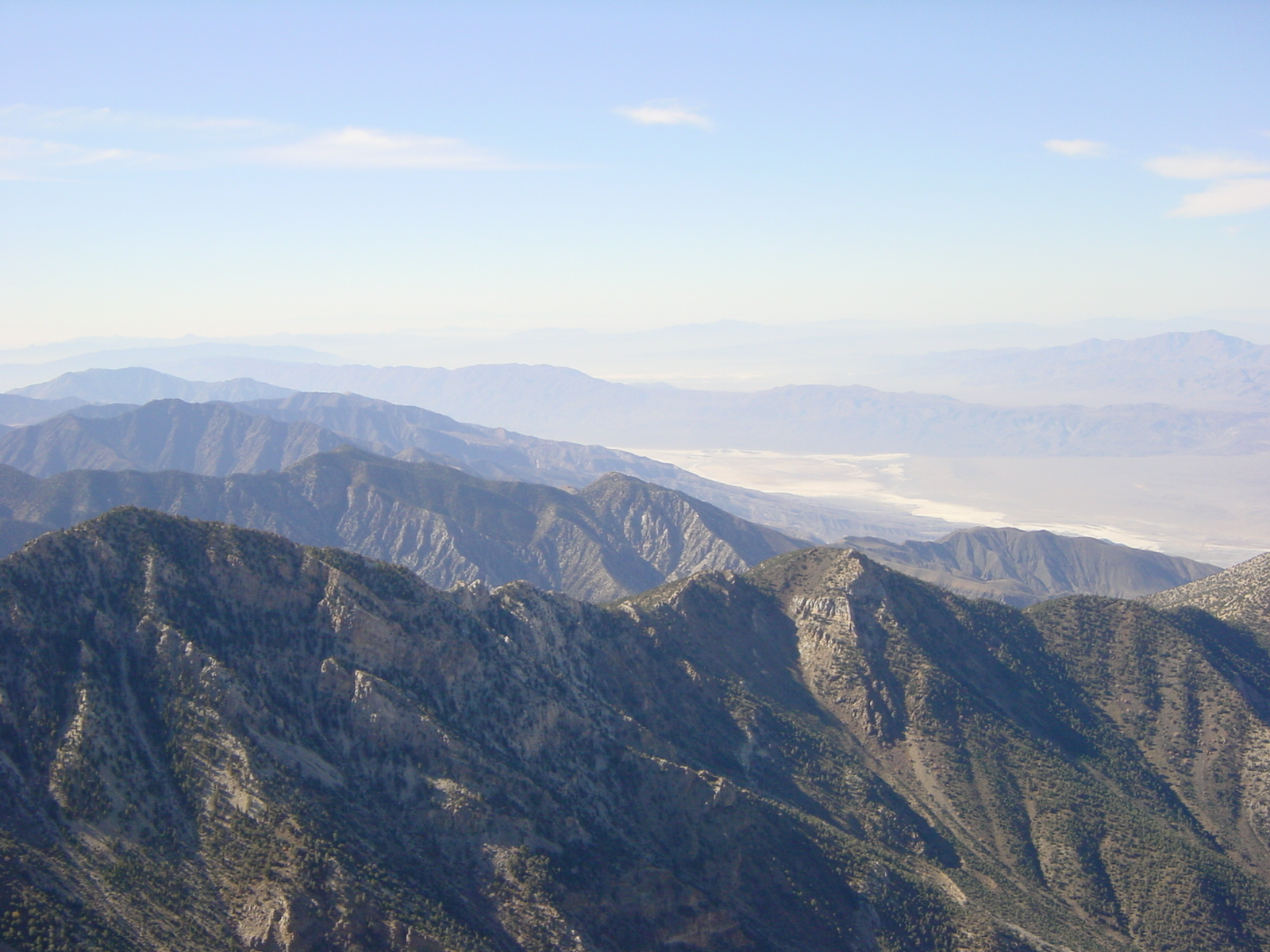
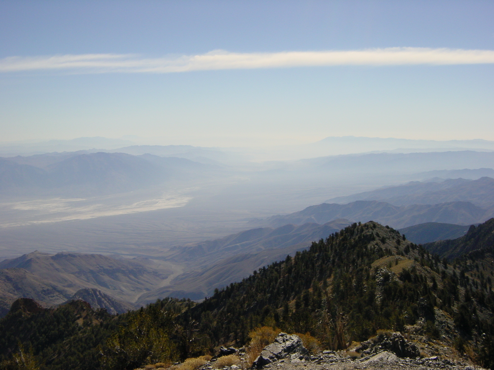
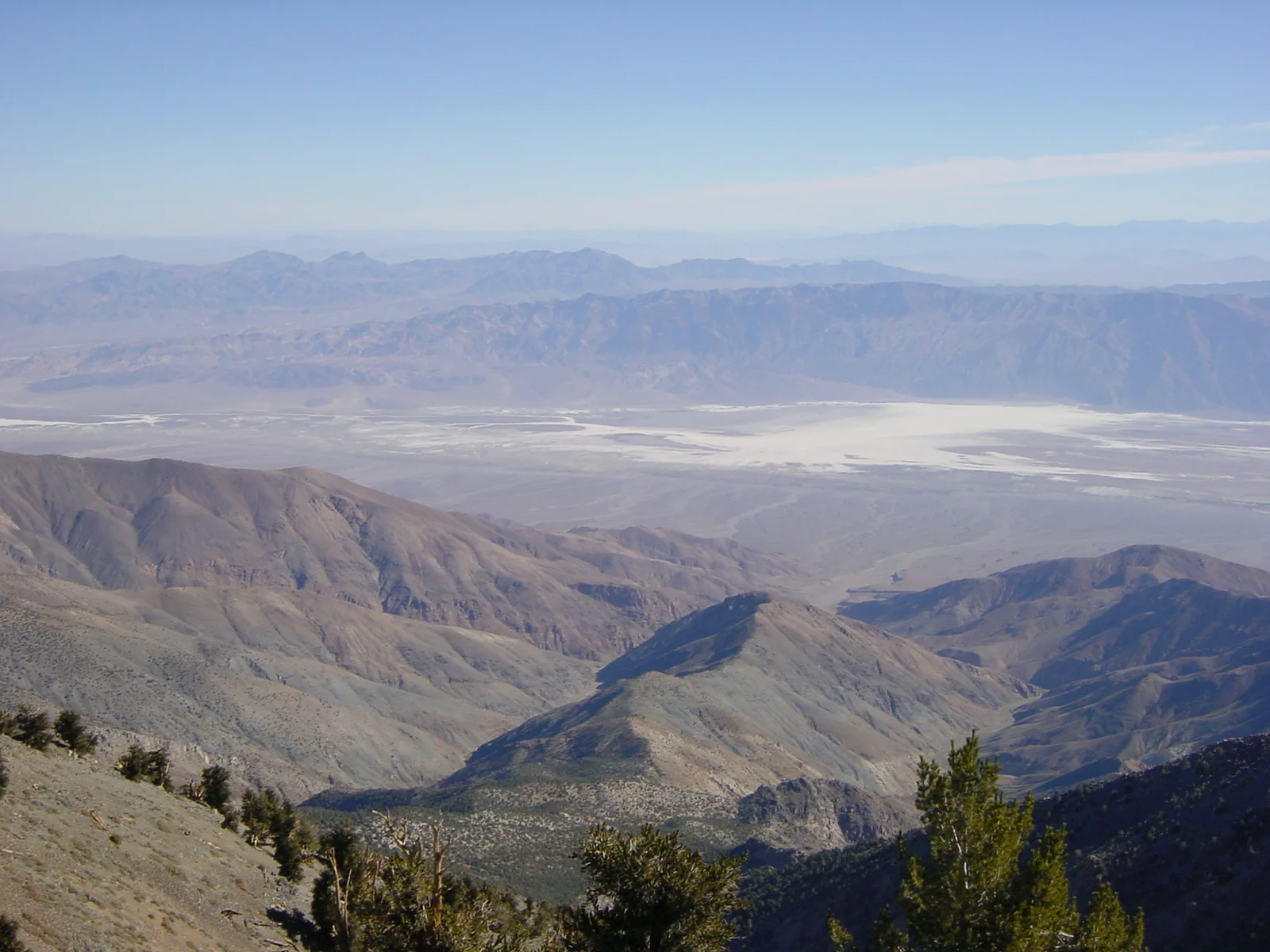
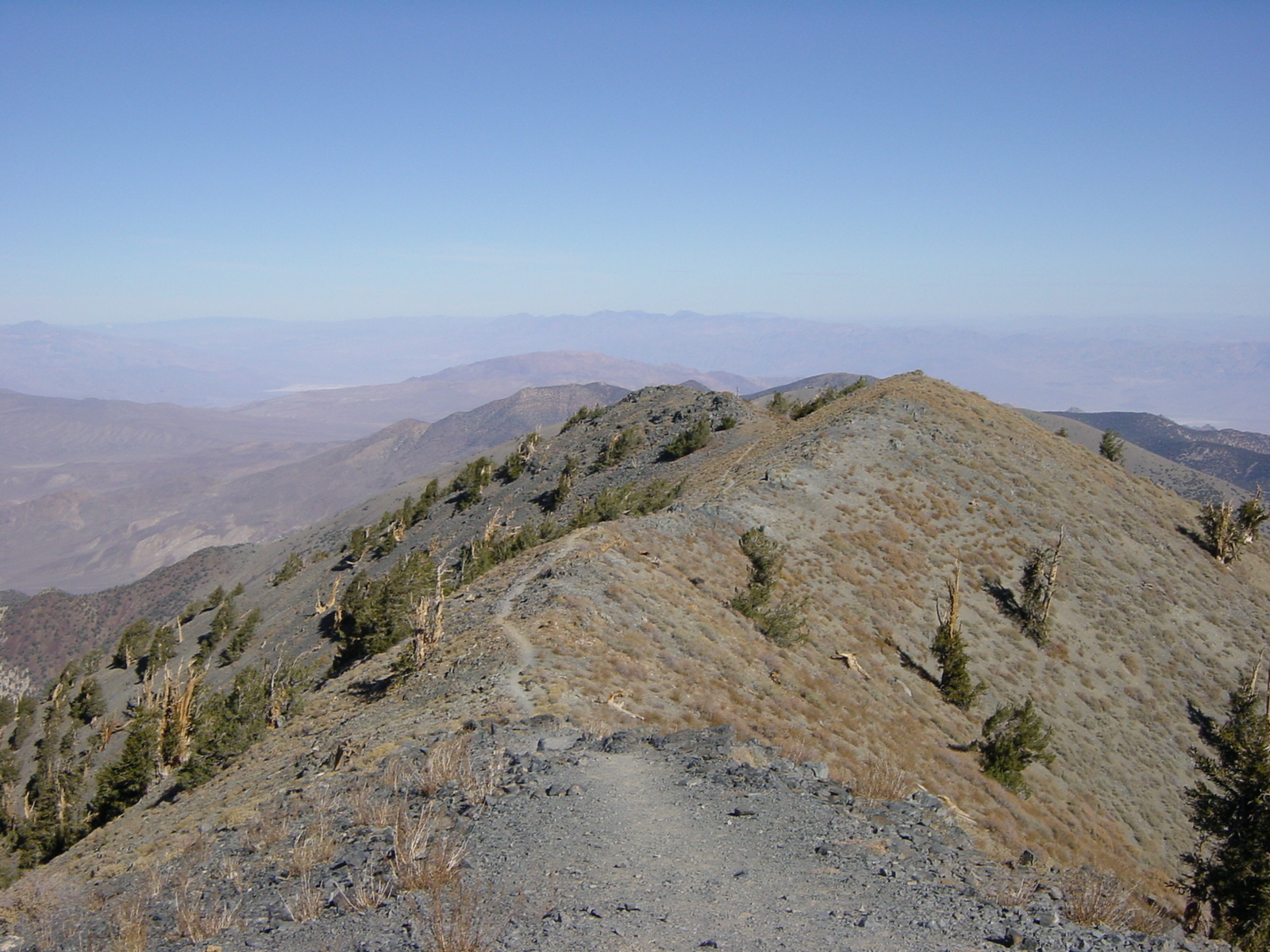
    In any case, as you head up from Mahogany Flat, the trail is well marked, graded, and winds around up toward Arcane Meadows. During the last half mile before Arcane Meadows, you will be on a section of trail that drops off to the South. Through this stretch, I would recommend watching your footing on the shale rocks so as to avoid a nasty fall. After this section of trail, you will crest a slight rise and be in Arcane Meadows at  9,263 feet; you will know you are in Arcane Meadows as it is nearly completely flat (the definition of a meadow), and there is a rock cairn built by former hikers next to the trail. From Arcane Meadows, the trail continues its slow-but-sure ascent up to the summit of Telescope while passing Bennett Peak. During this time, there are fantastic views to the West (of the Sierra Nevada) and to the East (of Death Valley proper). The last section of trail before the summit is the steepest; however, if you have made it this far, there is probably little doubt that you will make the summit. From the summit, there is an amazing three hundred and sixty degree view of the surrounding area; and on a clear day, to Charleston Peak by Las Vegas, and to the Sierra Nevadas to the North and West. Once you’re done taking in the view, you will head back down the way you came, unless you are traversing over Bennett and Rogers, as described in my previous post.

     Tips: As discussed above, and in the post about Rogers, if you are heading out to attempt this hike or climb in winter, do take the proper gear, as there will be ice and snow. It is also worth noting that most, if not all of the hike is exposed after Arcane Meadows, and even in the summer, there can be strong gusting winds that can affect a hiker. And, while this is a great summer hike to beat the 114 degree heat of Death Valley proper, do take lots of water to avoid dehydration as it is quite dry, even at that elevation.

     Telescope Peak summit, looking North.


    More Information: http://www.nps.gov/deva/planyourvisit/upload/Telescope%20&%20Wildrose%20Peaks-2.pdf, http://www.dankat.com/swhikes/tscope.htm, http://www.summitpost.org/telescope-peak/150584

    PrintView Printer Friendly Version

    EmailEmail Article to Friend

    Reader Comments

    There are no comments for this journal entry. To create a new comment, use the form below.

    PostPost a New Comment

    Enter your information below to add a new comment.

    My response is on my own website »
    Author Email (optional):
    Author URL (optional):
    Post:
     
    All HTML will be escaped. Hyperlinks will be created for URLs automatically.