Death Valley National Park

Road Trip Guide to Death Valley

Road Trip Guide to Death Valley

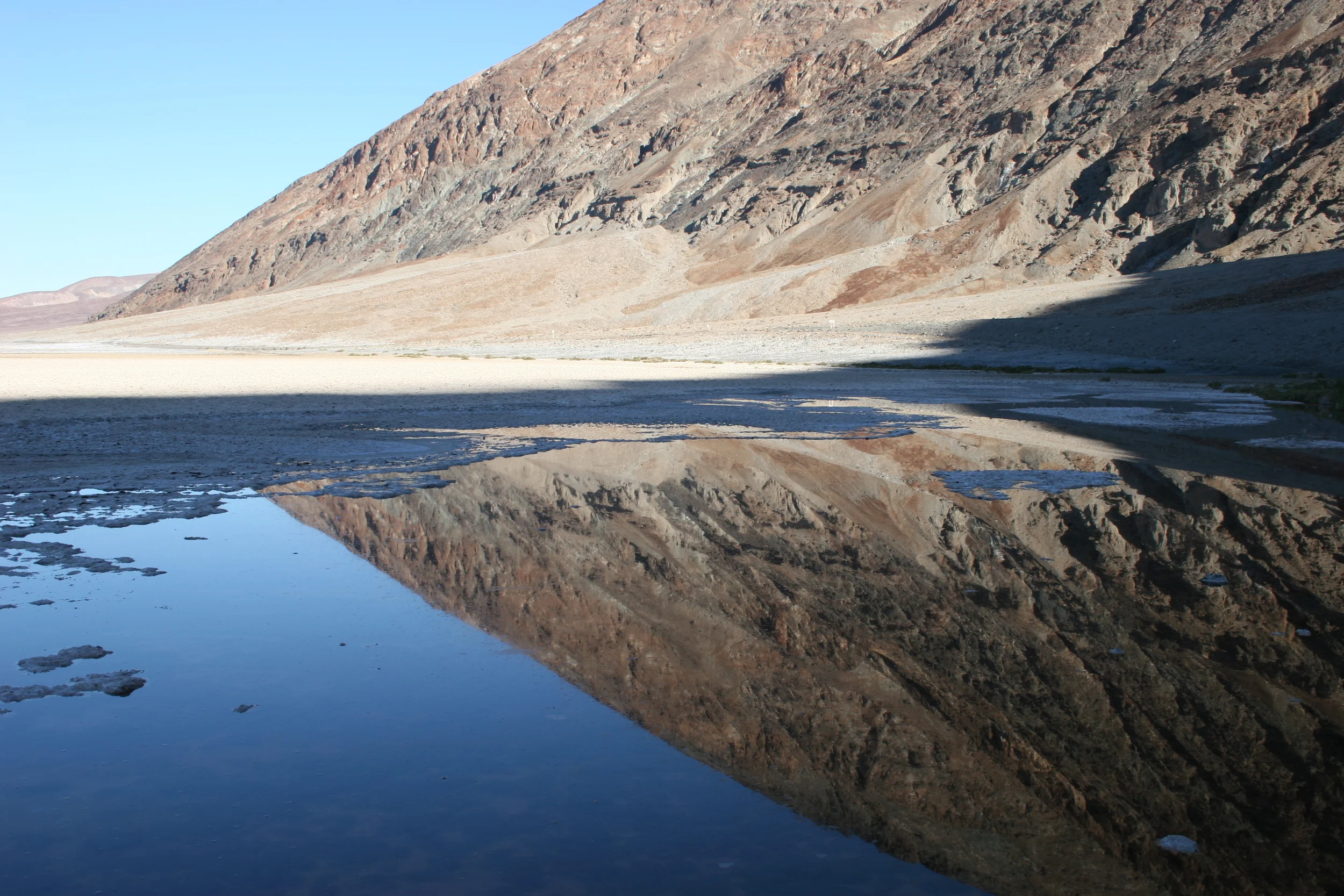
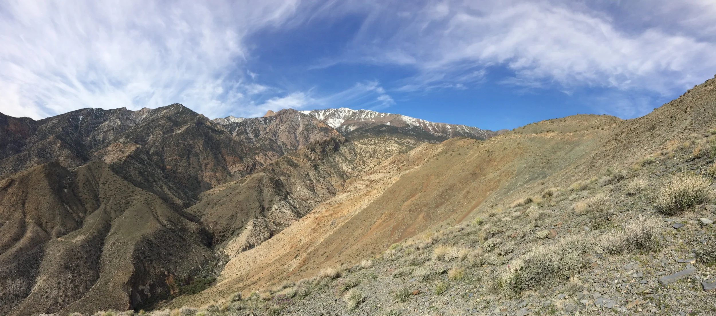
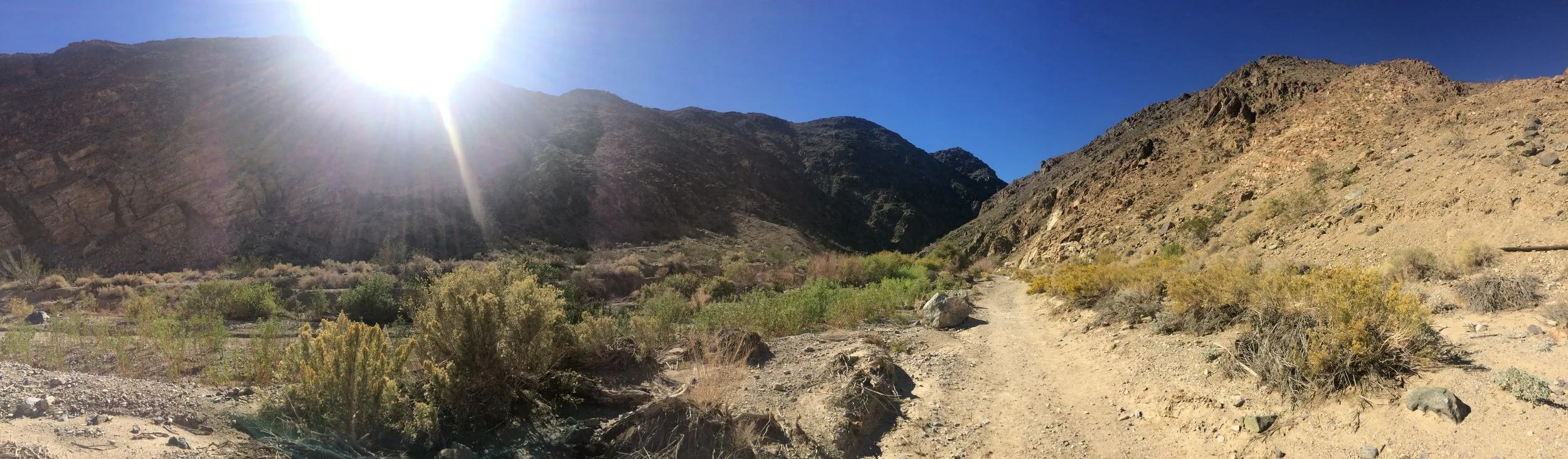
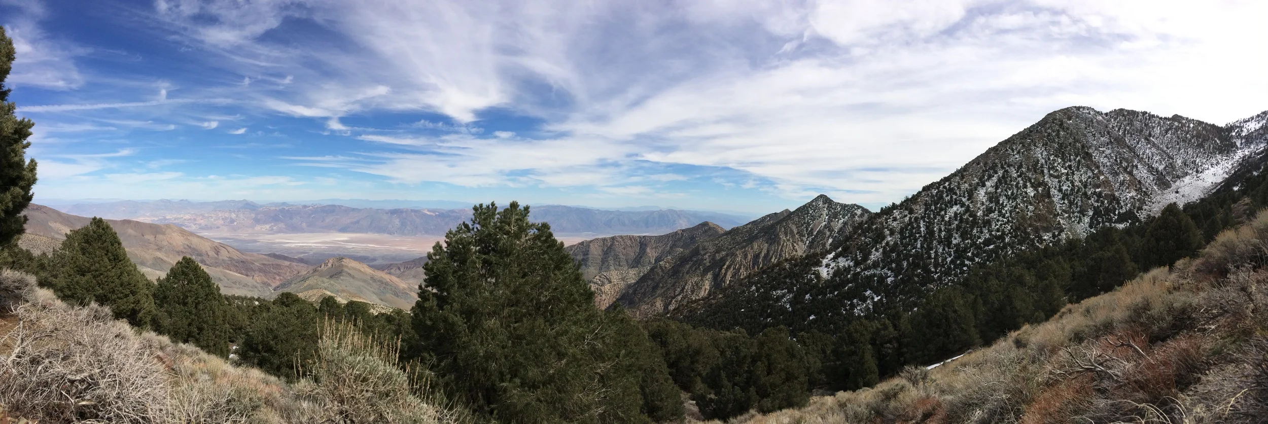
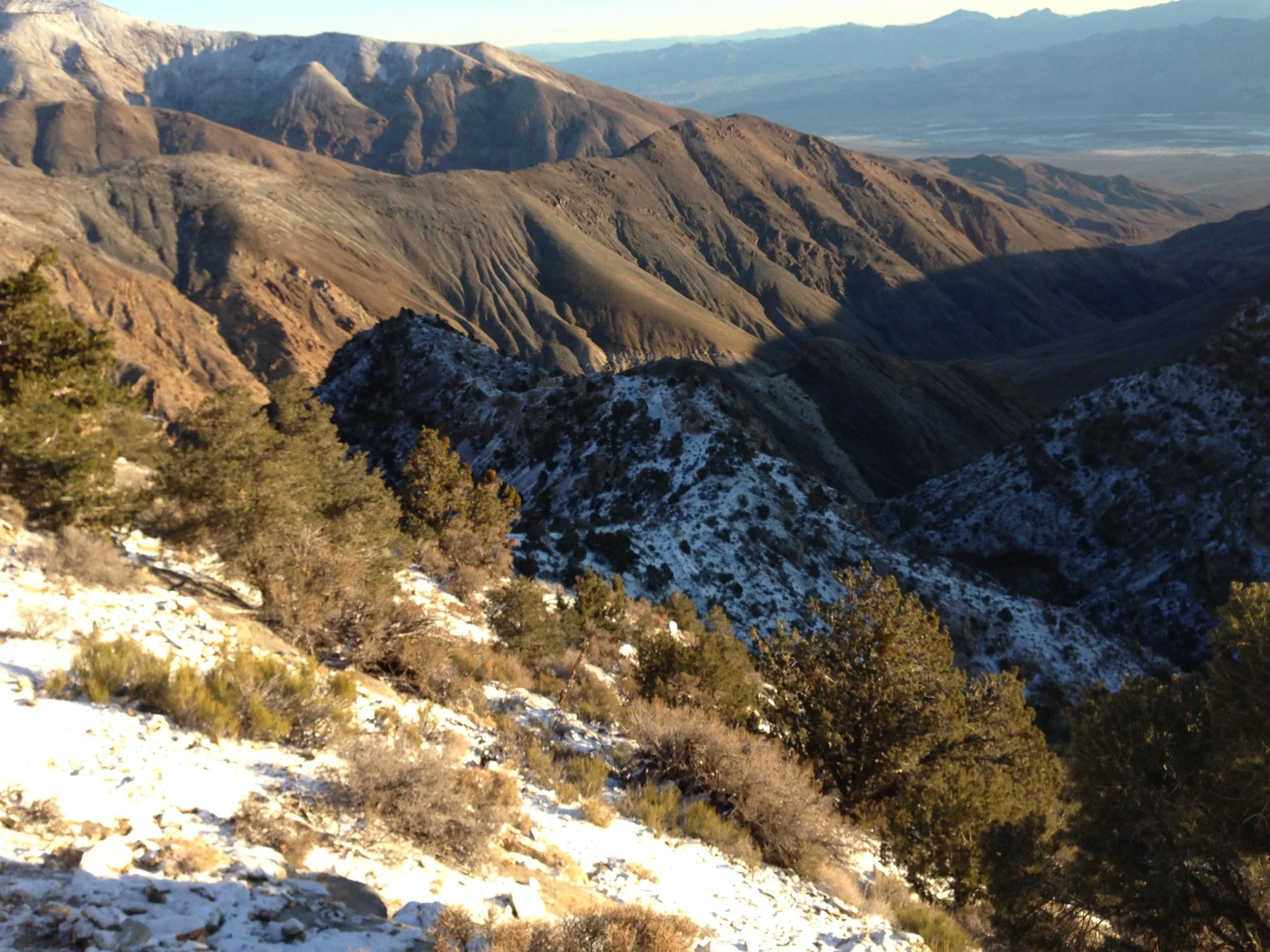
On the Eastern border of California, and near the Western border of Nevada, is an area that is full of mystery, wilderness, and desert solitude. This area is Death Valley National Park. The name alone “Death Valley” transcends time and space, and for hundreds of years has been a beacon to prospectors, explorers, adventurers, and today, casual visitors. While Death Valley is, as its name suggests – a fundamentally hostile environment, with temperatures regularly soaring over 100 degrees from April through October, it is more than a flat wasteland. In reality, Death Valley is one of the most geologically diverse environments on the planet, where the remains of glacial Lake Manly are laid bare, and the effects of active volcanism and erosion are easily visible. Within the confines of Death Valley, one can find tall, uplifted mountains, year-round waterfalls, volcanic craters, sand dunes, eroded canyons, and the lowest spot in North America.

Winter Climbing Rogers Peak

Winter Climbing Rogers Peak

The Route/Conditions: As I mentioned above, I chose Rogers Peak for my snow survey of Telescope because it was an “easy” way to get the information. While access to Rogers Peak is through a fire road, it is worth noting that in winter, nothing is “easy” as it seems. Also, I would be remiss if I did not mention that Rogers Peak is a 9,994 foot mountain, and like most things in life, “easy” is a subjective term that can mean many things to many people. Finally, for people that are not familiar with the area, Rogers Peak is one of three mountains in the Panamint Range of Death Valley that are generally climbed together – a sort of “three peaks in one day” challenge. The other two are, respectively Telescope Peak (the highest point in Death Valley at 11,043 feet), and Bennett Peak (9,980 feet). While Rogers can be climbed as part of the three Panamint Peak trifecta from the main Telescope Peak trail, it can also be climbed separately as a stand-alone mountain via the fire access road.

Badwater Basin

Badwater Basin

Of the fifty-nine National Parks in the United States, Death Valley is the most infamous, and the least well known. Most people assume that Death Valley is an inhospitable wasteland, with nothing of interest to see or do. However, outdoorspeople, geologists, and adventurers know that Death Valley is a location with interesting geologic features, mining history, tall mountains, sand dunes, volcanic activity, historic structures, and much more. Even if it did not have all of these things and more, Death Valley is a notable location to visit because of Badwater Basin.

Shorty's Well 2016 - Climb for Briley

Shorty's Well 2016 - Climb for Briley

The second favorite thing that I like about being an outdoor blogger and sometimes internet personality is helping people. The first thing, naturally, is exploring and being outside. But as for that second thing – I truly believe that, as Plato says, “Good actions give strength to ourselves and inspire good actions in others”. For me, blogging started out as a good action – a way to give back and share my knowledge of the wilderness. Since blogging is an imprecise art at best, I’ve also continued to do what I always had done – namely, real life good actions. To me, one of the many positive things about doing good actions is that you find more of them to participate in, which leads me to my current good action, a charity climb of the Shorty’s Well Route with a fellow mountaineer and blogger, David Wherry.

Darwin Falls

Darwin Falls

Death Valley is a land of many wonders. While it is hard to pick just one thing that is wondrous and amazing about the park, to me it is the prevalence of water in the region, and the different ecosystems that the pockets of water support. Now, let us be clear – not all of the water in that can be found in Death Valley is potable, such as the highly saline pools near Badwater, or the water in Salt Creek. But, for each pocket of water that has high mineral contents in the region, there are also areas like Shorty’s Well that are small, green, pure oases year-round. Out of all these “green” zones in Death Valley, the most famous is Darwin Falls, which is also, aside from Badwater, one of the most accessible water features in the park.

Shorty's Well Route

Shorty's Well Route

Start in darkness. End in darkness. This is what I was thinking at 11:49 p.m. on March 14, 2015. At that point, David Wherry and I had been mountaineering for almost twenty-four hours straight. Minutes before, we had exchanged a few words about how it would be nice to be back at the car before the next day began at 12:01 a.m.; but despite this conversation, we are still shambling along at a crawl into the Badwater Basin our normally powerful gaits reduced to pitiful zombie-esqe shuffling.  My legs hurt. My back hurt; and as of 11:32 p.m., my feet had finally started hurting. I felt more dead than alive. At that moment, a mere quarter mile from the car, I was thinking of nothing but two things: “Start in darkness; end in darkness” and its “not mountaineering until someone draws blood”.  What we had been doing was mountaineering; there was no doubt in my mind about that. As we finally reached the car, there was one thing I understood fully though: the Shorty’s Well Route was indeed the “impossible hike” and the hardest mountaineering route in North America.

Mystery Mine, Panamint Mountains

Mystery Mine, Panamint Mountains

One of the many things that I like about Death Valley National Park is its enormous expanse of open terrain. Its enormous swath of desert and mountain wilderness ensures that you will have solitude to appreciate the park's many amazing geologic features; and it also ensures that you will have the opportunity to have an adventure, and if you're lucky, the chance to discover things that have been lost. For example, earlier this year, when thepeakseeker and I were attempting the Shorty's Well Route (Trip Report here) to the top of Telescope Peak, we came across an abandoned mine. While abandoned mines are common in Death Valley due to the park's mining history, the location of this mine was unexpected. We had backpacked into the Panamint Mountains from the Badwater Basin; and had passed Shorty's Well, and Shorty's Mine. From the mine, we had followed a foot trail which had gradually become steeper deep into the mountains. At the end of the first day of backpacking, we had traveled ten miles from the nearest "road"; and were truly off the grid.