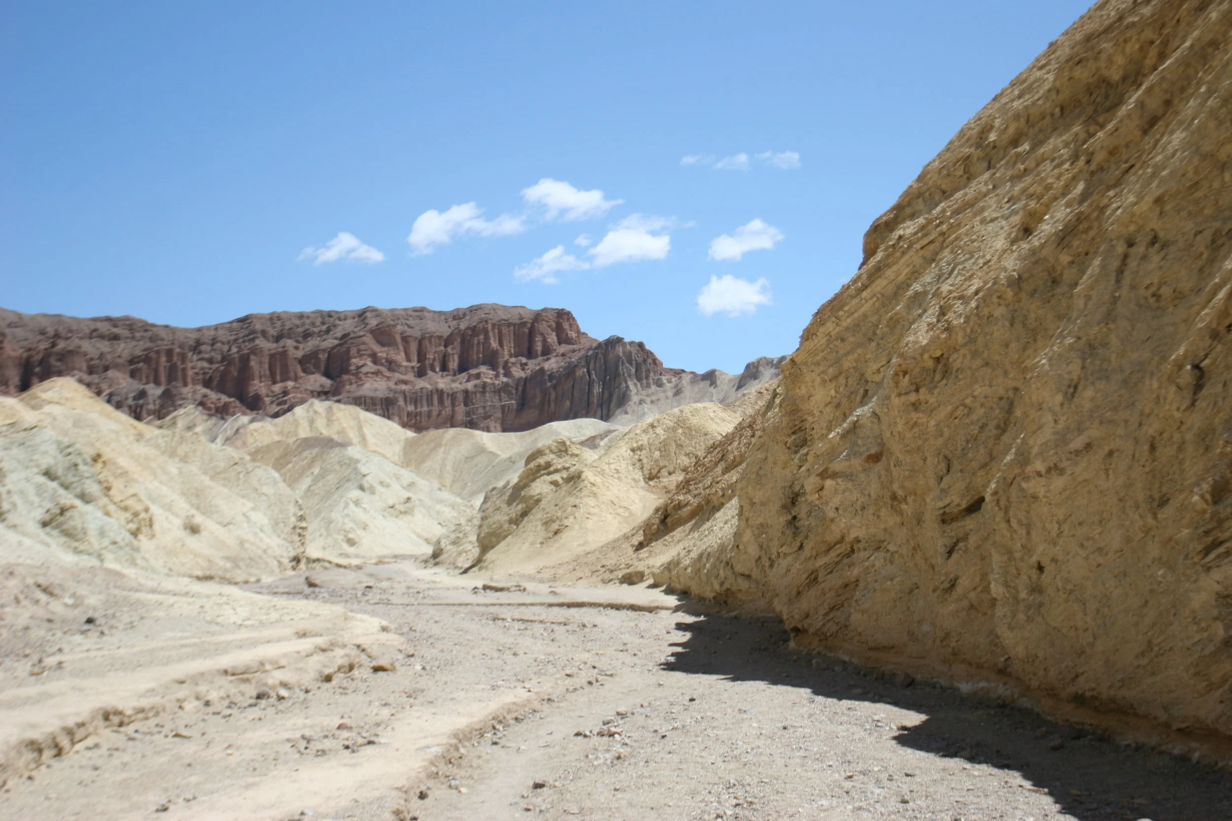
Red Cathedral, Golden Canyon
It should surprise no one that I am a child of the latter half of the twentieth century. As one, I listened to a lot of one-hit wonders. Now that I’ve made myself sound like my father: “You know what was great in 1962? Wilt Chamberlain”, I’ll get to the point. The point is this – in 1997, there was this song. It started with a little high hat, and then it had a repetitive five chord introduction, and since that could be any song, I’ll tell you what it was: it was Smashmouth’s Walkin’ on the Sun. I’m not sure what’s more embarrassing; that I’ve had this long lead in about how I used to listen to Smashmouth, or that whenever I think of the song, Walkin’on the Sun, I can’t even get the lyrics right, and I always think the lyrics are “You might as well be walking on the moon”.But let’s be honest here – sun, moon – who’s keeping score? Whenever I go to Golden Canyon, this is the song I think of because I associate it with being on the moon (not sun), and that lunar type of terrain is exactly what you will see from the moment you enter Golden Canyon.


Directions: The Golden Canyon Trailhead is two miles South of Furnace Creek Inn on the Badwater Road. The trailhead is well signed, and cannot be missed. Golden Canyon is one of the more popular hikes in Death Valley, due to its proximity to Furnace Creek, and due to the fact that it is an interpretive trail for the first mile and due to the fact that the hike to the Red Cathedral is largely flat. Like Mosaic Canyon, there is a high probability that you will indeed see people within the first quarter mile of the hike, and that the parking lot will indeed be busy. I have seen the parking lot full of cars, RV’s, and all other vehicles; and in my experience, there is generally a fair number of people milling around the trailhead.
But, do not despair: as I have noted in other posts, most notably Mosaic Canyon, timing is everything. You may be in Death Valley on a particularly cold day, or a particularly hot day, or maybe you got an early start; and maybe you will see no people. In my experience, however, most of the people that hike Golden Canyon do what hikers in Mosaic Canyon do, and that is that they will hike a quarter mile, then oooh and ahhhh about the formations, maybe sing a little Smashmouth (ok, that’s just me), and then head back to their cars to move on to the next item on their list. This means that once you get past the first quarter mile, or the first mile, after the interpretive section of the trail ends, chances are you will be by yourself, wishing you knew the words to more songs to break the silence of the trail. In any case, you should never let other people dissuade you from experiencing your National Parks, because chances are, only you can experience the park in your own way. In fact, I’m sure of that fact!
In any case, the trail leaves directly from the parking lot, and is well graded and easy to follow for the first mile. During this first mile, you will pass by many slot canyons to your North and to your South. While these canyons aren’t on the trail, there’s no reason that you can’t explore them, as long as you take the proper precautions (such as a map, and plenty of water), which is another way to separate yourself from other hikers and a great opportunity to explore. After one mile, conveniently marked by Marker 10 on the NPS Interpretive Trail, the trail forks in two directions. The left fork (heading roughly to the North) will take you to the base of the Red Cathedral; and the right fork (heading roughly to the South/Southeast) will take you to Zabriskie Point or Gower Gulch. From the signpost, it is roughly .25 (1/4) mile to the end of the approved NPS trail to the Red Cathedral. Again, however, along the way, there are many slot canyons that you can explore; and should you wish to walk to the very base of the Red Cathedral, it will be an additional .25 (1/4) miles of distance. This is an area with a variety of great geologic features, so even though it is a short distance, and an easy hike, I’d recommend that you plan a little additional time to explore the area and enjoy the scenery. If you don’t go up any of the slot canyons, and stick to the trail, and nothing but the trail, you will hike 2.5 miles total roundtrip, for a distance of 1.25 miles each way. As I will discuss tomorrow, you can also link this hike with longer walks out to Gower Gulch or Zabriskie Point.
Tips: The NPS interpretive trail for the first mile has great information regarding the area, its history, and the geology at work in the surrounding terrain. Brochures are available for the trailhead on most days, and at the Visitor Center for a mere .25 – a real bargain. As always with any hike in Death Valley, do take plenty of water, and if you are planning on exploring, a map as well.
