Folly Peak to San Jacinto Ridgeline, January 2016
Out of all the continental United States, Southern California offers some of the greatest variety in terrain. What it does not offer on occasion on certain trails is serenity, and solitude. While popular trails face heavy traffic nation-wide, popular trails in Southern California sometimes resemble a human version of the region’s congested roadways. Despite these problems, hikers of all skill levels in the region – especially in 2016 – know where to go and when to go to avoid crowds, thanks in part to the internet, and thanks in part to a greater interest in hiking generally. One of the routes in the region that has always been popular has been the Aerial Tramway to San Jacinto summit, due in part to the moderate distance (11.5 miles roundtrip), moderate elevation gain (2,190 feet), unique aerial tram ride experience, and possibility of summitting one of Southern California’s highest mountains (unofficially now known as the “Six Pack of Peaks”).
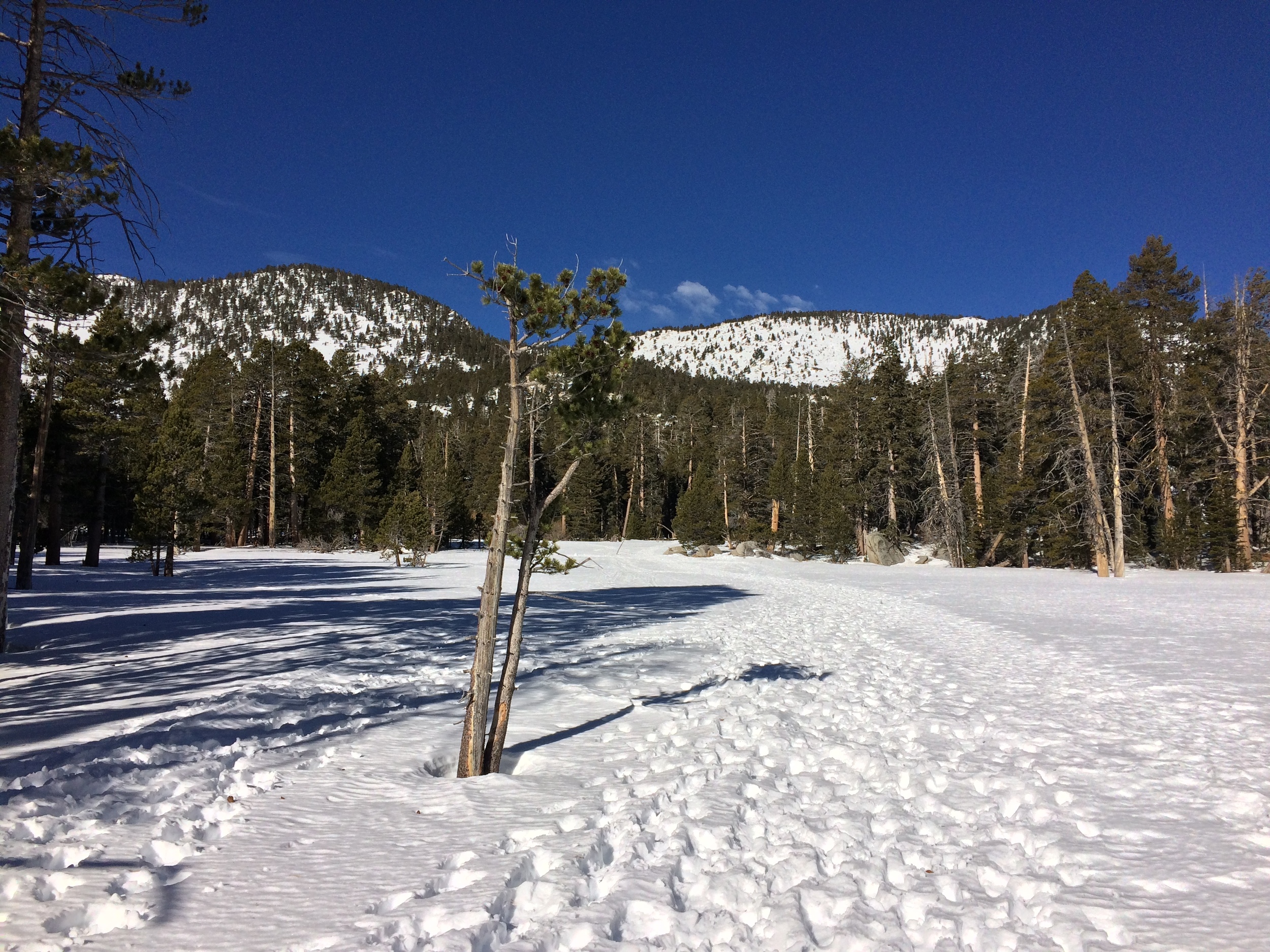
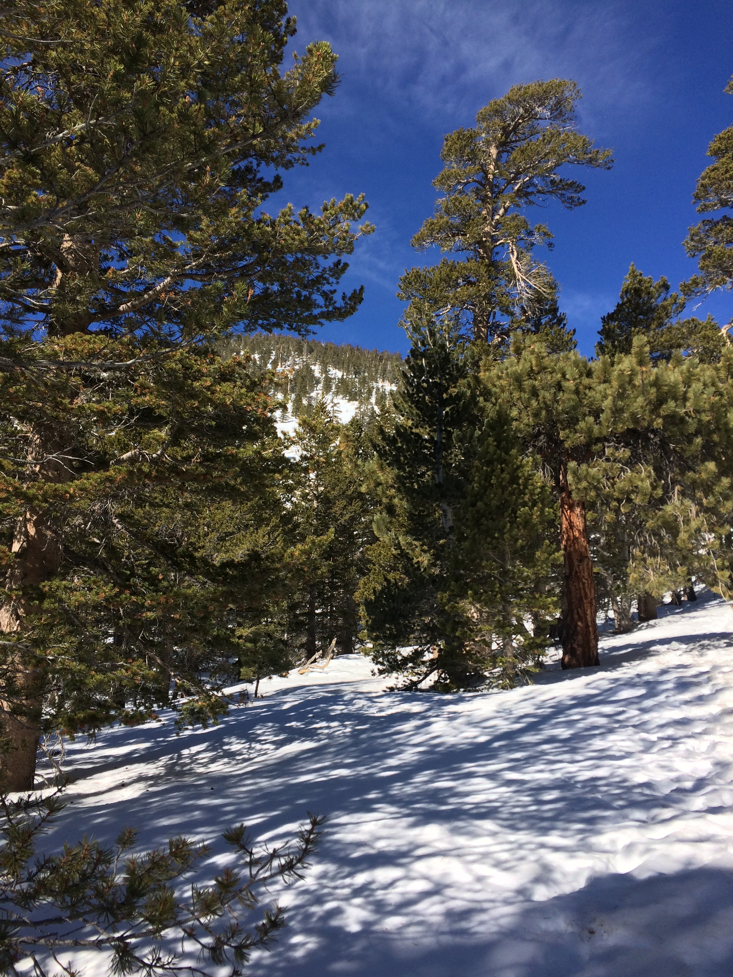
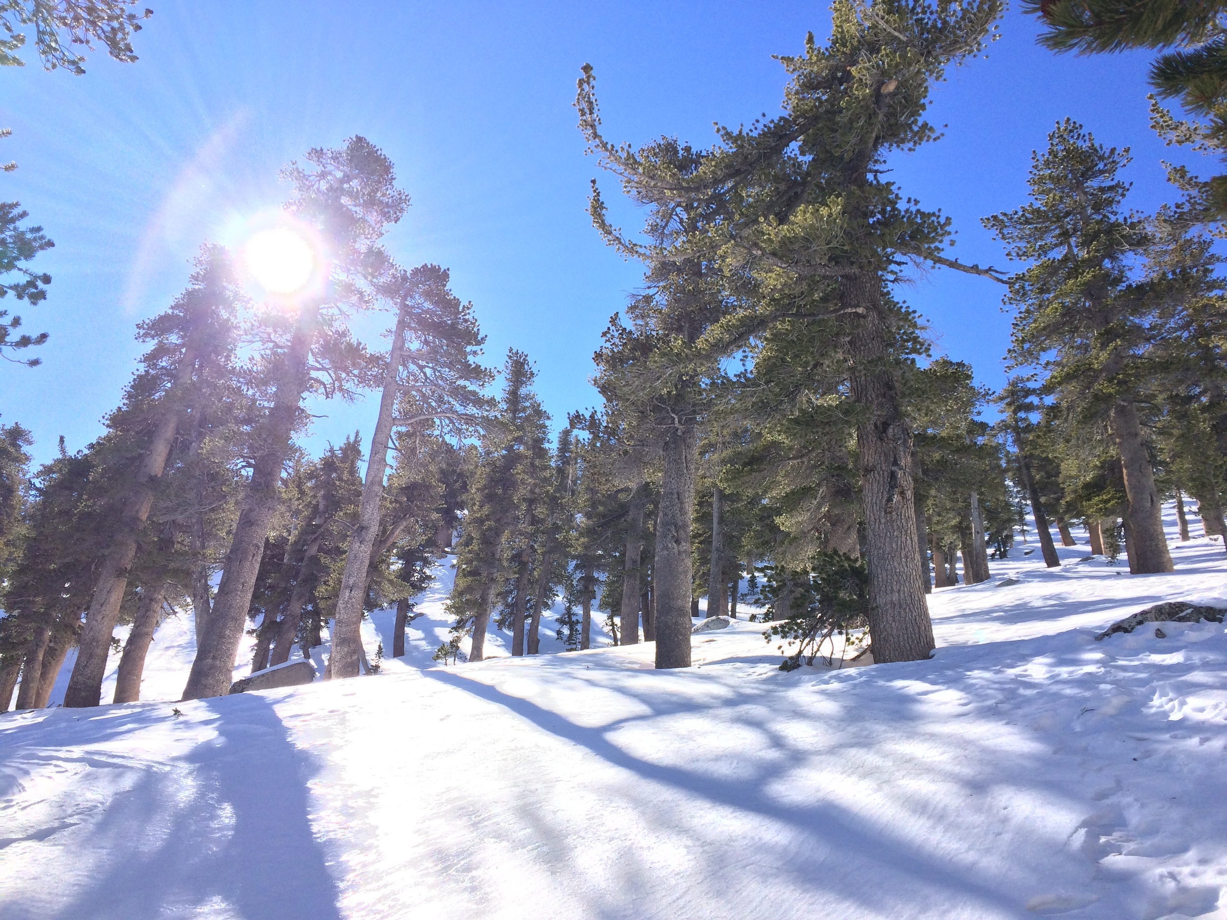
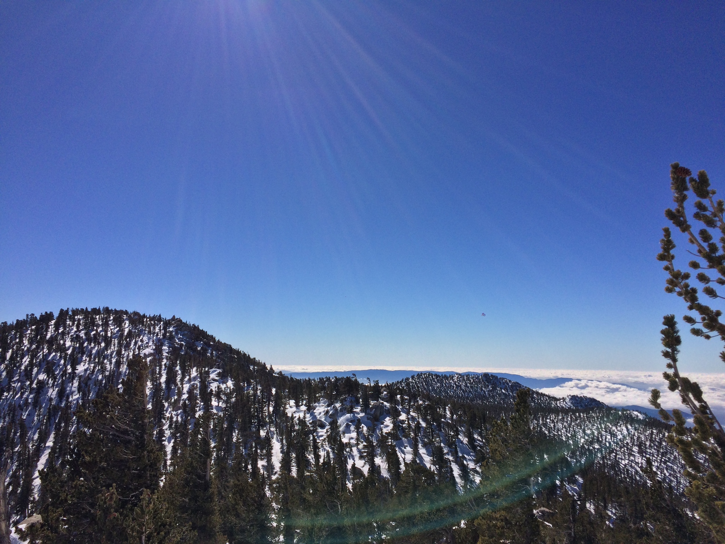
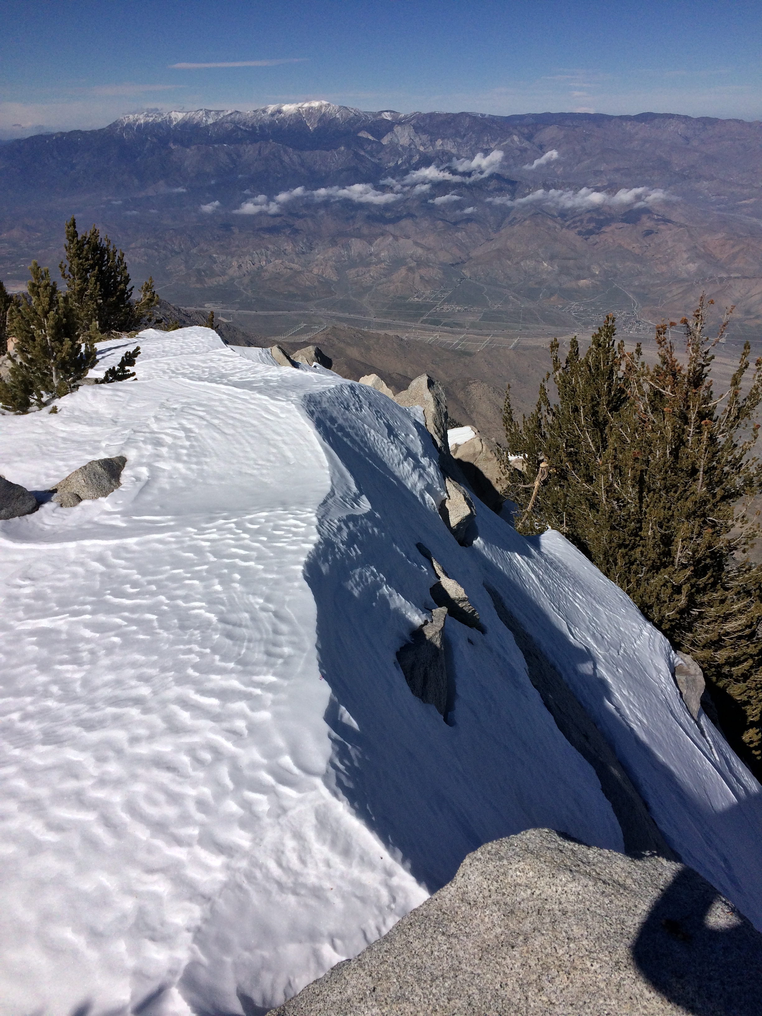
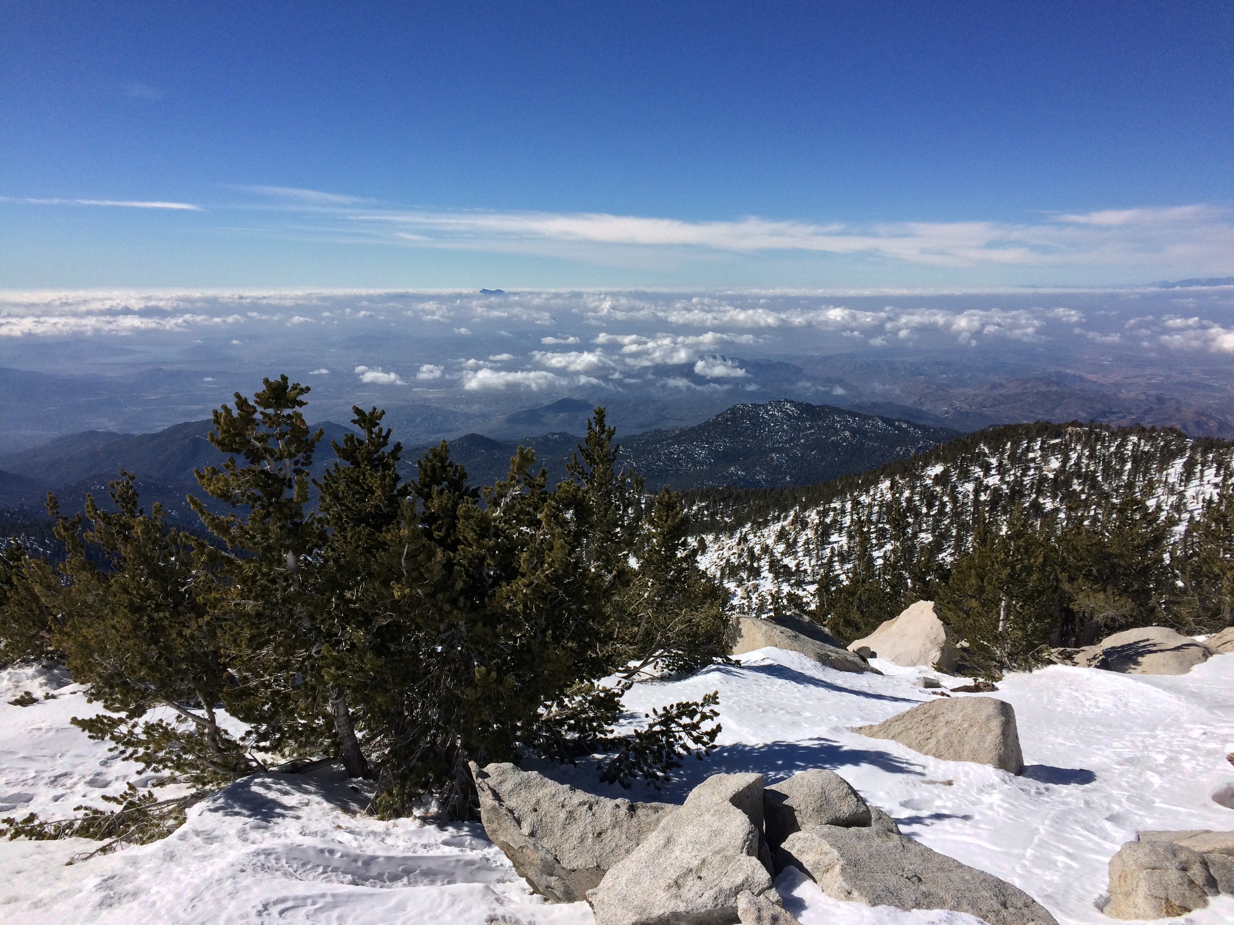
Current snow levels, Round Valley, San Jacinto, January 2016
However, veteran outdoorspeople have always known that during the winter months, outside of the Long Valley region (the immediate zone around the tram), San Jacinto is one of the premier destinations for scenery, serenity, and solitude in the Southern California backcountry. Like many people who grew up in the region, I visited and climbed San Jacinto many times, and for many years insisted that the best time to visit the mountain was during the snow-covered months. This opinion was only reinforced in my mind during the 2009-2011 period when I had a number of great backcountry experiences on the mountain.
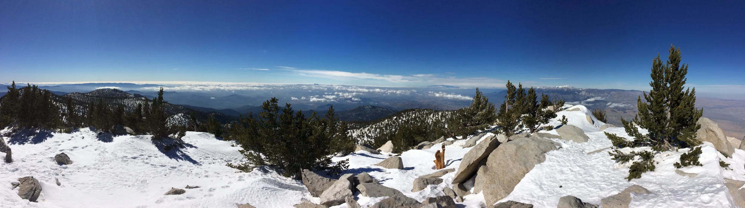
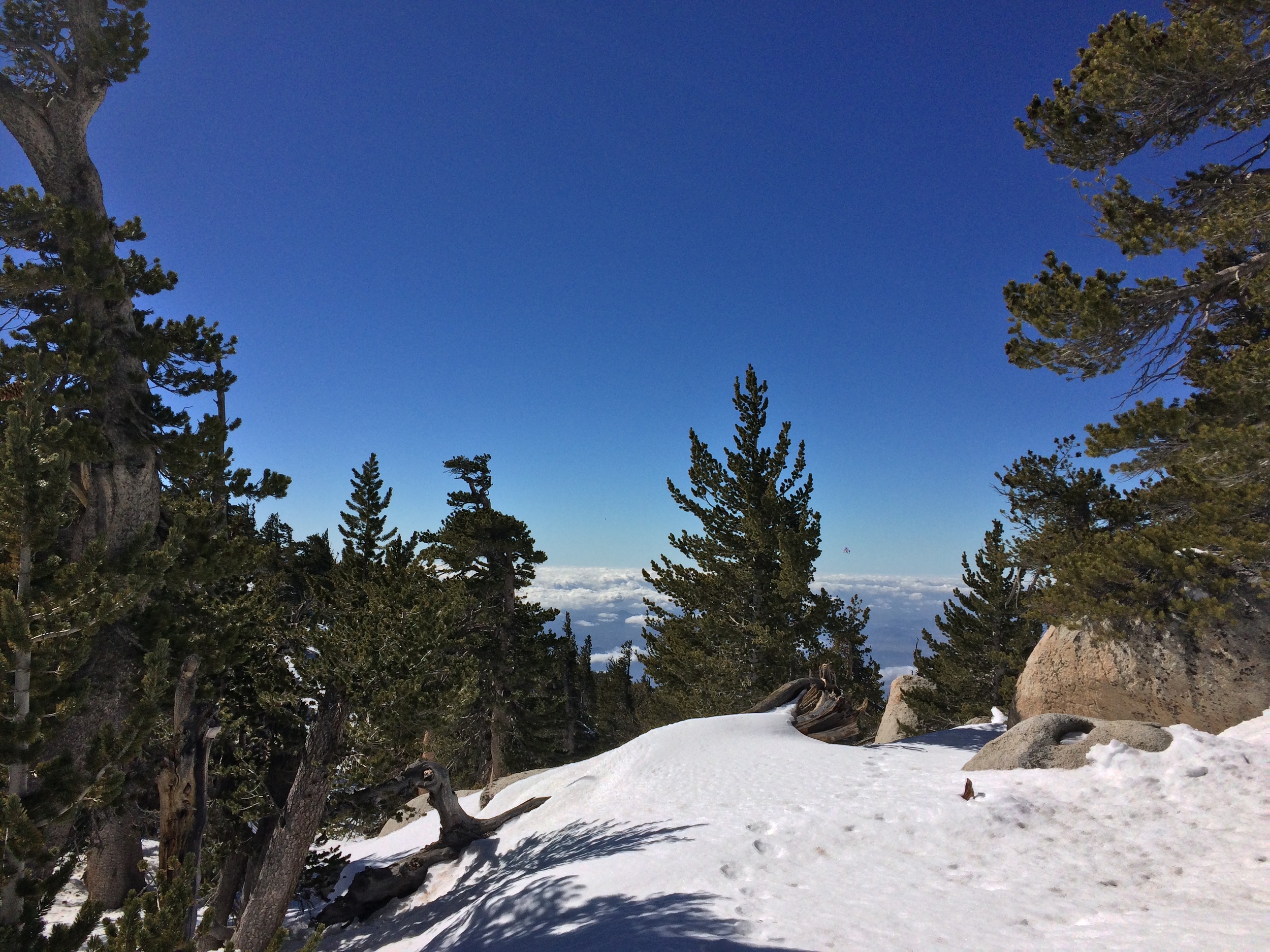
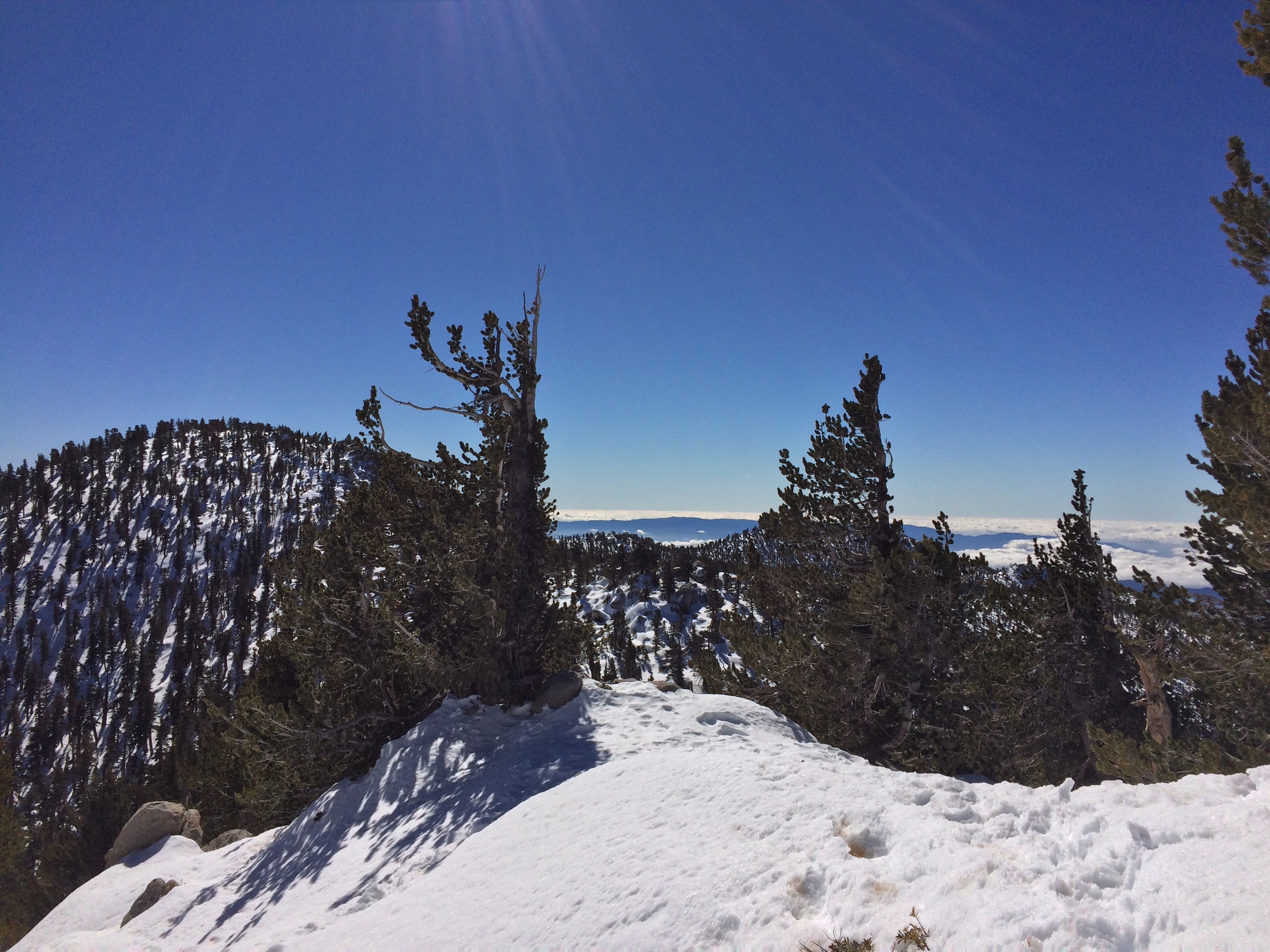
A short 360 panorama view of the summit of San Jacinto on January 30, 2016.
At some point during that time, I met Jeff Hester (“the SocalHiker”) online as part of the outdoor social media community, and offered to accompany him up the mountain during the winter. Unfortunately, then the drought hit. From 2012-2015, a winter ascent was somewhat pointless, as the region had no snow. Fortunately, with the arrival of El Nino this year, snow returned to Southern California, and Jeff and I were able to finalize our long standing plans. This last weekend, our meetup occurred, and we were able to successfully summit the mountain on Saturday, January 30. Below, you will find a few notes on the route we took, the snow conditions, and some other tips for the 2016 winter season on the mountain.
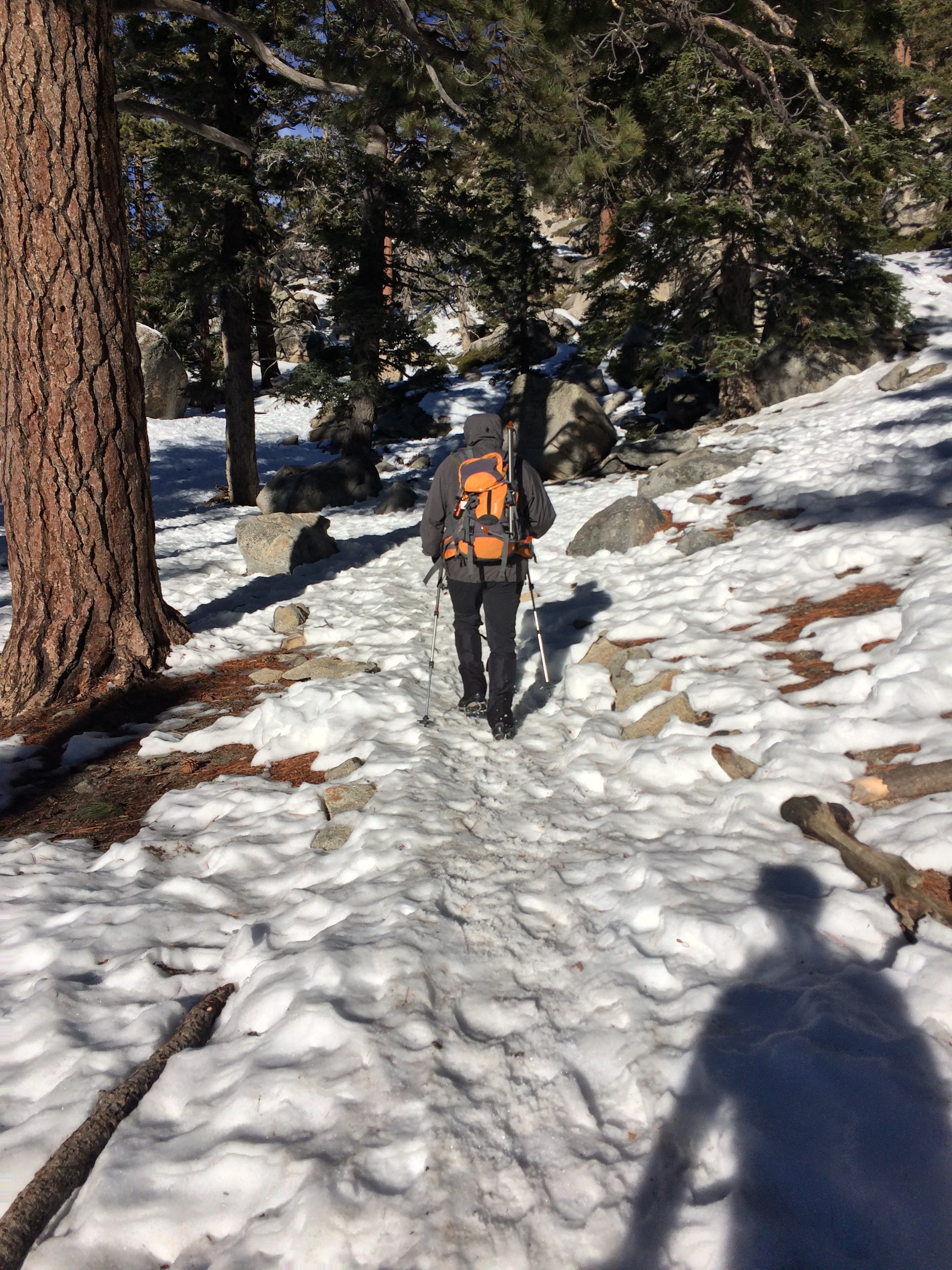
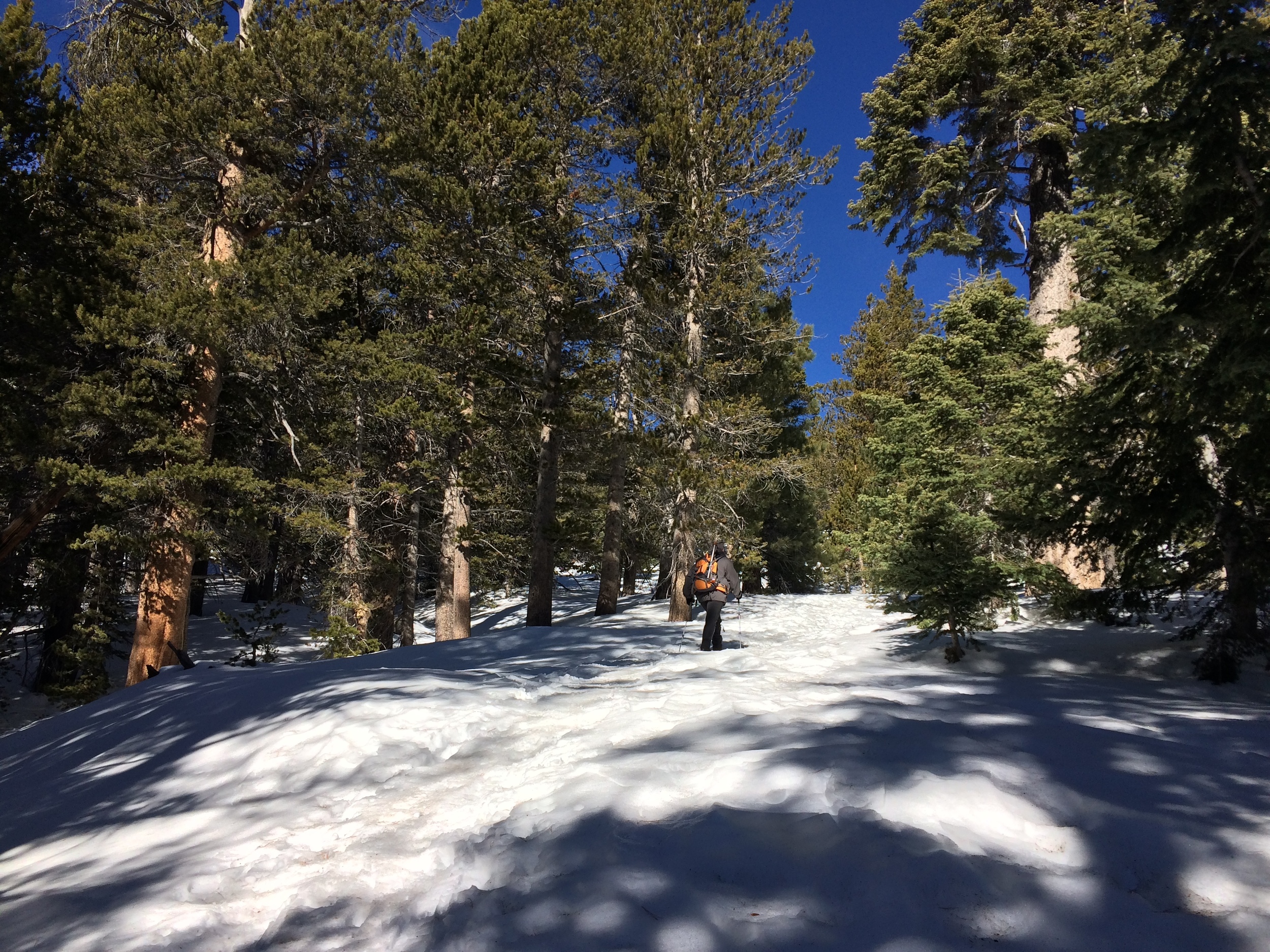
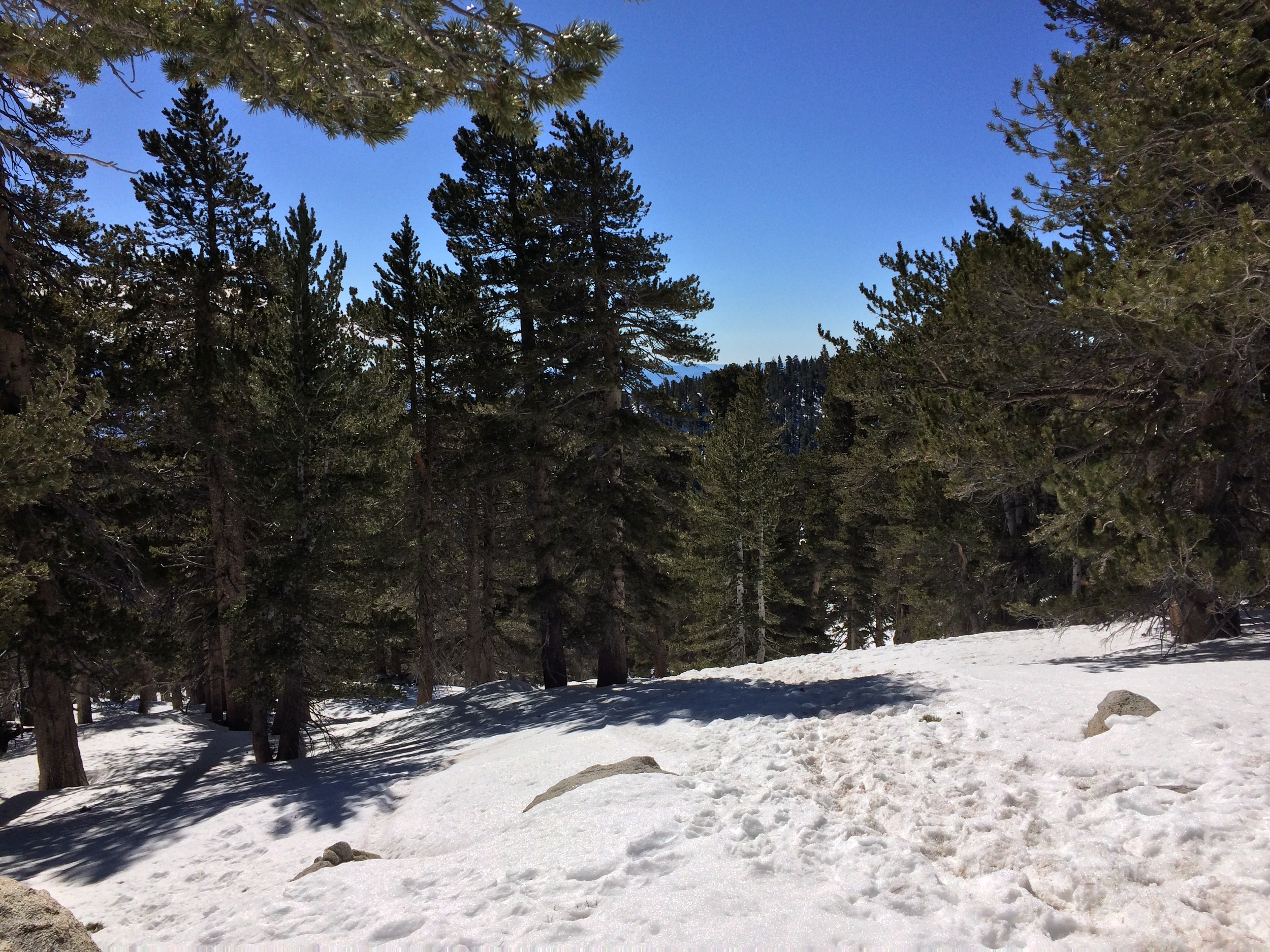
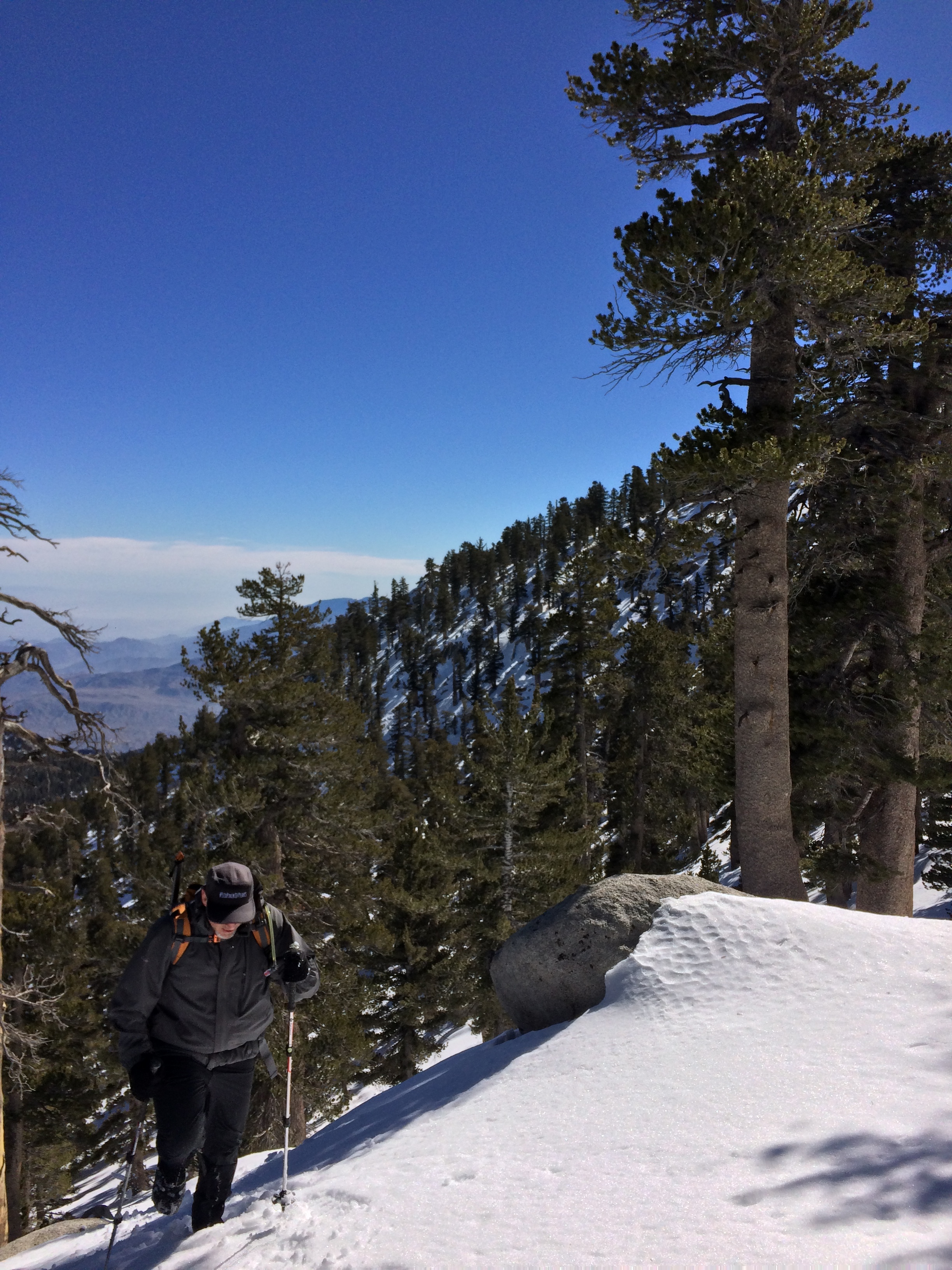
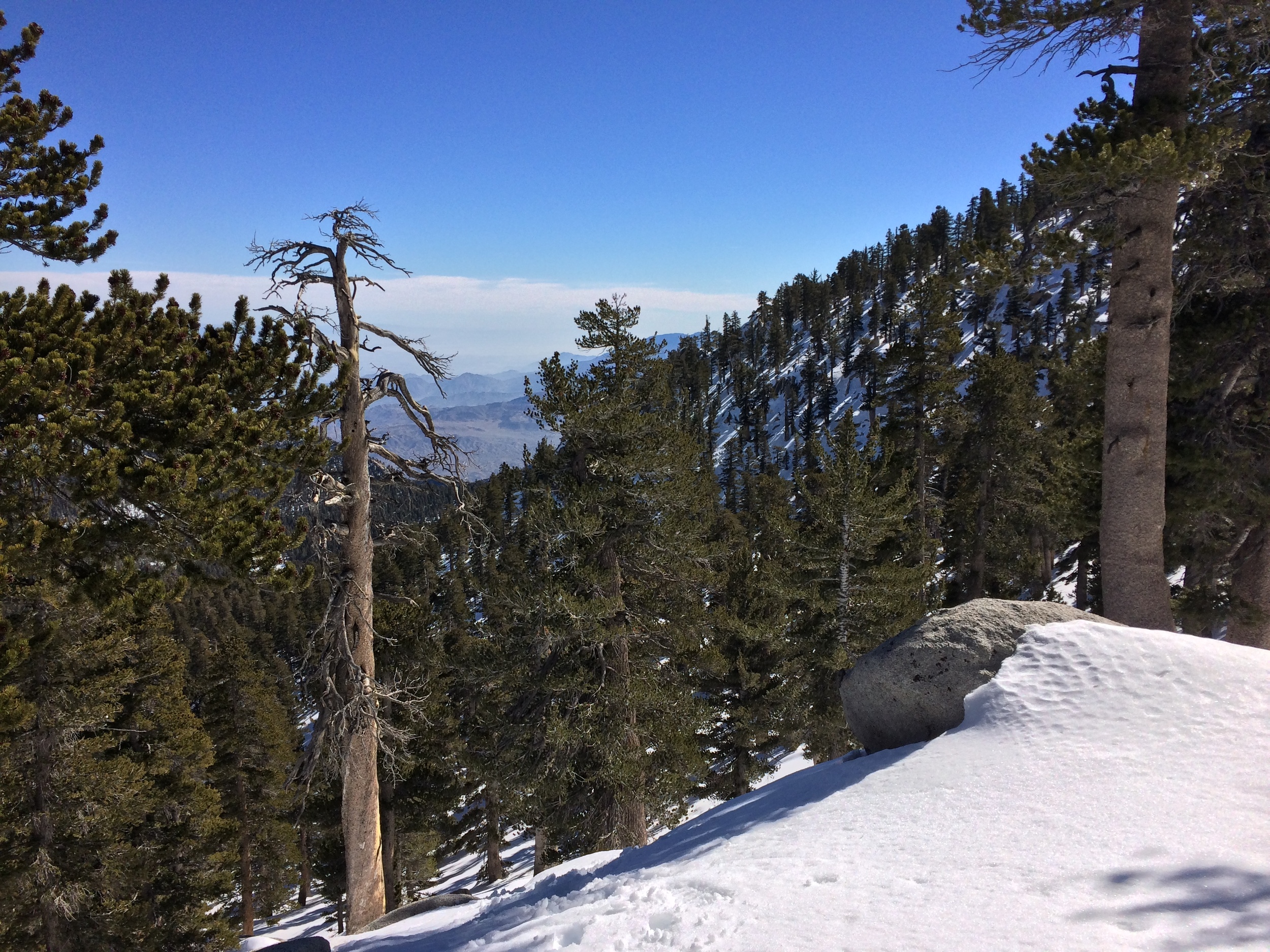


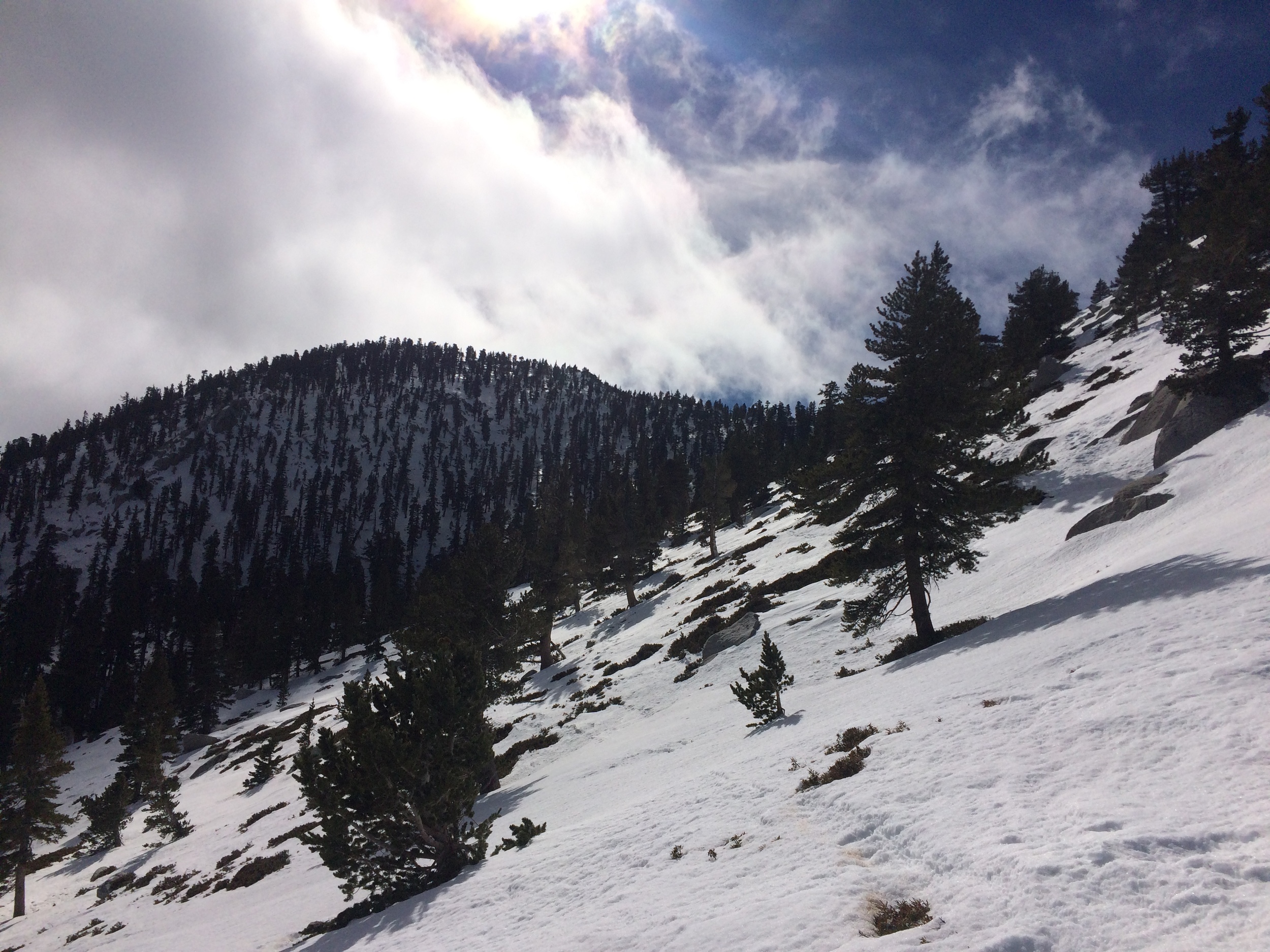
The Route: Unlike summer months, where hikers are confined to set trails, winter offers hikers and mountaineers the opportunity to plan (and follow) their own routes. While there are footprints, snowshoe tracks, and ski tracks along the same routes, visitors should be pre-prepared with either a GPS unit or a map (or both) so as not to become confused or lost. As Jeff and I were familiar with the region, we were comfortable navigating with minimal GPS assistance, but as any route in winter will be “off-trail”, every visitor should be prepared and knowledgeable as to how to navigate in such conditions. Overall, we followed the route of the main trail up to Round Valley, and then headed off up slope to the connecting ridgeline between Folly Peak (10,480) and San Jacinto. From the ridgeline, we were able to summit without difficulty, and then descended down past the emergency hut. After the hut, we glissaded down a good portion of the face, before walking back down to the tram through Tamarack Valley. Our total distance was ~8.5 miles according to the GPS, which, even accounting for electronic deviation was shorter than the traditional summer route (yet another advantage to visiting the mountain in winter).
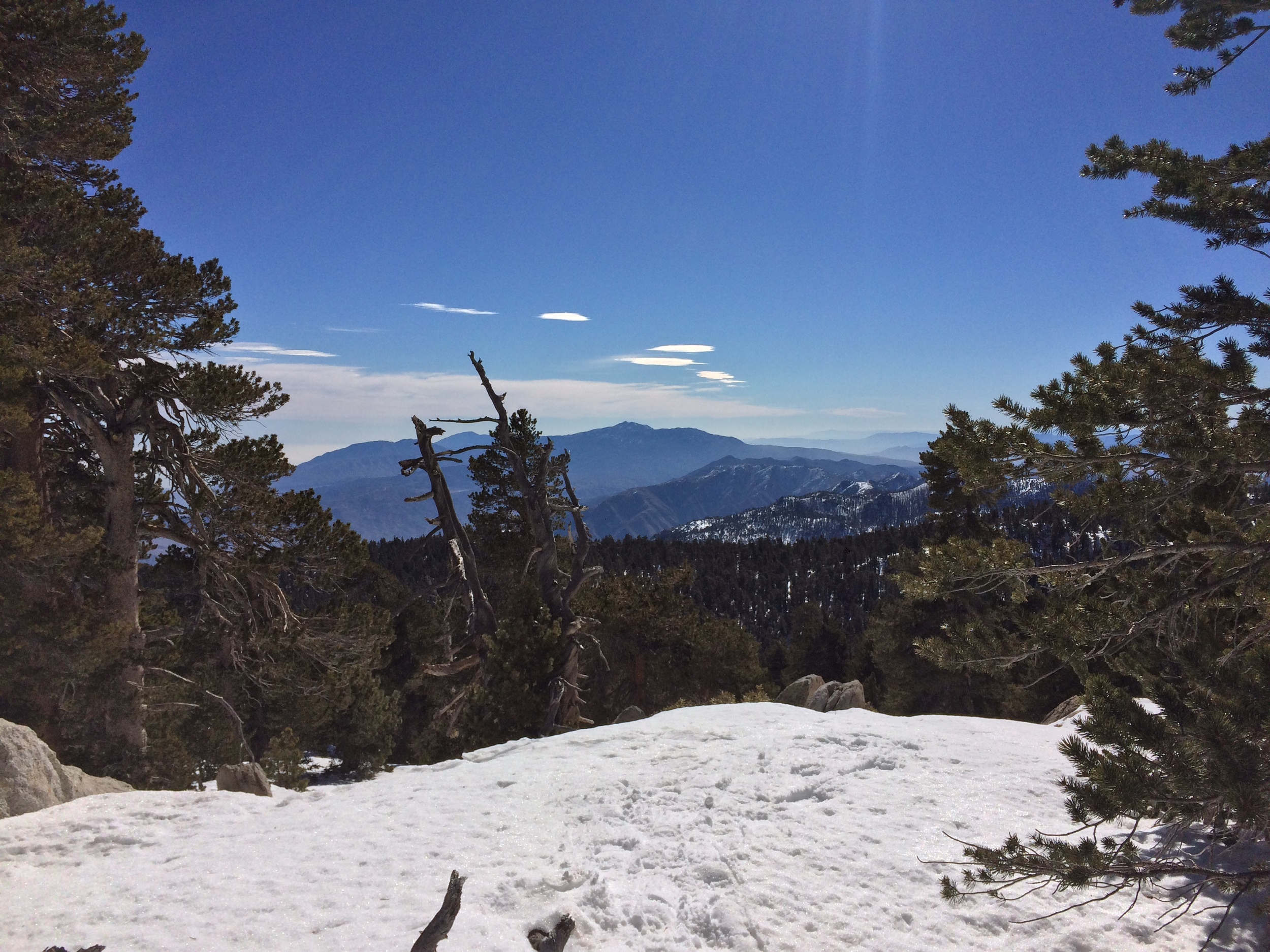
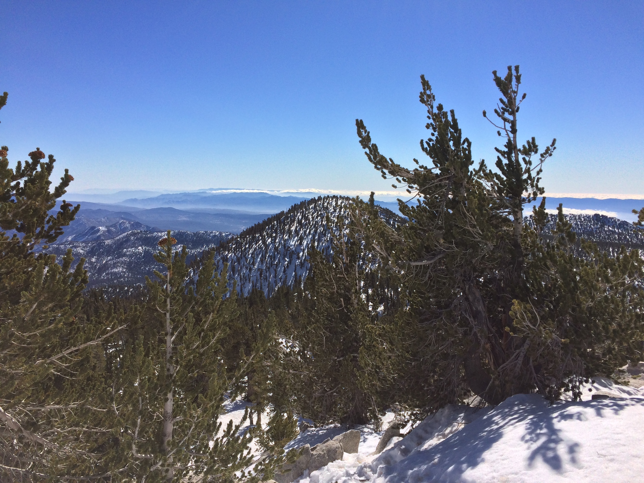
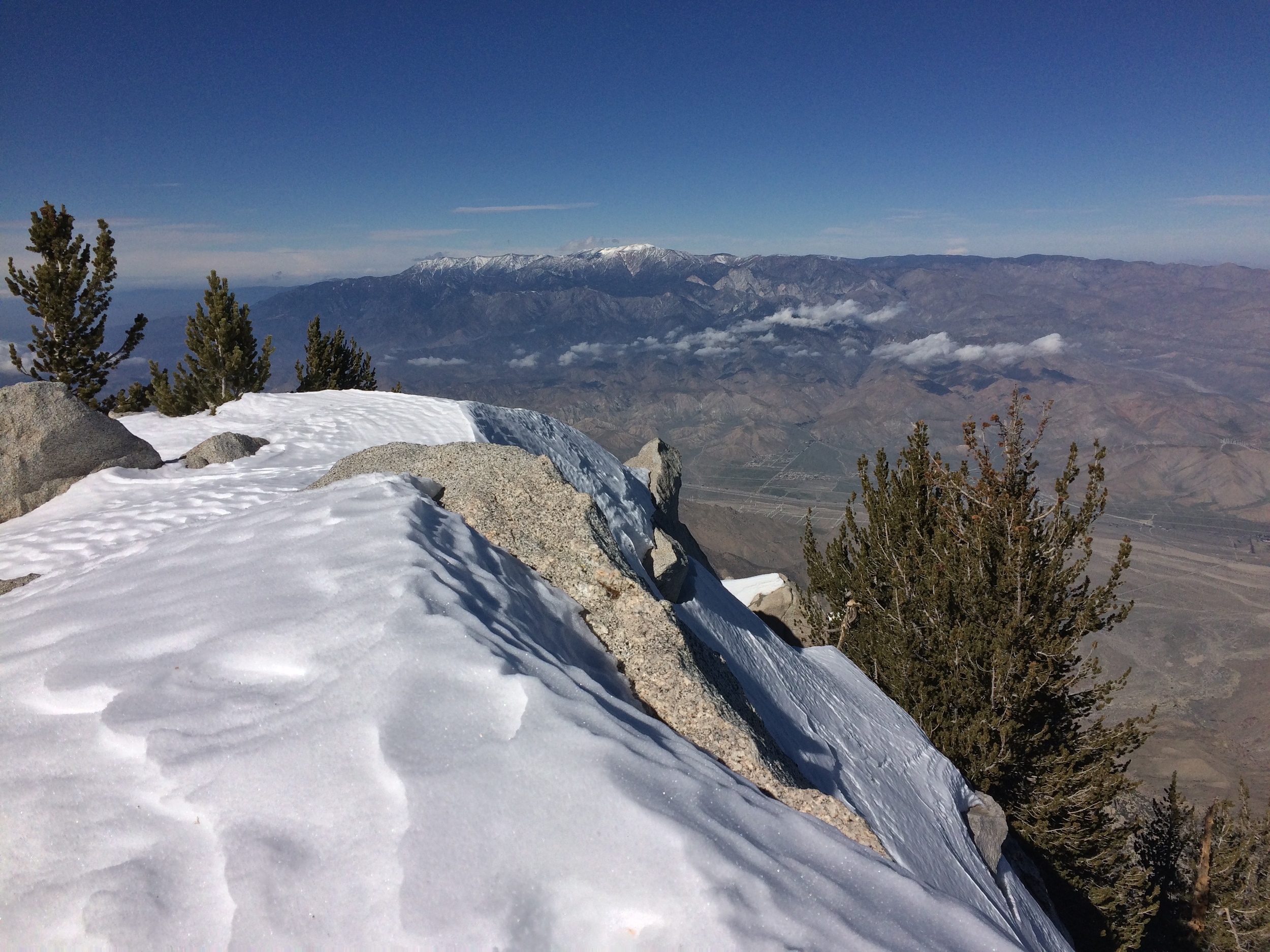
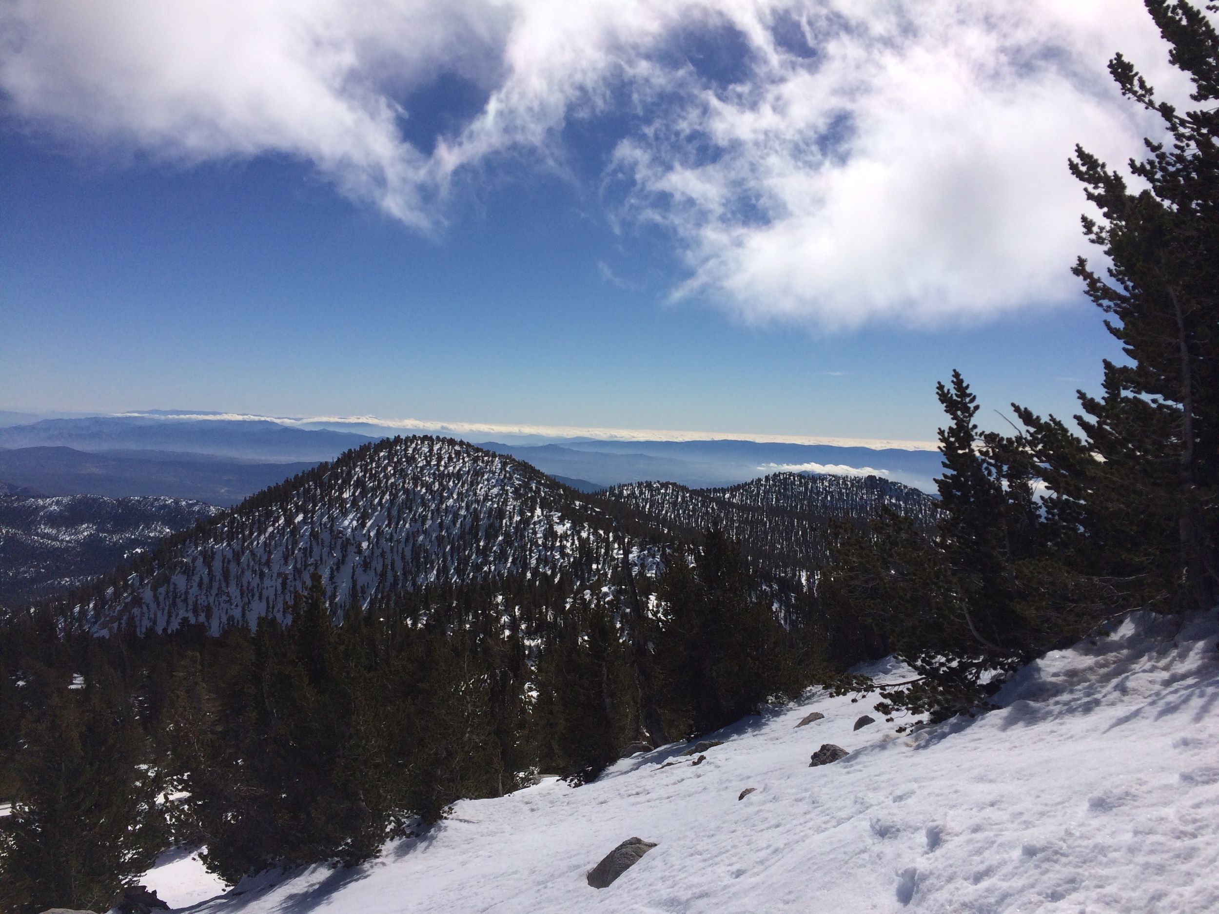
Summit Panorama, Mount San Jacinto, January 2016
Snow Conditions: I would be remiss if I didn’t mention at this point that the region had another storm that rolled through that evening, which likely dropped 6 inches-1 foot (or more) of snow on the mountain at the higher elevations. As such, my notes on the conditions are somewhat inaccurate. Having said that, the general conditions we faced will continue through the remainder of this year’s winter. From the tram, through Long Valley to Round Valley (8,500-9,200 feet), the snow is super compacted powder that is iced out in the early morning and slushy in the afternoon. This is the area where the highest amount of snow melt is occurring, before refreezing nightly. From Round Valley (9,200) to the summit ridgeline (10,000 feet), the snow is generally consolidated powder, with occasional drifts. While some melt is occurring, there is no suncupping as of yet; and in terms of backcountry pursuits, the conditions are very good. From the ridgeline to the summit (10,800), the snow is mostly consolidated, but there is a higher concentration of 6in to 1 foot unconsolidated drifts. From the summit down through Round Valley, daily thawing is occurring based on shade/elevation factors. I would assume that once the powder consolidates from the weekend’s storm, conditions will continue to be good for winter pursuits.
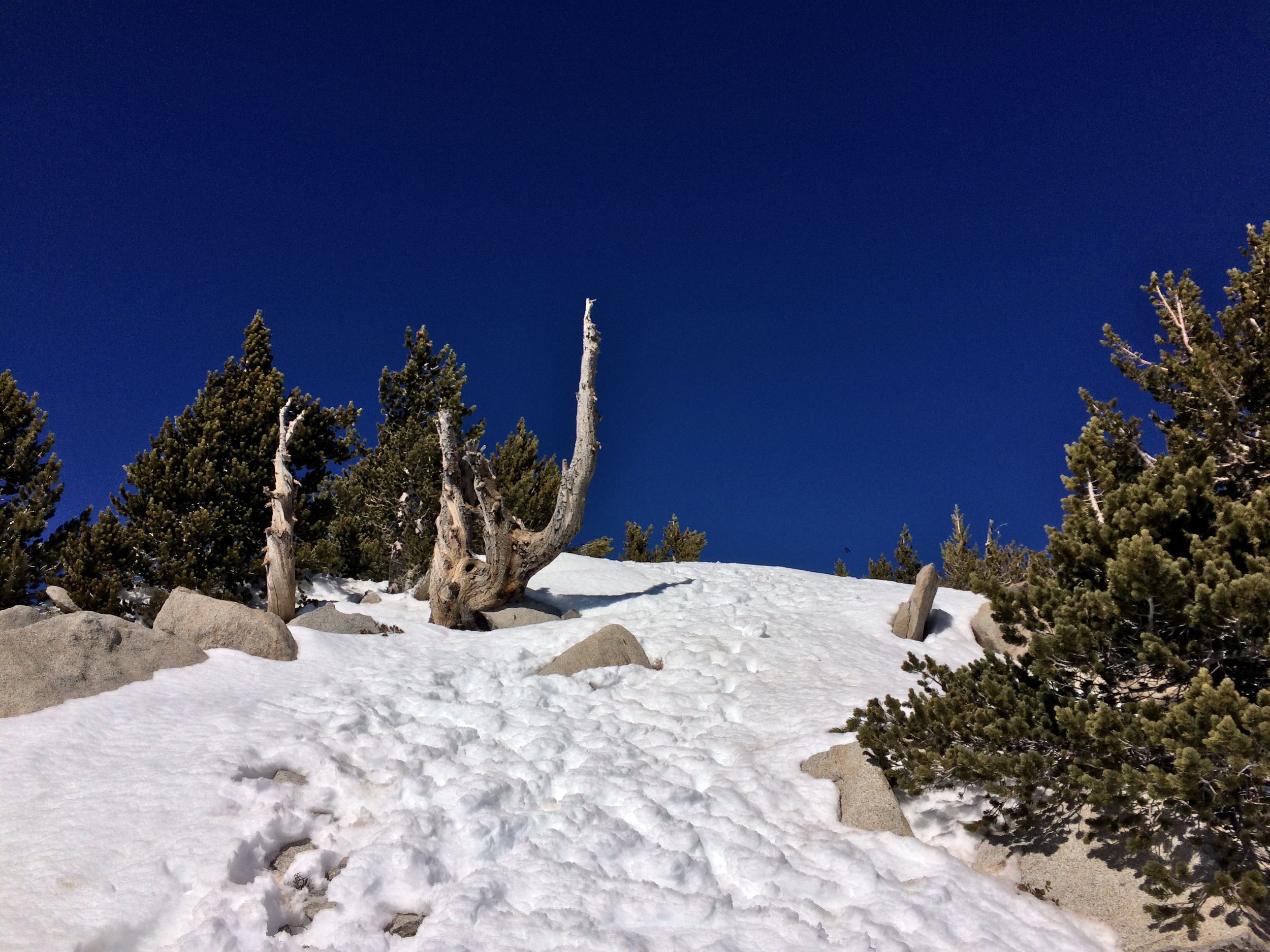
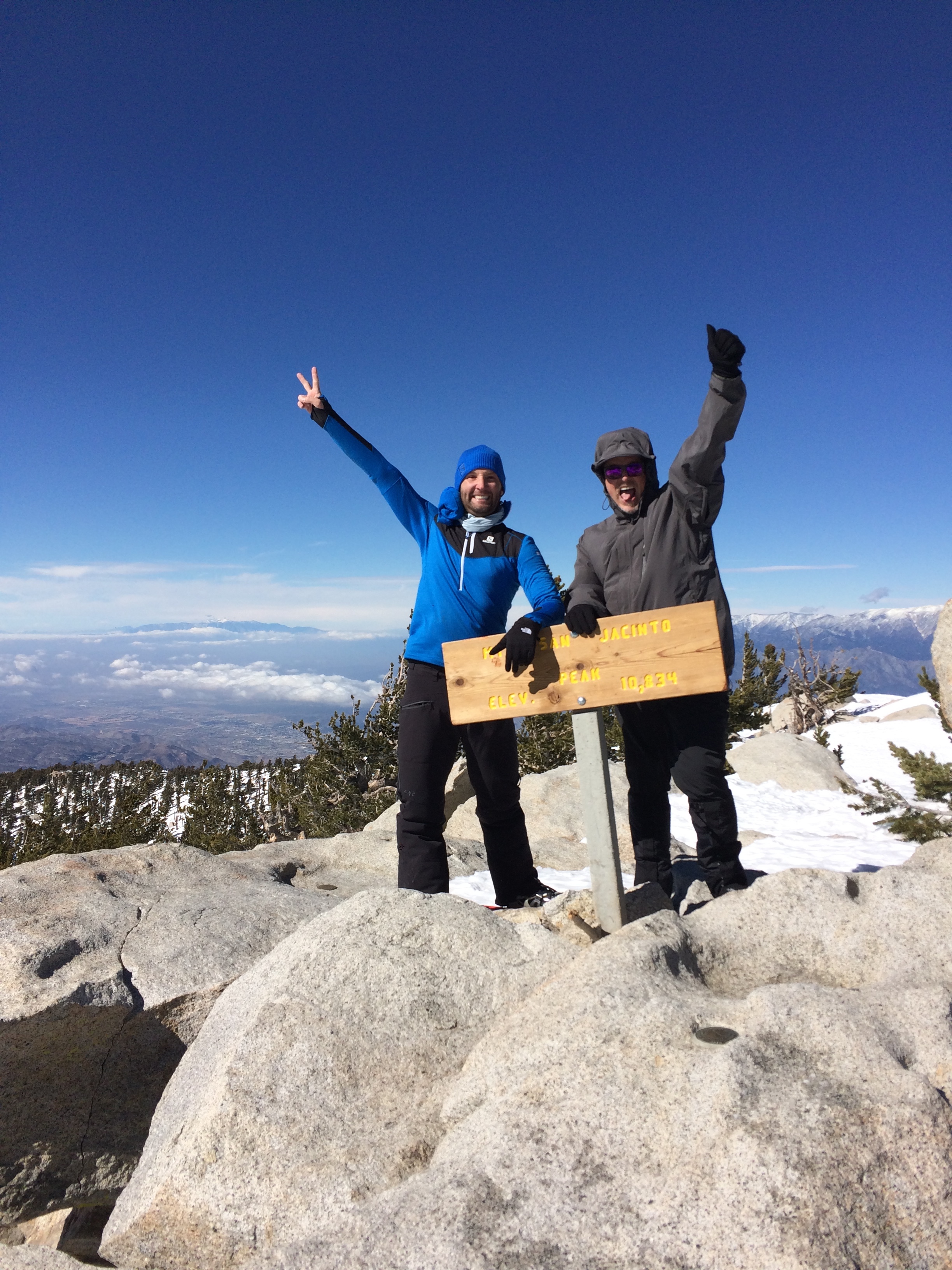
Summit, San Jacinto, January 2016
Tips/Trip Report: As Southern California is having a real winter, and San Jacinto is a real mountain (10K+ feet plus), anyone attempting the mountain needs to be prepared for the conditions. This means having proper navigation equipment (GPS/Map/Compass); and proper gear (waterproof shoes or boots; warm and waterproof clothing). I took snowshoes, poles, and an ice axe, and used all of them. Out of all of the equipment, I didn’t need the ice axe except to glissade down the slope, but it is an excellent piece of gear to have in order to be properly safe. While snowshoes are not absolutely essential, and we did see people successfully summiting the mountain in microspikes, they are a piece of equipment that will make life substantially easier and climbs substantially more pleasant, as they eliminate most of the postholing or trail breaking that occurs without them. I would personally strongly recommend their use over microspikes, especially given the prevalence of powdery drifts at the higher elevations.
A short clip of an approaching winter storm on San Jacinto during January 30, 2016. The weather can always change in the mountains quickly.
In terms of our climb, it was an excellent day. We caught the first tram up the mountain, which meant that we were some of the first people on the mountain. We had perfect blue bird conditions until ~1pm when the storm began to roll in, by which time we were already descending to the tram. For people considering a winter summit, both knowing the conditions on the day of your climb, and monitoring the conditions are key, as the weather can change on the mountain very fast. Finally, in terms of my last tip, I will again mention that route-finding, GPS skills, or map and compass skills are important. On our descent, we assisted two people who were if not lost, were disoriented. While they probably would have been fine (or been found by the State Park staff), it was obviously a bonus for them that they were able to follow us out. It should, however, go without saying that you cannot count on experienced veteran strangers to randomly encounter you on the mountain. Be prepared, and be ready to find your way if you do plan on heading up San Jacinto before May 2016.
It was a great day, and it was great hiking and climbing with Jeff, who has a number of great tips on his site and in real life about the outdoors. If you ever get the opportunity to either randomly meet and hike with him, or at a planned event, I would highly recommend it. It was also a great opportunity for both of us to get on the board for the “Six Pack of Peaks” challenge, which Jeff also runs. If you’ve never heard about it, it’s a great way to motivate and challenge yourself in the Southern California region on a yearly basis, and a great community of people to interact with. As for the rest, the tram fees remain the same, the parking fees remain the same, and as always, any day in the mountains is better than one not. See you on the trail!