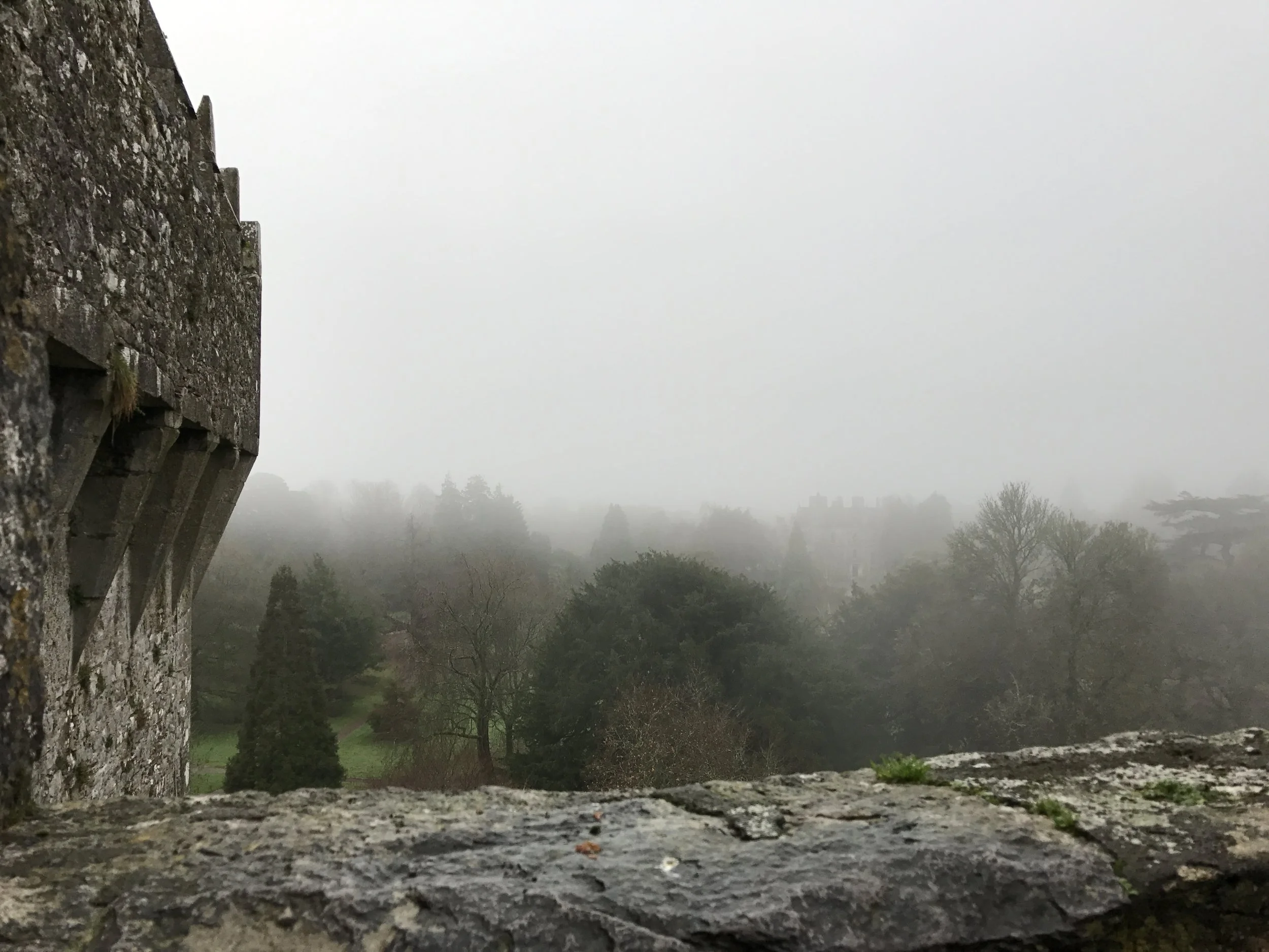
The Alabama Hills

The Alabama Hills - full of adventure opportunities.

The Alabama Hills - full of adventure opportunities.

Stop me if you’ve heard this before: in order to save the world/survive the apocalypse, a lone wanderer/group of travelers travels across a rocky wasteland near some tall snow-capped mountains, and along the way, encounters zombies/aliens/cowboys/zombie-alien-cowboys. Sound familiar? Of course it does. It’s the plot from every summer blockbuster you’ve ever seen. You know where they’ve been filmed? I do. The Alabama Hills. Where are the Alabama Hills? Why, they’re at the base of a little-known mountain: Mt. Whitney. They’re also located right next to the town of Lone Pine, California, right off the I-395, and near another geological feature that I just talked about – Fossil Falls.

What are the Alabama Hills? The Alabama Hills are another interesting geological feature in the Eastern Sierra. According to the experts, they are the same age as the Sierra Nevada; and are made up of two types of rock: aged volcanic rock; and weathered granite. (More rock info here).  While I can’t get into the geologic particulars of the area, I can tell you that this is a great area to explore in terms of bouldering, hiking, and photography.

The Top Things to Do in the Alabama Hills. Unlike Fossil Falls, I’ve been visiting the Alabama Hills for years, ever since I started climbing Mt. Whitney and its companion peaks. While I haven’t yet explored the entire region, I have been in numerous spots and have never had a bad time. One of the key things to remember about the area is that it is BLM land; so it is almost an open area for exploring, either by vehicle or foot. In my opinion, the best thing to do is to simply head out into the hills to have an unplanned and unmapped adventure, assuming you’re prepared and don’t get lost! If you’re more into the tried and true, the below recommendations are also fun too!

The Mobius Arch

The Mobius Arch

1) The Mobius Arch. On many of my early visits to the Alabama Hills, I explored portions of the area, and found many weathered openings and arches. Years later, I started getting questions about the “Mobius Arch”. At first I assumed it was like the Devils Punchbowl, and that everyone had their own Mobius Arch but after a while it became clear that it was a specific named spot. Again, in my opinion, the hills have many Mobius Arches, but now there is a specific Mobius Arch that has a specific trail and parking area that has been constructed by the BLM. To get to the actual named Mobius Arch, you will want to drive West on Whitney Portal Road from Lone Pine for three (3) miles until you reach Movie Road, which will be on the North (Right). Follow Movie Road for 1.5 miles until you reach a T-Junction. Once you reach the T-Junction, you will see the BLM parking area for the arch; and from the parking area, it is a .5 mile hike to the arch. While this is a stunning feature, keep in mind that it has become perhaps the most popular part of the Alabama Hills. You will see people on this hike; and chances are, you will see a number of photographers at the arch, striving for their own signature shot! (More information on the Mobius Arch here and here).

The Mobius Arch

The Mobius Arch

2) The Lathe Arch. This arch is located immediately to the West of the Mobius Arch, although it is much smaller arch than its larger friend. In order to get to it, you’re going to follow the directions listed above for the Mobius Arch. Like the Mobius Arch, the Lathe Arch has some great photography opportunities, and has a great view. However, as I said above, the Alabama Hills do have many of these eroded features, so if you’re looking for an arch, hole, or other angle that has not been photographed by many people, get out there, and find your own. I guarantee there are plenty of spots that have yet to be discovered.

3) The Self Guided Movie Road Tour. Did I mention something about movies at the beginning? Yep, I totally did. While the Alabama Hills always had “Movie Road”, some of the features and their attendant movies and TV shows were a little harder to find. While you could always speak to some of the locals in Lone Pine about where to go, now the BLM has a handy board in the Alabama Hills marking locations, and it also has a handy printout here online of how to proceed and where to go.

4) General Exploration. As I’ve mentioned frequently, the area is fairly open, and there is plenty to do, from looking for old mines, to fishing in certain spots, and just general camping, hiking, bouldering and photography. One word of caution: beware the Lone Pine Devil. Other than that, have a great time!

Lathe Arch

Lathe Arch

The Alabama Hills - Does the Lone Pine Devil truly live here?

The Alabama Hills - Does the Lone Pine Devil truly live here?

Fossil Falls

The volcanic scenery around Fossil Falls, including Red Hill

The volcanic scenery around Fossil Falls, including Red Hill 

There’s stretches of country in the United States that are off the map. While I don’t mean they’re off the map literally, as they’re present on every map, they’re off the map in terms of public knowledge. In my opinion, the largest of these black spots in public consciousness stretches anywhere East of the I-395 from Lone Pine down South. For the most part, this is land that time has abandoned and the world has moved on from. I am talking about an area that was covered with glacial lakes eons ago, had abundant wildlife frequenting it, and bore absolutely no resemble to the blasted and sculpted desert that remains today. Today, this area is good for three things: 1) adventure, imagination, and exploration; 2) studying geology; 3) and for demonstrating that everything has its time. Make no mistake about it, there is mystery in this land, in long lost fossil pools of water in and outside of Death Valley; history in abandoned ruins and long lost places; and beauty in this land in rock formations - the Trona Pinnacles; the Alabama Hills; and today’s area, Fossil Falls. The point about all of this is that even though this area is considered a wasteland, what it really is a place of adventure, and an opportunity to see things that are mostly lost to the public consciousness of the world.

What is Fossil Falls: It is an area with unique geologic features. The area was part of the Coso Volcanic Range, which was an active volcanic area thousands of years ago.  Some of the remnants of this volcanic activity can be seen in the form of a cinder cone, Red Hill, which is next to Fossil Falls. The other remnants of this volcanic activity are the “falls” themselves, which is a large area of basalt (hardened lava). This large sheet of basalt blocked portions of ancient Owens River, and probably portions of the Owens Lake. The significance of this is that during the last ice age, water from receding glaciers (and the river and lake) flowed over this basalt, smoothing it, eroding it, and forming the canyons and holes that remain today over a period of thousands of years. Today, what remains is smooth basalt that has eroded into a distinctive geologic area. (For more information click here and here).

Where is Fossil Falls: Fossil Falls is located directly off of the I-395. If you’re looking to visit, the BLM provides some great directions here.

The LA’s Guide to Fossil Falls: Fact: I totally blew it about discovering Fossil Falls. I had plenty of opportunites to check it out, especially as I’ve driven by it innumerable times on my way to Mt. Whitney, but I never did. It was only when I read my friend Josh’s blog post about it, did I realize that I needed to check it out. When I was headed up to Whitney this last April with my girlfriend, I knew that the time was right to visit. As described above, the location is super easy to find, and it is a short walk from the parking area to the actual “falls” (.20 miles). My first thought when I saw the falls was that not only had I blown it in not visiting sooner, I had really blown it. The geologic features there are mind-boggling to see; and it’s also amazing to feel the strange and smooth texture of the eroded basalt.

If you know me, you know that I don’t just stop and stare and touch a few things in an area, I explore the area, and explore I did. From where the trail ends, you can downclimb into what I would call the “falls canyon”. In this area, there are innumerable caves and holes, and it is a fairly spectacular area to examine and explore. As the majority of the basalt in this area is quite smooth, you do have to be careful as to where you are ascending and descending, and you also have to keep an eye on your surroundings.

The canyon stretches out for quite a distance, and eventually, I found myself in a spot where I would have needed a rope to descend further, which, unfortunately, I did not have. It is worth noting at this point that the area appears to be quite popular for climbing, as I did see a couple people working on their technique with some top ropes. I spent a fair amount of time in the canyon looking for petroglyphs, but either I missed them, or I was not far enough down in the canyon. But, if you are on the I-395, I’d highly suggest stopping by to see the remnants of the past!

The "Ten" Backcountry Essentials

Forget ultralight top-notch gear for a moment. Forget epic climbs; and long lost waterfalls. And yes, even forget Sasquatch, Batsquatch, lemurians, the lone pine devil, and even Cibola. Let’s go back to the beginning. Let’s talk about the first thing you should learn as a hiker. Yes, I’m talking about the infamous “ten essentials”. I’ll admit that I don’t spend a lot of time talking about the basics like this, because I assume that if you’re reading my blog, you already know about these things. But you know what – when I assume things, I make an ass of u and me, and bad jokes aside, if I’ve learned anything from my time in the wilderness, many times people don’t know these things; so with summer fast approaching, now’s a good time to go over these things.

Before I get to talking about the specific items that make up the ten essentials, it’s a good idea for me to define what the concept is behind the ten essentials. The reason I phrase it like that is because there’s no set standard definition of a specific set of ten items that everyone agrees upon. There are some standard answers and standard categories (see here, here, here, and here) but there is also a great deal of variety out there. Again, if there’s anything I’ve learned over my time in the wilderness, everyone has their own modified version of the ten essentials. Which is why I’m talking about the concept behind it; which is that these are the items you would want to have with you should disaster befall you in the wilderness. These are the items that would enable you to survive.

Now, in practicality, if you are hiking or mountaineering, chances are that you will have some or all of these items with you, and you will likely be using them throughout the normal course of your day, which is great. The key to me, however, is to ensure that you have all of the items, because even if you think you’re not going to use them. Truth: you never know when disaster will strike in the backcountry. It may never strike. You may never use some of the items you have. You may carry them (or some variation of them) for years. And that, my friends is great. I hope disaster never befalls you, or your expedition, or anyone. But you carry them to be prepared; because in the backcountry, you are in the black of the map; the great unknown; and in that place of terrible beauty, anything can happen. At those times, all you will have is what you have carried; and your knowledge and that can be the difference between life and death. And that is why you carry the ten essentials: to ensure that you will survive until you can either rescue yourself; or be rescued.

Supplemental Truth: you can’t prepare for every contingency that exists. You are carrying these items to best deal with the potential nightmares that could exist. There’s a difference between being prepared; and being so over prepared you’re not prepared. I will also say that experience; and the knowledge how to use these items is key: as I documented when talking about winter hiking, the gear on its own does nothing for you. The gear only works for you when you know how to use it. A GPS unit doesn’t carry you back to civilization; and a compass doesn’t show you where you are on a map. You do those things; and you need to know how to use them, and not lose your head in doing so when in the wild. Finally, adjust your items accordingly: if you’re out for a 1 mile walk, know what to take versus a 21 mile hike. My list below is for me, and based on the fact that when I usually am out in the wild, I am out alone, meaning that I will only rely on myself and my twenty plus years of experience. Your list will likely be different; but the concept remains: take what you need to survive, that is essential. And, without further ado:

The Last Adventurer’s List of “Ten” Essentials:

1) Waterproof sack to hold items; 2) Extra Food; 3) Extra Water; 4) Extra clothes; 5) Map; 6) Compass (GPS Unit); 7) Emergency Blanket; 8) First Aid Kit (Homemade); 9) Three Trash Bags; 10) Matches (in Waterproof Match Container); 11) Lighter; 12) Whistle; 13) Flare; 14) Signal Mirror; 15) Water Purification Tablets; 16) SPOT Unit; 17) Headlamp; 18) Omnitool; 19) Duct Tape; 20) Cell Phone/Solar Panel.

That’s my list of “ten” things I’d need to survive. What’s yours?

IIAWT April 2013 and May 2013 Recaps

Muir Snowfield, Mt. Rainier

Muir Snowfield, Mt. Rainier

If you think you think Matt and I missed our podcast window on Wednesday, you'd be wrong. Yes, there was no show last week. And yes, we did not Tweet or promote a show this week. No, goats have not completely eaten IIAWT's technical equipment and clocks. The answer to why there was no IIAWT is because IIAWT is only on the second and fourth Wednesday's of each month, and between May and June, the calendar sets us, the hosts up with a nice little break. So look at things positively - you didn't miss anything, and we didn't trick you - the calendar did! But in case you did miss us, here's what you've been missing in the last two months!

Ingraham Flats, Mt. Rainier

Ingraham Flats, Mt. Rainier

April 10, 2013, Episode 6:  Mt. Rainier, Part I: The IIAWT How-To-Climb-Guide. Mt. Rainier - a mountain - no, a volcano so big it deserved two shows. On this first episode, Matt and I spoke with Katie Levy of Adventure Inspired, who had some great insights to how a novice prepares for the Disappointment Cleaver, and mountaineering in general. Katie also had some great comments about climbing mountains for charity; and about how she reviews gear for her readers, so this episode, like always, is a must listen! (Also, stay tuned to the end for a special guest - and friend of the show!)

April 24, 2013, Episode 7:  Mt. Rainier, Part II: The IIAWT How-To-Climb-Guide-Continues.  What's better than talking Mt. Rainier? Talking Mt. Rainier with a veteran climber like Kevin Cherilla of K2Adventures. We also had on our friend of the show, Jes (more info here) for some added color commentary. On this show, we again talked about climbing for charity, and the difficult - and STEEP Liberty Ridge Route. 

 May 8, 2013, Episode 8: Mt. Whitney, Part I: The IIAWT How-To-Climb-Guide. This show is also known as "When Goats Attack". Although there was no guest host, both Matt and Chris picked up the slack in an information packed must-listen guide about climbing Mt. Whitney. (For an added bonus, read more here  about what you need to know about Whitney, the highest peak in the Continental United States).

Western Side, Mt. Whitney Trail

Western Side, Mt. Whitney Trail

May 22, 2013, Episode 9: Mt. Whitney, Part II: The IIAWT Guide on the JMT and Other Routes to the Top. Once Matt and Chris got rid of those pesky goats, they were ready to talk Whitney the way Muir saw it after his long treks in the Sierras. What better way than to talk about this than with a bona fide expert, the SoCalHiker, also known as Jeff Hester. This show had some great details from Jeff, who has hiked the John Muir Trail twice, and also had some great secret tips on how to ascend Whitney via non-traditional ways. 

If these shows don't get you out into the mountains, perhaps next week's show on Mt. Shasta will intrigue your mind and inspire your body; but until then, see you on the trail!


Painted Rock Petroglyphs, Arizona

I’m a fan of petroglyphs, pictographs and anything old. It’s intriguing to me to see things from the ancient past, and wonder what inspired them and what they mean. It’s also interesting to see what similarities exist from site to site, and what differences also exist. It’s also fun to imagine what exactly life was life when they were created thousands of years ago. In California, where I live, most petroglyph and pictograph sites are either require a hike or some exploration; and while I don’t mind either of those activities, they’re generally hard to find and in some cases, found by too many people. On a number of occasions, I’ve been told of great rock art secreted away in remote areas, only to find that innumerable prior “adventurers” have already ruined the spot, or the art. Because of these unfortunate experiences, I’m also a little skeptical when I research or hear of a new spot for rock art, and temper my expectations accordingly.

Last weekend, my girlfriend and I had an opportunity to head out to Phoenix for a bit, and when I was finalizing our plans, I looked online to see what strange things were available to do in the area. When looking at our driving route, I saw that we would pass by Painted Rock Petroglyphs on the I-8 (or, as some maps say, Painted Rock SP). I took a quick gander at what was available online (Information here, and here), and with my diminished expectations, figured that while it was worth a stop, the chances of seeing anything truly amazing was slim to none as it was pretty much right off the freeway.

When we pulled off the freeway in the 95 degree heat, I figured we’d be there a couple of minutes, tops. After all, it was completely impausible that great rock art would be that close to a major freeway. And, when we arrived at the abandoned BLM lot, I felt even more certain that we weren’t going to really see anything. I figured that maybe we’d see a partial carving and it would probably be mostly obliterated by KILROY WAS HERE or THE WALKING MAN COMETH or JOHN GO TO PROM? COUGARS ’99! But since I explore even on off days when I have a cynical attitude, I got out of the car and started walking around. At first I saw was what I expected to see – graffiti. The one cool thing about this graffiti, was that it was not the above type of graffiti – it was old graffiti. I saw a 1906, an 1840-something, and some dates before that. That definitely piqued my curiosity. I then saw some well preserved pieces of rock art, and while that was fairly awesome, that was nothing compared to what I saw when we came around to the far side of the hill. As we came around to the far side of the hill, I blinked, because I didn’t believe what I was seeing.

In fact, for about fifteen seconds, I thought that even though it was a dry heat, and even though I had only been outside for a couple minutes, I had heatstroke and was seeing things. The reason I thought I was seeing things? Almost every rock in my field of view had a petroglyph on it. Even better, 99.9% of these pieces of rock art were undisturbed and as pristine as they could be for being thousands of years old. It was so unbelievable it was like a mirage. We stayed for a while longer, comparing drawing to drawing, before deciding to head out of the sun and onto Phoenix, but my takeaway from the site is this: it is a must visit. Sure, it’s off the freeway, and sure, from Ocotober to February, it’s probably quite popular (there is a campground), but the pluses – getting to see pristine rock art in mass quantities, getting to stand where Juan Batista de Anza roamed, and getting to wonder why so much art was placed in that spot, and other things far outweigh any negatives. It was a great quick adventure in an obvious spot – not something that always happens, even though adventure is everywhere.

Directions: The site is located 12.5 miles North of I-8 at Exit 102, Arizona. There are signs both on the Eastbound and Westbound sides of the I-8, and there is a sign directing traffic toward the site from the freeway exit.

Tips: If you are going in the summer like me, bring water. Also, don’t be an idiot. The site is in great condition, especially considering there is no full time guard or BLM ranger. Don’t be the person that ruins thousands of years of history for the rest of us. Do enjoy what’s there, and enjoy the mystery of the sketchbook of the ancients.

Mountain Lions on the Trail: They See You Before You See Them.

I like to tell stories. Sometimes, I even like to write stories about things that I've seen, done and experienced. This one's a long one, so don't complain about "TL; DR" to me - you've been warned, but it is one of my favorites. I'm also happy to say that in my opinion, the story is made at least ten times better by the great photos that Calipidder lent me to accompany the piece, so go check out her site as well for more great trail reports and photos! So, without further ado, here's the story about how I avoided death-by-mountain-lion!

Heading up the Old Rockslides Trail. Photo Courtesy of  Calipidder.com

Heading up the Old Rockslides Trail. Photo Courtesy of Calipidder.com

In 1998, I was offered a job from the Backcountry Division of the National Park Service in Yosemite.  The job was longer than a summer, since it started in April and ended in September, but the term of my contract said summer – one of the longest and best summers of my life. I went into my job a fresh faced 20-something year old, and came out a tan, still mostly fresh faced 20-year old with a unique perspective on wilderness, the National Parks, and life who was ten pounds lighter and needed a haircut badly. There is no doubt in my mind that that job was the experience of a lifetime.

In case you’re not familiar with the National Park Service, it has a number of divisions and departments. My division, the Backcountry Division had three primary responsibilities: patrol and maintain the trails; issue wilderness permits; and preserve, protect and educate the general public about the park. These three responsibilities sound simple enough, but in reality, the job encompassed everything from telling park visitors where the bathroom was, to providing first aid on searches and rescues. Although it was the job of a lifetime, it was not for the faint hearted. Even though my contract said that I would work 8 to 5, or ten hour shifts, it was an all day job from the moment I went to bed and took off the uniform, and from the moment I woke up and put the uniform back on.

Yosemite is a large park – as big as Rhode Island, and in Yosemite, there are a number of Backcountry Rangers with different areas of responsibility. I was a Valley Backcountry Ranger, meaning that I was responsible for the middle corridor of the park, heading down towards Wawona, and up towards Tuolumne, and bordered on the East by Big Oak Flat. Some people would say that as a Valley Ranger, I had the worst assignment, as I would see the most people. Actually, I had the best assignment as I ended up seeing most of Yosemite; but when I was starting out in April, I didn’t know much about the park. I had been to the park several times, but compared to visitors who had been traveling to Yosemite for over twenty years, or Rangers who had been living there for thirty years, I knew nothing.

Looking at El Capitan from the Old Rockslides Trail. Photo Courtesy of  Calipidder.com

Looking at El Capitan from the Old Rockslides Trail. Photo Courtesy of Calipidder.com

The first couple weeks turned out to be the best weeks of my job: as I was new, and as it was April, I spent nearly all of my time patrolling the trail, in order, as my boss put it “to get the lay of the land”. In those early weeks, I definitely got the lay of the land, covering mile upon mile on every conceivable trail. It was great – I was getting paid to hike. Even on my off days, I was encouraged to go to new destinations from other Rangers that I lived with. Despite all of the hiking, I still had a two page list of unknown spots in the park that people told me I “had” to visit. One of the spots on that list was the “Old Rockslides Trail”. If you haven’t heard of this trail in Yosemite, it’s because it isn’t really a trail.

The thing about the Old Rockslides Trail that I’m trying to remember as I tell this story if it was an actual trail back in 1998. I think it was a trail that was semi-maintained by the National Park Service, but then again, perhaps it wasn’t even back then either. In any case, what the Old Rockslides Trail really is is the Old Big Oak Flat Road that used to run out of Yosemite Valley before rockslides (I know, surprising with a name like “Old Rockslides”) caused the road to be closed. If you’re at Inspiration Point even today, you can look across the Valley, and see what looks like a straight line road cutting across part of a talus covered road. You guessed it: that is the remains of the Old Big Oak Flat Road/Old Rockslides Trail. If you’re interested in hiking this trail, be prepared: while it may be a “trail” in the sense that it is easy to follow in places as it is an old road; in other places, it is overgrown, blocked by boulders, and not traveled by many visitors. (For more information on how to get here, check here and here).

The terrain of the Old Rockslides Trail. Photo Courtesy of  Calipidder.com

The terrain of the Old Rockslides Trail. Photo Courtesy of Calipidder.com

I was told that I had to check out the Old Rockslides Trail by my co-workers for one reason and one reason only: to see amazing views of the North Rim without being surrounded by tons of visitors. I was also told that one of the great forgotten viewpoints of the park was Rainbow View, which had been abandoned, but was accessible after heading up a steep boulder field. (This is the hike discussed in the link above). So, one Wednesday (Park Rangers never get Fridays, Saturdays, or Sundays off), I headed out from the Ranger Club (Yes, that’s where I lived, the Ranger Club – swanky!) and across the valley. It was a great spring day, and the temperatures were finally beginning to melt the snow up at the higher elevations. All around me, waterfalls – seasonal and regular – were roaring with the ferocity that only an El Nino year of melting snow can bring.

After a bit of route-finding past El Capitan, I found the trail and continued up, heading out of the valley. It was a quiet day, and I could hear the snap of every twig and the crunch of brush as my boots passed through overgrown areas and various deadfalls. Alongside the trail, chipmunks raced along, chirping at me for a free handout. The wind rustled the leaves of the plants alongside me, and I could hear every leaf stretching and growing in the spring sun. As I ascended, I knew exactly why this “trail” had been recommended: there was indeed nothing like it on the “approved” list of National Park valley trails. It was wild. It was what the park had been; and what the park could be if man vanished. It was a great hike.

On the Old Rockslides Trail, looking at Bridalveil Falls/Bridalveil Canyon/Yosemite Valley. Photo Courtesy of  Calipidder.com

On the Old Rockslides Trail, looking at Bridalveil Falls/Bridalveil Canyon/Yosemite Valley. Photo Courtesy of Calipidder.com

It was also a hard hike. After I broke treeline, the road – what was left of it – vanished. In its place? Rocks. Lots and lots of rocks. And when I say rocks, I mean boulders. As I hefted myself over boulders, I checked my holds; checked my landings and most of all, watched for snakes. I even had to constantly check upslope for the stability of the field – it was after all, the old rockslides trail. At around 2pm, I began to consider turning around. I had probably gone about seven miles total from the Ranger Club, which meant that I would have had a fourteen mile day when I returned back home – on my “day off”. While the view was spectacular, I knew it wasn’t going to get any better within the next mile or so. I stopped on a particularly large rock, ate some lunch, and began to descend back the way I had come.

The trouble about abandoned places, in my opinion, is that the mind begins to play tricks on you. The mind has evolved over thousands of years to survive; and it doesn’t like to be alone in the wild. The mind hears things where nothing makes a sound; it sees things where nothing is; and these two things are just the top of the iceberg. As I had traversed the boulderfield on my way up, I had begun to feel like I was being watched; and after several breaks to ostensibly look at the view, I had satisfied myself that those feelings were nothing more than the usual “heebie-jeebies” that new and empty places sometimes bring. But as I descended, the feeling began again, except this time, it was more intense.

After a certain point, I was rattled. I had one eye on my immediate surroundings, so I wouldn’t break an ankle, and one eye on everything else. It was a sort of hop-drop-scan-hop-drop-scan routine that probably made me look ridiculously paranoid, and made me glad that there were indeed no people anywhere around me. Finally, after a while, I found myself at the edge of the boulderfield, and near actual cracked pavement leading back into the trees. I dropped down at the base of one last boulder and looked up as a matter of recent habit, and froze. Upon the top of that boulder, not more than six feet from me was a full grown mountain lion.

Looking down the Old Rockslides Trail. Photo Courtesy of  Calipidder.com

Looking down the Old Rockslides Trail. Photo Courtesy of Calipidder.com

My first thought was that my brain was playing a hell of a trick on me. There was absolutely no way that I could be that close to a mountain lion. After all, it was six feet away! I blinked. In fact, I didn’t blink. I shut my eyes for at least five seconds. I opened them. It was still there. At that point, my brain was positively screaming at me to MOVE! MOVE RIGHT NOW! But I couldn’t move. I was frozen solid. And then it looked at me. Its head turned silently on those creepy smooth cat vertebrae and it was looking right at me. Before its head turned, my brain had registered how I couldn’t see it. Its lower coat was gray – gray that blended right in with the rocks and its upper coat wasn’t exactly brilliant gold.

These were the things my brain was chattering at me as I stared into golden eyes that looked like certain death. Because while its coat wasn’t snap-pow brilliant, it was clearly a healthy mountain lion. It was big – at least six feet. It didn’t appear to have an inch of fat on it; but neither was it skinny: all I could see was powerful cat muscles as it laid on the rock. And while I was dead certain its eyes were the last things I would see, they were stunning. I wasn’t sure how long I had been standing there, staring at it, watching it stare at me, but I knew my mind was still screaming at me to move, before it started screaming at me to go for the knife I had in my front right pant pocket. It was a three inch Buck folding knife. The fingers on my right hand may have flicked imperceptibly toward it as I continued to stare at the lion before a thought raced through my brain even faster than the one that had preceded it. That thought? Going for the knife isn’t going to do anything for you. You’d never get it out of your pocket at this distance.

It wasn’t that I was resigned to die at that moment; it was just the certainty that there wasn’t anything that I could do to stop the process. Run? I wouldn’t make it a foot. Go for the knife? I was six feet away. The cat would leap on top of me, pinning me down with its momentum, claws, and teeth at a large twitch. So I stared. I stared. It stared. Time, to me, stopped. And then it closed its eyes, put its head down and stopped looking at me. I stared. Clearly, I was hallucinating. It didn’t move. It didn’t raise its head. Then, the voice in my head came back. GO. GO NOW. It said. As quick slow as I dared, I began to ease away from it, while facing it. Its head stayed down. By the time I’d reached the treeline, it was just a blob on a rock. A furry blob of death that I hadn’t seen and I had stumbled at least five times.

Two switchbacks down the trail from treeline, when I couldn’t see the rocks, nor the blob anymore, I threw caution to the wind and broke into a flat out panicked full out sprint, risking ankles, knees, legs, and pretty much any body part to a major fall. I didn’t care. It wasn’t until I was on the valley road again did I allow myself the luxury of walking. And that was how I saw a mountain lion, got to participate in a mountain lion research study, and how I escaped death from a mountain lion as well. So yes, mountain lions: they're out there, and they see you before you see them.