Along with Cowles Mountain, and innumerable other locations in San Diego County, Viejas Mountain is an interesting peak with cultural significance for the Kumeyaay people. Prior to the arrival of Europeans, the Kumeyaay people would climb the mountain to watch the sunrise on the winter solstice. Today, like Cowles Mountain, Viejas Mountain is on the list of San Diego’s “100 Peaks” - the one hundred tallest mountains that grace the confines of the county. However, unlike Cowles Mountain, Viejas Mountain features a leg-burning ascent up a steep slope, and for large parts of the year, a great deal of hiking solitude to go with the suffering.
North Fortuna Mountain
At 1,291 feet high, North Fortuna Mountain is the third highest mountain in the confines of Mission Trail Regional Park and is 197 feet higher than its neighbor, South Fortuna Mountain. In my mind, however, out of all of the five mountains in the park, North Fortuna Mountain features the toughest leg burning ascent. Like many things, this is something that is open to debate. While both Cowles Mountain and Pyles Peak for the most part do not feature tough straight uphill sections, both South Fortuna and Kwaay Paay Peak have solid claims to the toughest leg burning ascents as well. Even with the toughest - or near toughest leg burning ascent, North Fortuna Mountain is a great hike as it provides great views, and is part of the Five Peak Challenge within Mission Trails.
South Fortuna Mountain
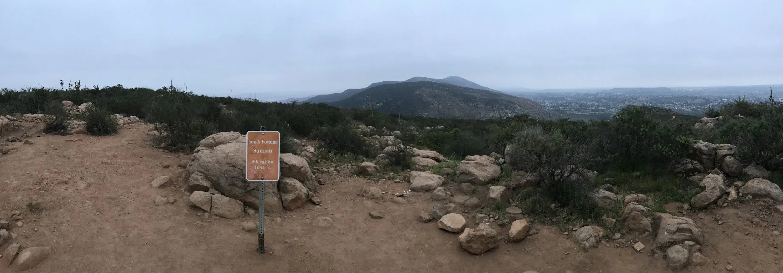
Mission Trails Regional Park is an area that is rich in pre-European history from the Kumeyaay people, and an area that is rich in post-European history with the Old Mission Dam along with the remnants of Camp Eliott. Within the confines of its 7,220 acres are five mountains, which comprise a hiking challenge for adventurous locals and visitors alike. However, a little known historic fact is that the park actually has four - not five mountains. Earlier maps of the region called both South Fortuna Mountain and North Fortuna Mountain simply “Long Peak”. Even today, from a distance, the separate summits of South Fortuna (1,094 feet elevation) and North Fortuna (1,291 feet elevation) separated by the Fortuna saddle appear to be one mass with a number of humps. Despite visual appearances and former maps, even though South Fortuna is the smallest summit in the park, it can be a great strenuous day hike, as part of a larger trek, or as a stand-alone summit.
Sunset Cliffs Open Ceiling Sea Cave
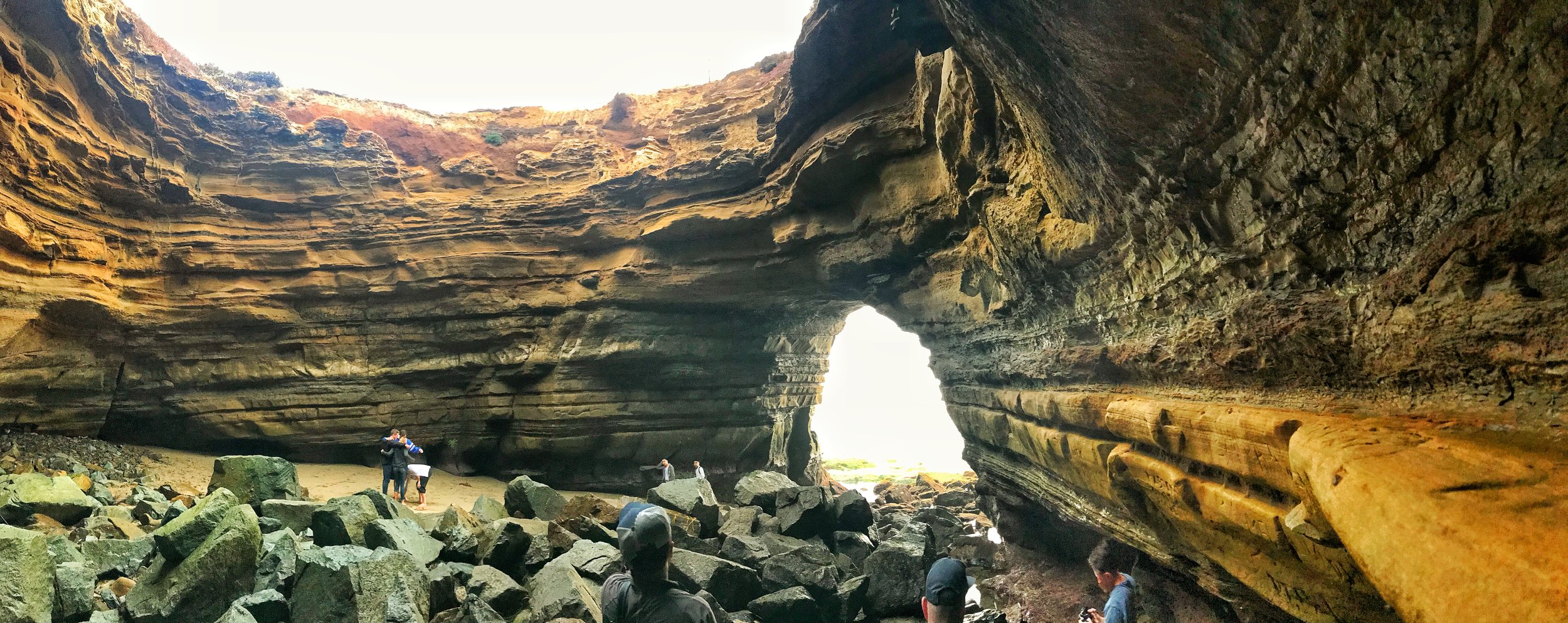
From the south to the north, San Diego county has over seventy miles of pristine coastline that, among other things, is honeycombed with a variety of sea caves. Over the years, these caves have been used for a variety of purposes, including bootlegging, tourism (or in the case of the Sunny Jim Cave, both), and everything in between. While some of these caves are inaccessible without a boat, and some of these caves are flat out inaccessible or unsafe, the best place to visit and experience sea caves is in one of San Diego’s most popular public spaces, Sunset Cliffs Natural Park. While the sixty eight acres of Sunset Cliffs Natural Park are perhaps best known as a great place to watch the sun set for tourists and locals alike, its most popular - and striking area is an eighteen acre linear portion south of Ocean Beach leading down to Point Loma and Cabrillo National Monument.
Stonewall Mine
While the gold rush of the nineteenth century in California was largely confined to the northern portion of the state, prospectors also fanned out to all regions of the state, seeking to strike it rich. In San Diego County, most of the mining exploration occurred in and around the town of Julian, but the largest and most productive mine was located a little bit further south, in what is now Cuyamaca Rancho State Park. In 1870, gold was discovered, and after a great deal of legal difficulties, the Stonewall Mine began operating. Over a fifty year period, the Stonewall Mine became the most productive and profitable mining operation in the county, producing over two million dollars of gold.
San Diego's Five Best Waterfall Hikes
With miles of pristine beaches, rolling chaparral covered hills, and a constant semi-arid desert climate, San Diego will never be identified as one of the hot spots for waterfalls or hikes to waterfalls. However, unbeknownst to many people, from December through Memorial Day, San Diego does have a number of great seasonal waterfall hikes that highlight some of the best features of the county’s backcountry. As all of these waterfalls are seasonal, timing is everything, and also somewhat dependent on the weather pattern for the year. During wet winters and springs, these waterfalls will have high flows, and creek crossings; and during drought years, there may only be a trickle and dry stream beds. Similarly, with respect to timing, at the right times, these waterfalls can and will appear spectacular – but at the wrong times, may be a letdown after a hot, dusty trek. Keeping all that in mind, these hikes can also be great gateways to explore other regions of San Diego County, and again, at the right times, great spots to view spring wildflowers. I’ve listed the below hikes in order of difficulty, and let me know your thoughts about them, or any additions you have to the list below!
Inaja Memorial Park
Julian is one of the most popular destinations in all of San Diego County for a number of reasons – in the winter; it is one of the few spots in the county that receives regular snowfall. In the fall, it is also one of the few spots in the county that allows apple picking. Year-round, however, it is popular for its distinctive – and tasty pies. While there are a number of trails one can select in the area in an attempt to mitigate the damage from pie and donut consumption in town, the easiest and most family-friendly with the best view is at Inaja Memorial Park, which is located some six miles to the east of Julian.


