
In 2016, getting outside and experiencing the outdoors is more popular than ever, and along these lines, microadventures are more popular than ever. In case you’ve been living on the moon, a “microadventure” is an adventure that doesn’t require a large amount of time or specialized gear, and is something that in theory, is accessible to everyone, and yet somewhat secret at the same time. In short, a microadventure is whatever one wants it to be. As a long-time San Diego resident, it’s been my position for years that San Diego County is one of the best spots in the country to have microadventures, mainly because of the huge variety in types of terrain located in a two hour radius (beach, mountain foothills, alpine, and desert) and because of the many wilderness pockets that honeycomb the area, even in the urban corridors of the City of San Diego.
The restored canyon of the Annie's Canyon Trail
The newest trail to open in San Diego on June 20, 2016, the Annie’s Canyon Trail supports my above hypothesis as the trail provides access to a variety of types of terrain (coastal lagoon; coastal sage; and coastal canyons) in one of the premier wilderness pockets in San Diego County, the San Elijo Lagoon Ecological Reserve. Further, because of its unique features, and unique (and short) route, this trail, while new will likely become one of San Diego’s signature microadventures along with Potato Chip Rock, Cowles Mountain, Iron Mountain and others.
End ladder of the canyon traverse, Annie's Canyon Trail
Information: The San Elijo Lagoon Ecological Reserve is north of Solana Beach and south of Cardiff in the northern part of San Diego County. The Reserve comprises some 979 acres, and has seven miles of trails which stretch from Cardiff State Beach and the Pacific Ocean into Rancho Santa Fe; and the lagoon itself is formed from intersection of the Escondido and La Orilla creeks. The San Elijo Lagoon Ecological Reserve is operated by a multi-agency partnership between the County of San Diego, the State of California, and the San Elijo Conservancy.
San Elijo Lagoon
While the lagoon has for years been a place for quiet introspection, great trail running, and excellent bird watching, recently, the park has been working on developing and opening Annie’s Canyon for public access. While the canyon was unique for a long period of time in the reserve and had a different name, it was technically closed to the public, because of safety concerns and because of vandalism and littering. Over the course of many months, the area was painstakingly restored to remove as much graffiti from the sandstone cliffs as possible, and to build as safe a trail through the area as could be maintained. One of the key components to the successful completion of the project was the financial contributions from “Annie”, the now namesake of the trail, and a long time Solana Beach resident, and supporter of the San Elijo Conservancy.
Directions: Annie’s Canyon Trail is tucked away in the Southeast corner of the lagoon, and is accessible by a number of the park’s trailheads, including the La Orilla Trail. However, the easiest and shortest route to Annie’s Canyon Trail is by from the North Rios Avenue Trailhead, which is the route I took when I hiked the trail. North Rios Avenue is located in Solana Beach, and is directly off of Lomas Santa Fe Drive. From Lomas Santa Fe Drive, visitors should follow North Rios Avenue until it dead-ends at the reserve. While the trailhead does have street parking, visitors to the area should be aware that such parking is somewhat limited as it is a residential area.
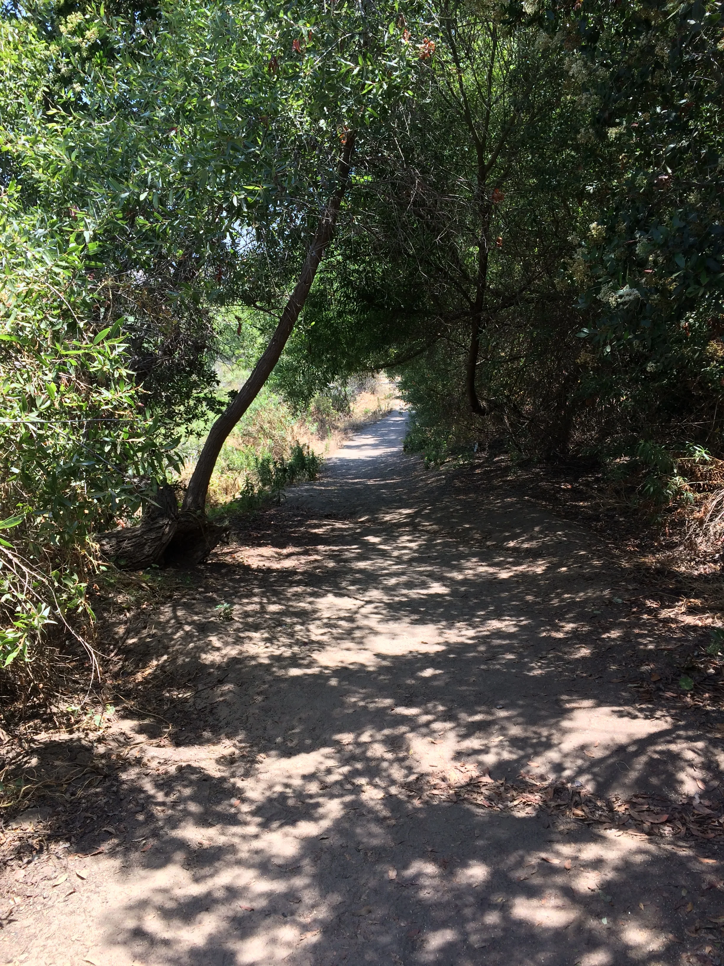


From the trailhead, visitors should head down a slight grade to the east along the La Orilla Trail for .6 miles. Along this mostly flat section of trail, visitors will have excellent views of the San Elijo Lagoon and the surrounding areas. At .5 miles, the trail will head slightly uphill, and pass under some tall Eucalyptus trees, before arriving at the Annie’s Canyon Trail junction, which is very well signed.
From the junction, visitors can choose to either head to the left (east) on the “Moderate” more traditional trail to the viewpoint, or to the right (west) on the “Strenuous” route through the canyon. The trail as a whole is a giant quarter mile loop (.25 miles); but can also be broken up into these two separate routes. The “Moderate” section of the trail consists of a normal well maintained trail that has some nice elevation gain and terminates at a lookout about the canyon facing northwest. From this point, there is a good three hundred and sixty degree view of the canyon; the eastern portions of North County, and of course, the lagoon and coast.
There is also the connecting trail to the canyon. For many years, the canyon was the problem area with graffiti, trash, and various other unsavory things. In this respect, a majority of the work in creating the trail was done in the canyon section by removing graffiti, cleaning trash, and other things. The trail however, through the canyon is steep and narrow in places, and has a small ladder near the top that one must either descend or ascend (depending on which way one is going). While I don’t regard anything in the canyon as insurmountable based on my experience level, I would caution people who do not feel comfortable on steep slopes, uneven surfaces, and narrow spaces from attempting this section (even though it is quite short - .1 miles). In my opinion, the canyon portion is what will make this hike popular with people, as it is exactly what made the area popular even when it was off limits. Again, in my opinion, it is pretty unique, and irrespective of skill level, is a great spot to visit on a microadventure before trying out some of the region’s larger adventures, like the Slot, or Ladder Canyon.
While the Conservancy rates the hike as “Strenuous”, I would say that in all honesty, it is more of a moderate to beginner level hike with a great microadventure payoff, due to the short distance, and short elevation gain. From the trailhead at North Rios, this is a 1.45 roundtrip distance hike that almost anyone can attempt and complete. Dogs are also allowed on this trail, and other trails of the reserve, as long as they are kept on a leash no longer than six feet.
La Orilla Trail, San Elijo Lagoon Ecological Reserve
Observations: I’ve been visiting – and running the trails of the San Elijo Lagoon for years now, and have picked up a great deal of trash (and dog poop) during my runs. I’ve always thought that the area was a great underappreciated spot within the county. While I was impressed to see the work that went into cleaning – and creating this trail, what I’d be more impressed by is new visitors respecting the area and the work that went into it. I make this comment based on what I observed when I hiked the trail the day after it opened. At that time, it was busy with many new visitors, and despite the numerous, obvious, and somewhat cute signs, a number of people were off-trail (as you can see in the video). As I’m a former ranger, and because I’m me, I tried politely to get everyone back on trail with mixed results.
My thoughts on that are as follows: don’t do it. Don’t go off trail. I get that it’s a cool area, and a unique area, but the reason it was closed was because well, people were doing just that – going everywhere and doing what they wanted. The result was an area that looked like a dumpster – and smelled like one too. A lot of time, work, and effort went into rehabilitating the area, so the least we – the public can do – is respect it, and apply leave no trace principles. This means stay on trail; encourage others to do so; and take only photos (along with some trash at times). Acting that way will both help the area, help others, and continue the cycle of education about wilderness spaces, whether they are large, or small. And also, trust me, there’s plenty of room for adventure and Instagram shots in all of the spots that are on-trail, so stay on it, and have fun.