Death Valley is a land of many wonders. While it is hard to pick just one thing that is wondrous and amazing about the park, to me it is the prevalence of water in the region, and the different ecosystems that the pockets of water support. Now, let us be clear – not all of the water in that can be found in Death Valley is potable, such as the highly saline pools near Badwater, or the water in Salt Creek. But, for each pocket of water that has high mineral contents in the region, there are also areas like Shorty’s Well that are small, green, pure oases year-round. Out of all these “green” zones in Death Valley, the most famous is Darwin Falls, which is also, aside from Badwater, one of the most accessible water features in the park.
One of the seasonal falls by Darwin Falls in Death Valley National Park, November 2015
Directions: Darwin Falls is located on the Western side of Death Valley National Park, just off Highway 190, and just West of the town of Panamint Springs. It is worth noting that access to Darwin Falls is by a 2.5 mile dirt road, whose condition varies. When I went in November of 2015, the road was in excellent condition, was well graded, and I did not need any sort of 4WD or AWD features to reach the trailhead. However, I have heard from other people that on occasion, the road to the falls does require 4WD. Like many destinations that require some off, or dirt road travel, I suggest that potential visitors contact the Park Service to find out the conditions on the road before their visit.
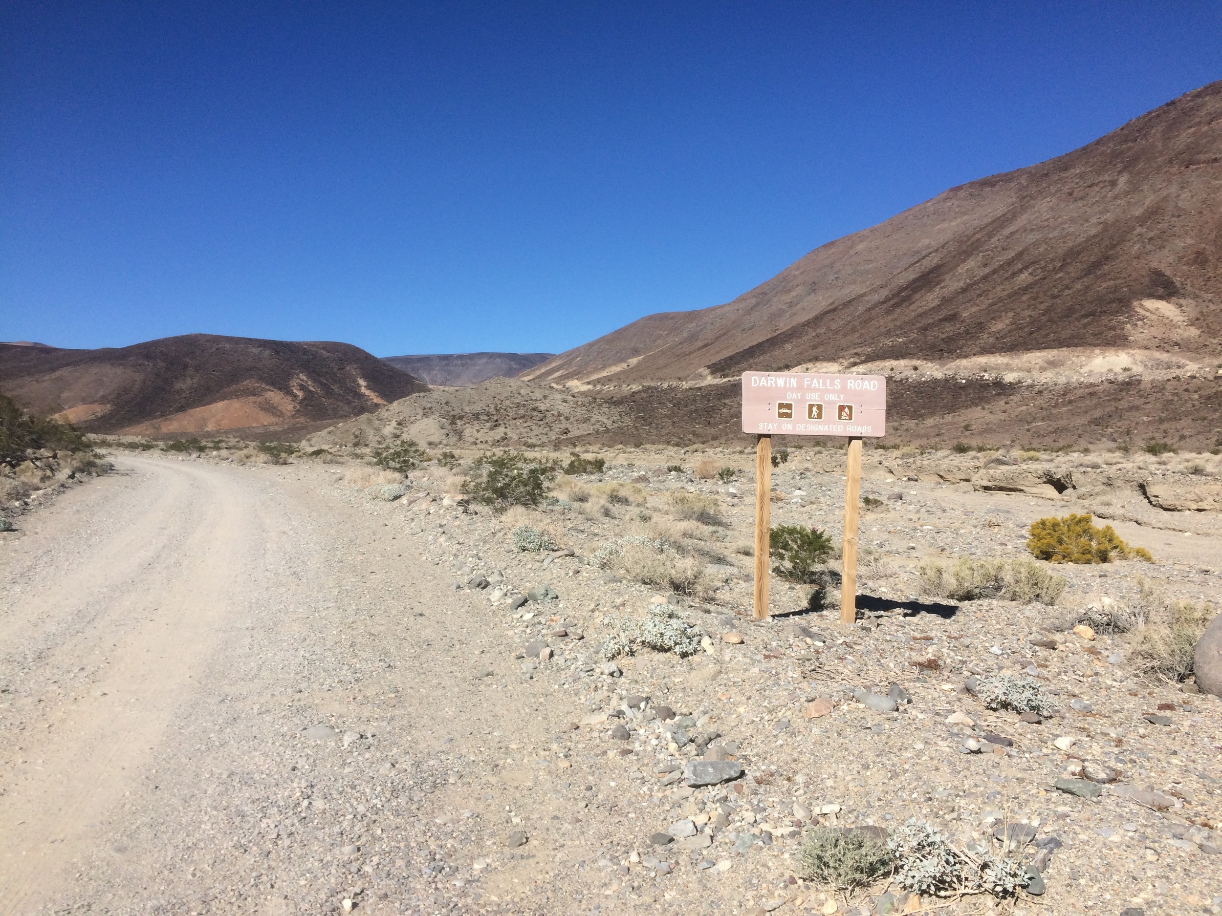


Two things about the Darwin Falls dirt road that are certain are: 1) there is no sign for the exit off Highway 190 as of November 2015; and 2) after the Darwin Falls trailhead, the dirt road is most definitely 4WD only. With respect to the sign issue, even though there is no sign, the turnoff for Darwin Falls is readily apparent. From Panamint Springs, drive one mile West on Highway 190 whereupon the highway curves through a canyon before heading up the hill. At that point, to the left (South), there is a visually obvious dirt road. This is the turnoff and the road to Darwin Falls. After .1 miles on the dirt road, there is a sign indicating that this road is the dirt road to the falls. Having said that, this sign is not visible from Highway 190, so it is more of a confirmation one is in the right area than an actual direction to the right area. The Darwin Falls dirt road is the only road in this area of the park, so while it is not marked aside from the secondary sign, it is almost impossible to miss. From Highway 190, visitors should follow the Darwin Falls dirt road 2.5 miles to the trailhead.
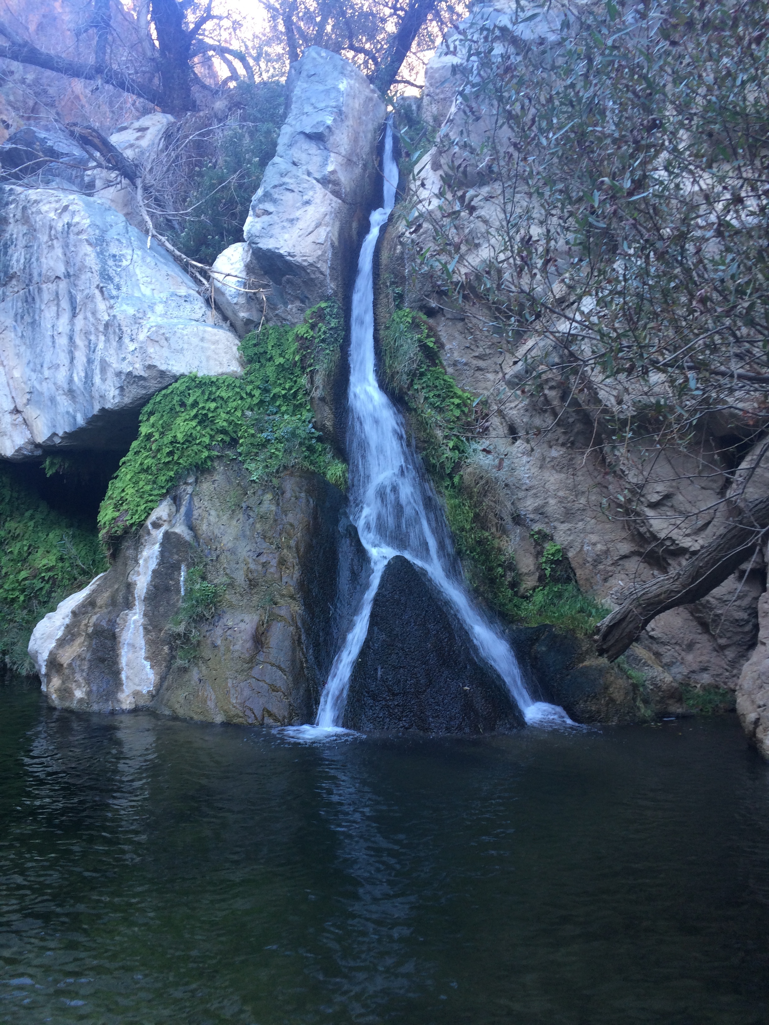
Darwin Falls, November 2015
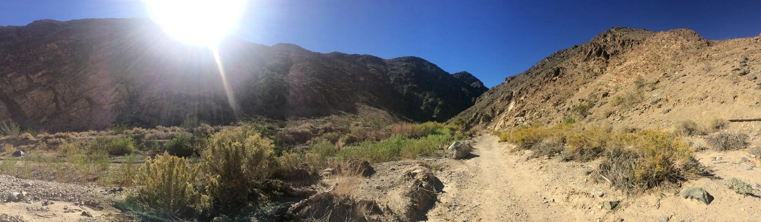
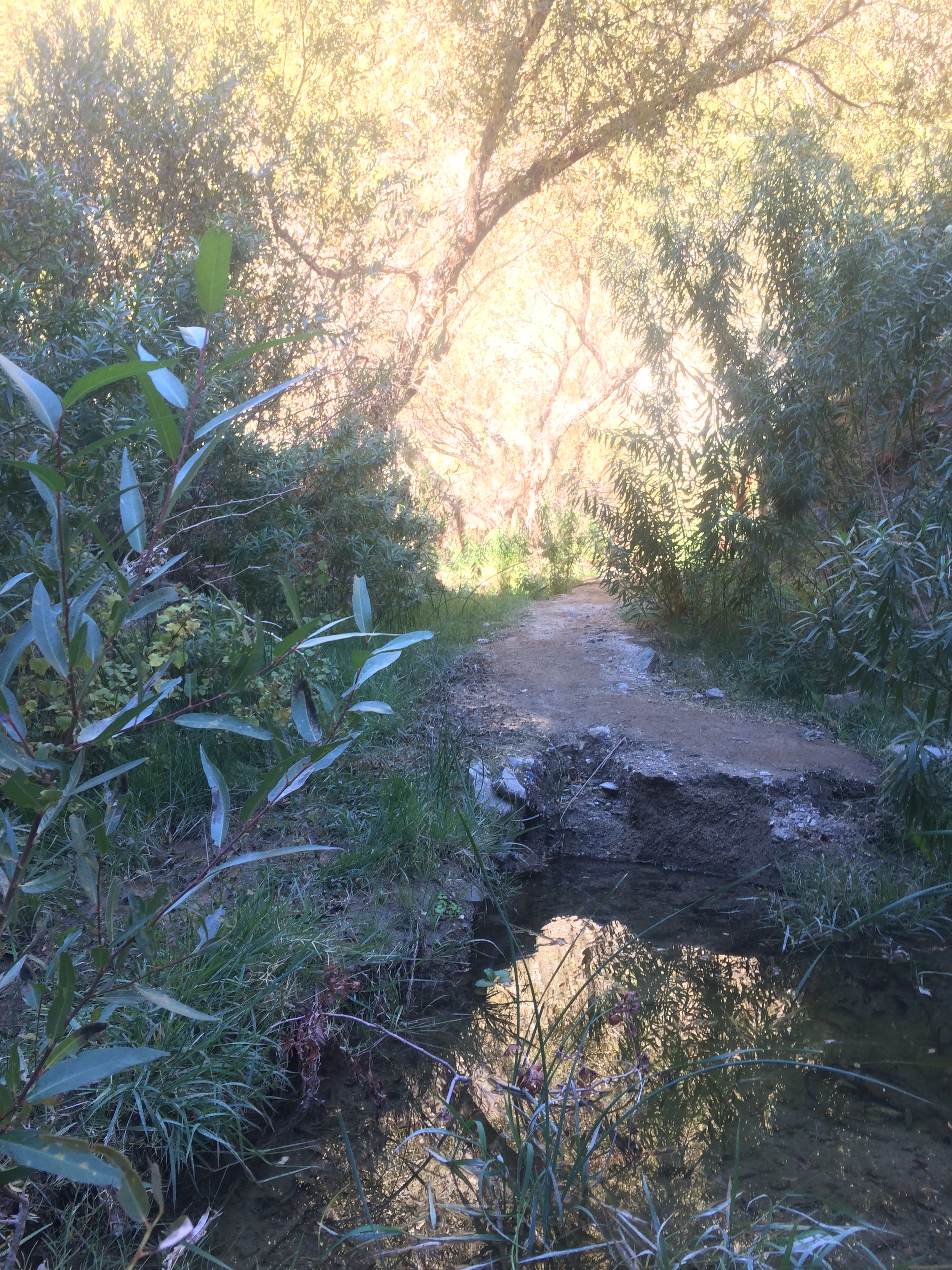
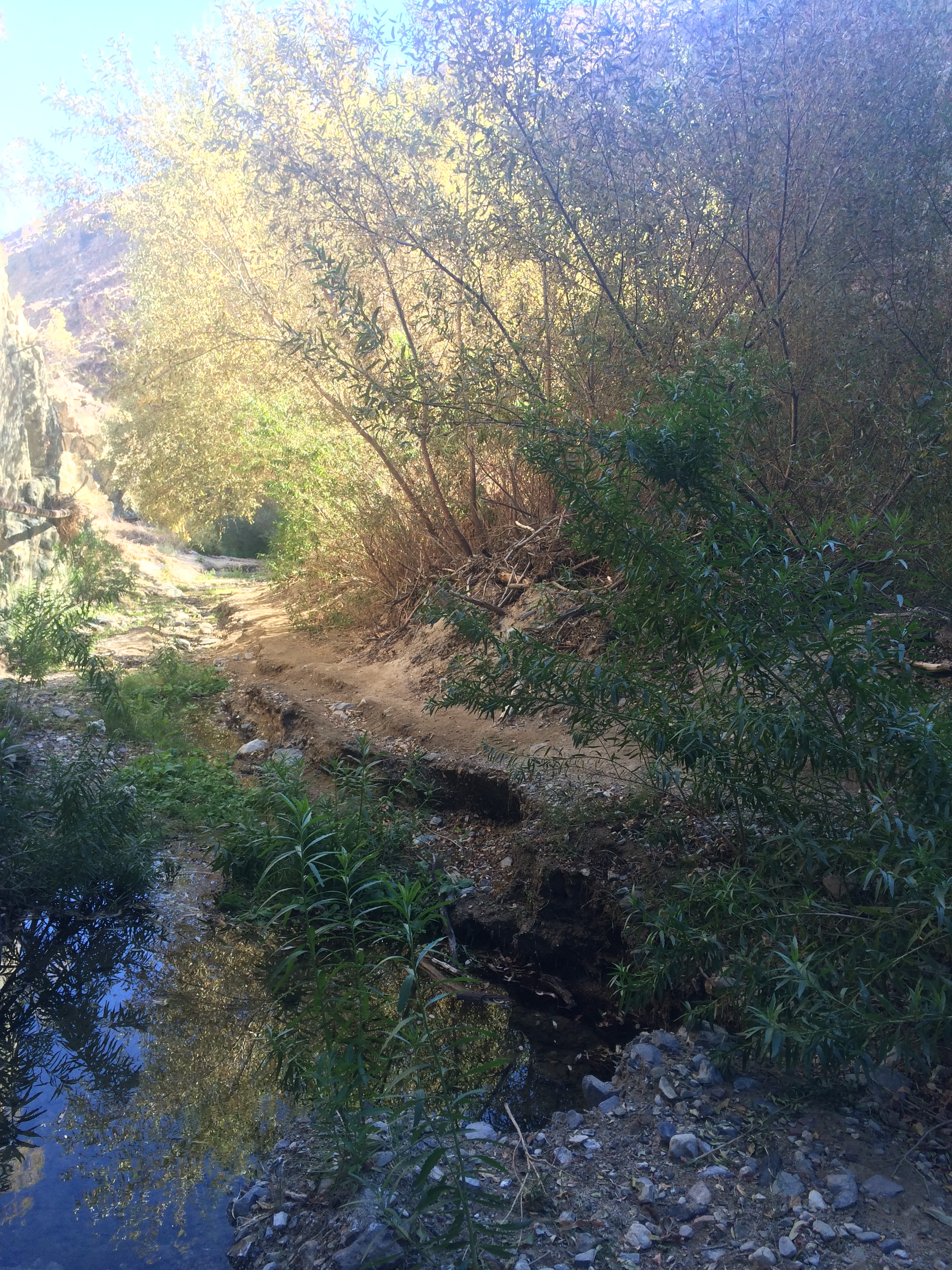
The trailhead is marked by a National Park Service signboard, and there is a parking area, but there are no facilities. From the parking area, follow the wash to the South-Southwest (the left) for half a mile. As this area is a wash, there are a number of foot trails on both sides and through the middle portions. Some guides recommend following the water piping on the Western side of the wash so as not to lose the trail, but realistically, visitors can walk on any non-plant areas up the wash. Depending on the season, and the conditions in that season, the wash may have small to large stream crossings present in it, either from the trailhead itself, or at some point up the wash. Obviously, if it is raining, visitors should not attempt this hike due to the dangers of flash flooding present in the canyon and wash areas.
Trail to Darwin Falls
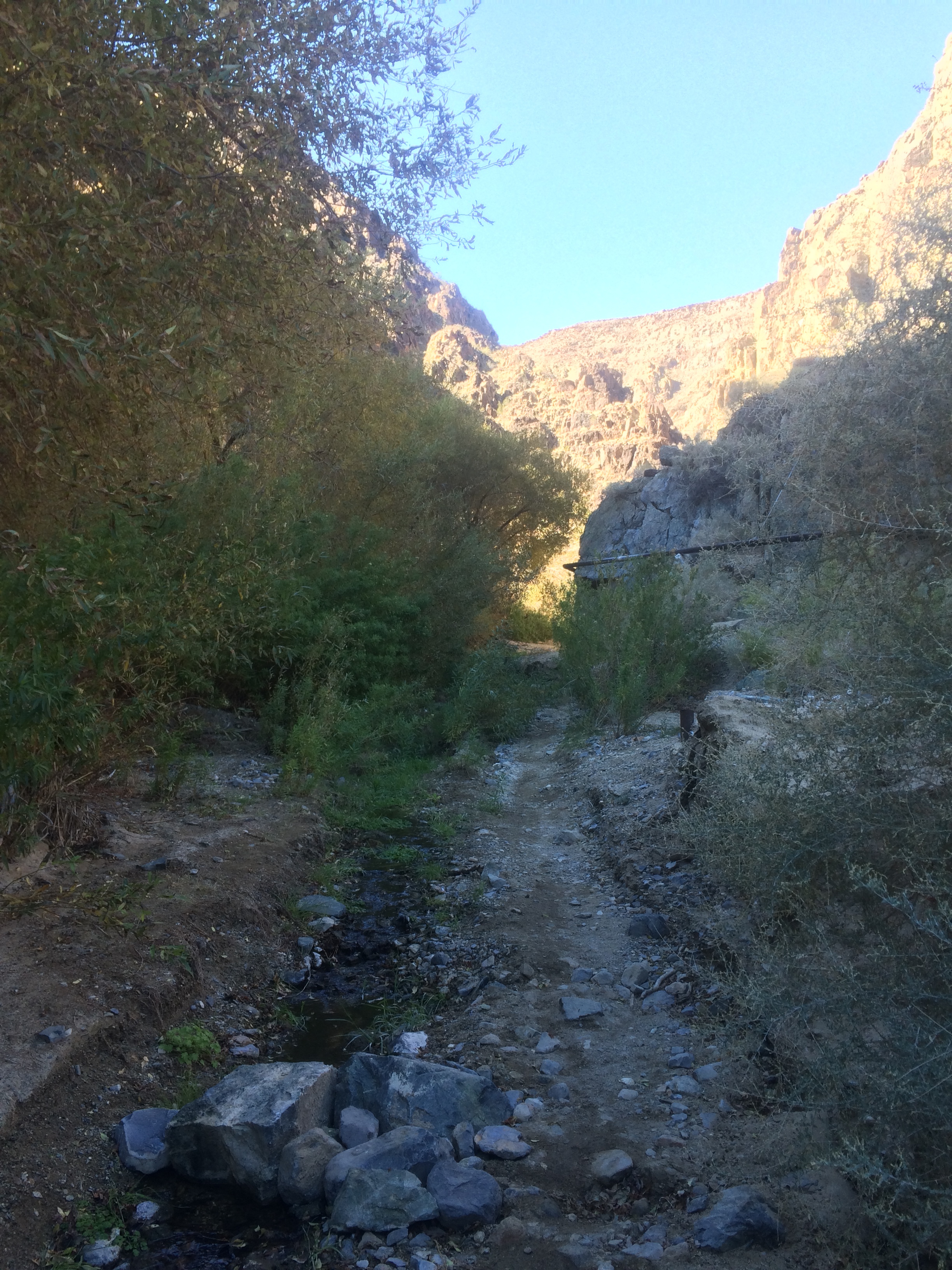
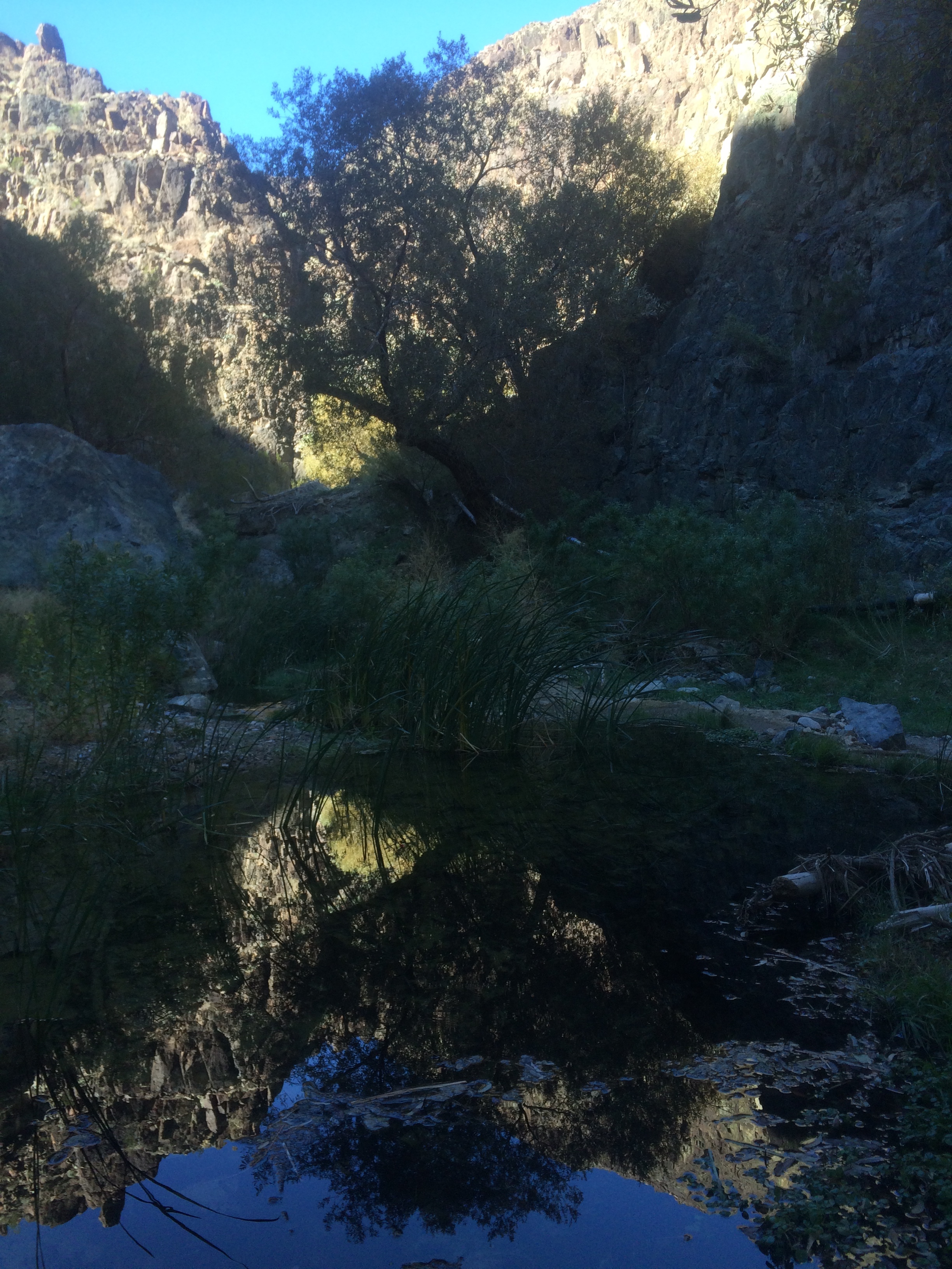
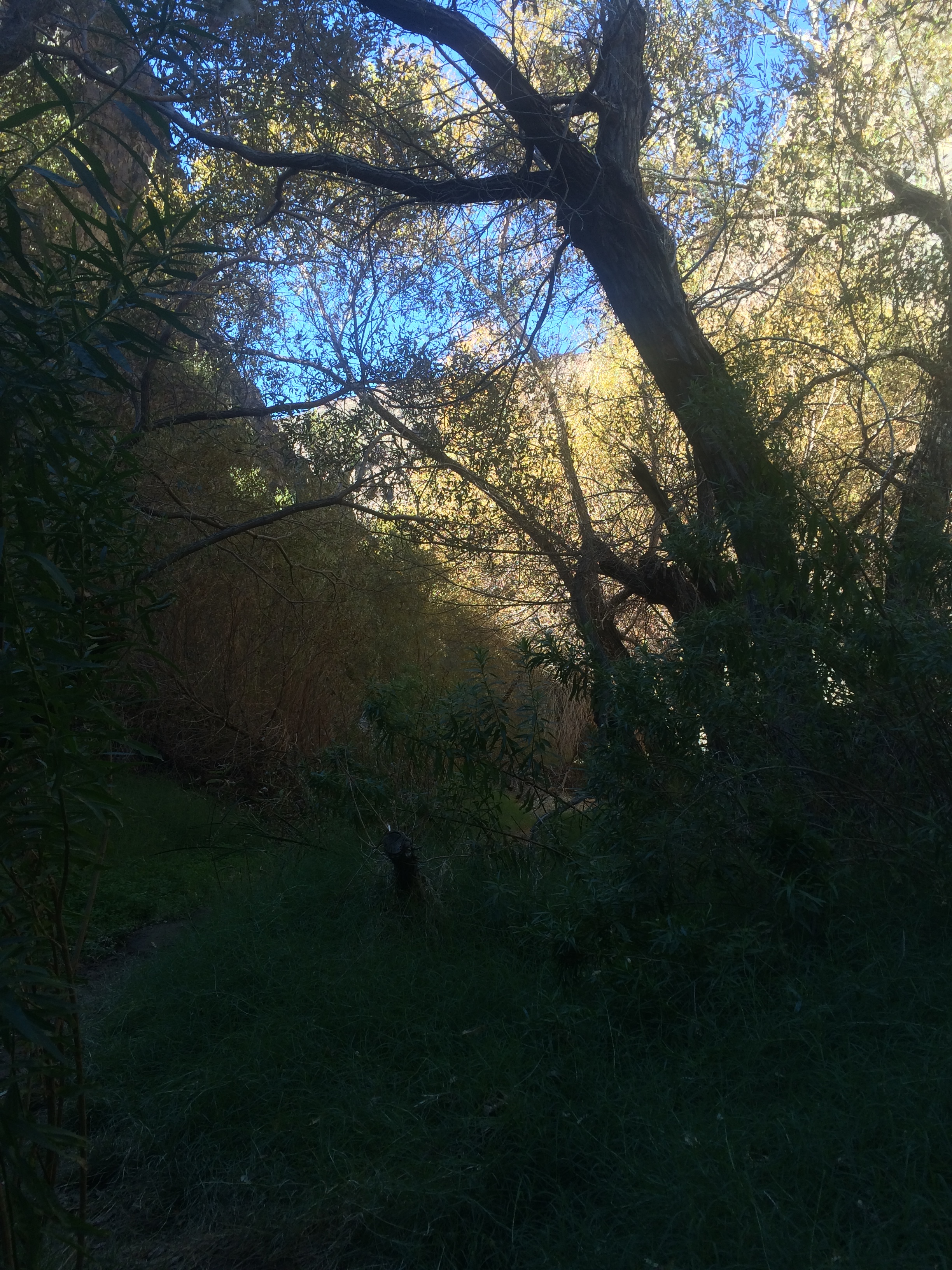
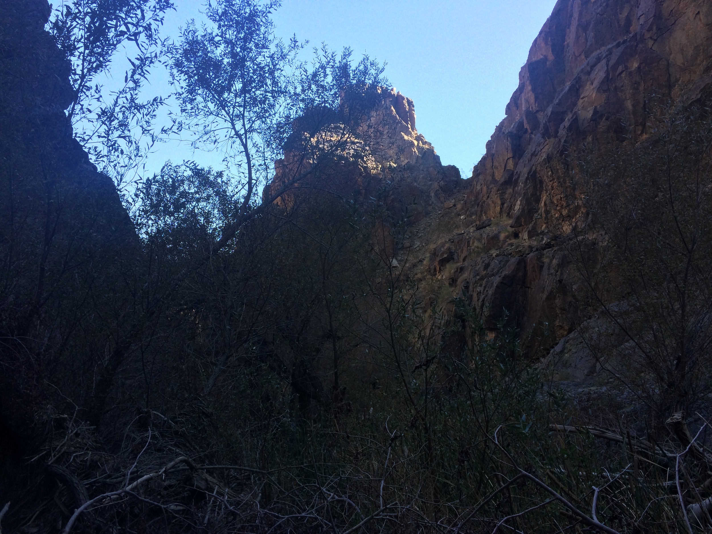
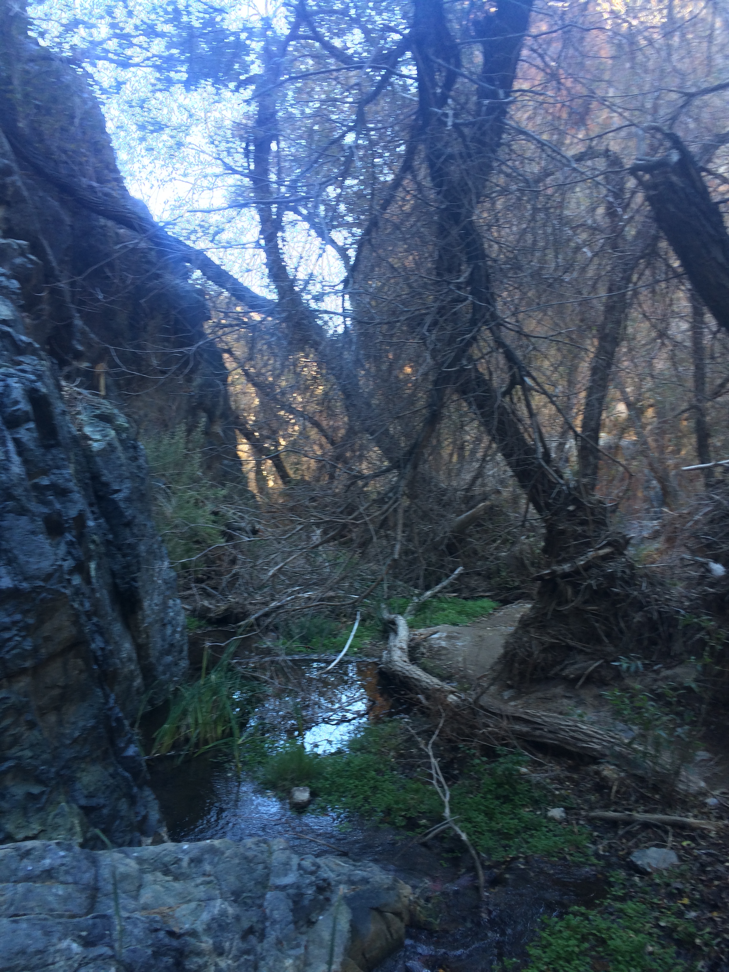
At the half mile point, the wash narrows and becomes Darwin Canyon, a narrower slot canyon with plutonic rock. Visitors will know they are in the right area as the plant growth in the area will increase exponentially, and unless it is mid-summer, there will likely be flowing water at or around the entrance of the canyon. From this point, it is a short distance to Darwin Falls itself, which is spring-fed year round. Before I discuss Darwin Falls itself, let me say that the section of the hike from the entrance of Darwin Canyon to the falls is a magical place. All around the canyon are small seasonal streams and falls fed from Darwin Falls, and interspersed among these seasonal flows are trees and other desert plants. With the high walls of the canyon blocking out a great deal of direct light from the desert sun, this area feels like a spot that could be anywhere on Earth but Death Valley. Finally, as this area is somewhat remote, there is a good chance that one might find some quiet solitude amongst this oasis, which is a very relaxing experience. In terms of trails through the canyon, as there are seasonal flows, there are a number of foot trails that wind up the canyon. These all lead to the same place, the lower falls itself, which is a year-round flow as it is spring fed, but is obviously more impressive during the winter months due to winter storm runoff. At this point, visitors can either return back the way they came for an easy two-mile roundtrip hike, or can proceed forward up the canyon over rocks to explore more of the Darwin Falls network.
Tips: Although Darwin Falls is not as remote as some areas of the park, it does involve off-road travel in Death Valley. Visitors should have the proper equipment and resources before venturing to this region. Darwin Falls is named for Dr. Darwin French who was a local rancher, miner, and explorer. Visitors should also be aware that the Falls themselves are within Death Valley. Although there is a “Darwin Road” some 10 miles to the East of Panamint Springs on Highway 190, this road provides no access to the falls whatsoever.