
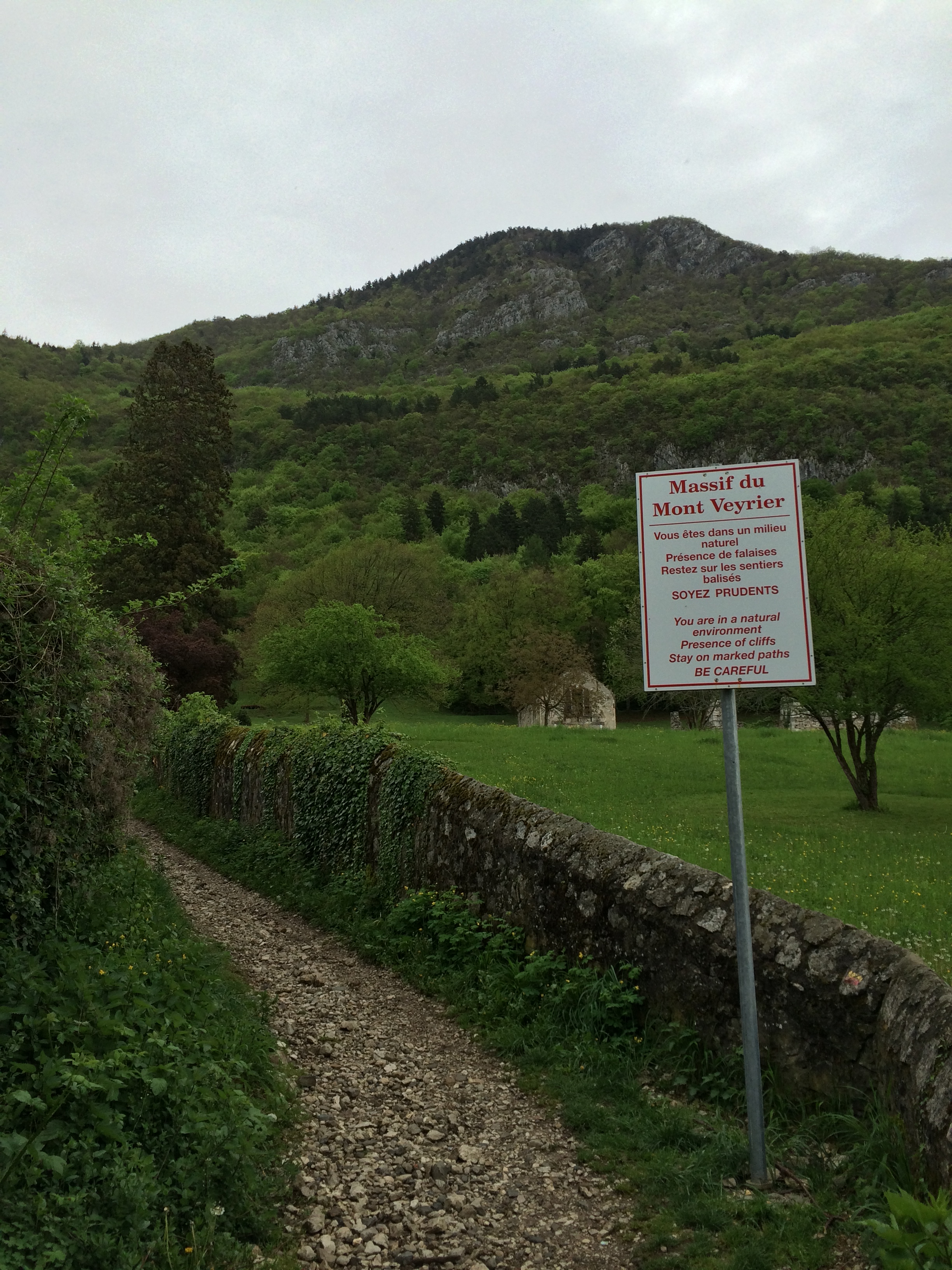
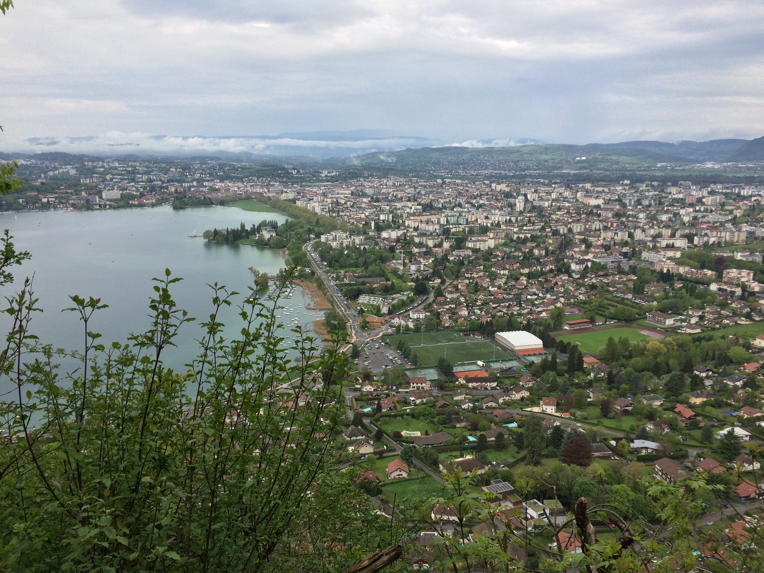
Annecy is one of the more picturesque towns in France, and a charming destination in the Haute Savoie region. With a beautiful lakefront park along Lake Annecy, an old town with historic structures, and expansive trail networks bordering the town, the town presents a plethora of options for visitors who are looking for outdoor activities. The most popular hike(s) near the town is to the summit of Mont Veyrier (and its companion, Mont Baron), which is a mid-sized mountain that dominates the lake’s Eastern shore. At 4,236 feet in elevation (1,291 meters), Mont Veyrier is hard to miss, but what makes the mountain really stand out is a prominent limestone band near the summit. While Mount Veyrier is not the largest mountain in the French Alps, it is a great hike that is suitable for all levels of experience, and one that has a bonus of providing great views of Annecy, and the Haute Savoie region from the top.
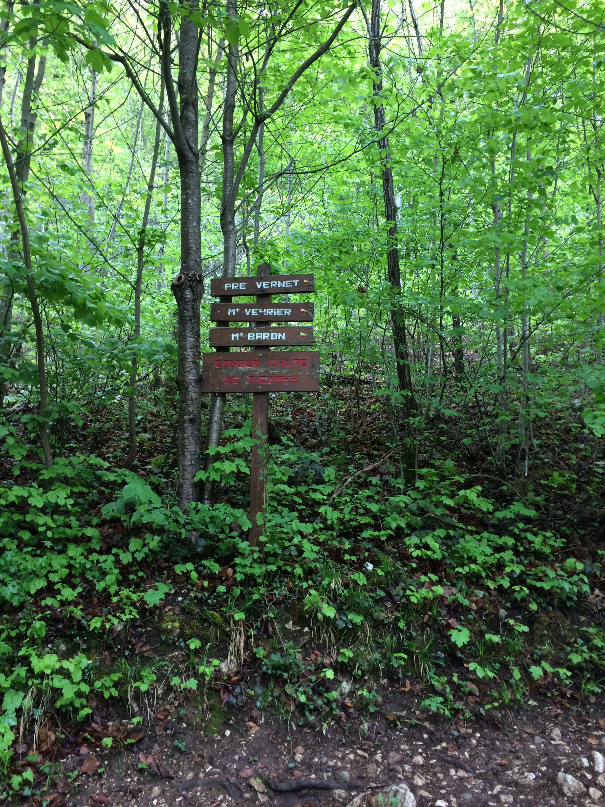

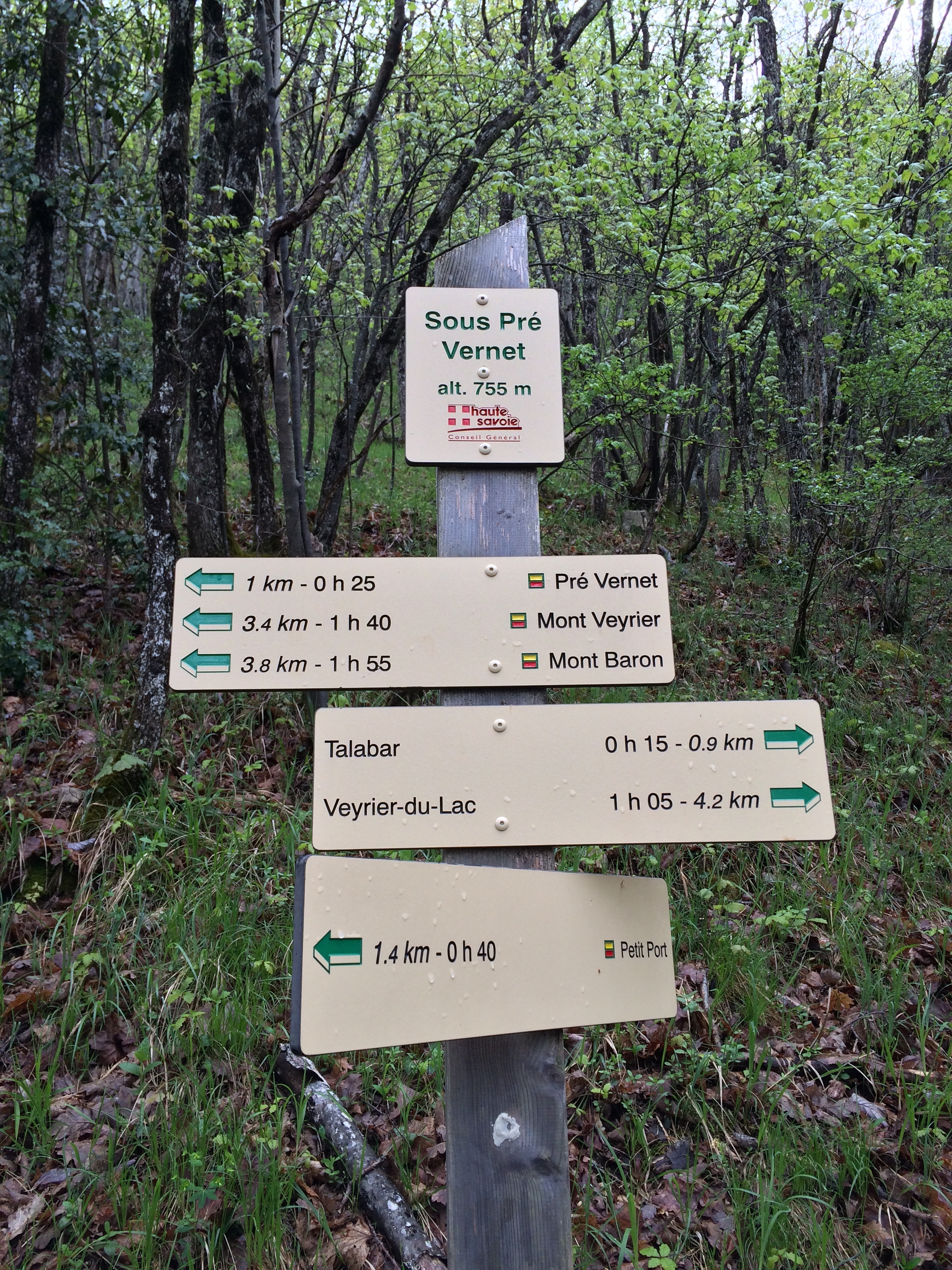
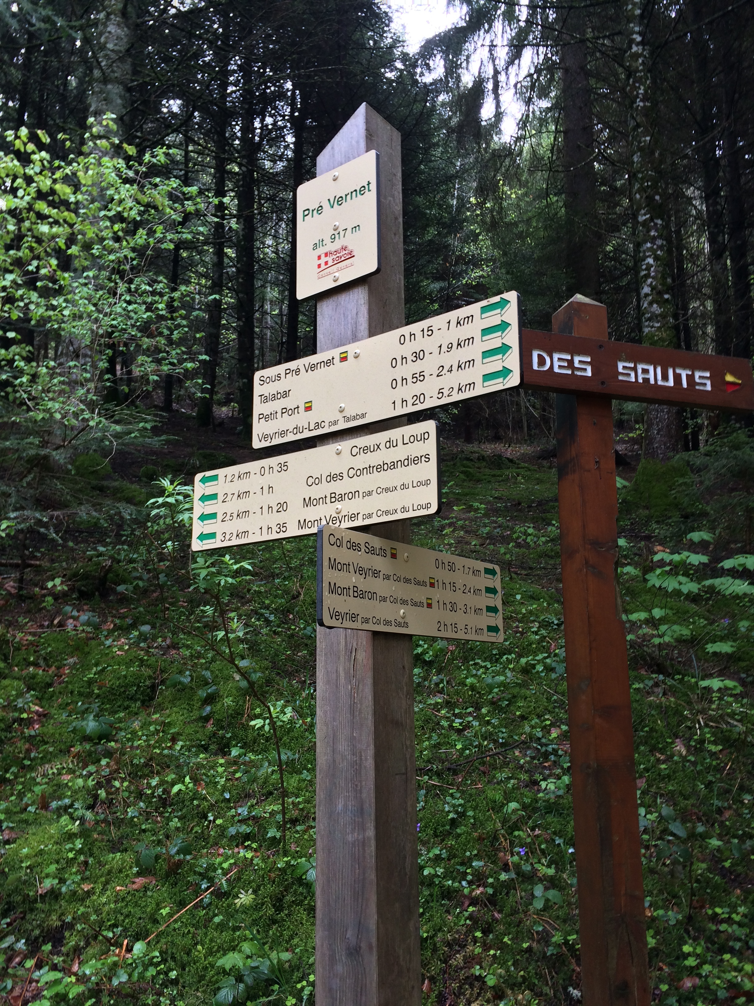
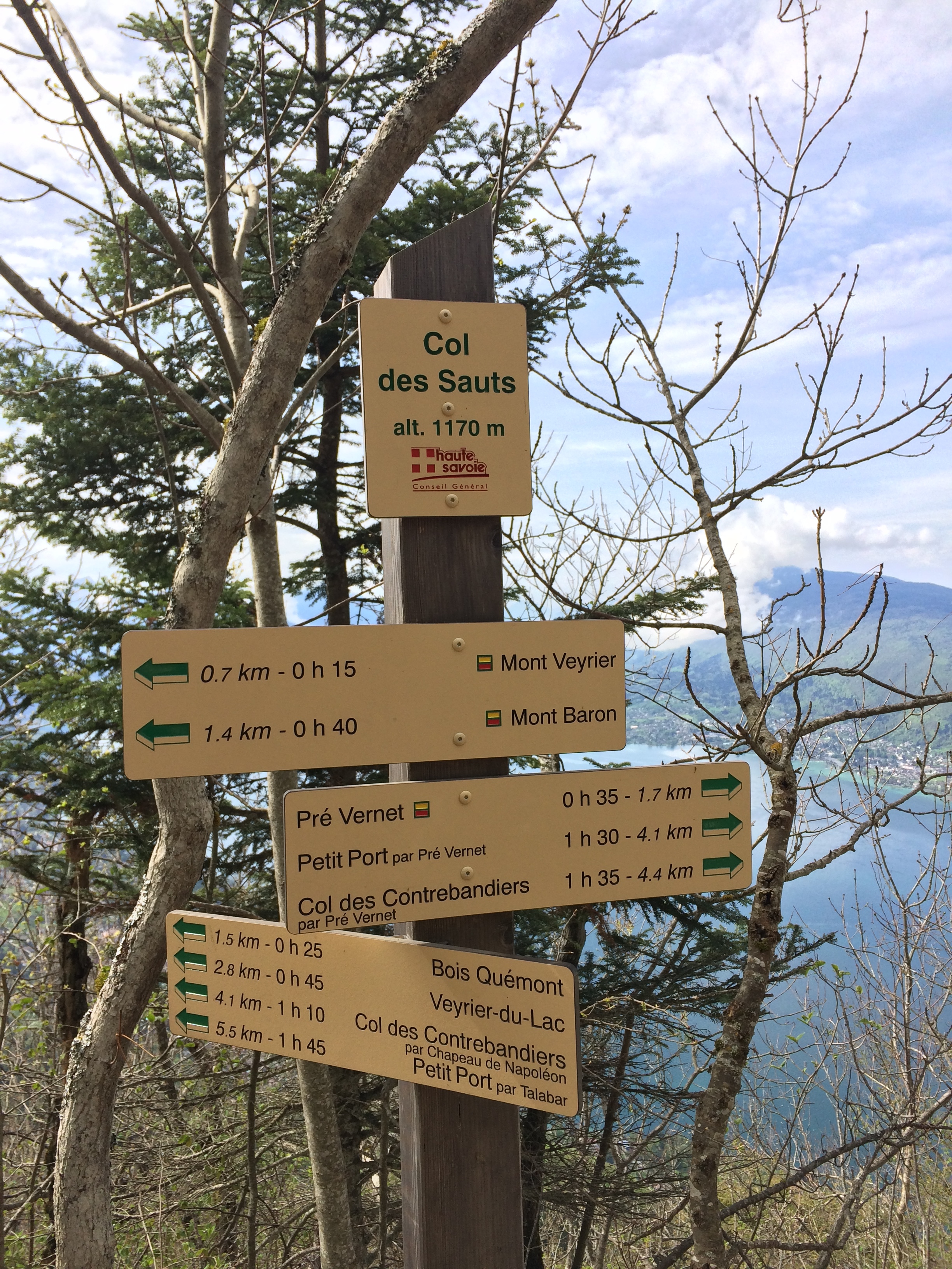

Directions: One of the other advantages of the Mount Veyrier hike is the fact that there are a number of trails of varying distance that lead to the summit (and on to its companion peak, Mont Baron). For hikers who have never hiked in France, it is worth noting that unlike most North American trails, trails in France are well-marked with frequent signs that delineate distance and time. While time estimates obviously vary from hiker to hiker, the signs provide a great resource point for visitors to understand what they are undertaking, and to plan their routes accordingly.
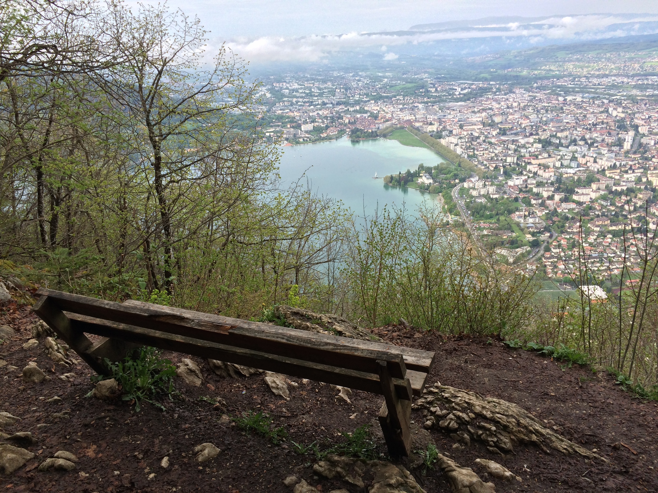
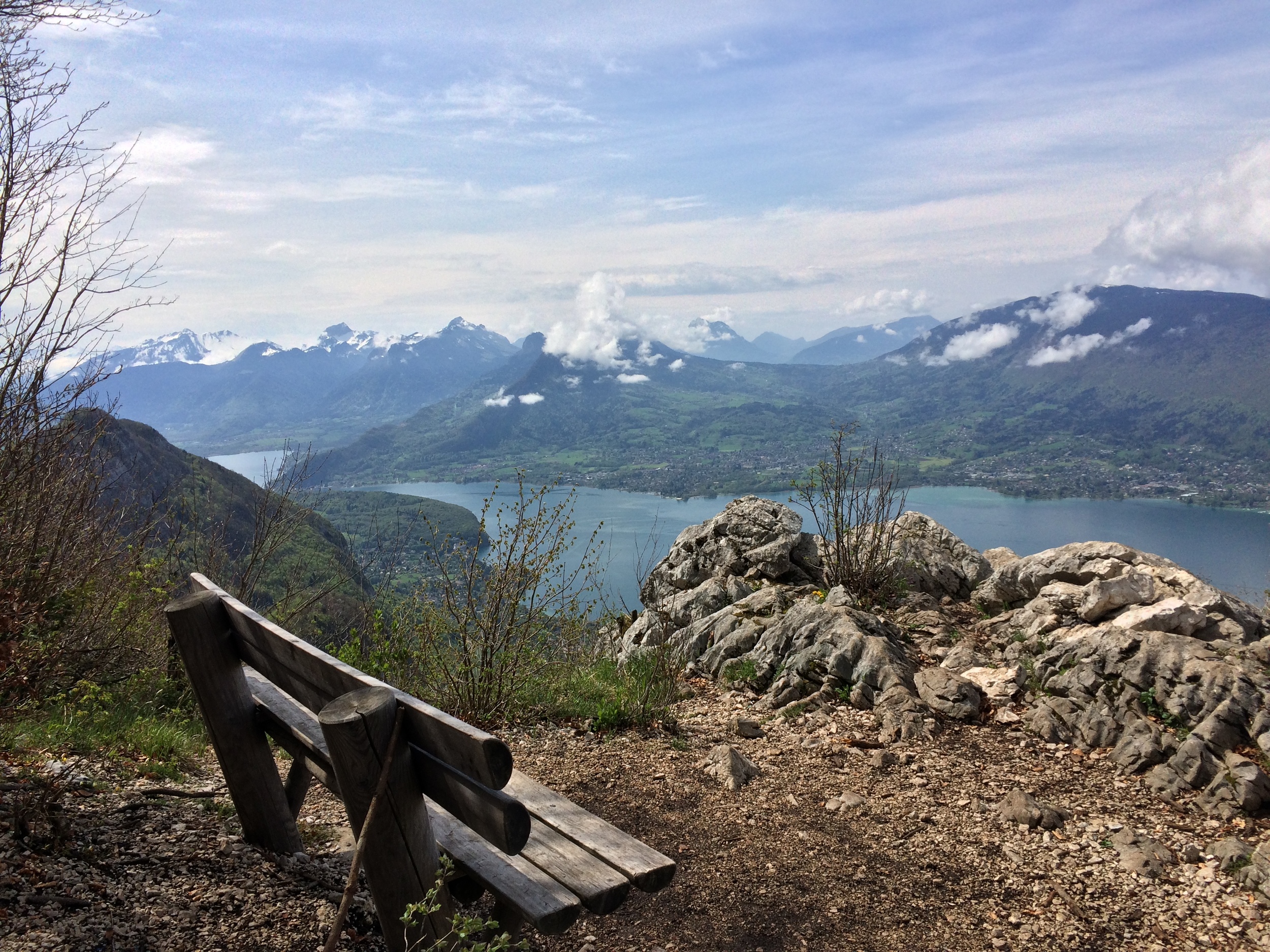
Summit views, Mont Veyrier
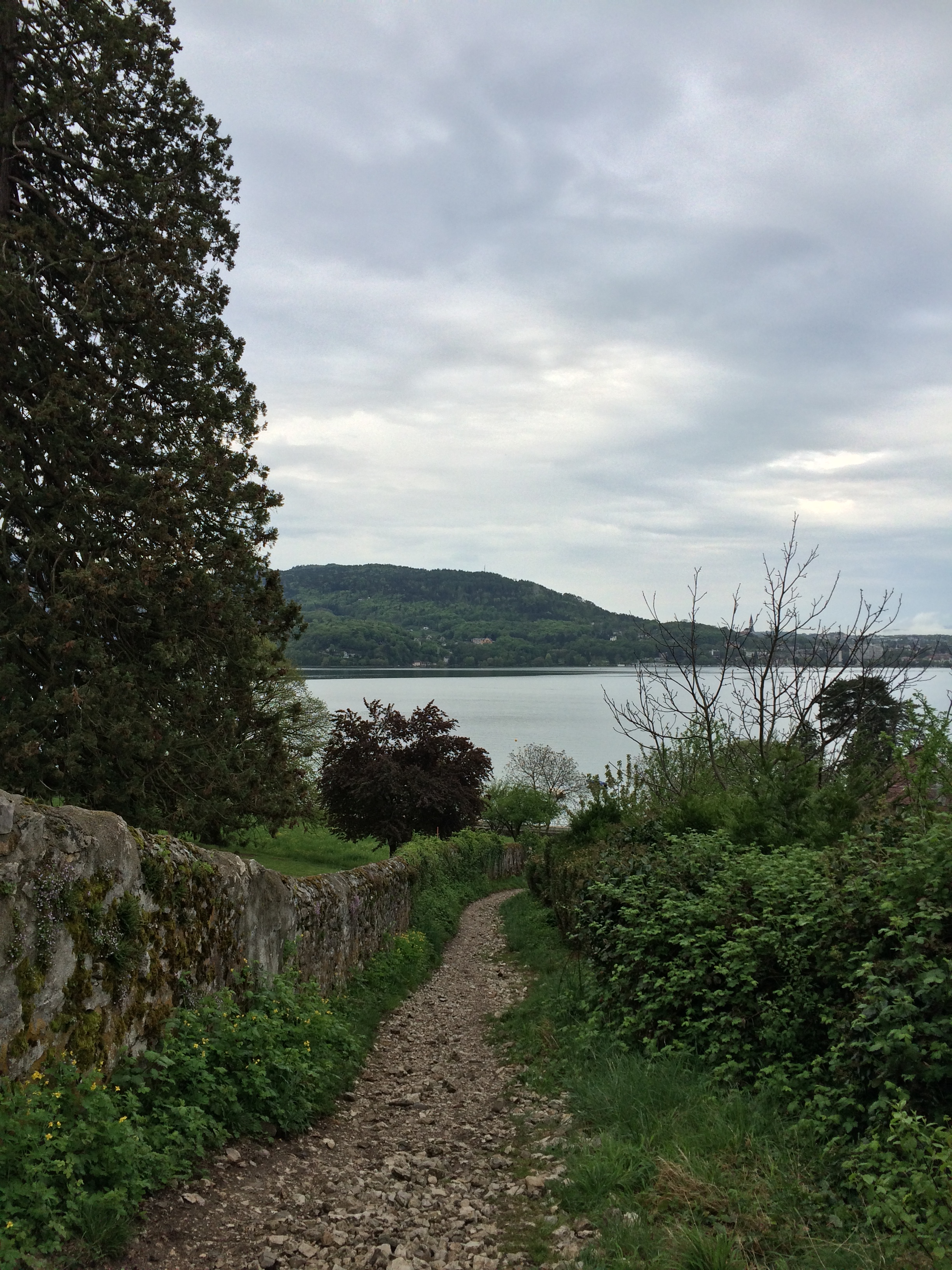
From Annecy, one of the most common access points is the trailhead near the intersection of the D909 and Rue de Verdun. This trailhead is on the east side of the D909, and near the Northeast corner of Lake Annecy, and is very well marked. Another common access point is from the car park at Veyrier-du-Lac, which is further south on the D909 on the east side of Lake Annecy. When I did this hike, I walked along the North side of Lake Annecy from the old town to the first trailhead mentioned above. In terms of distance, there is a route on the mountain that calculates distance from the “Petit Port”, which is midway along the north shore of Lake Annecy. From the Petit Port, it is a one way distance of 5.5 kilometers (3.4 miles) to the summit of Mont Baron, and 4.7 kilometers to the summit of Mont Veyrier.
As I’ve noted herein throughout the post, Mont Baron is Mont Veyrier’s companion peak. At 4,260 feet of elevation (1,299 meters), it is only twenty-four feet higher than Mont Veyrier. And, as its summit is only .7 miles from the summit of Mont Veyrier, I’m not sure why one wouldn’t climb it while climbing Mount Veyrier. As an added benefit, there is a small area of “ruins” (mostly just foundation) where the Mont Baron hotel and ropeway used to stand. However, for those that are tired by the climb to Veyrier’s summit, Mont Baron is an added distance that does not provide much extra benefit in terms of distinct scenery; and as such, I’ve provided the different distances above.
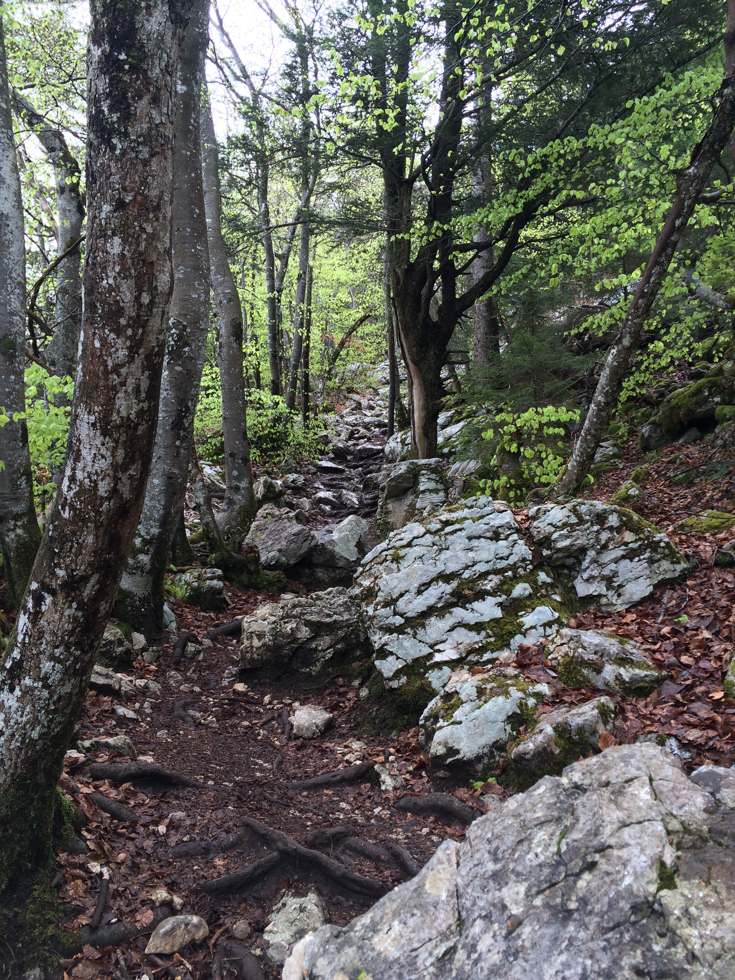
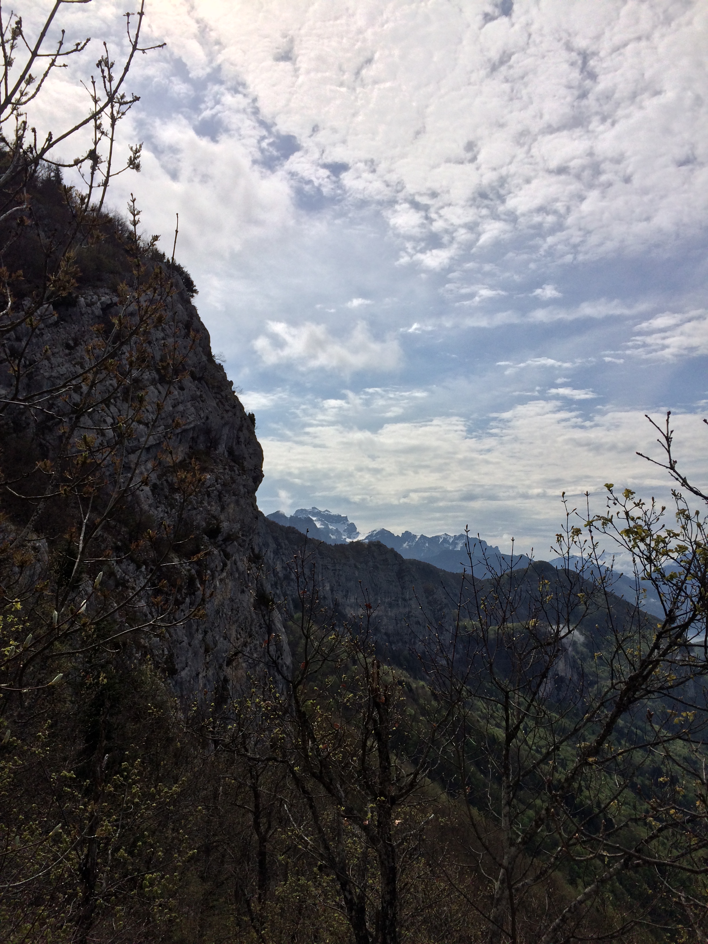
Like many hikes in the French Alps, the trail to the summit of Mont Veyrier from Lake Annecy is steep. The base elevation of the lake is 1,466 feet (488 meters). In order to reach the summits of Veyrier and Baron, a hiker must ascend just under 3,000 feet of elevation in around three miles. While this is not impossible, this hike, like many other hikes in the region is a real leg-burner. From the Lake, the trail heads up a cobbled slope, into the forest. For a majority of the hike, the trail ascends through the trees, providing obscured, or limited views of the lake, and the surrounding region.
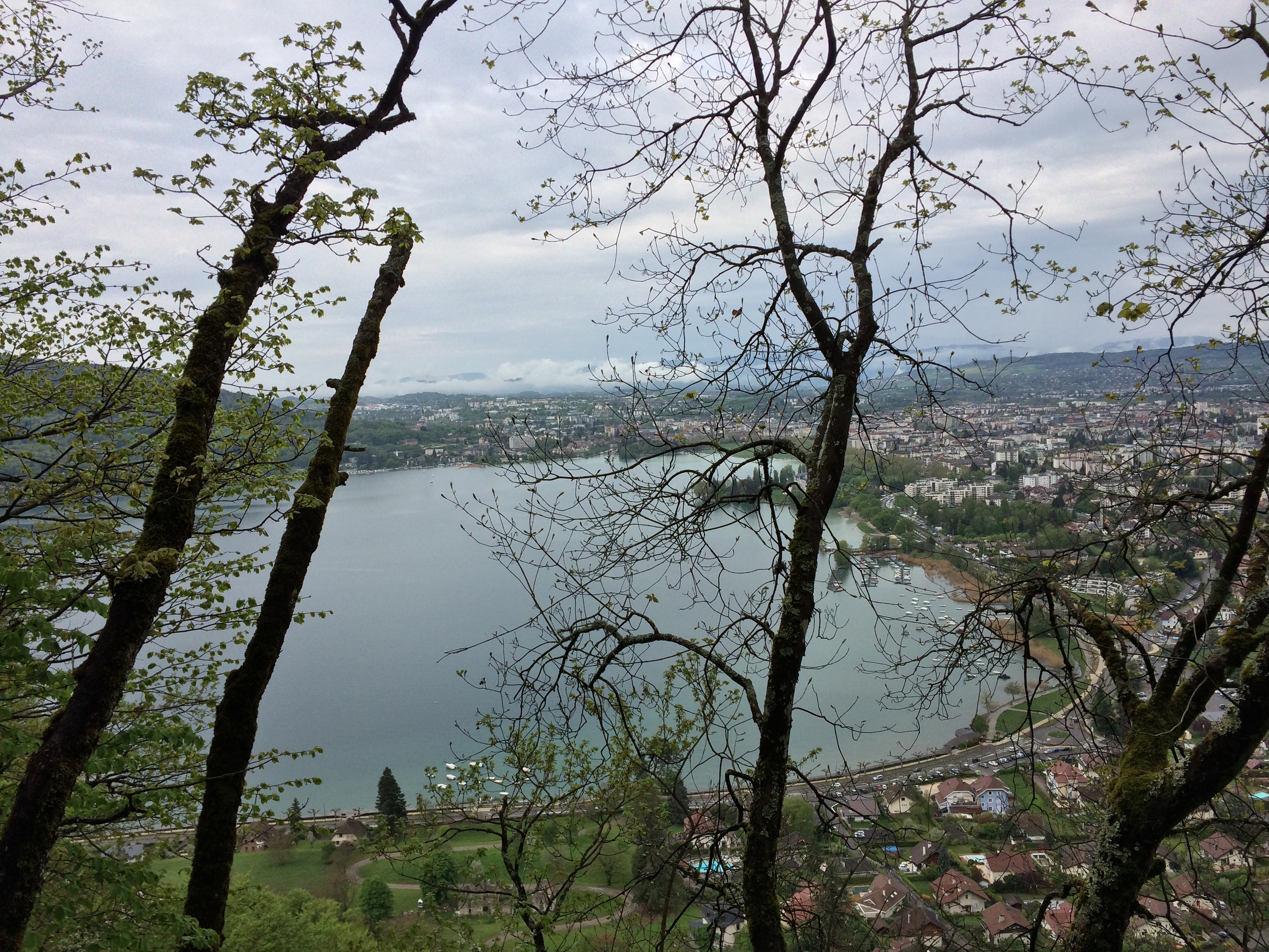
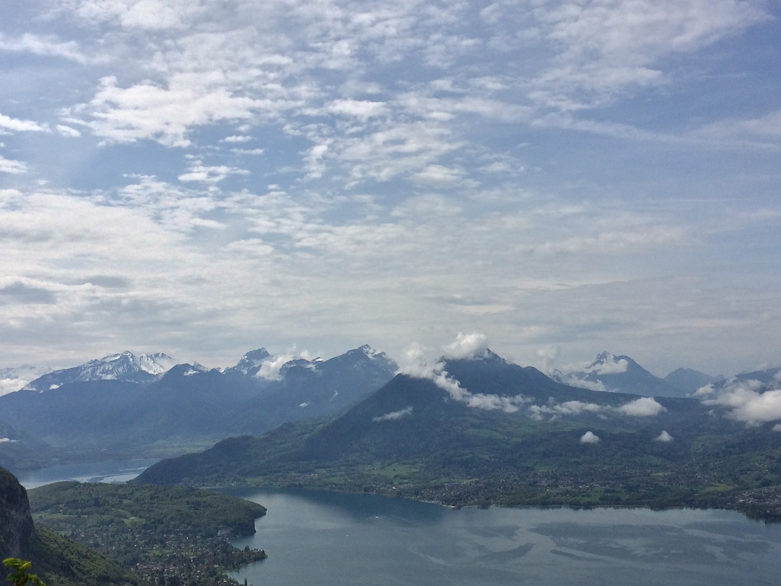
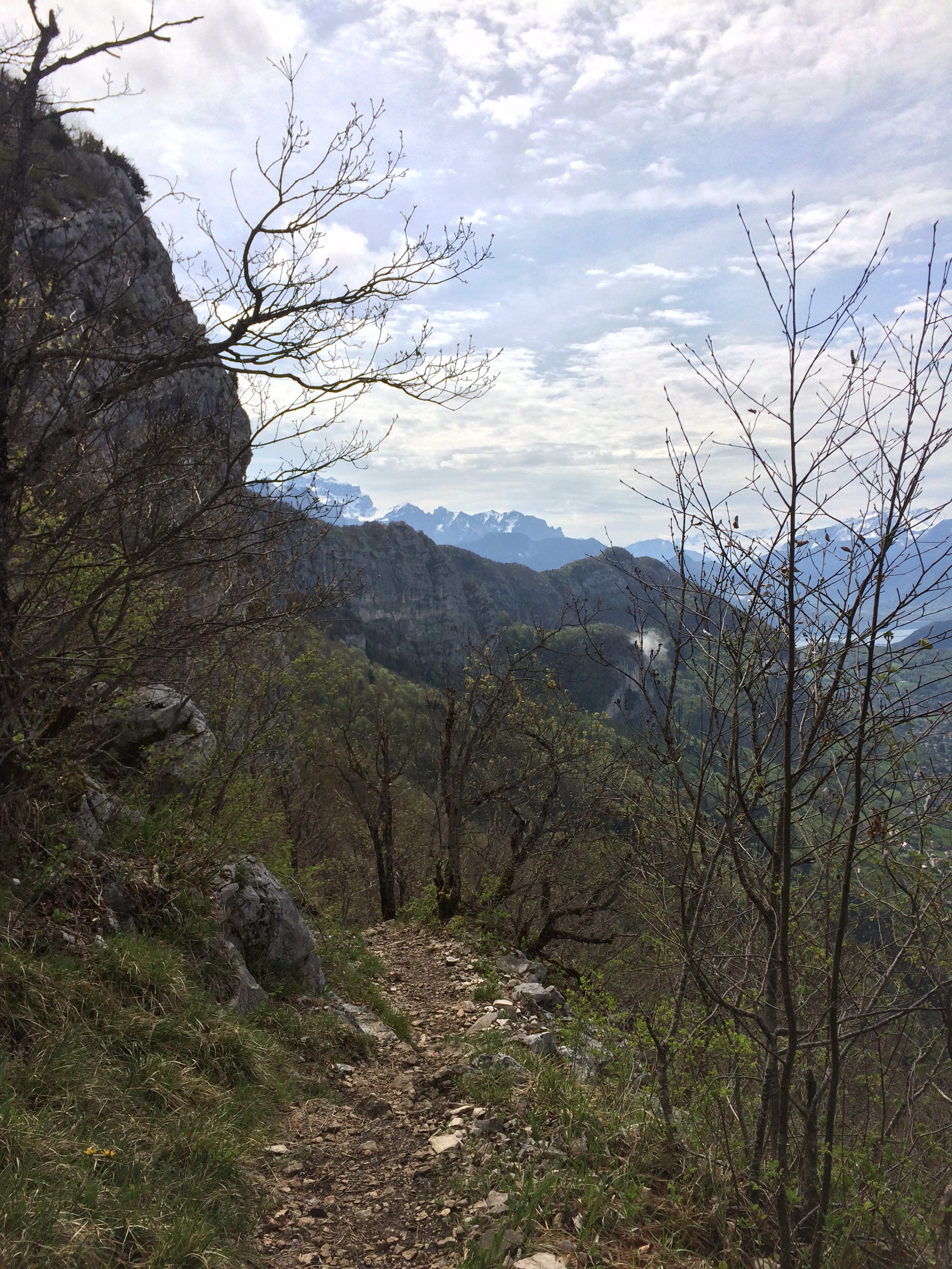
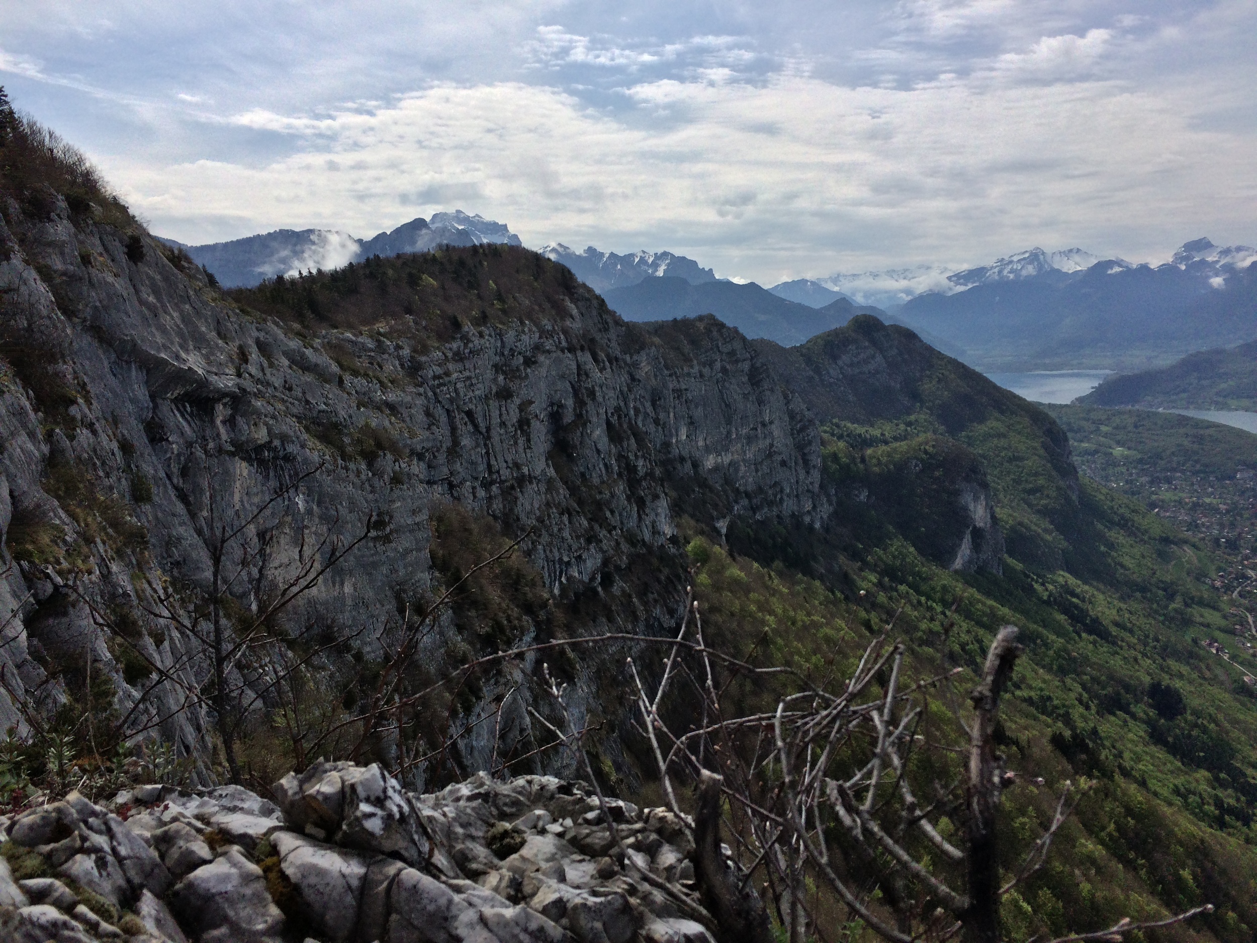
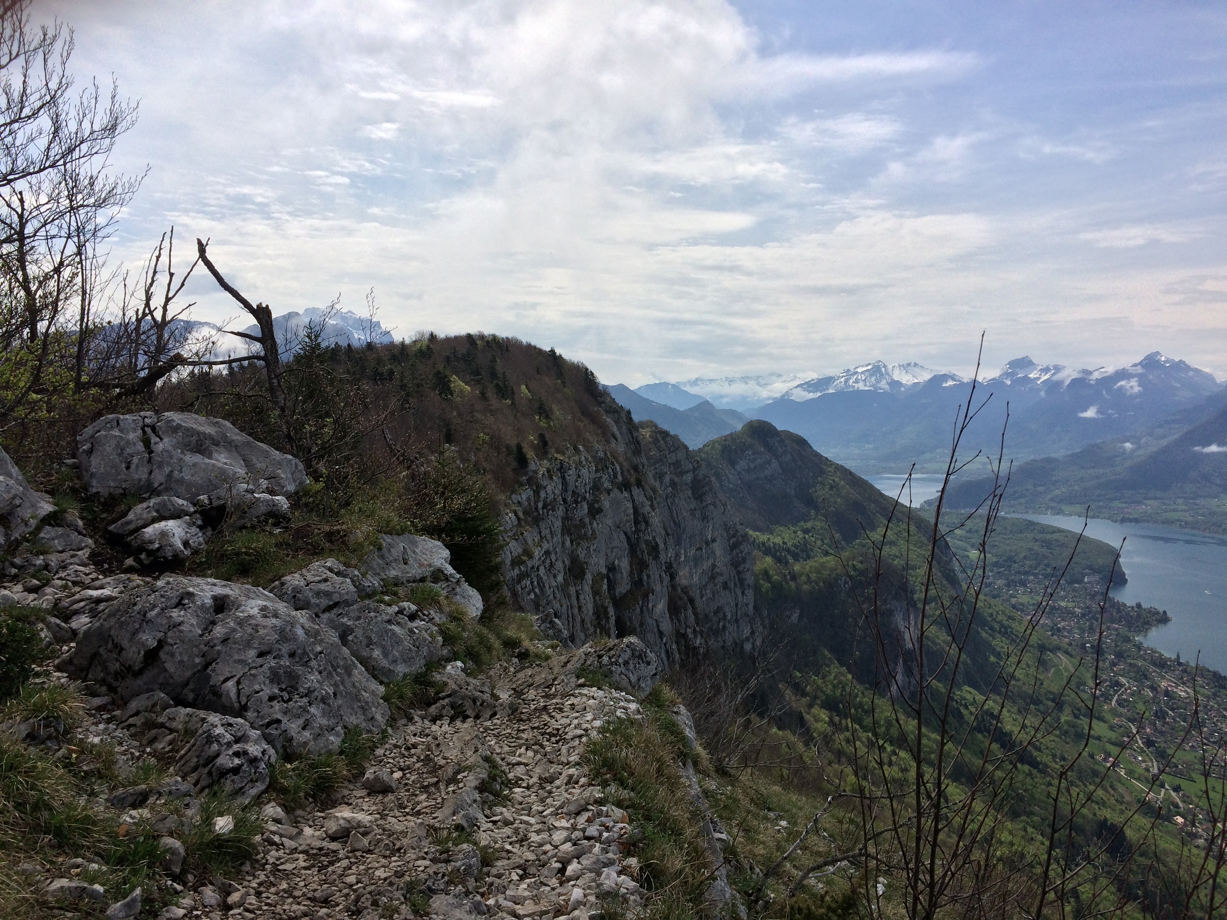
While this is tranquil, scenic, and relaxing, for those who are expecting great views, or vistas, the payoff is not until near the summit. At 1170 meters of elevation (near the end of the hike, at 3,510 feet), hikers will find themselves at Col Des Sauts, which is .7 kilometers from the summit of Mont Veyrier and 1.4 kilometers from the summit of Mont Baron. From this point on, hikers will have great views of the lake below, as they will have cleared the treeline, and of the limestone ridge visible from anywhere in Annecy. A short uphill walk further will place any hiker on the summit of Veyrier, which provides great views of the lake, the town, and the trail. For those hikers who still have the ability to go further, the traverse to Mont Baron goes along the edge of the limestone ridge visible from below, and then ascends to provide three hundred and sixty degree views of the Alps, and the Haute Savoie region. From the summit of Mont Baron, it is an 11 kilometer roundtrip hike back to the town for a well-deserved meal.
Tips: As with any hike, proper preparation is key with water and food. Most of the hike is shaded, as it is heavily forested, but as the hike is uphill to the summit, hikers will burn through a fair amount of water. While this hike is suitable for anyone and a great experience, given the well-marked route and relatively short length, it may be challenging to parties not familiar with the steep ascents of trails in the Alps.