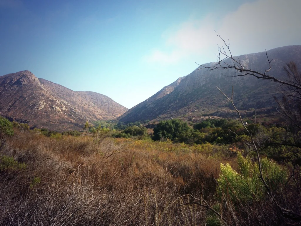
Sometimes, adventures are easy to find – they’re marked in large white letters on big brown signs right next to highways, telling you where to turn to find something unique. Other times, adventure takes a little initiative to find. Take Hospital Rock, for example. It’s located at the southern end of Sequoia National Park. It is well marked, but other than that, not much is publicized about it other than that it’s a picnic area. On the surface, it doesn’t appear to be that interesting of a spot, nor a spot containing adventure – but it is. For starters, let’s address what it is – it’s not just a National Park Service picnic area, but a large quartzite rock that is partially is a “cave” due to its resting location next to other rocks.
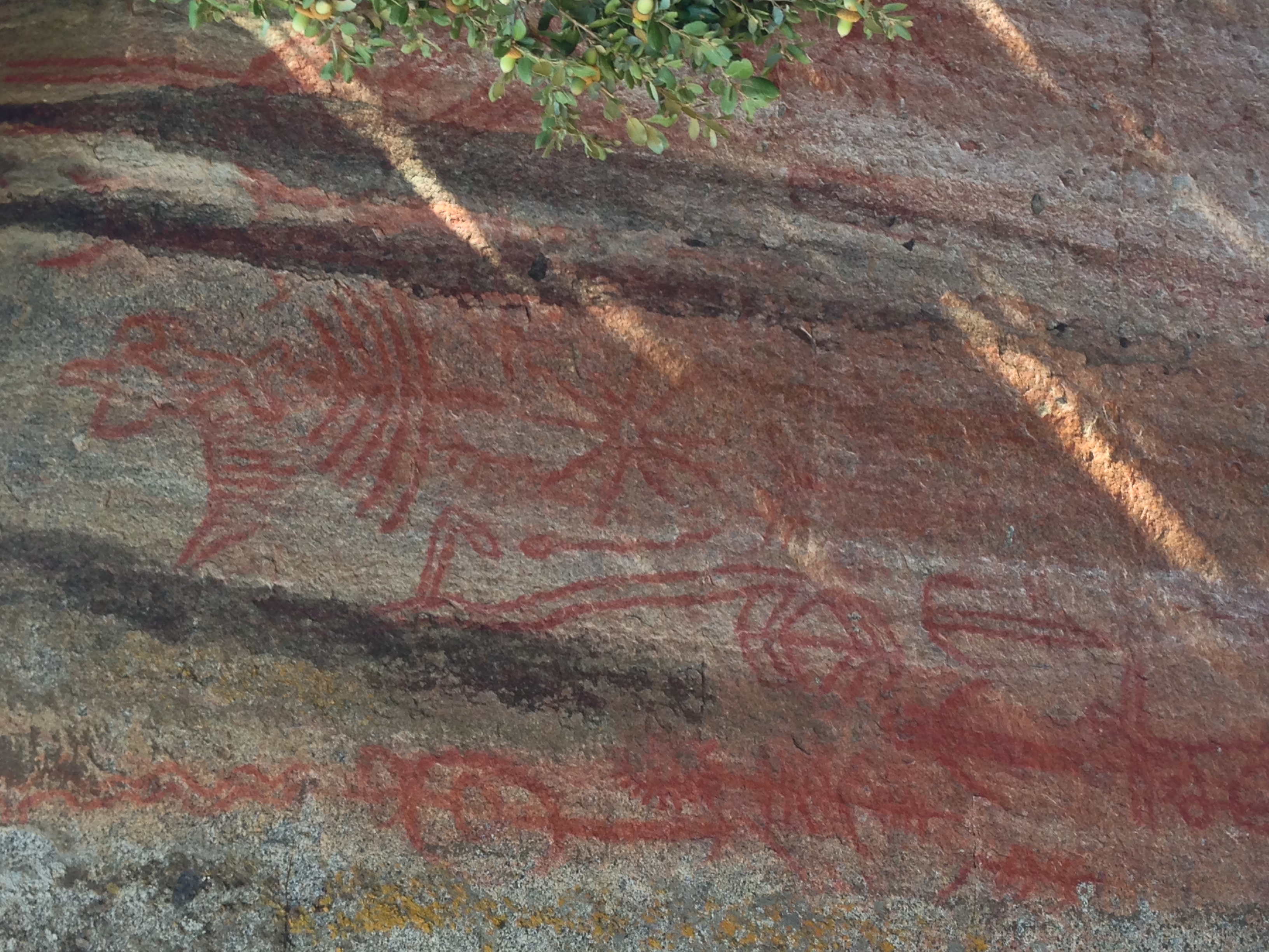
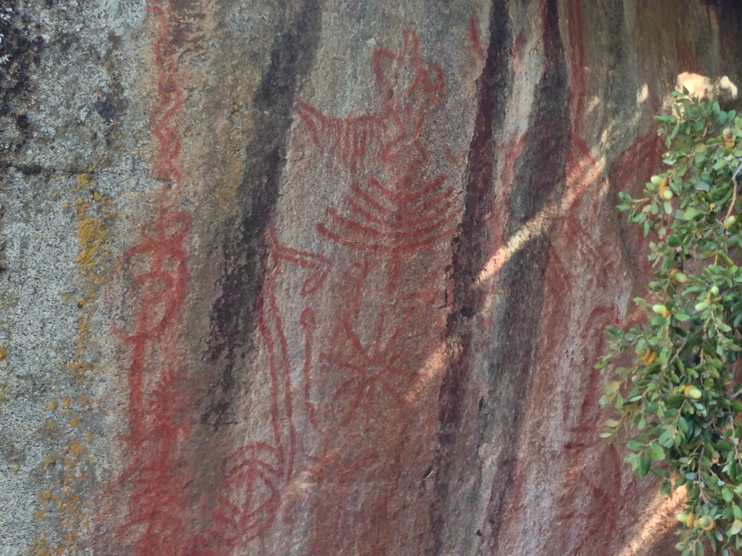
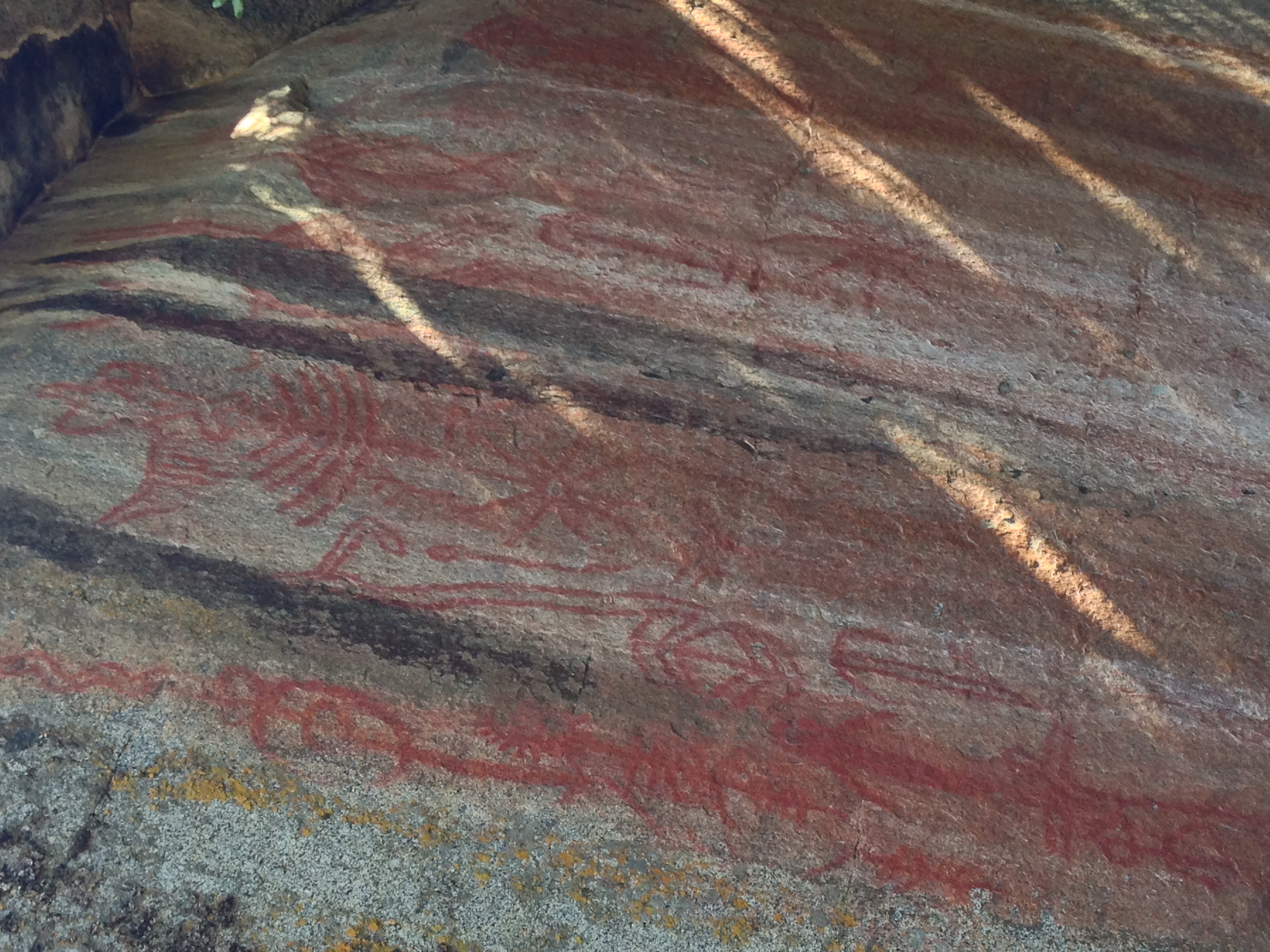
However, it’s not just a rock – it’s a series of rocks, and is an area that Native Americans – particularly the Potwisha lived in as early as 1350 A.D. This area isn’t just a point of archeological curiosity: it’s also the best – and easiest place in the park to see Native American pictographs. (Remember, pictographs are painted on the rock, whereas petroglyphs are carved into the rock). Yes, hidden away on the dark side of the rock are the vibrant red Potwisha pictographs that are pictured above. In addition to the pictographs, there are also several well-preserved morteros in another nearby rock. Why are these things a secret or an adventure? Well, for starters, as I noted above, this area isn’t well publicized by the Park Service. Second, all of these things – pictographs, morteros – can’t be seen from the road. All that can be seen from the road is the Park Service sign for Hospital Rock. This is why it always pays to stop, get out, and explore, irrespective of whether an adventure is obvious or not.
Directions: Hospital Rock is located directly off of the Generals Highway in the Southern portion of the park. It is seven miles east from the Ash Meadows Entrance (off of Highway 198). However, the easiest way to find Hospital Rock is to look for the Buckeye Flat campground turnoff; as the rock is right next to the campground access road. The picnic/parking area is on the West side of the General’s Highway, and the actual rock itself is on the East side, next to the Buckeye Flat road. If you are parking in the picnic area, take care crossing the road, and follow the trail to the rock, where you will be able to see the pictographs. Directly across the Buckeye Flat road are the morteros, and a National Park Service interpretive panel. The total distance of such a walk is no more than .1 miles total and is accessible to all.
Final Fact about the Area that May Only Interest Me: The rock received its name after John Swanson injured his leg while exploring the giant forest and was treated at the rock by local Native Americans.