Cottonwood Springs to Mastodon Peak

Cottonwood Springs to Mastodon Peak

Joshua Tree National Park is known for one thing, and one thing only: rock climbing. This is a good thing: there are many great routes in the park for climbing. As I have climbed there many times, and have recommended it to many people, there is no way I could complain about that association. However, there’s a lot more than just climbing going on at Joshua Tree. There’s excellent stargazing; excellent spring blooms; and excellent hikes, both day, and multi-day. One of the shortest and the most popular hikes in the park is the hike from Cottonwood Springs to Mastodon Peak. There are two ways to do this hike: first, as a loop trail from the Campground (“the Mastodon Peak Loop”) or as part of the longer hike to Lost Palms Oasis. The loop trail is 2.6 miles long roundtrip; and if you add the Mastodon Peak section of trail to the Lost Palms Oasis hike, you are left with a hike that is 8.2 miles roundtrip.

Smugglers Cove Olive Grove and Ranch

Smugglers Cove Olive Grove and Ranch

The prime example is the olive grove that sits directly off the Smugglers Road trail about .1 miles away from Smugglers Cove. Olive Trees, while beautiful, are by no means native to the island; and were planted over a hundred years ago in order to harvest the fruit for commercial purposes. Today, the groves of trees are still standing outside Smugglers Cove in their orderly, neat rows, waiting for a non-existent harvest. While I’m not usually one to celebrate invasive species in National Parks, in this case I’ll make an exception. There’s something about these old trees waiting on the shore of a now-empty island that stimulates one’s imagination while hiking. On a hot, summer day it’s easy to imagine that you have left California, and are hiking one of the Mediterranean islands near Spain; or are in an empty part of the Iberian Peninsula. However, if the scenery doesn’t remind you of Europe, there’s plenty of other ideas that could sprout in your imagination as you pass through the grove. And, even if you don’t imagine anything as the wind whispers to you as it passes through the branches of the grove, the grove is a great spot to sit on either your decent or ascent from Smugglers Cove, as it provides some much needed shade on the hike from Scorpion Ranch to Smugglers Cove.

Abandoned Oil Well, Santa Cruz Island

Abandoned Oil Well, Santa Cruz Island

ast week, I mentioned what I think is the best hike in Southern California – the Scorpion Landing to Smugglers Cove trail on Santa Cruz Island. Even though I listed about twenty gazillion good reasons in the limited space I had about why that hike was the best hike in Southern California, I have some follow up points about why this hike is the best in Southern California. The first of these bonus tips is this: if you have the time, and the energy, there are some interesting ruins along the trail that are quite accessible, and more than a little mysterious. The largest set of these ruins is the ruined oil well that is just off the Smugglers Road, two miles up the trail from Scorpion Landing.

2012 Orionid Meteor Shower, 10/17/12-10/25/12

As I always say with all these astral phenomena, unless you've been living on the moon​, you know that something is going on in the sky. This weekend, its the Orionid Meteor Shower, which according to all reports, is particularly strong and visible this year. It may have already caused a giant fireball that was visible in Northern California - or not. Perhaps that giant fireball was the work of batsquatch, lemurians, or just plain old 2012 apocalypse-time-hijinx. In any case, the best time to view the shower - wherever you are in North America, will be anytime after 11:00 p.m. PST, October 20, 2012 (Saturday) to dawn on October 21, 2012 (Sunday). You can rest assured that I'll be out watching, and you should be too - should be a lot of fun. And, if you're interested in science, help NASA out, and check out this app here. More info: here, here, and here.

Scorpion Ranch to Smugglers Cove

Scorpion Ranch to Smugglers Cove

Southern California has a lot of places to hike. From the desert; to the beach; to the mountains; to the high country chaparral; to the seasonal rivers and waterfalls and beyond, there are a lot of places to hike. You don’t need to take my word for it – there’s a plethora of books and blogs out there about hiking, backpacking, and all of the areas that are available to explore. And there should be – there’s so much variety out there, it’s good to get advice not just from one source, but a number of sources. I always tell my friends, and you, my readers not just to take my word for things; but to do your own research and to always do your own exploration, because in my experience, when people do those things, they always make the adventure their own. 

White Mountain

White Mountain

Directions: The trail to White Mountain is located at the end of the aptly named White Mountain Road. I talked about directions to the Schulman Grove last week here, and these directions would get you to the trailhead of White Mountain, as all you have to do is follow White Mountain Road to the end. As I said last week, White Mountain Road from the Schulman Grove on is unpaved, and is sometimes in poor condition due to either snow or ice. While it is not a far distance from the Schulman Grove to the trailhead, chances are that the road conditions will prevent you from arriving there quickly. I would allow forty-five minutes to an hour of driving from the Schulman Grove to the Barcroft Station. Even though this section of the road is short, don’t feel like you’re in a rush – this is an interesting drive, and one with many beautiful things to look at as you head down the road.

Ancient Bristlecone Pine Forest

Although California has its share of natural - and unnatural disasters, it also has some of the greatest biodiversity present on the planet; and some of the most impressive examples of biodiversity are the types of trees present in California. California has the world's tallest tree; and the world's largest tree (the General Sherman). California also has some of the world's oldest trees, Bristlecone Pines, which are also the oldest trees in North America. The largest concentration of Bristlecone Pines can be found in two spots in the White Mountains of California, in the Schulman and Patriarch Groves of the Inyo National Forest. 


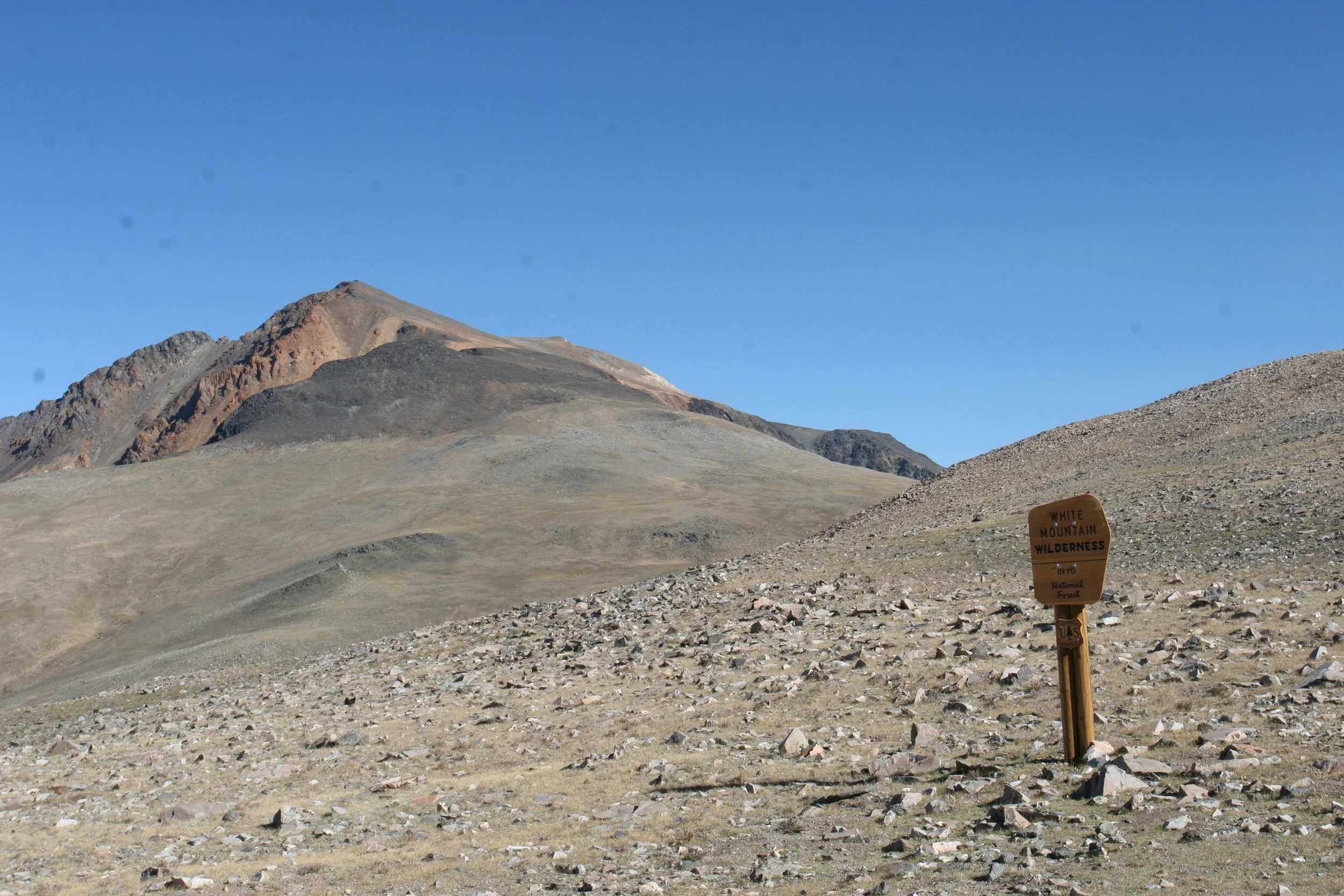
Directions: The Ancient Bristlecone Pine Forest is located in the White Mountains, which is a remote area of California. The Forest Service, which manages the Ancient Bristlecone Pine Forest has provided some great directions here to Schulman Grove. From Schulman Grove, it is another twelve miles on a graded gravel road to Patriarch Grove. Before you go, however, you should know couple things about the White Mountains: 1) While the total distance from Big Pine to the Schulman Grove is only 23 miles, the roads are single-lane, windy mountain roads. This means that even under ideal conditions, it is about an hour drive one way; 2) The White Mountains are high – quite high, over 9,000 feet, topping out at White Mountain, which is over 14,000 feet. A majority of the White Mountain Road is above 6,000 feet, which means that during a large portion of the year, part, or all of the road is inaccessible, as it is covered with snow and ice. In particular, the road from Schulman Grove to Patriarch Grove and beyond to the Barcroft Station is usually inaccessible and unplowed well into June or July of most years. While these conditions are great for snowshoeing or cross country skiing, they are not good for driving; 3) While the White Mountain Road from Schulman Grove to the Patriarch Grove is graded, it is unpaved. The conditions on that road vary depending on the season; and on when the Forest Service has graded/conducted repairs upon it. While it is passable at times in a regular car, at times AWD or 4WD is required. Depending on the season, judge the conditions accordingly before setting out in your car, as the area is quite remote, and does not have cellular coverage.

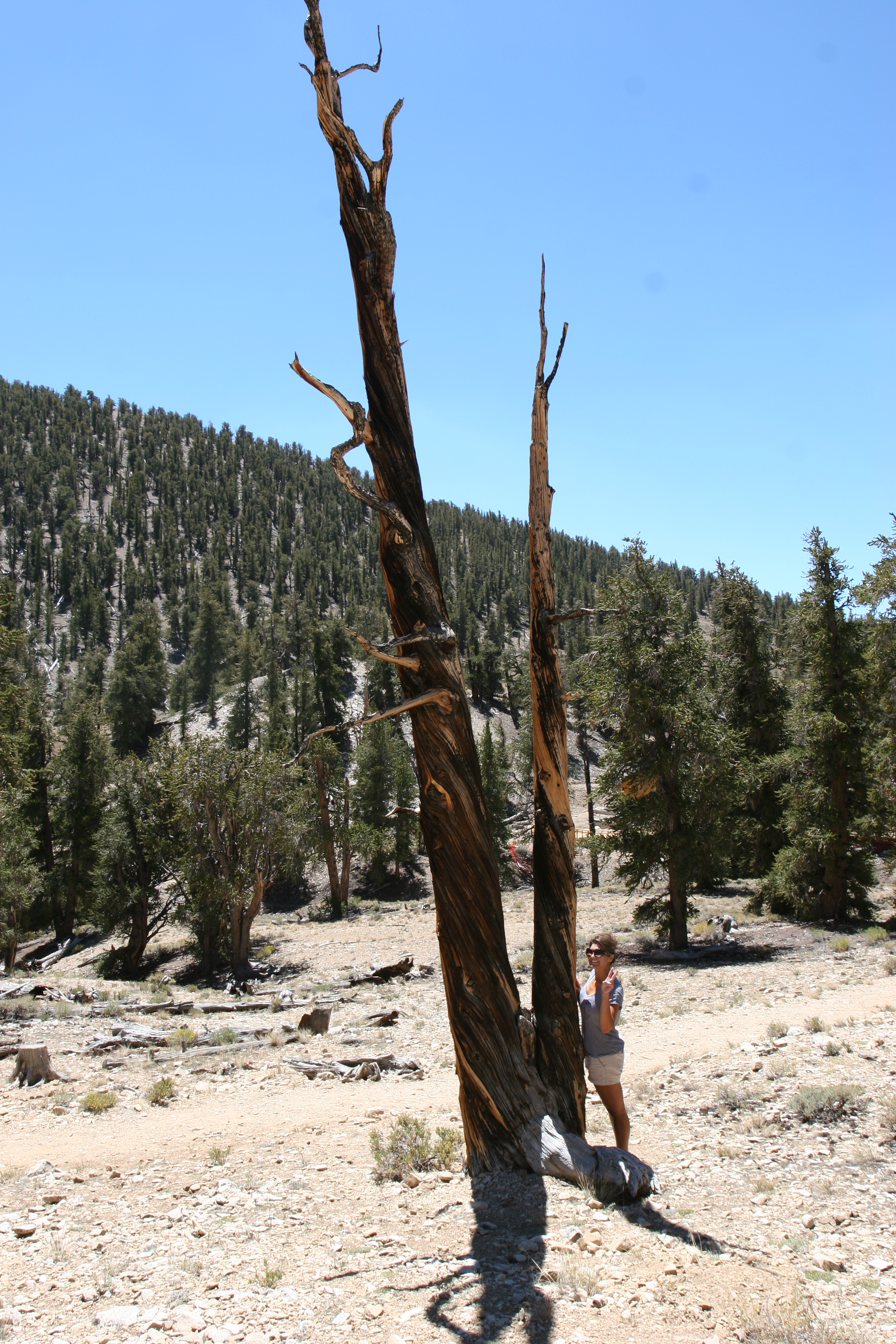
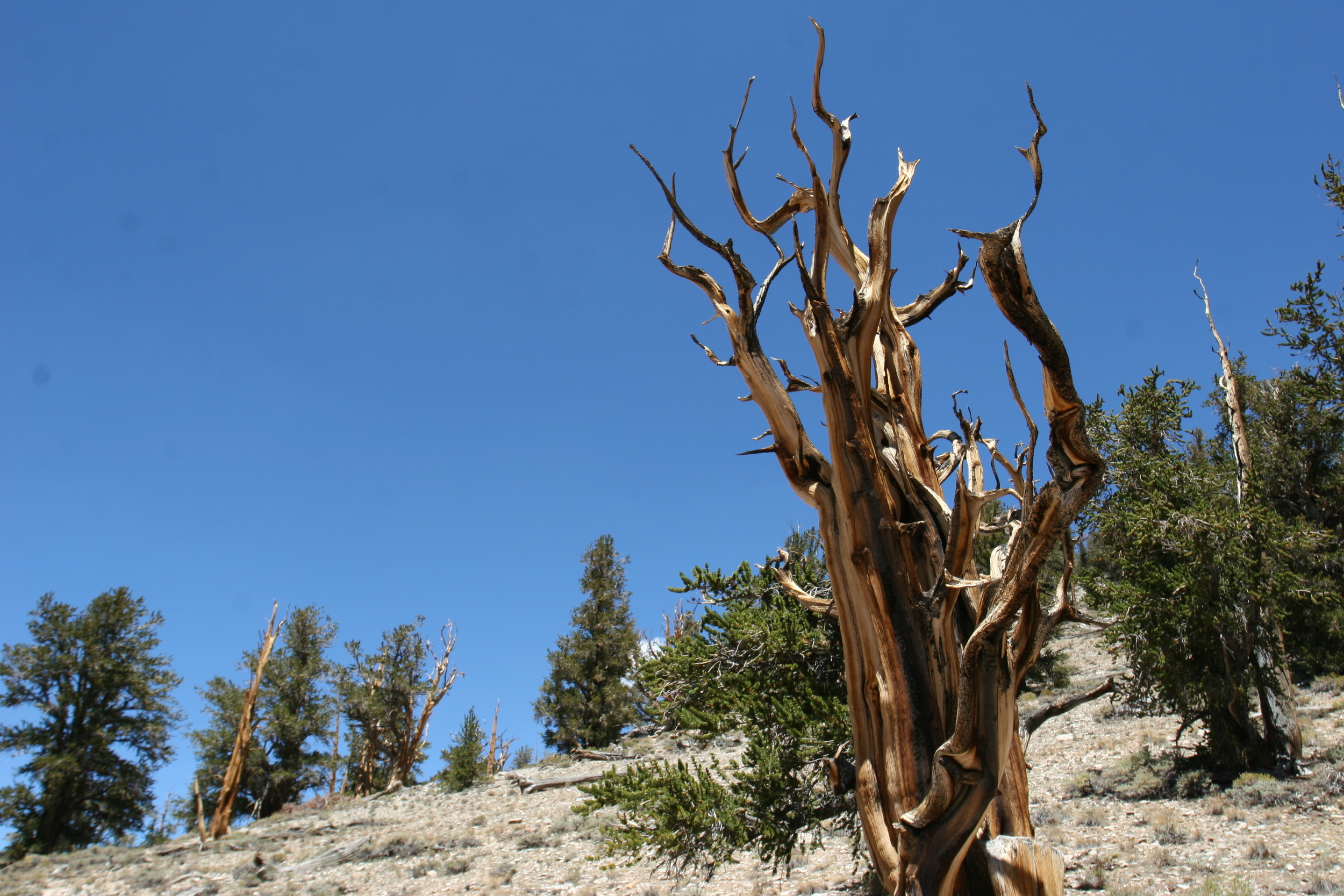
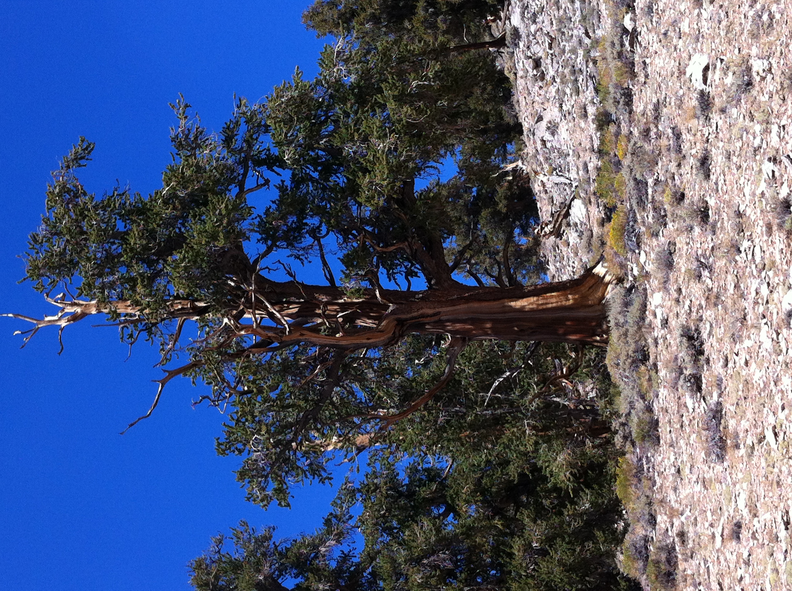
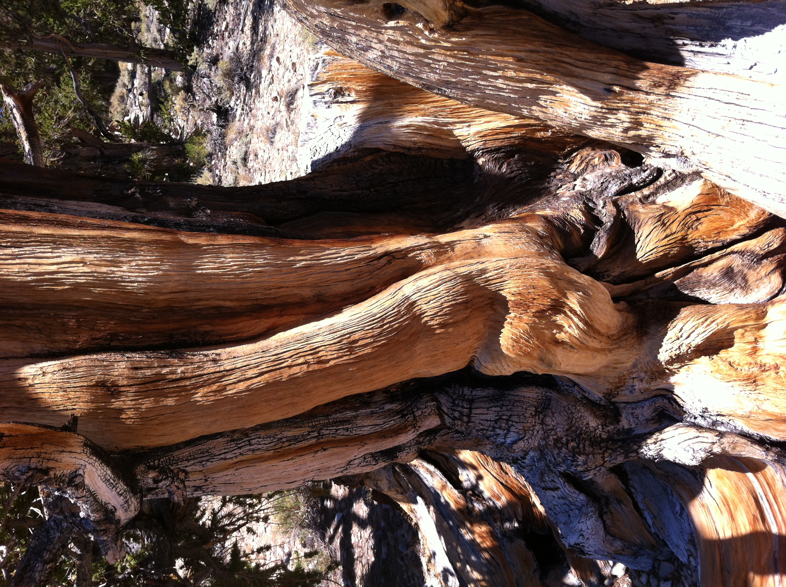
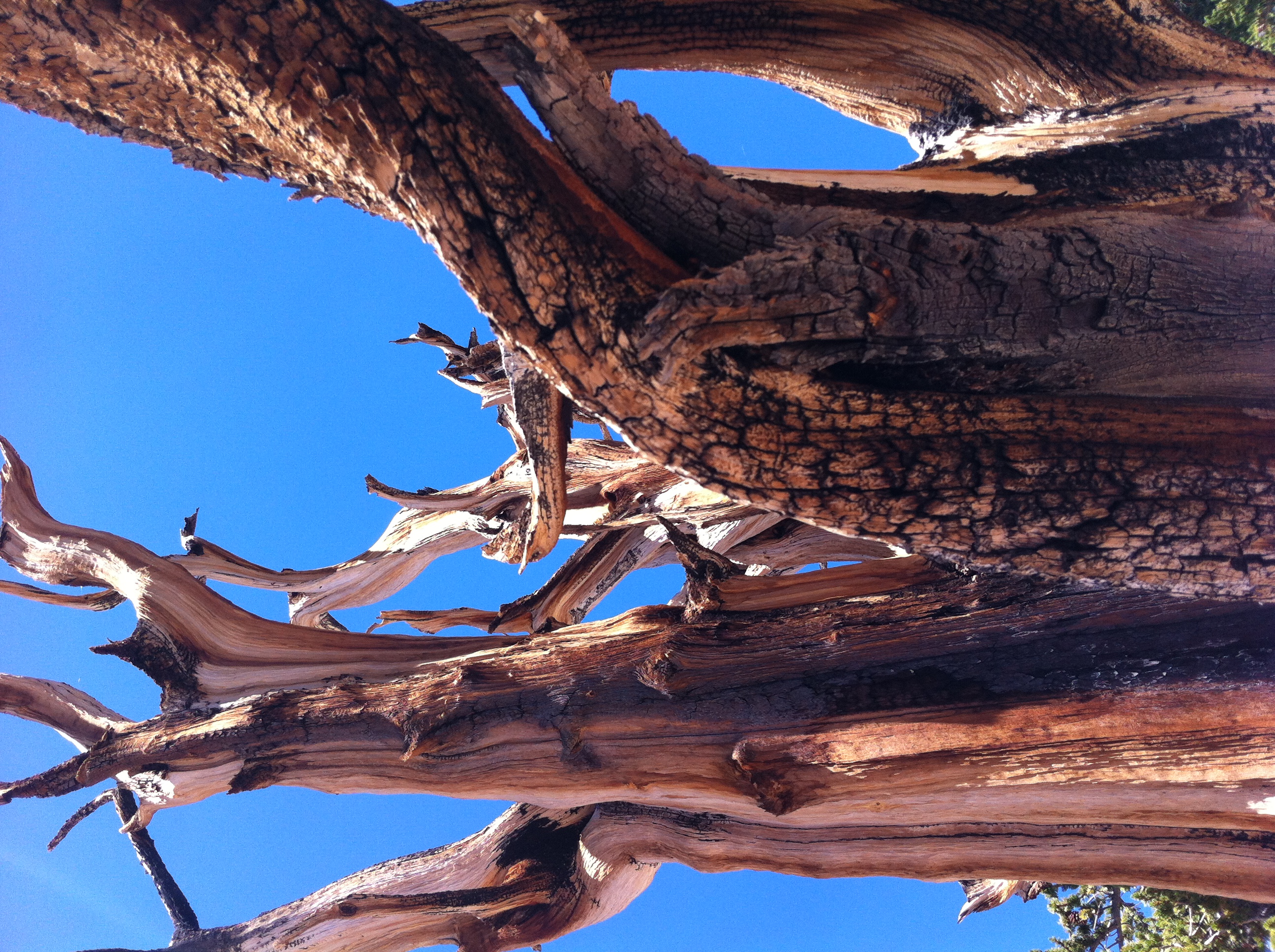
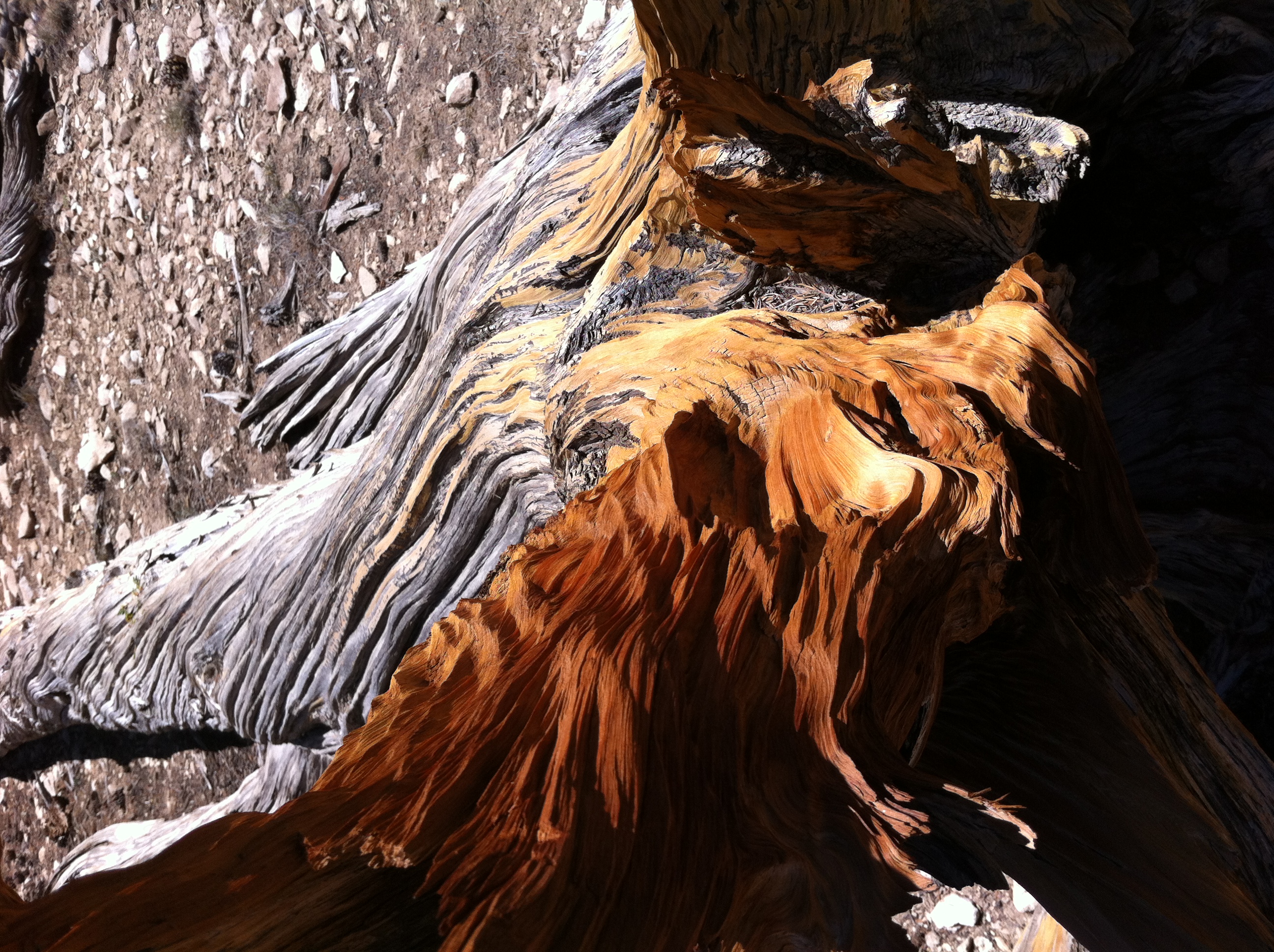
The Schulman Grove has an interpretive trail that winds through some of the Bristlecone Pines, the Methuselah Loop Trail. The trail is named for the oldest bristlecone pine, Methuselah, which is over 4,700 years old. It can be difficult to judge a large amount of time like this, so to put this accomplishment in layman's terms, this tree sprouted while the Egyptians were still constructing the pyramids. This tree has lived through the major events of the human race; and has had to survive the climactic changes that have passed through the White Mountains on a yearly basis, from droughts to storms, as well as insects, fires, and the occasional earthquake. If that isn’t amazing, I’m not sure what is. Then again, if you don’t find it amazing, maybe you don’t like trees – or history – or both.

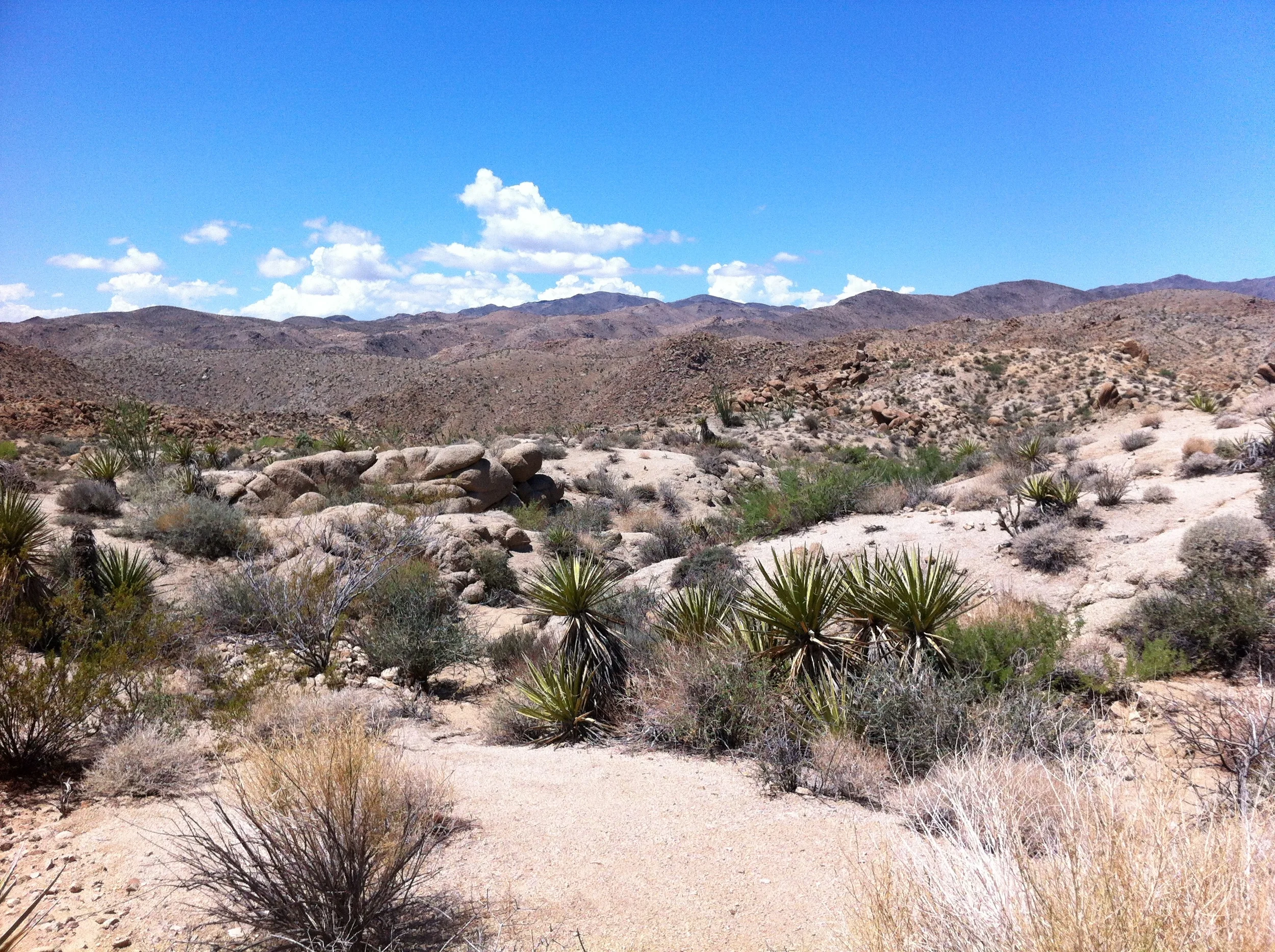
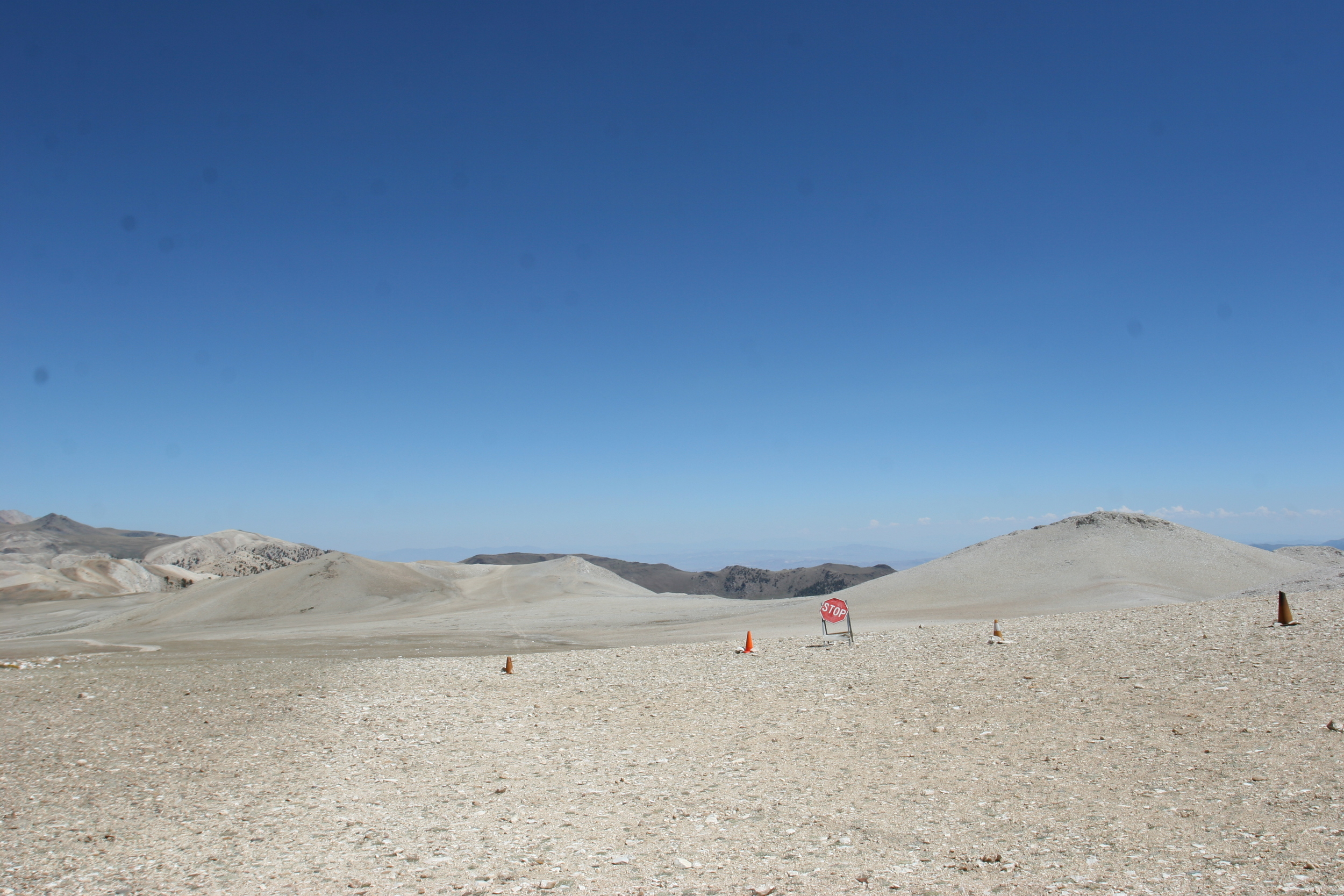
The 4.5 mile long loop trail begins at the Schulman Grove parking lot. Although the trail is relatively flat, with only 800 total feet of elevation gain, it starts at an elevation of just over 10,000 feet. Because of the high elevation, this hike can be difficult for people who have traveled to the Schulman Grove for a day, even though it is not a challenging hike based on the mileage. For purposes of perspective, Big Pine is 3,989 feet elevation; so a day visitor will gain some 6,000 feet in a matter of hours if they head up to the Schulman Grove by car.  In my opinion, even if you do not want to hike the entirety of the trail, you should hike a portion of the trail, as it allows you to experience the desolation that these trees have survived and thrived in for thousands of years; and it also allows you to get up close and personal with some of the living organisms on the planet, meaning that you can see the what the effects are of hundreds of years water, wind, and sun on the trees. For visitors that have the time, the Patriarch Grove is located twelve miles to the North of Schulman Grove on the unpaved portion of the White Rim Road. 

Trivia. Out of the three unique trees in California - tallest, oldest, and largest, only the General Sherman (the largest) is known and readily accessible to the public. The tallest tree is unmarked, and hidden somewhere in Humboldt State Park, and Methuselah, the oldest bristlecone pine has also received the same treatment from the Forest Service. 

Poetry about Bristlecone Pines (Not written by me).  I grow in dolomite soil/facing harsh elements./My thoughts live for thirty years/with minimal nutrients./Your wild fires will consume me,/but I grow in spite of you./My bark is decimated,/Yet I will weather it through./Strong winds spread innuendos/of weakness, sickness and death./But winds do not contemplate/what inspires my current breath./The forest seems so clueless/in assuming I am dead./I am not dead already,/I am already dead.