Start in darkness. End in darkness. This is what I was thinking at 11:49 p.m. on March 14, 2015. At that point, David Wherry and I had been mountaineering for almost twenty-four hours straight. Minutes before, we had exchanged a few words about how it would be nice to be back at the car before the next day began at 12:01 a.m.; but despite this conversation, we are still shambling along at a crawl into the Badwater Basin our normally powerful gaits reduced to pitiful zombie-esqe shuffling. My legs hurt. My back hurt; and as of 11:32 p.m., my feet had finally started hurting. I felt more dead than alive. At that moment, a mere quarter mile from the car, I was thinking of nothing but two things: “Start in darkness; end in darkness” and its “not mountaineering until someone draws blood”. What we had been doing was mountaineering; there was no doubt in my mind about that. As we finally reached the car, there was one thing I understood fully though: the Shorty’s Well Route was indeed the “impossible hike” and the hardest mountaineering route in North America.
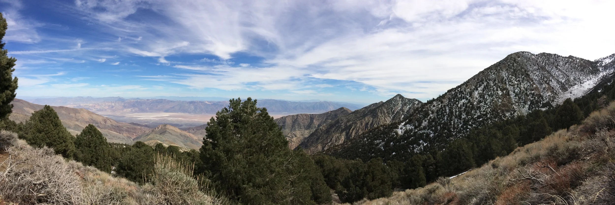
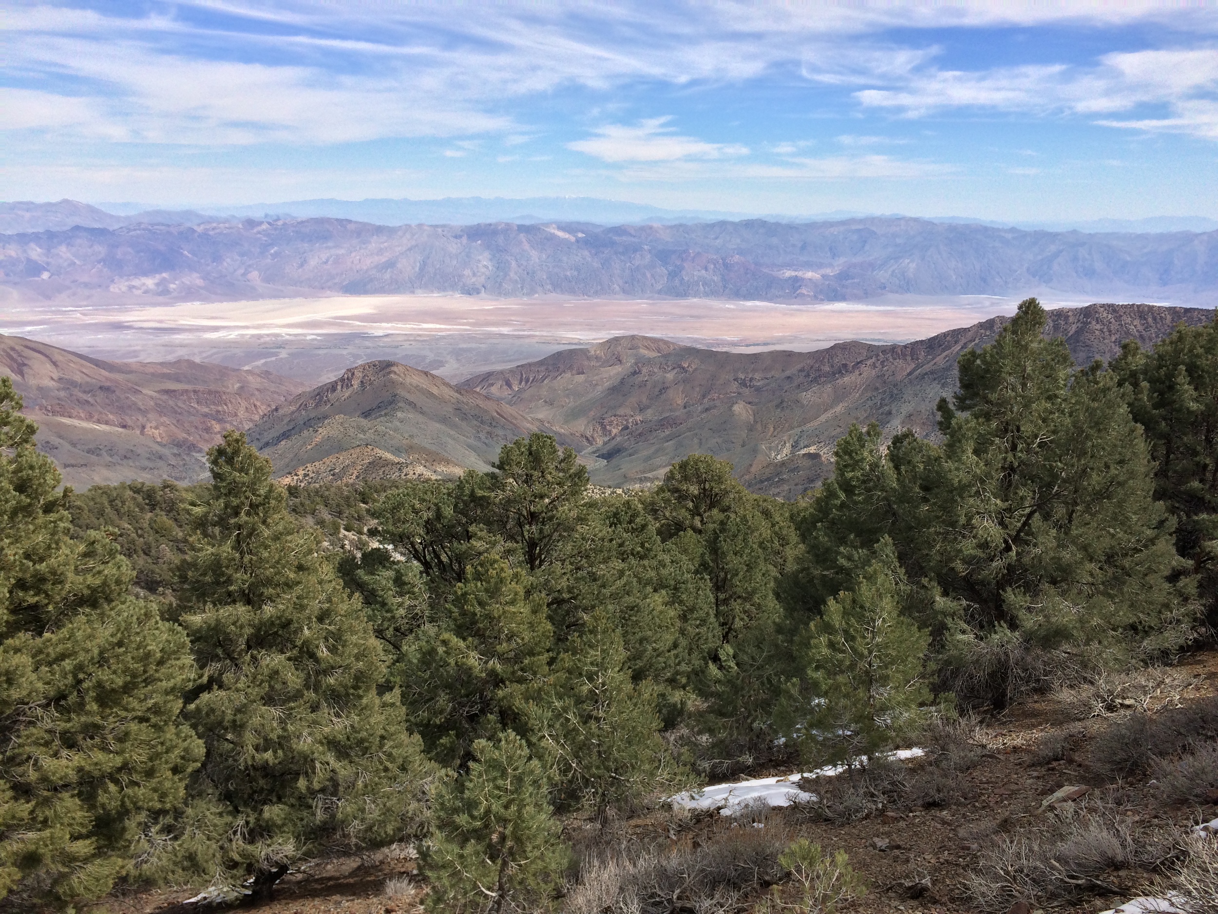
Telescope Peak, March 2015, as seen from the Shorty's Well Route
Before I discuss our climb further, let me talk about the route for a minute, because although it is the impossible hike and the hardest mountaineering route in North America, it is not a well-known route like Liberty Ridge on Mount Rainier; or the Casaval Ridge Route on Mount Shasta. The Shorty’s Well Route is located in Death Valley, California. The route departs from the Badwater Basin – yes, that Badwater – the lowest point in North America at -282 feet. While the route does not begin from Badwater itself, it begins from a point sufficiently close to Badwater, at a mere -262 feet below sea level. From there, the route ascends up Hanaupah Canyon to the summit of Telescope Peak at 11,043 feet. This is the first reason the route is considered the hardest: over the course of the ascent, a mountaineer will gain 11,305 feet of elevation.
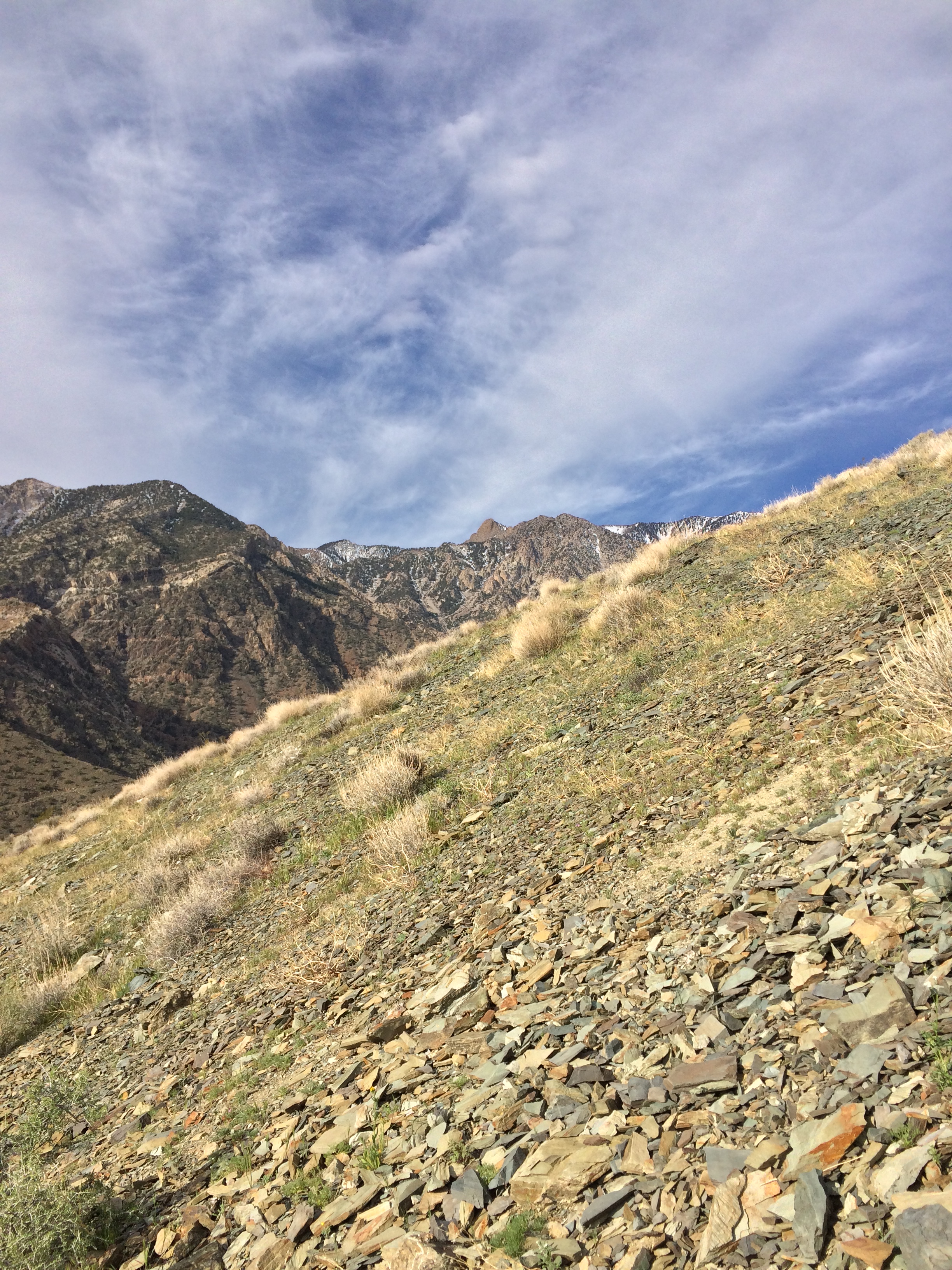
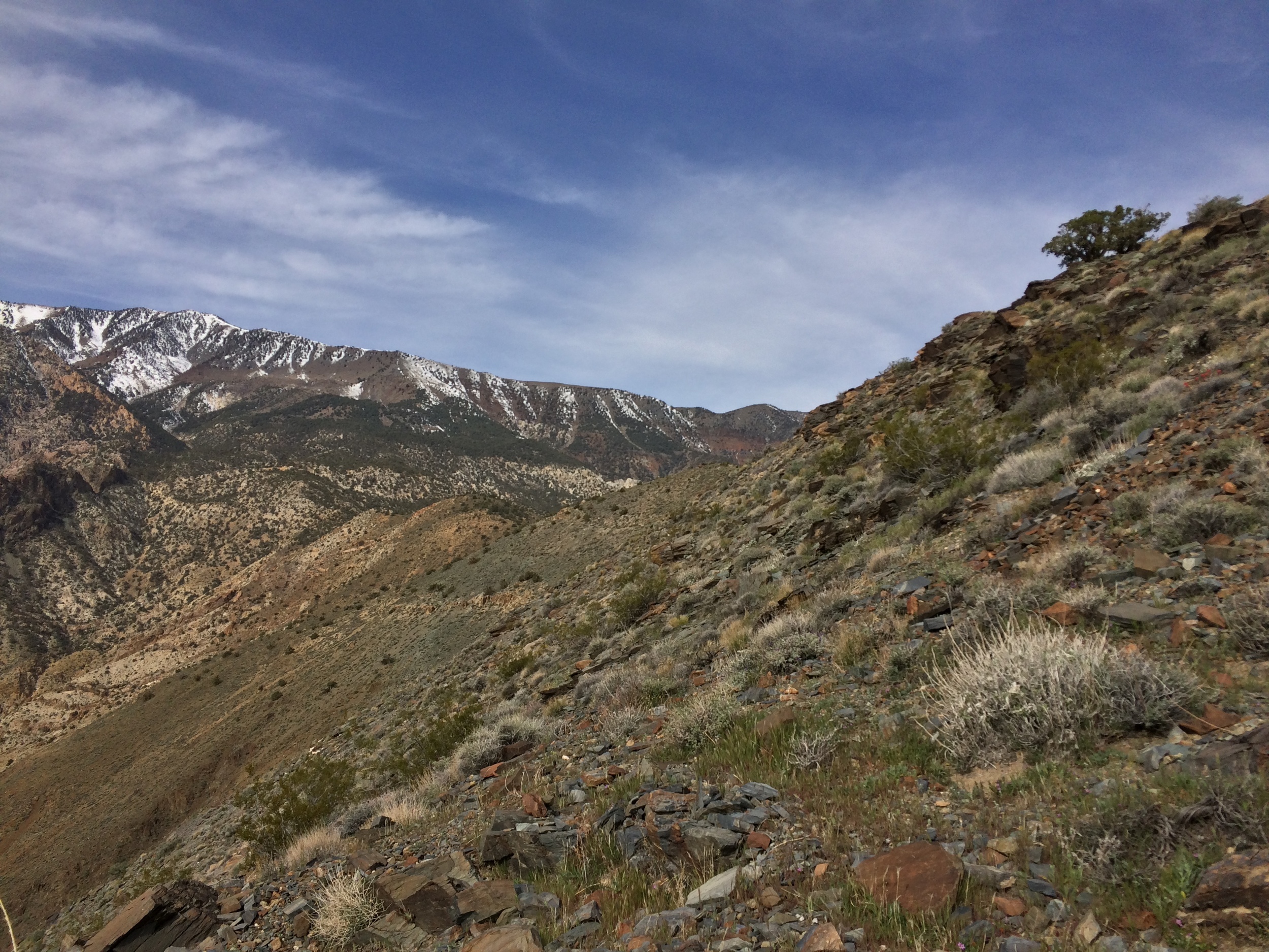
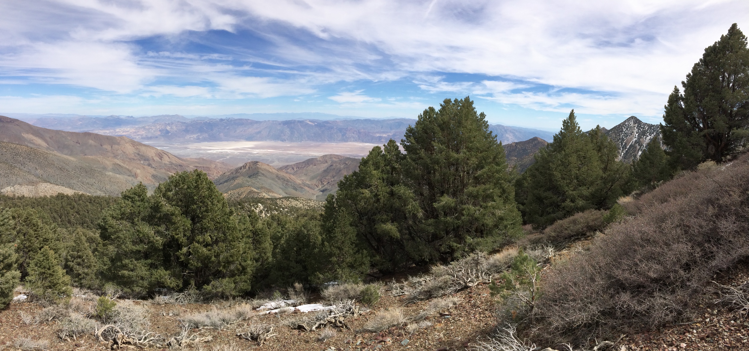
Ascending along the ridgeline toward Telescope Peak along the Shorty's Well Route, March 2015
Numbers, like statistics mean nothing without context. While mountaineers routinely gain large amounts of elevation and lose them through the course of a climb; most gain/loss figures for North American mountains are substantially lower. For example – the most popular and highest mountain in the lower forty-eight states, Mount Whitney, has a substantially lower amount of elevation gained. The main Mount Whitney Trail departs from the Whitney Portal at 8,360 feet and ascends to the summit of Mount Whitney at 14,505 feet. This means that mountaineers climbing Mount Whitney gain 6,145 feet of elevation – 5,160 feet less than the Shorty’s Well Route. Similarly, mountaineers attempting Mount Rainier from Paradise via the Disappointment Cleaver Route start at 5,400 feet of elevation and ascend to the summit of Mount Rainier at 14,409 feet for a gain of 9,009 feet of elevation – some 2,296 feet less than the Shorty’s Well Route.
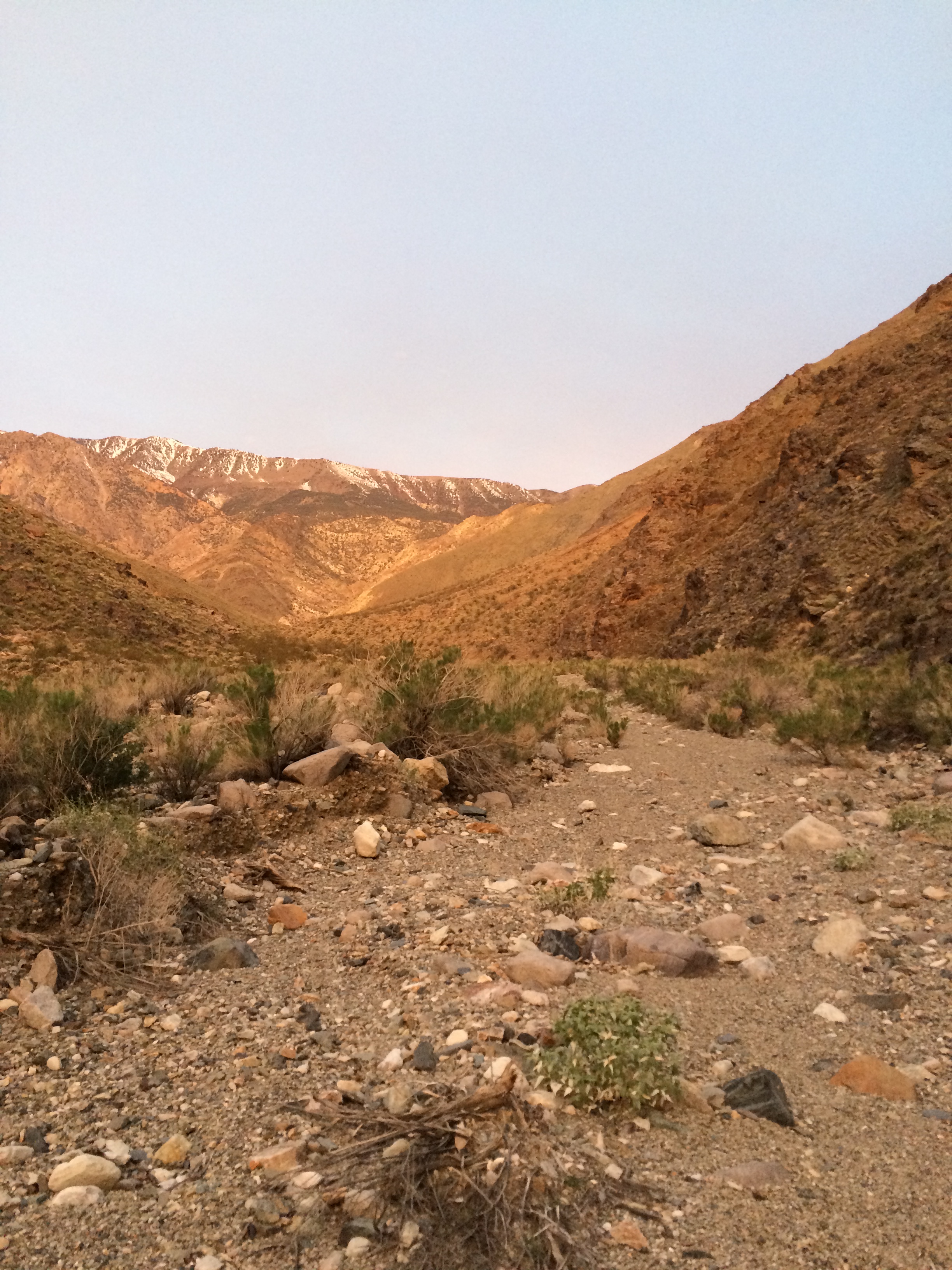
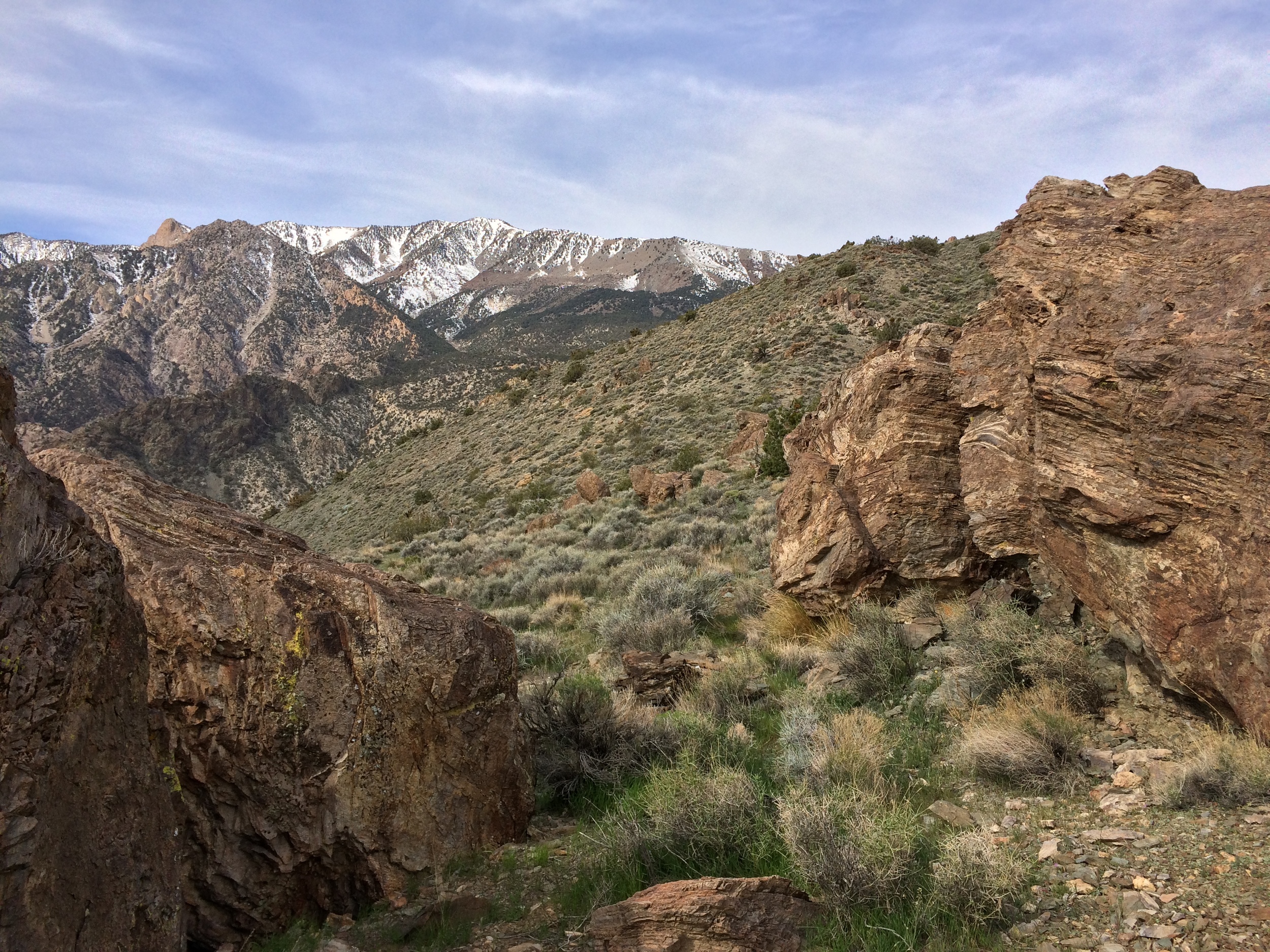
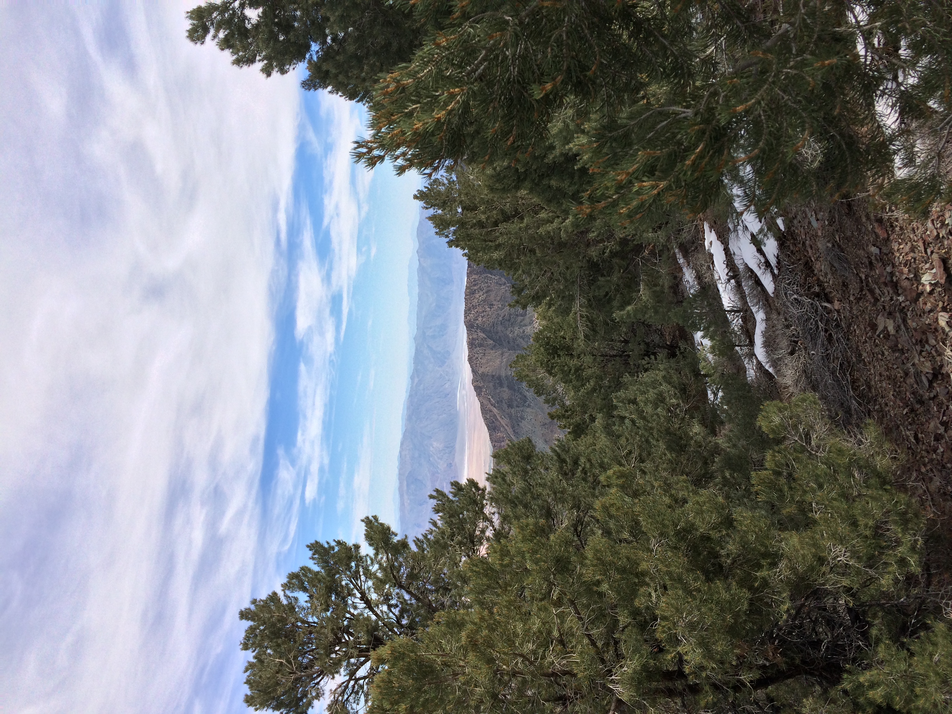
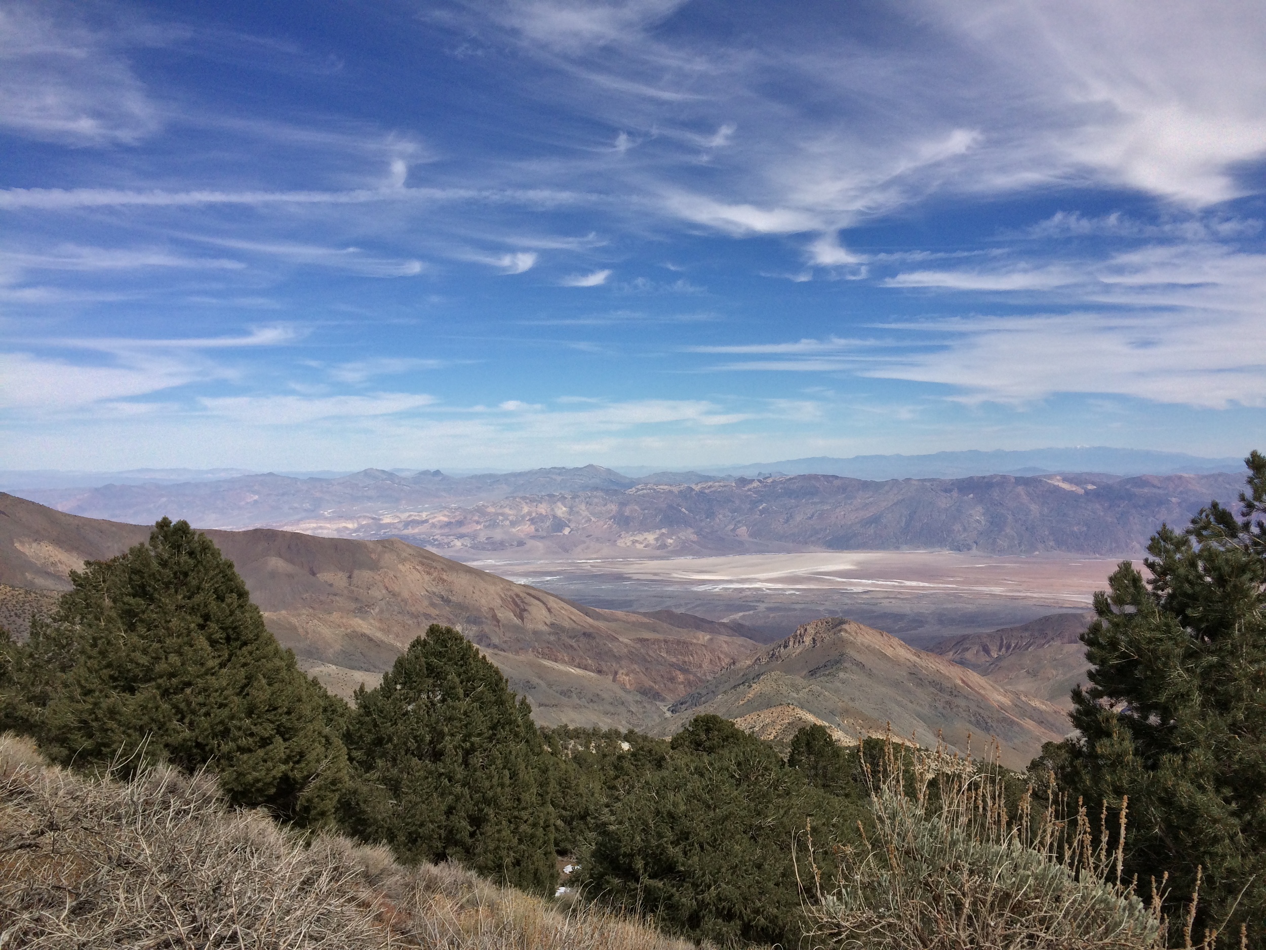
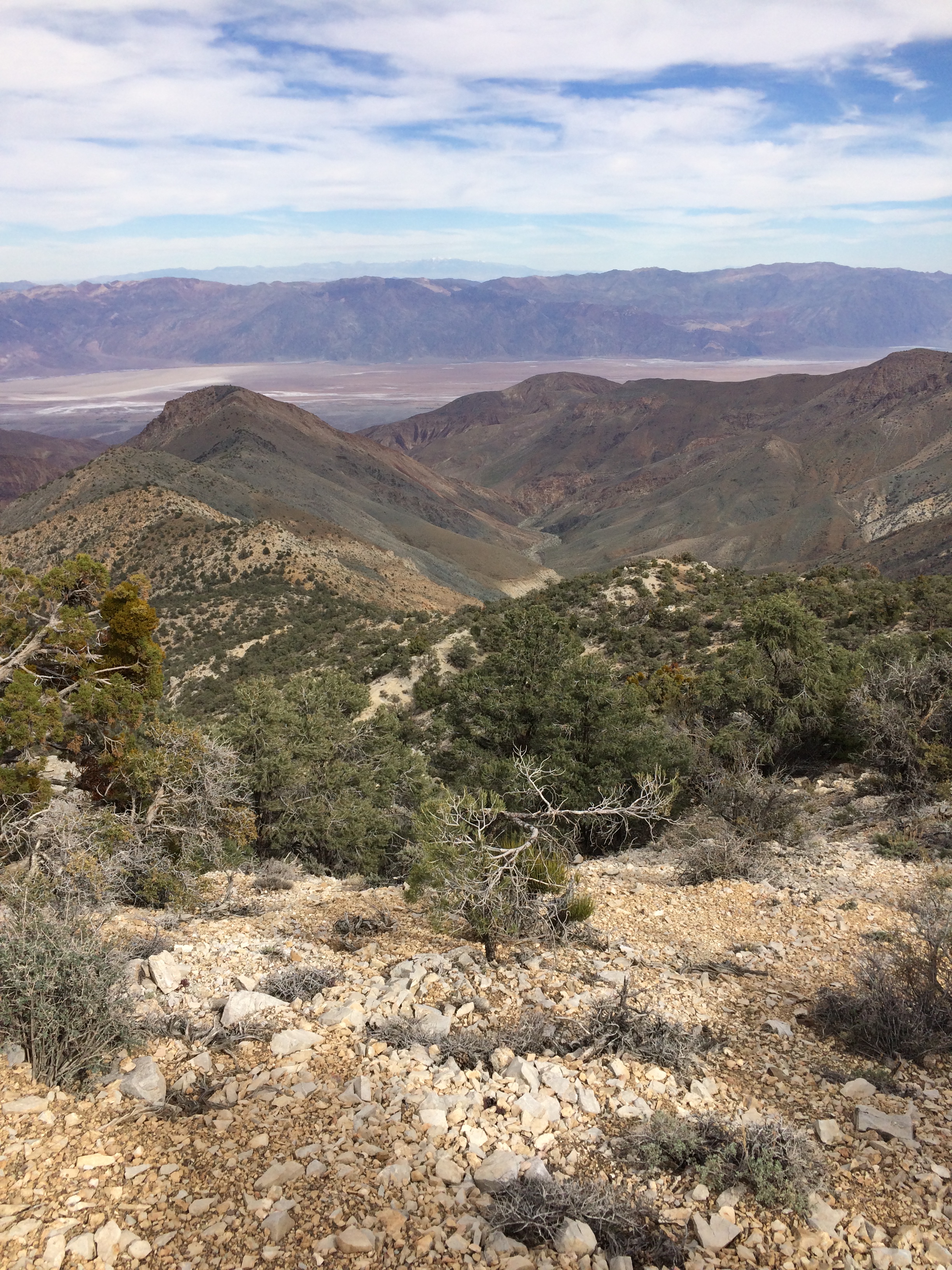
Death Valley, and Hanaupah Canyon, as seen from the Shorty's Well Route, March 2015
If the elevation gain (and corresponding loss over the climb) wasn’t daunting enough, the Shorty’s Well Route has a roundtrip distance that is in dispute. And when I say, “in dispute”, I mean that the total distance is in dispute only to a certain extent. Most people agree that, at a minimum, the distance is at least 15.6 miles – one way, leaving the minimum roundtrip route distance at 31.2 miles. Again, numbers mean nothing without context. The Mount Whitney Trail is 22 miles roundtrip; and the Disappointment Cleaver Route is 13 miles roundtrip – distances that are at least 9 and 18 miles shorter than the Shorty’s Well Route.
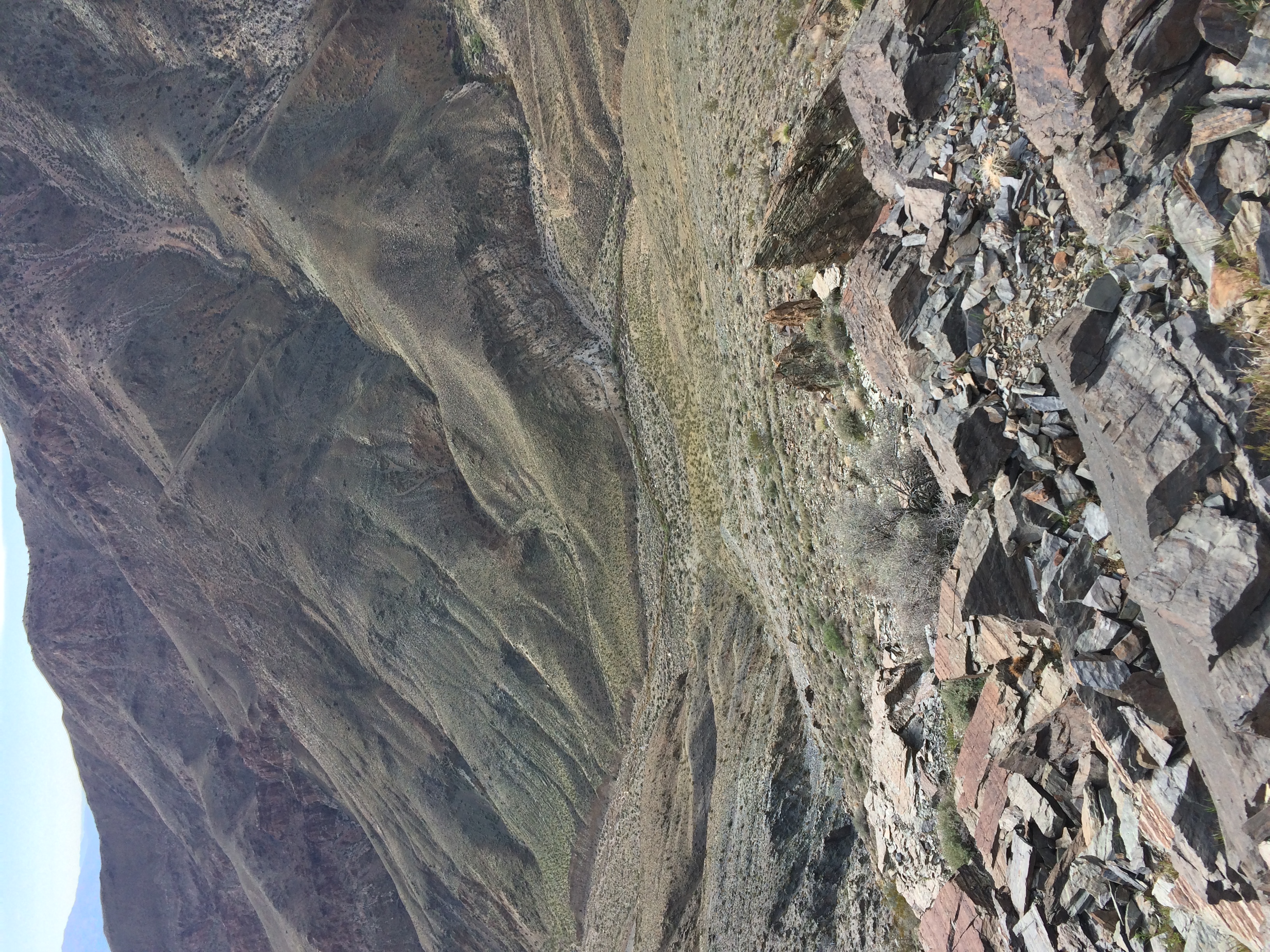
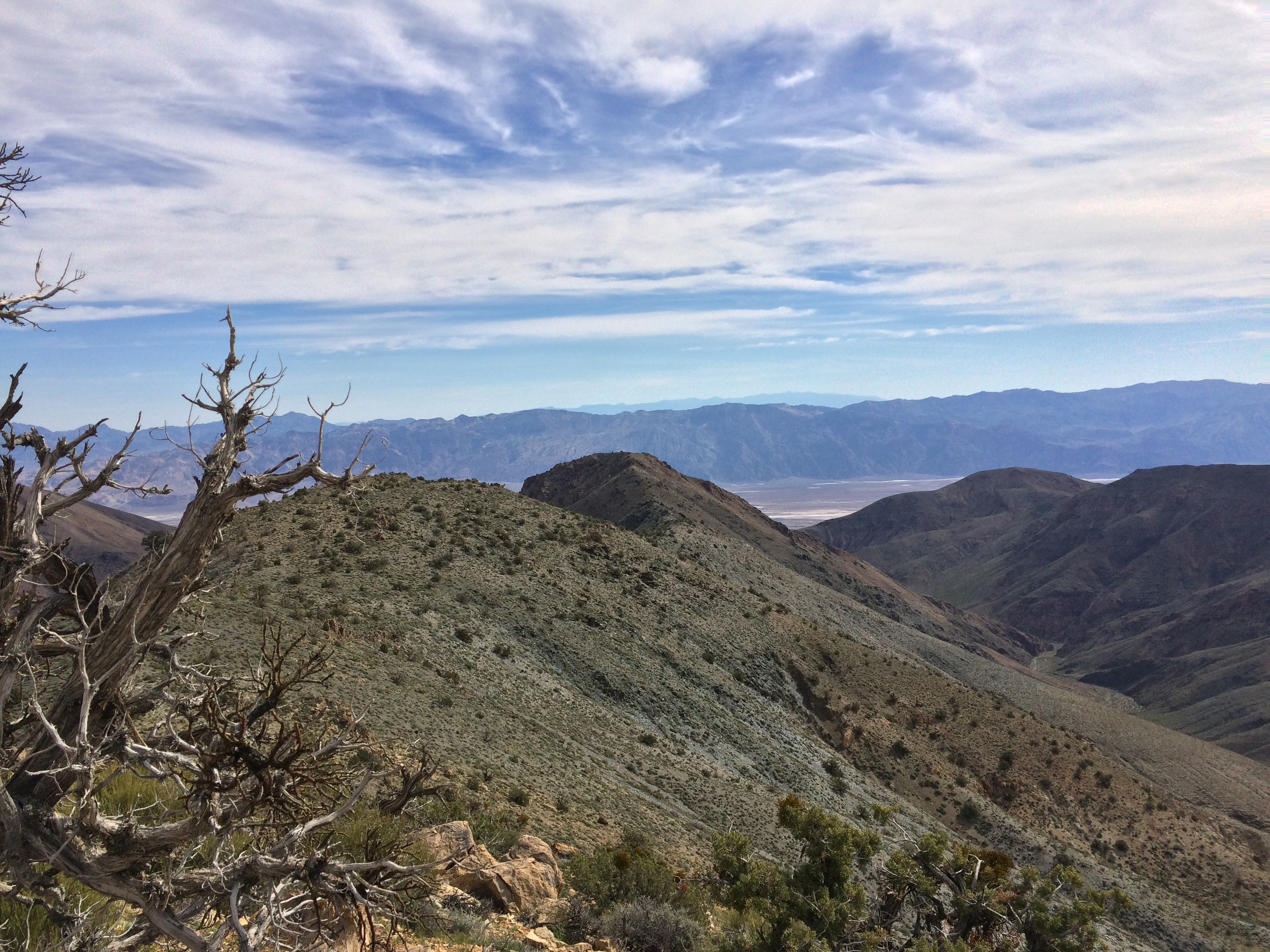
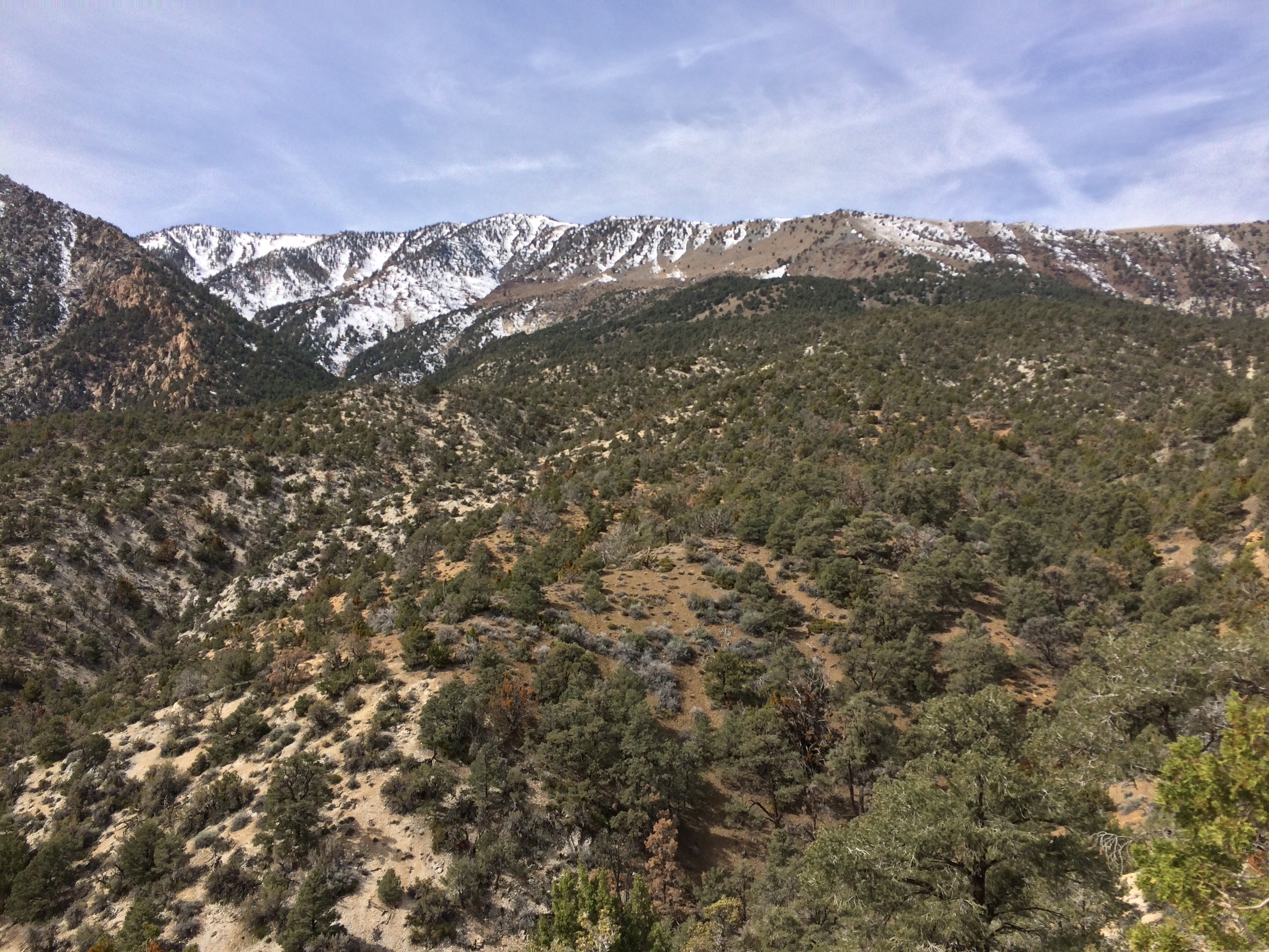
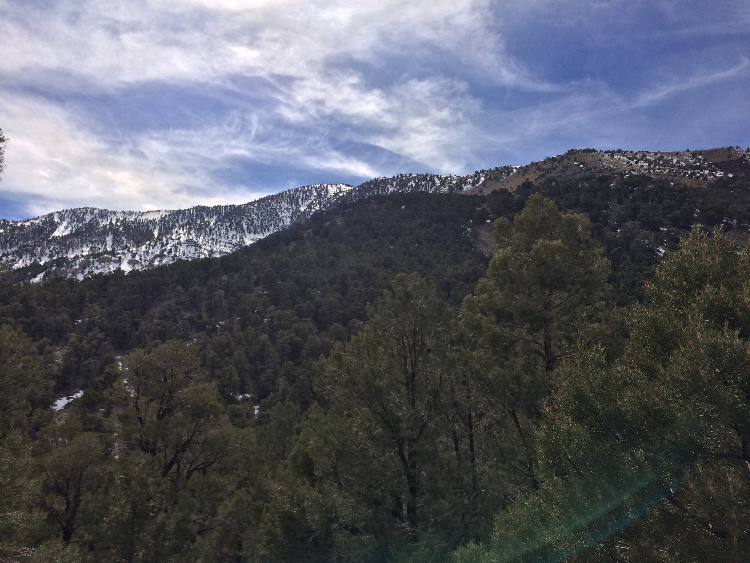
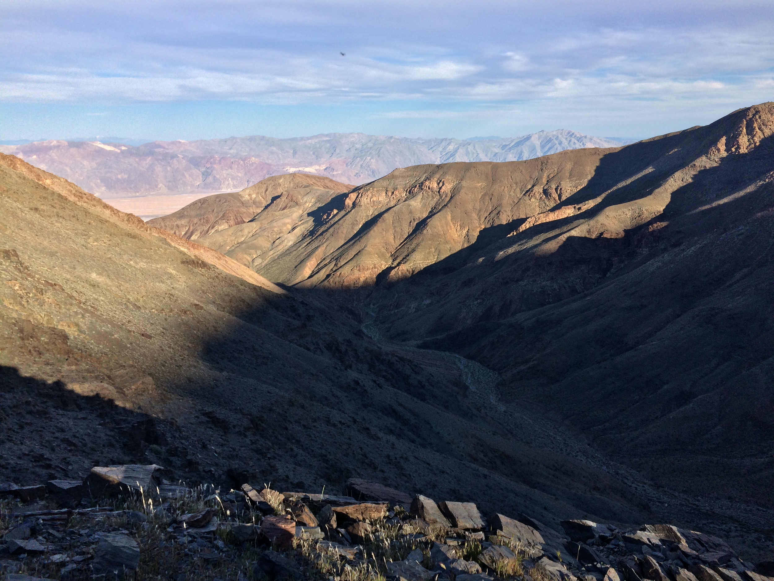
Panamint Range, Death Valley National Park, March 2015
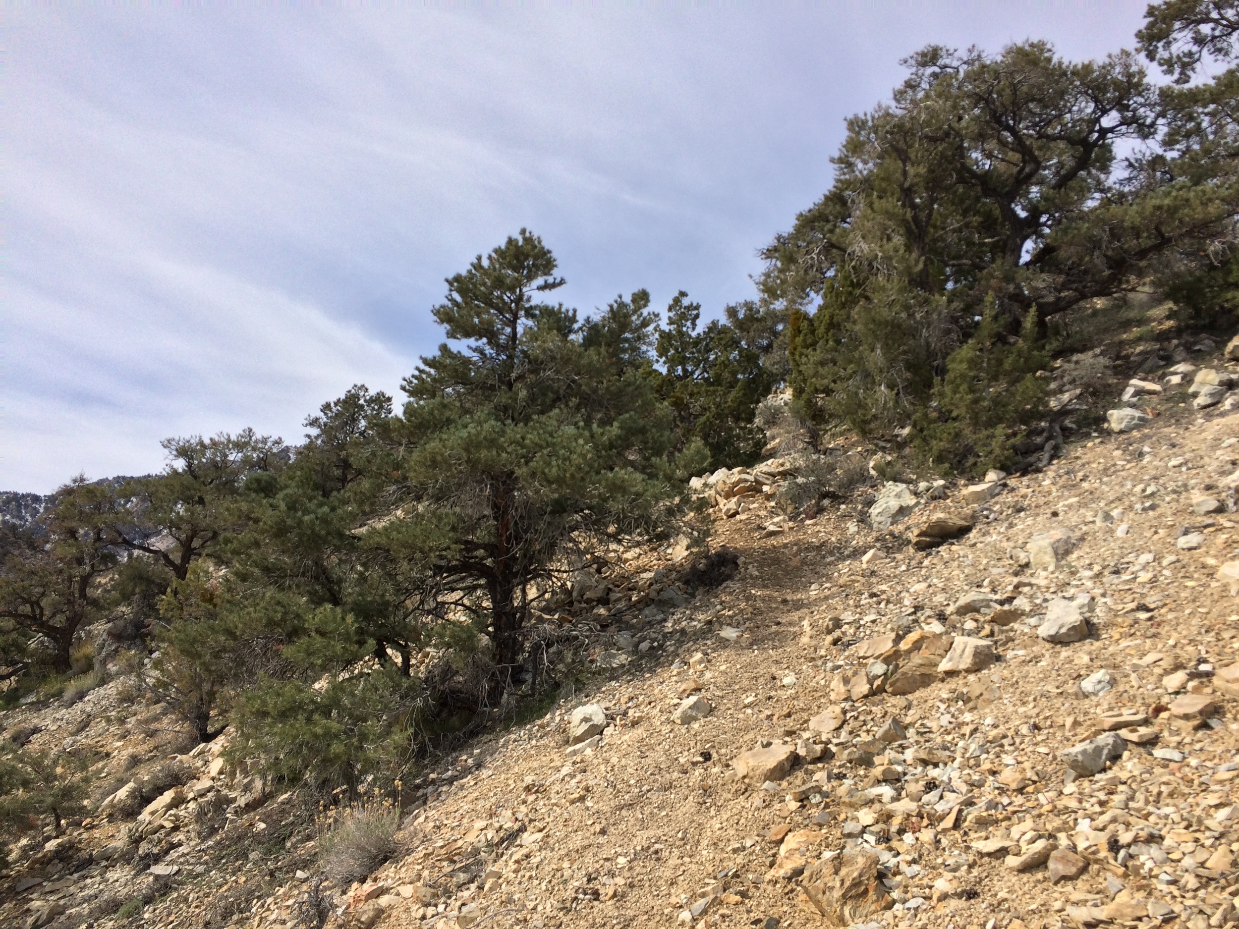
In addition to the distance, the Shorty’s Well Route features some unique problems that more popular, mainstream mountaineering routes do not. First, there is no trail. While the Mount Whitney Trail is routinely climbed in a day (I myself have done it multiple times), one of the reasons that it is possible is because there is a straightforward route to follow. The Shorty’s Well Route does not have a trail at all. Nothing has been established; and nothing will likely ever be established. As such, the distance figures quoted above are estimates, not facts, as each mountaineer’s climb of the route will have variations, something that does not happen on a route like the Mount Whitney Trail. The route is also not like the Disappointment Cleaver route on Mount Rainier, which is climbed by hordes of people yearly, flagged out by guide services, and virtually impossible to lose. In contrast, the Shorty’s Well Route is cross country, traveled by few people yearly; and unmarked in almost all spots. What route markings that exist are to put it mildly, somewhat confusing, and in some cases, inaccurate. Therefore, unlike almost any other route, mountaineers attempting the Shorty’s Well Route must continually – and almost constantly routefind.
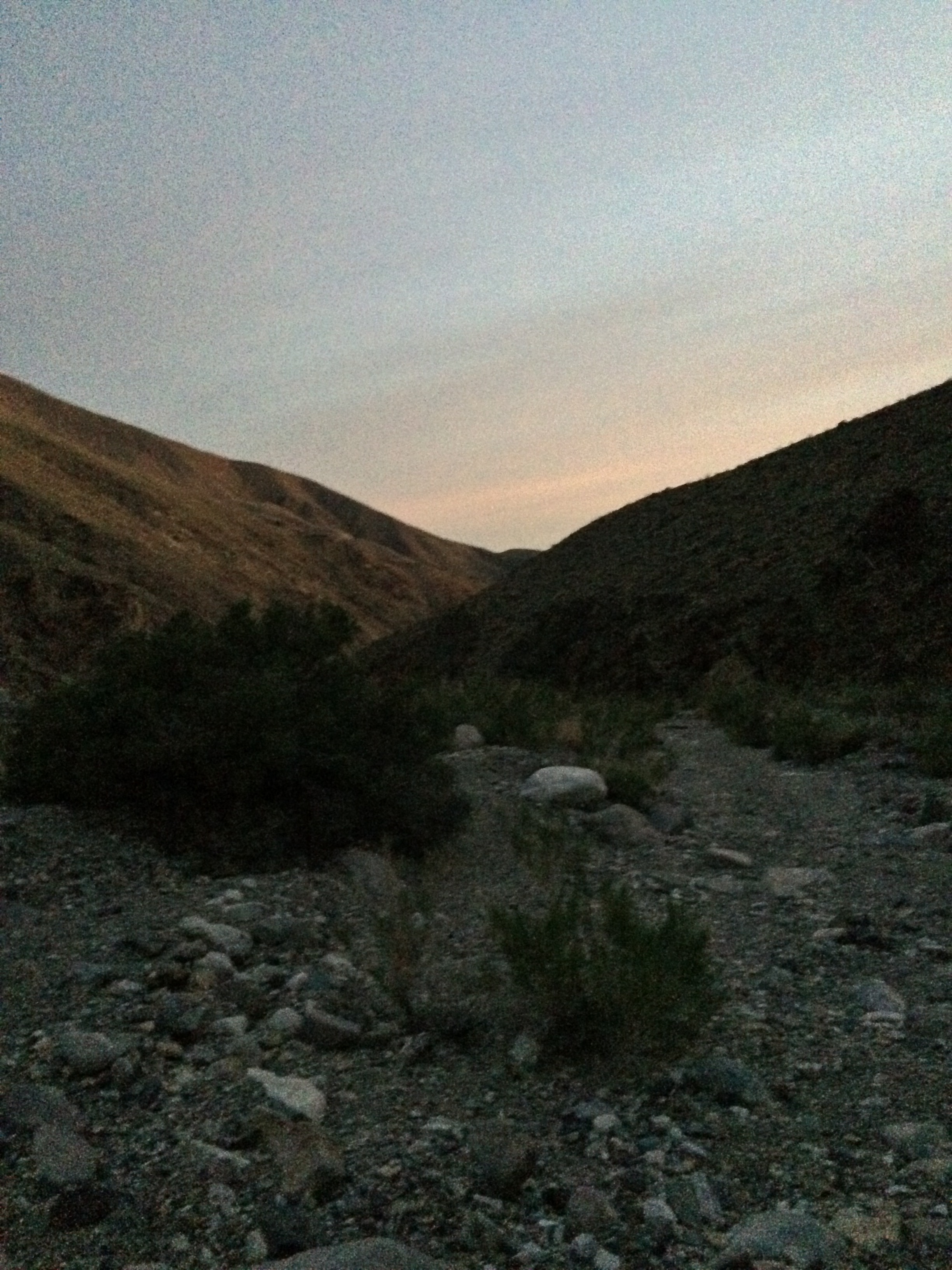
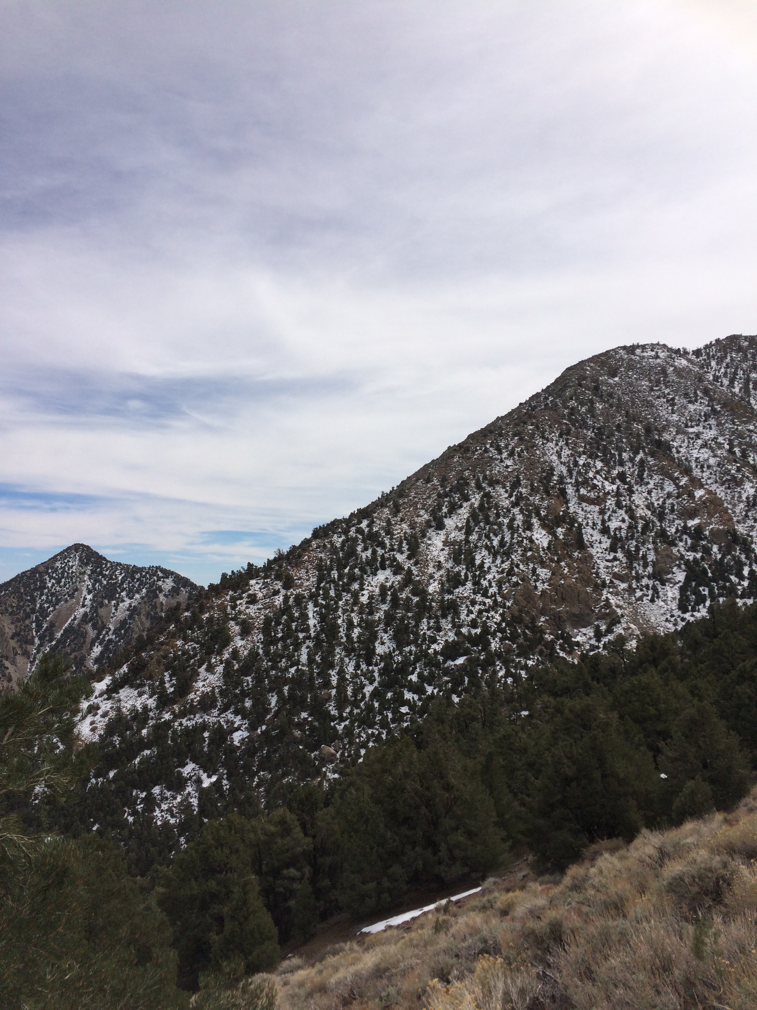
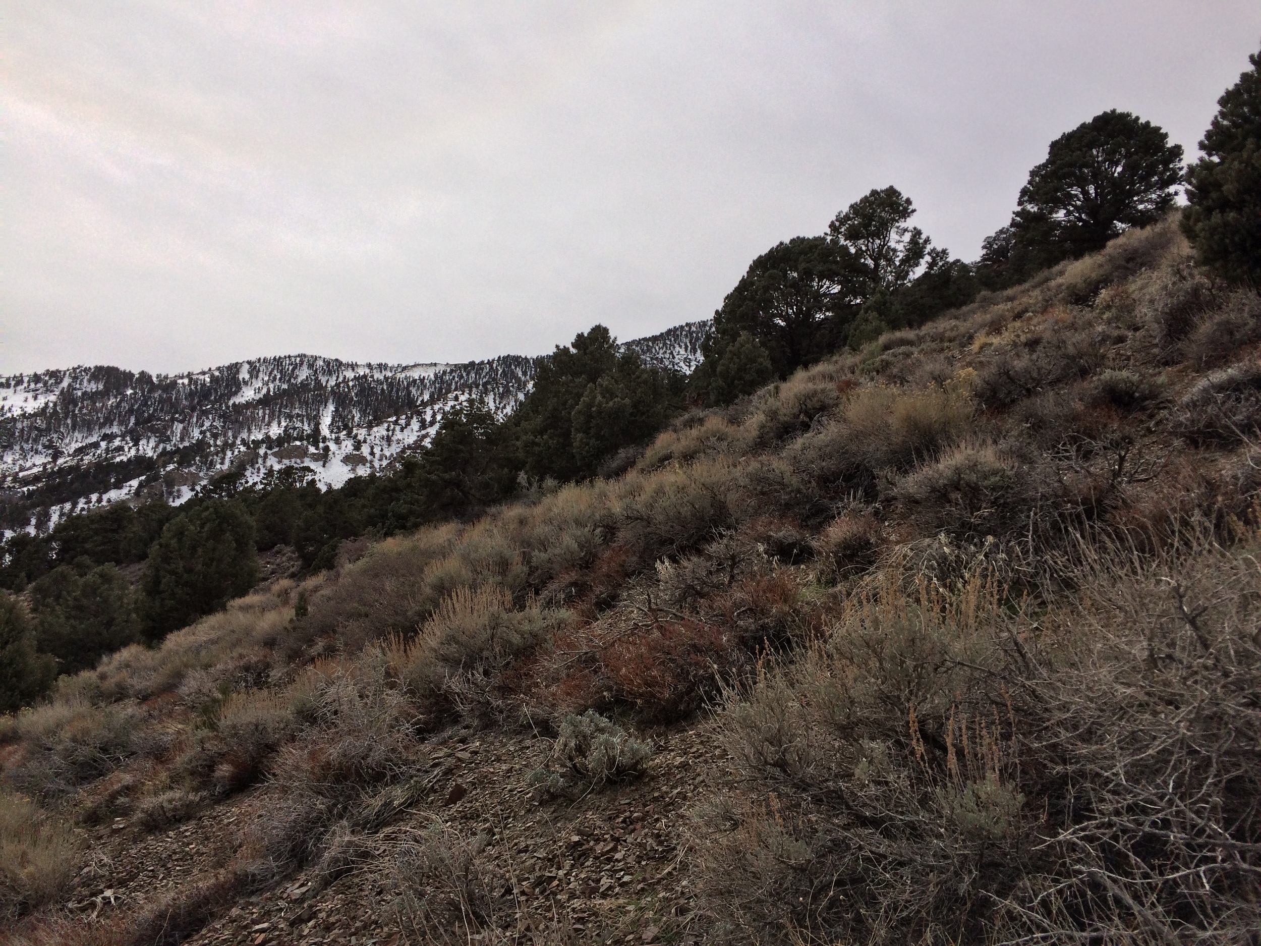
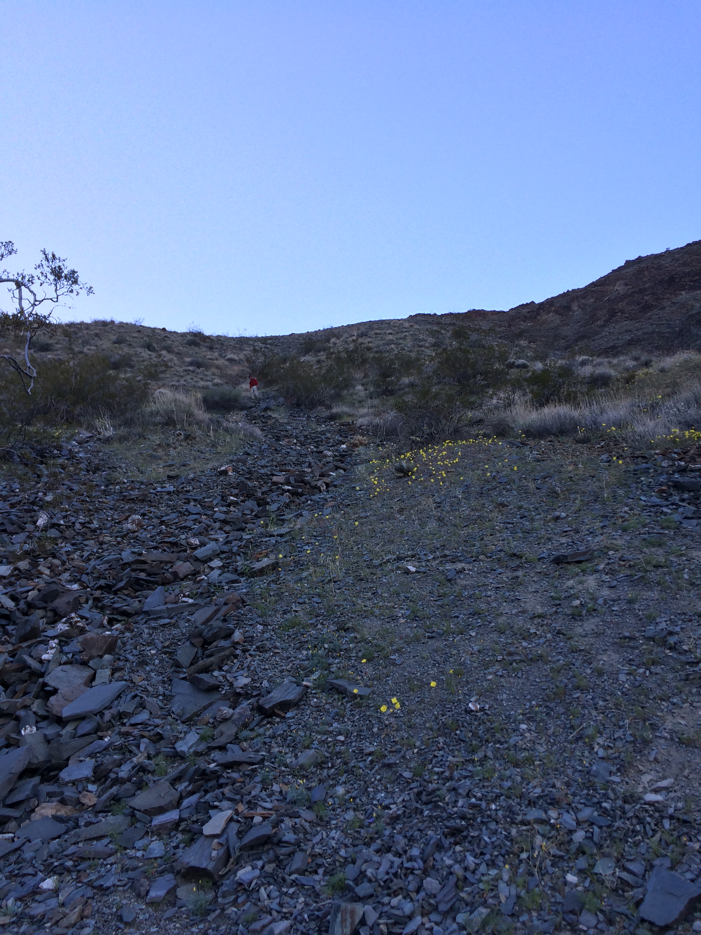
Shorty's Well Route, March 2015
The last challenge that exists for the Shorty’s Well Route is the very nature of the route as it is in Death Valley. Death Valley has, and will always have, some of the most inhospitable conditions in North America. With temperatures regularly above 115 degrees for portions of the year, it is an environment with extreme conditions. As the route begins in Badwater Basin, mountaineers are required to be prepared for temperatures ranging from 100 to 10-20 degrees on the top of the peak. Similarly, in terms of equipment, the route requires gear for that temperature range, as well as during the winter and spring months, mountaineering equipment such as crampons and an ice axe for the snow and ice near the summit of the peak. All of this is to also say nothing about other challenges that the Shorty’s Well Route presents, such as water and food.
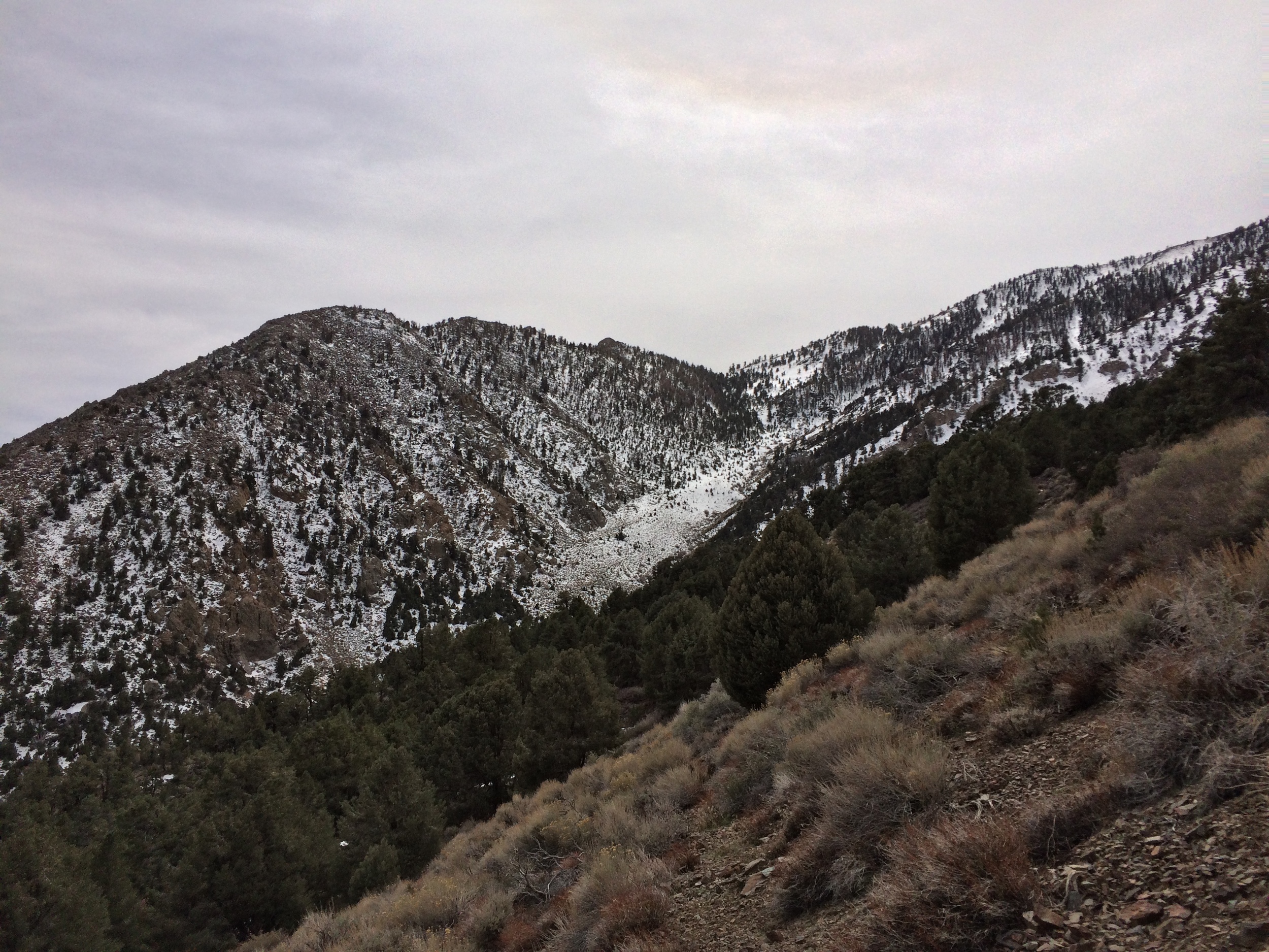
Shorty's Well Route, March 2015
These are the main challenges that the route presents. In terms of where it is located, it is also in a fairly remote spot. I can honestly say that if you are not comfortable in remote locations; or not comfortable using a map, compass, or GPS unit, this is not the challenge you should consider – or do. It is also worth noting at this point, that this is an area of Death Valley that has spotty GPS coverage at times (and no cell coverage); and in an area of Death Valley where there are few, to no people for multiple days. As I mentioned above, the route starts out in Badwater Basin. Specifically, the route starts at the intersection of the West Side Road and Hanaupah Canyon. The West Side Road is in part, a 4X4 road that crosses the western portion of Death Valley, and is considered one of the unpaved backcountry roads of the park.
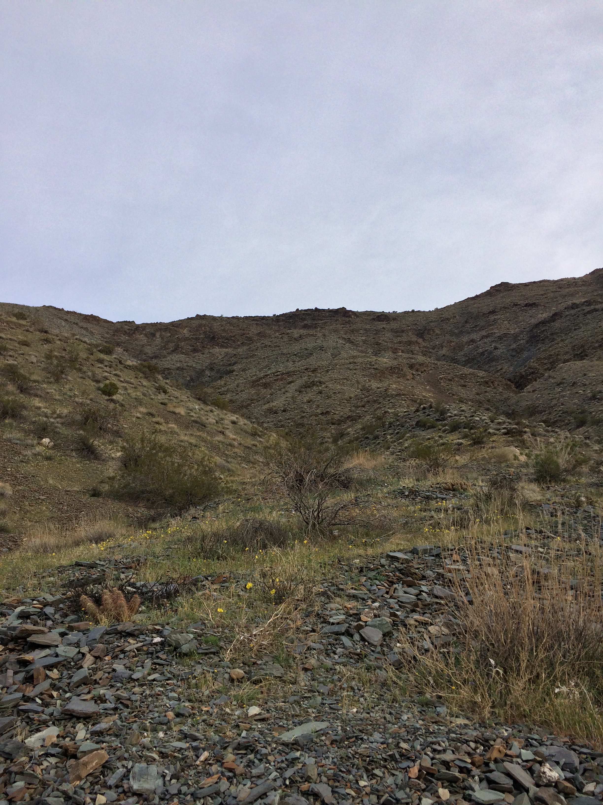
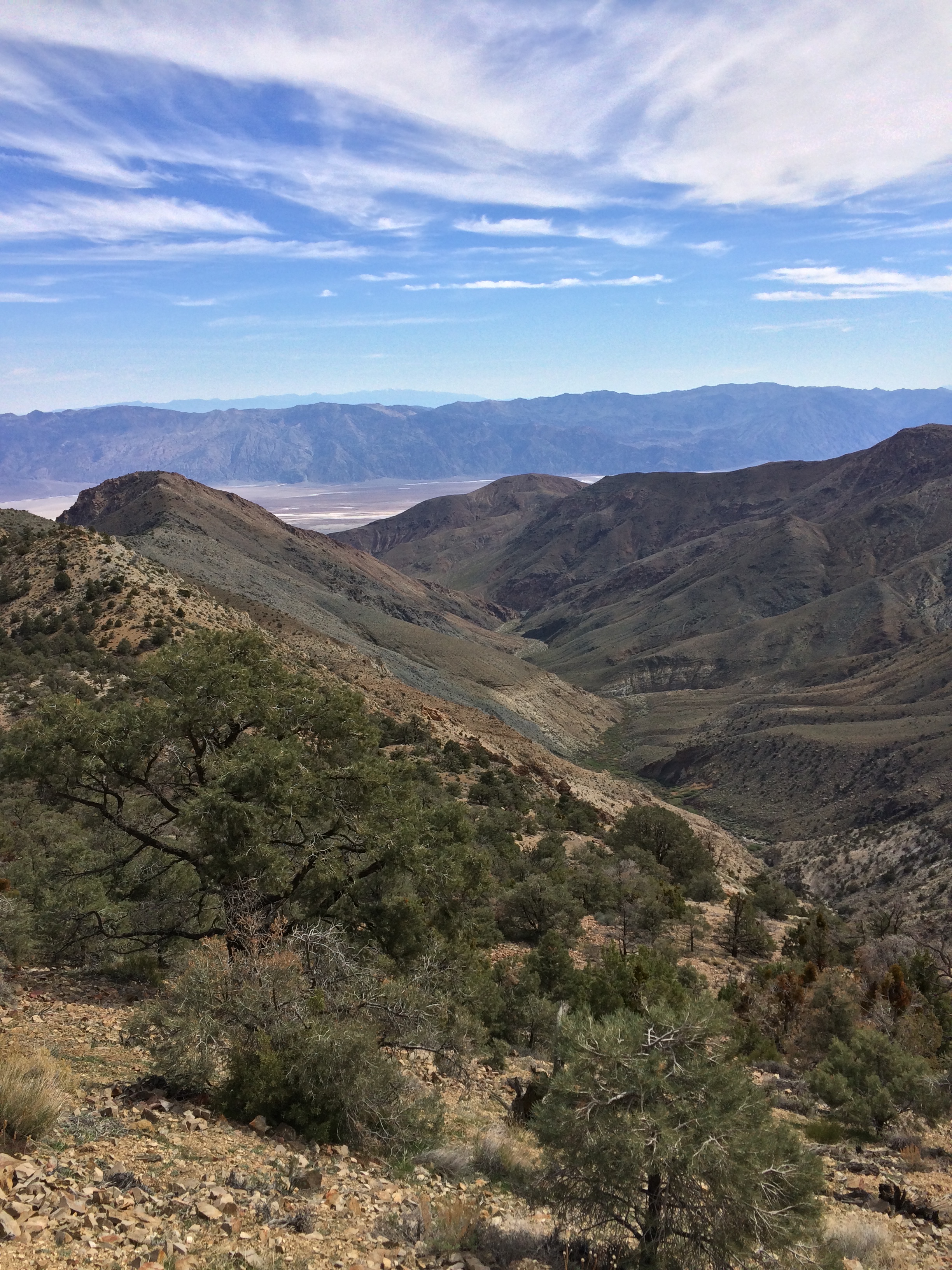
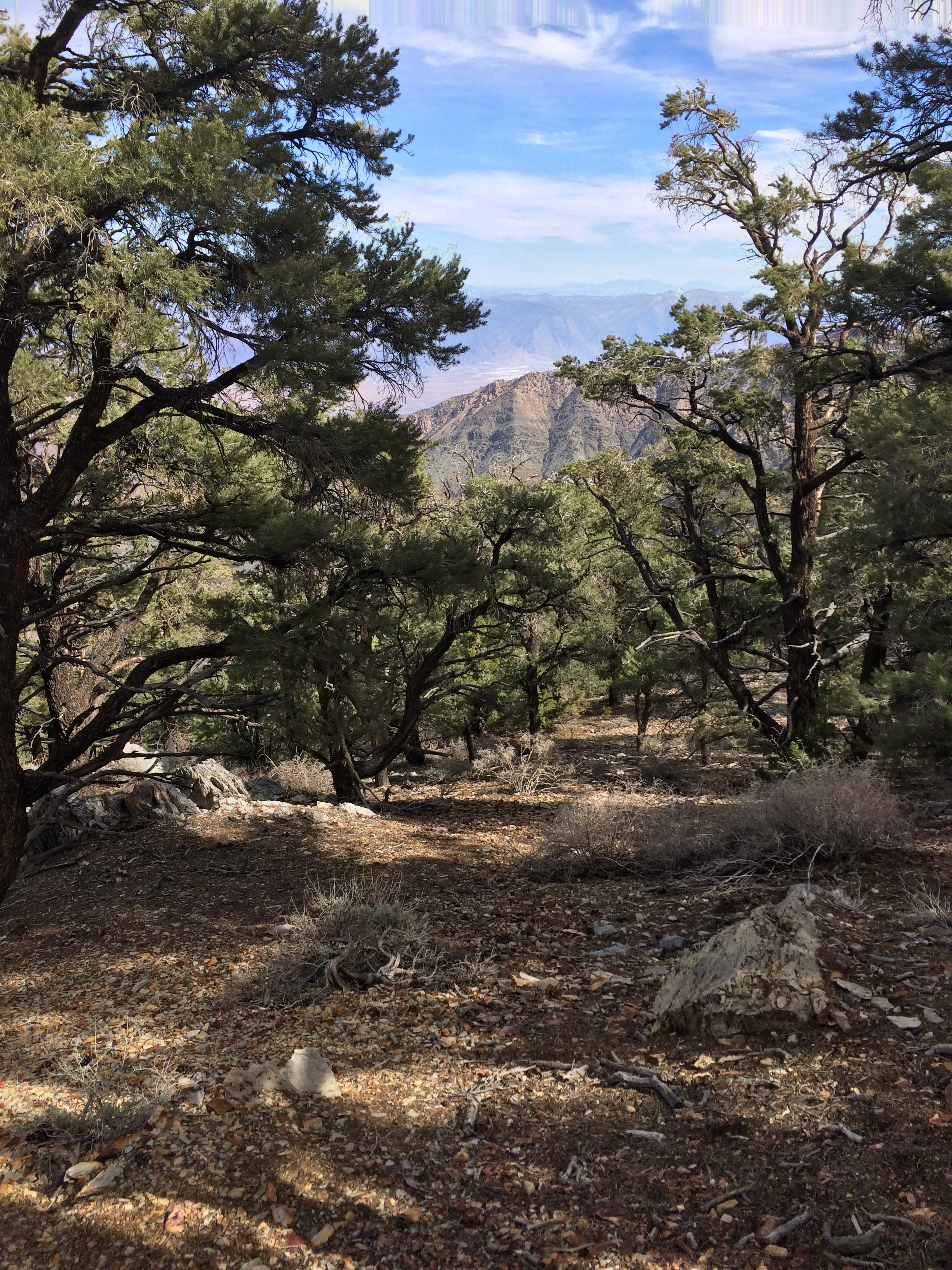
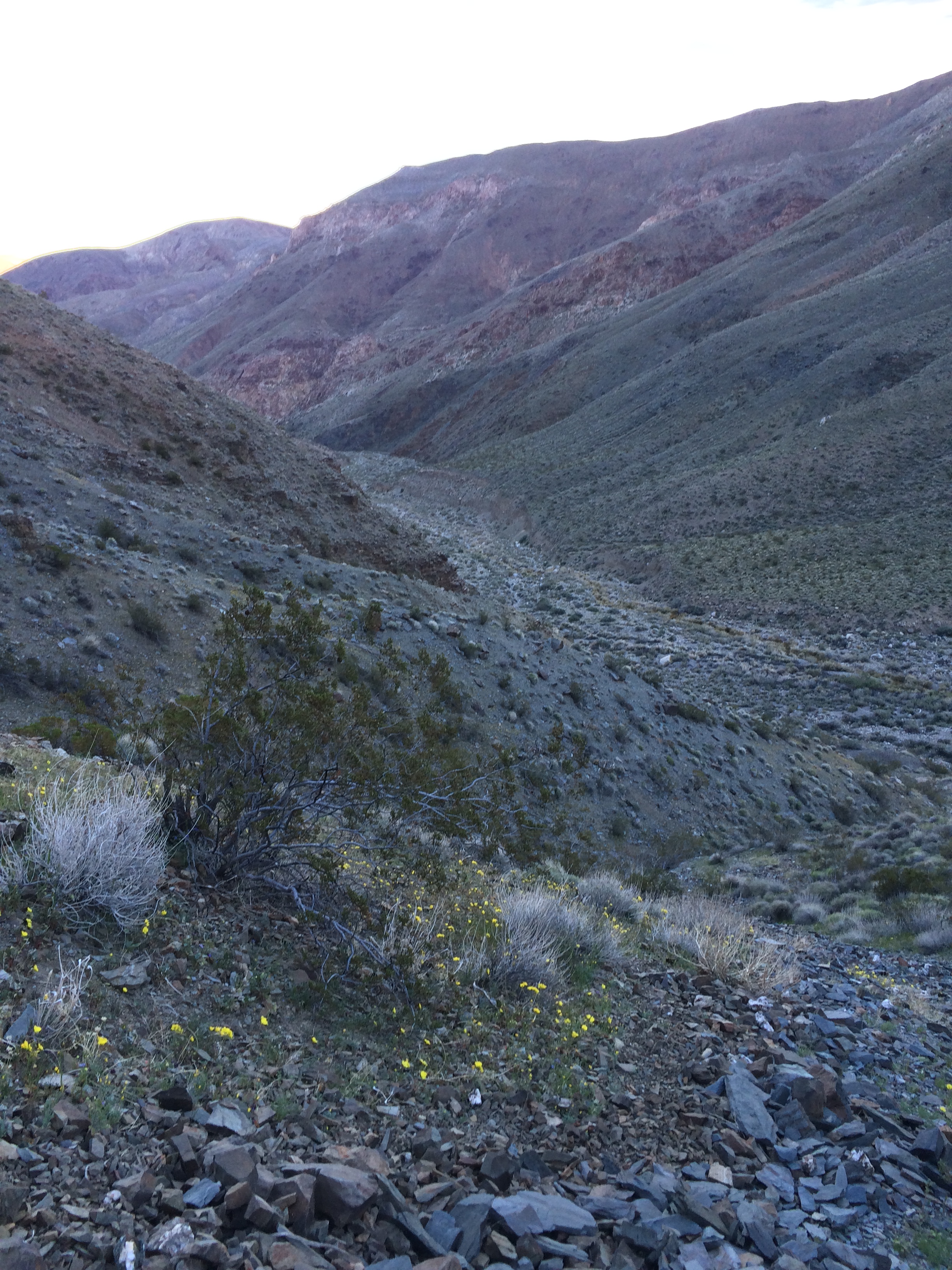
Hanaupah Canyon, Death Valley National Park, March 2015
The West Side Road is located 6.2 miles South of Furnace Creek in the park off of the 178, and is well signed on both sides of the road. From the 178, mountaineers will need to follow the West Side Road for approximately 11.7 miles to reach the Hanaupah Canyon junction. While the West Side Road is usually fairly graded through this area and does not require a 4WD or AWD vehicle, it is important to note that this is a dirt road which conditions can change on throughout the year. The trick I have used to find the intersection for Hanaupah Canyon for the last two years (even though it is signed) is to look for the junction for “Tule Spring” (also signed), which is slightly before the Hanaupah Canyon turnout.
As one can see, getting to the route from anywhere is also part of the adventure. Since the route starts from the West Side Road/Hanaupah Canyon intersection, once you arrive at this spot, you should park your car, and set out on foot. From this point, you will start your ascend of the route at -262 feet; and for the first several miles up Hanaupah Canyon, you will be heading up the “easy” portion of the route. I say that this is the “easy” portion of the route, because the route follows the 4X4 road into the canyon, before the road dead-ends. This is the “easy” portion only because it is the only portion of the route that is relatively planned or marked out. It is still difficult physically as you are climbing several thousand feet out of the Badwater Basin. (For a detailed description of this portion of the route, check out this link I wrote about Shorty’s Well here).
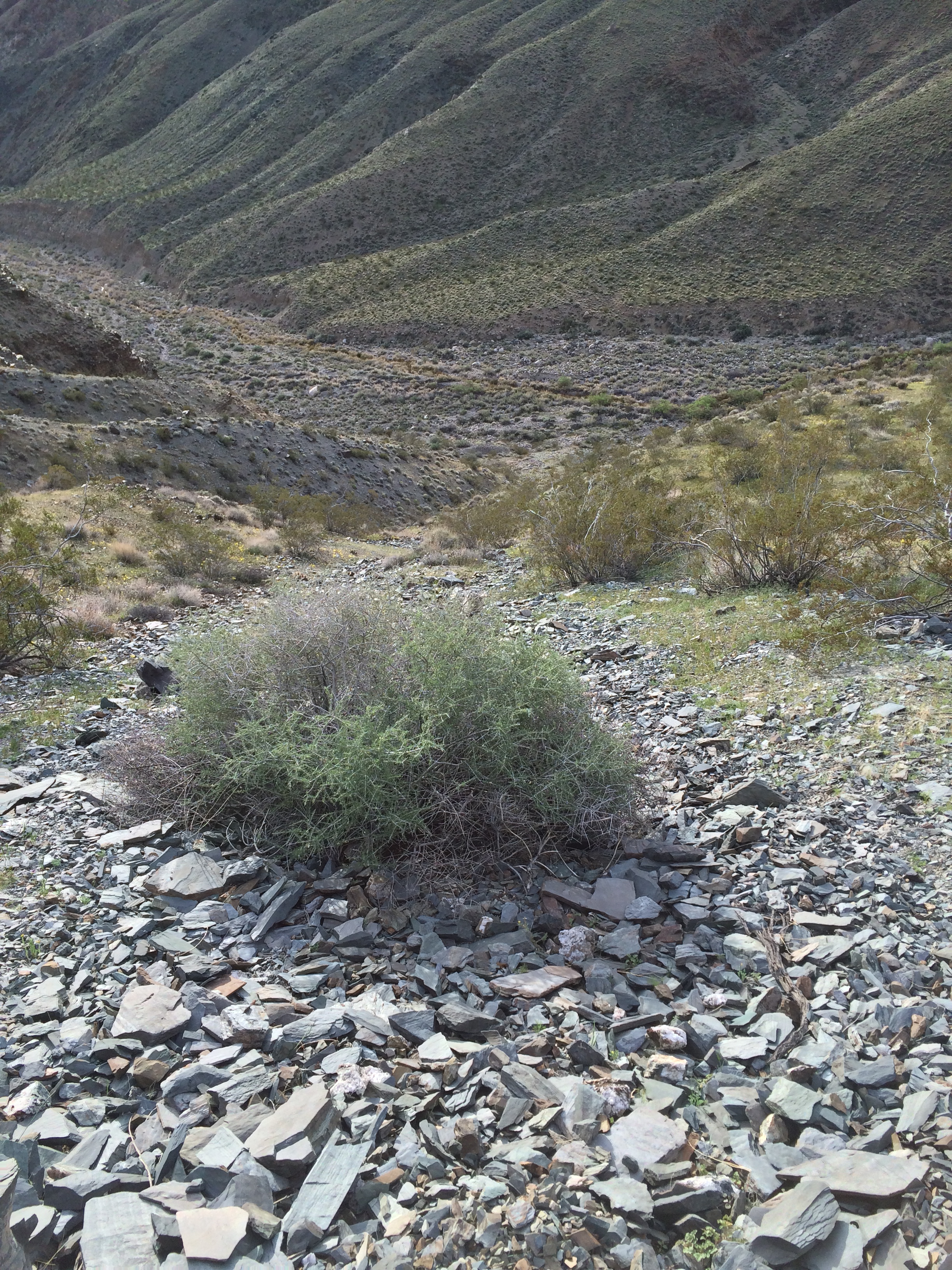
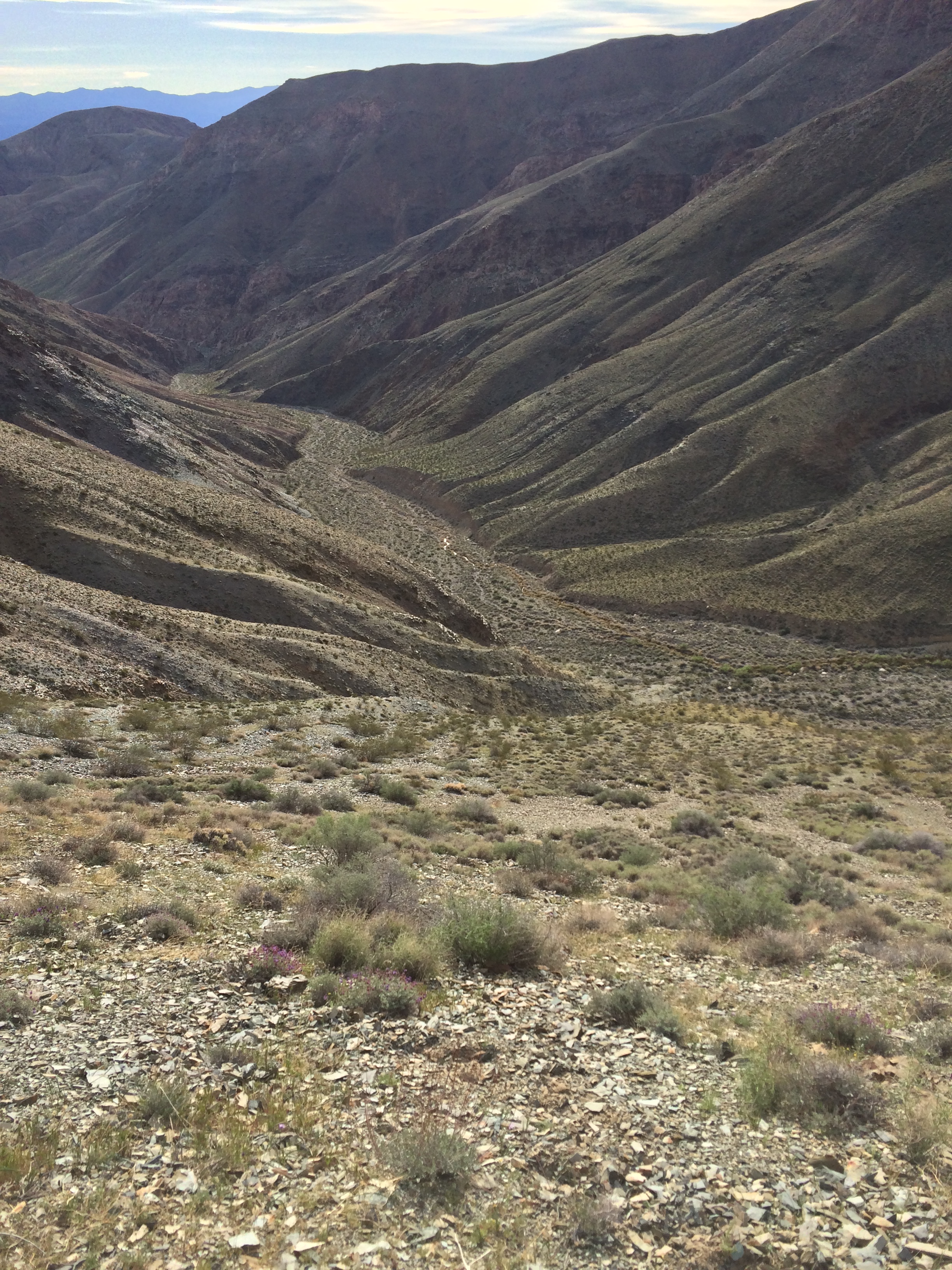

From the end of the road, the route then heads up the canyon. This is an area with a lot of up-and-down terrain, as this area is a wash; and while there are many marked out routes that all lead to Shorty’s Well, this portion of the traverse is time consuming. After a couple of miles, all of these routes end at or near Shorty’s Well. The “well”, like many things is not what it seems, especially as it is not an actual well. It is, however, a spring that has water year-round, which also flows down the canyon, and the only guaranteed source of water throughout the route. Behind the spring (and the plants that envelop it) is Shorty’s Mine. The mine is on the left, or Southeast facing side of the canyon. To the West, there is an old road/footpath that heads up into the Panamint Mountains. While this looks like the route toward Telescope Peak (especially based on comments made in some other trip reports online) it is not the route. (For where this route takes you, check out this link here.)
The route at this point stops being “easy” and becomes difficult. Namely, the route heads up a steep steep steep talus and loose shale covered slope out of Hanaupah Canyon. This slope is located directly to the right (North) of the well. While it may appear that this is not the route, as it is very steep and almost appears impassable, it is the route. Near the base of the slope there is a cairn, and while many cairns/routemarkers in this area cannot be trusted, in this case, this cairn marks the direction one must head to complete the route. From this point, one must routefind the best (if possible) and shortest way up the talus covered slope. This is a very steep and treacherous ascent, and one that requires near total concentration, in order so that one does not slip and fall during any point. I would also be remiss if I did not mention that due to the difficult nature of this slope, it is an extremely strenuous part of the climb due to the steep angle of ascent; the elevation gained, and the loose rock that comprise the terrain on the slope.
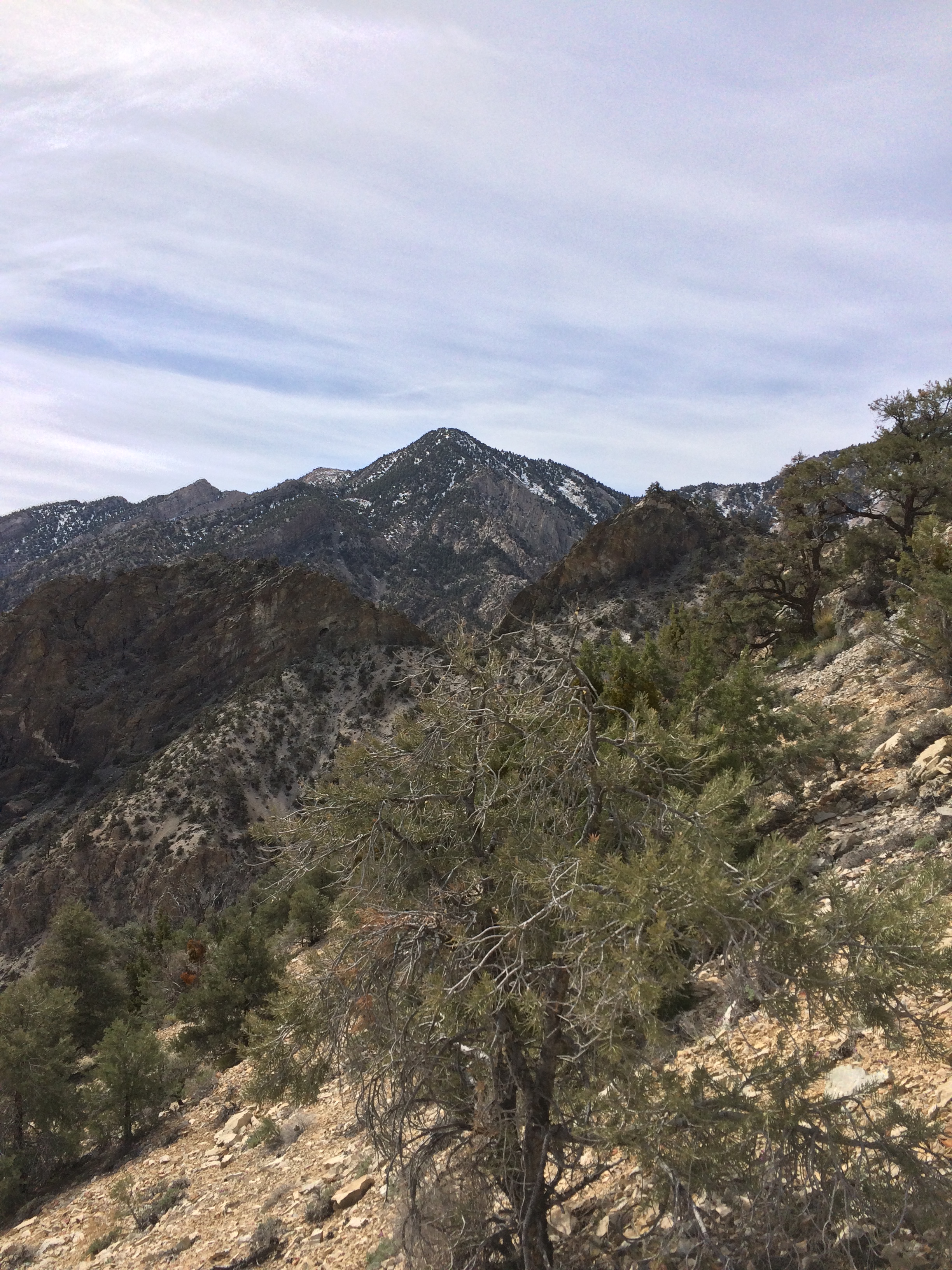
The payoff of this climb is a ridgeline that is relatively flat near the slope. From this point, one can look East, back down in to Hanaupah Canyon, toward the mine, the wash, and the distance they have traveled, and see Badwater Basin in the distance. To the West, the view along the ridgeline looks directly at Telescope Peak; and to the South and the North, surveys the Panamint Mountain Range. From the ridgeline, it is apparent which direction the route heads – straight and up toward the junction of the Telescope Peak Trail and the peak itself. This is not to say that the remainder of the route is simple. For starters, the route ascends – and descends several sections along the ridgeline while heading up toward the peak. Any mountaineer must find the shortest distance along these traverses, while at the same time, keeping track of the shortest distance to the upper ridgeline that runs toward Telescope Peak.
While there are some faint (and little used) foot trails along the ridgeline, not all of them are helpful. While some of them provide guidance toward the peak; others clearly have destinations in mind that are not the mountain. Absent a clear map or directions, any mountaineer attempting this route should use their best judgment when following any foot trail through this area; and keep a solid eye on their surroundings. Eventually, the route ascends through forested areas to the intersection of the Telescope Peak trail, which then leads the mountaineer to the summit of the peak. In terms of a return trip, a mountaineer can then elect to head back to the Telescope Peak Trailhead at Mahogany Flat (the most popular option), or navigate back down through Hanaupah Canyon to the intersection of the West Side Road.
As I have said many times, this is a challenging – and somewhat daunting route. While my words my not effectively convey the epic scope of the terrain, hopefully the pictures, and videos attached to this post do. In terms of David’s and my trip, we got off to a good start – at 345 am. We made good time over the road; and were at the Well by sunrise, where we replenished our water bottles. While the talus slope was challenging, we made good time up it, and found ourselves on the ridgeline in the early morning hours. As I had been in the area before, we had not had to worry about routefinding, as we knew which way to go. Moreover, as we ascended toward the peak, we were able to utilize some of the foot trails to our advantage as to aiding us ever closer to the peak.
But – and this was a big but – even with everything breaking our way, and keeping a good pace, we could not do anything about the clock. Even though every step we took brought us closer to the peak, it also brought us seconds to minutes later in the day. Our original plan had been to be on or near the peak by noon. When it got to be noon, and we were in the forest at around 8,000 feet below the peak, we judged that we could safely continue on based on our conditions and our ability. But when it reached 1:45 p.m., and we were at ~9,600 feet, in snow, still several miles away from the peak, there was only one viable choice remaining to us: to turn around. This was not a decision we made lightly – but at that point – low on water (we eventually filled our bottles with snow; and again at the well on the descent); and having climbed over 9,000 feet over the course of ten hours, it was the best and only decision. By the time we arrived back at the car, it was 12:11 a.m., and for most of that time, we had been mountaineering.
This then gets to the impossible nature of the hike, or the hardest nature of the traverse. In terms of full disclosure, this was my second time on the route. The year before, I had attempted the route with a full backpack – some forty to fifty pounds of gear – in the hopes of a two day ascent of the route. Poor decision making on my part, as well as a storm had precluded me from making the summit that time, but what it had left me with was an excellent knowledge of the area, and of what I would face if I returned. When I agreed to return with David, part of the reason I went was because I knew he would push my pace. I had seen how David climbed first hand back when we climbed Whitney in September of 2014; and I knew he was fast. I also knew he had completed other challenging routes, so I felt confident that between us, we had the experience to handle the challenges the route would throw at us. And, for most things we did. We kept a good pace. We did not get lost. We did not go off route. We did not have extra weight in terms of gear. We were able to filter water; and melt water for snow.
And yet, we did not reach the summit. And, finally, here is the kicker. If you are still reading this, because you have an interest in this route, you should know that when we reached the car, the reason we were tired was because we had hiked over 35 miles in one day. How do I know this? Because I was wearing a Fitbit to track our progress, in addition to the GPS app I was running. The GPS track had gaps, as I thought it might – but the Fitbit said we had walked over 40 miles. 40 miles – in one day. The reason I led with 35 miles above, is because I would say that a Fitbit – like any piece of technology has room for error. Leaving room for error; along with side trips – say to filter water, and other things, leaves me with about five miles that could potentially be removed from the distance we went. Which leaves me with 35 miles. But realistically? That number is probably closer to 40. So think about that for a minute: David Wherry and I went 35-40 miles in one day – and didn’t make the summit.
This then leaves me with a question. Can this route be done in one day? From what I can find online – there is one report which sounds (and looks credible) from four years ago. Every other report (all two of them) from the last four years has the mountaineers leaving through Mahogany Flat, which shaves off quite a bit of distance. As for me – I don’t know. I’ve now been twice – and failed twice. While the failures were successes in their own way, in terms of finishing the route, which is always the ultimate goal of any mountaineer, they were failures. In all honesty, this last attempt was in many ways probably one of the best shots I could get – good conditions; no problems to speak of; and a great partner to attempt it with. And yet, we still didn’t make it. So that leaves me wondering – can this route even be done in a day? I don’t know if I’ll ever go back and attempt it again; but until I do, I’ll always wonder. And this, above all else, is why it is the hardest – and most impossible mountaineering route in North America.
Tips: I don’t think I should have to say this, but knowing how people are (tl;dr), let me just say that this route is a very challenging and advanced route for experienced mountaineers only. If you are considering attempting it, I recommend that you be in as close to the best shape you can be, because this route will test you physically in addition to all of the mental challenges it provides. And finally, if you do attempt this route, I don’t care if you succeed or fail, but more so that you come back safely. This is very remote terrain, and dangerous terrain. Caution should be taken when attempting it; and if you do succeed, my hat goes off to you, because I know – probably better than anyone currently alive – how difficult it is – and remember – start in darkness; end in darkness.