PCT

San Diego's Five Best Waterfall Hikes

San Diego's Five Best Waterfall Hikes

With miles of pristine beaches, rolling chaparral covered hills, and a constant semi-arid desert climate, San Diego will never be identified as one of the hot spots for waterfalls or hikes to waterfalls. However, unbeknownst to many people, from December through Memorial Day, San Diego does have a number of great seasonal waterfall hikes that highlight some of the best features of the county’s backcountry. As all of these waterfalls are seasonal, timing is everything, and also somewhat dependent on the weather pattern for the year. During wet winters and springs, these waterfalls will have high flows, and creek crossings; and during drought years, there may only be a trickle and dry stream beds. Similarly, with respect to timing, at the right times, these waterfalls can and will appear spectacular – but at the wrong times, may be a letdown after a hot, dusty trek. Keeping all that in mind, these hikes can also be great gateways to explore other regions of San Diego County, and again, at the right times, great spots to view spring wildflowers. I’ve listed the below hikes in order of difficulty, and let me know your thoughts about them, or any additions you have to the list below!

Kitchen Creek Falls

Kitchen Creek Falls

Among outdoor enthusiasts, through hiking the Pacific Crest Trail (“PCT”) is one of the most coveted accomplishments. But at 2,650 total miles, completing the PCT is a daunting task that requires a substantial amount of time. As a result, instead of completing the PCT in one fell swoop, many hikers elect to “section hike” – hike sections of the trail – over an extended period of time. While perhaps not as glamorous as a through hike, section hiking allows hikers to complete the trail at their schedule, and allows one great latitude to appreciate the many hidden gems that are along the PCT. One of the first hidden gems along the PCT is Kitchen Creek Falls, a seasonal waterfall that is just off the first section of the PCT near Campo, California. Irrespective of whether one is starting out to complete all of the PCT, section hike the PCT, or head out for a day hike, Kitchen Creek Falls is a great destination year-round.

Sunset Trail, Winter

Sunset Trail, Winter

One of the most popular misconceptions about San Diego is that it is an area that does not have seasons. Even I will joke around with fellow outdoor aficionados that San Diego has two seasons: green and brown. Having said all of that, San Diego is a great area for outdoor activities, and it is a great place to observe the sometimes subtle changes that occur on the local backcountry trails. And sometimes, San Diego receives weather that usually is reserved for other parts of the country. While these winter storms are rare, they are a great opportunity for people to see parts of the county in a different way. Last week, when a winter storm rolled through San Diego, I knew that I wanted to head into the mountains to a place I had visited earlier in the year - the Sunset Trail, as it is one of the few alpine areas above 6,000 feet in the county, and would be assured of having a substantial amount of snow.

Kwaaymii Point

Kwaaymii Point

One of the more obscure and strange hiking destinations in San Diego is located on the Eastern border of the county, and sits right on the border of the Anza-Borrego State Park and the Cleveland National Forest. In addition to being one of the strangest hiking destinations, the spot has some of the best views in the county as it is located on the edge of the Laguna Mountains. 

Penny Pines & Garnet Peak Conditions September 2013

Penny Pines & Garnet Peak Conditions September 2013

On July 5, 2013, I left work early, and headed up to Garnet Peak in the Cleveland National Forest to start my weekend with a short hike. It was a picture-perfect day with blue skies and since it was Friday afternoon, there was absolutely no one on the trail. The only downside on that day was the weather: it was hot and the wind that rushed out of the Anza-Borrego Desert felt like an open oven. I remember feeling some of the plants and they were dry . Everything was tinder dry - not good for July in San Diego, where fire season lasts until October, or even November in drought years. Since I couldn't make it rain for the plants, I did the only thing I could: appreciated the natural beauty around me. Although I didn't know it, I was probably the last hiker to hike that area before it burned (photos here). On July 6, 2013, what became known as the Chariot Fire started, and spread through that portion of the Cleveland National Forest due to those dry conditions and high winds. 

Garnet Peak

Garnet Peak

One of my favorite spots in San Diego County is one that most people haven’t heard about. No, it’s not Cowles Mountain. It’s not Iron Mountain. It’s Garnet Peak, a medium sized mountain that’s located on the Eastern edge of San Diego County in the Laguna Mountain Recreation Area. Even though the peak is somewhat unknown to the hiking community in San Diego, the Laguna Mountains are well known to everyone in the county as “the place with the snow”. Yes, you read that right – San Diego gets snow! While it is not a lot of snow, San Diego – and the Laguna Mountains definitely get snow during the winter months as the range is above four thousand feet. Don’t believe me? Well, you can check these pictures here. This is one of the amazing things about San Diego County; it has a variety of biomes that range from coast, alpine, and desert; and from the summit of Garnet Peak, you can see all of these on a sunny day.

Canyon View Loop Trail, Whitewater Preserve

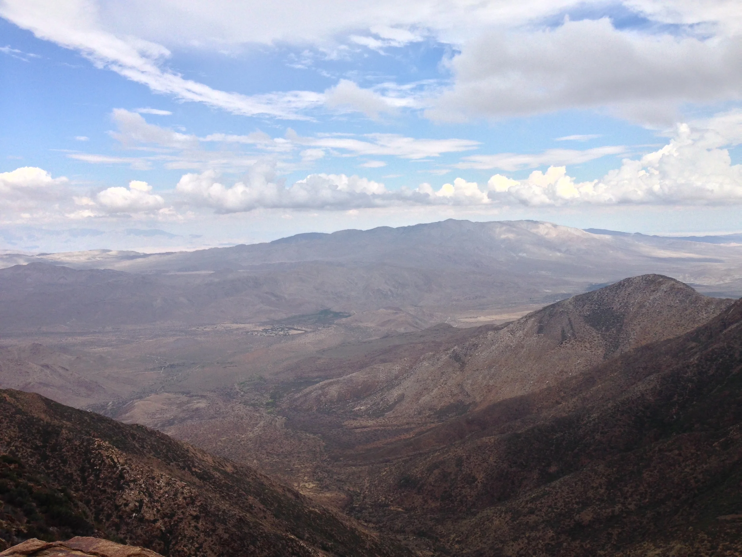
Whitewater River, looking up Whitewater Canyon

This week on lastadventurer.com, true confessions. Confession number one: I have been going back and forth from Southern California to the Coachella Valley region and areas North of it for over twenty years off and on. Until about a month ago, I had no idea that there was an area of pristine flood plain, containing miles of hiking trails, and great views of the San Gorgonio Wilderness in the area. No. Idea. At. All. I feel at this point that there should almost be some sort of demerits taken against my wilderness specialist card. After all, the area I’m talking about is part of the Pacific Crest Trail (“PCT”) – how could I miss this? However, it’s better to arrive at the party late than not arrive at all.


Yes, what I am talking about is the Whitewater Preserve, an area of over 2,826 acres that is owned by the Wildlands Conservancy. The region is situated directly on the floodplain of the Whitewater River, and is surrounded by large swaths of land owned by the Bureau of Land Management and the San Gorgonio Wilderness, providing one large area to explore, and one colossal wildlife corridor. The Wildlands Conservancy holds a number of pieces of land within California, and in my experience, each of them are well managed, well maintained, and well protected, something that is definitely needed with the Department of Parks and Recreation in California facing continuing budget cuts. Due to time constraints, I didn’t get as far out into the backcountry as I would have wished, but I did get out on the Canyon View Loop trail, which leaves directly from the picnic area/Ranger Station/interpretive center, and in my opinion, provides a great scenic overview of the preserve for the first time visitor.

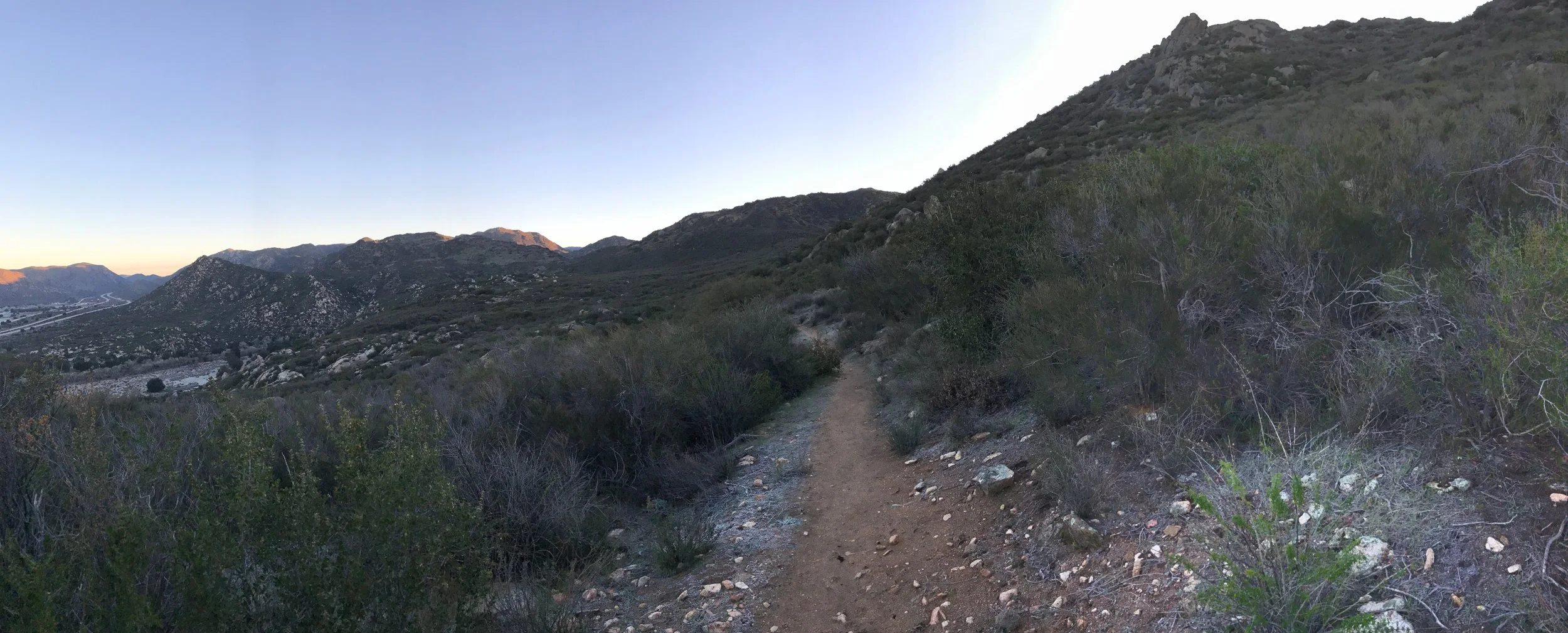
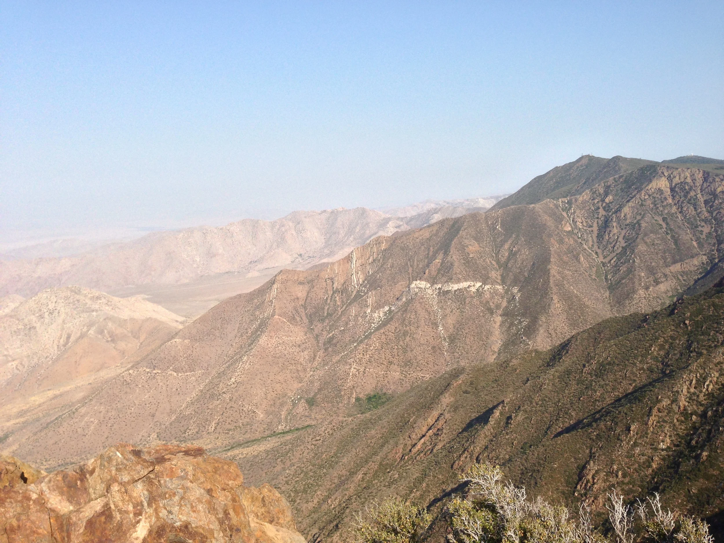
Looking at the Ridgeline of Whitewater Canyon

 Directions: To enter the Whitewater Preserve, exit the I-10 at the Whitewater exit, and head North up the Whitewater Canyon Road for five miles until the road ends. There is a parking lot at the end of the road, but do note that the area is popular for picnics as well as hiking, and the lot does fill up. From the parking lot, the trailhead is directly to the North, and is the main jumping off point for all of the hikes into the backcountry. The trail is well marked from the beginning, and leads past a large boulder with mileage distances along the PCT as well as the preserve. After about a half mile (.5), you will see a turnoff to the West, which will lead you over the Whitewater River on a well maintained footbridge.

As 2012 has been a dry year for Southern California, the water was well below the bridge; but I suspect that in a wet year, the river could be difficult to cross; something you should keep in mind depending on when you are visiting. Once across the bridge, the trail heads through some brush before heading uphill through some switchbacks to the top of the ridge, where the Canyon Loop Trail is again well signed. From here, you can see some great views of the canyon as you head South before ultimately looping back around to the Ranger station and parking lot. Roundtrip, this hike will be about three and a half miles (3.5), and I would rate it as easy and suitable for all ages. Do note that there is indeed some uphill portions; but overall, the hike is not overly strenuous.
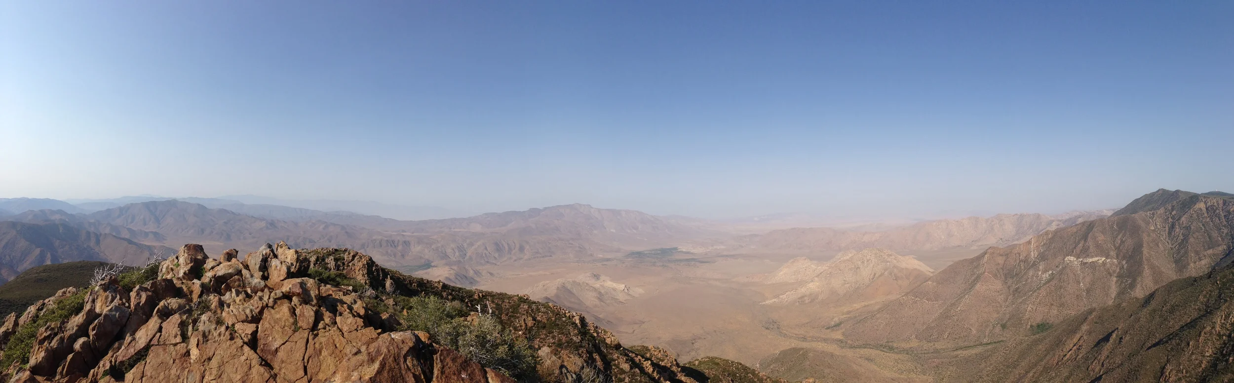
 Whitewater Canyon

Tips: There’s a secret river and park near Palm Springs! What more do you want? Ok, let’s go for bonus tips: due to the fact that the preserve is connected to large swaths of backcountry, it is a wildlife corridor for many animals, including black bears which do head into the canyon on a regular basis. From my observations, it’s also a great place to view animals, as I saw plenty of small animals in the area during the middle of the day. Last, if you don’t feel like hiking, it’s a great place to sit back and relax among the trout ponds and river to beat the desert heat.

See you on the trail!


More Information:

http://www.wildlandsconservancy.org/maps/Whitewater%20Canyon%20Preserve%20Map.pdfhttp://www.wildlandsconservancy.org/maps/wwtm21610.pdf, http://www.wildlandsconservancy.org/preserve_whitewater.html, http://www.yelp.com/biz/whitewater-preserve-white-water, http://calitravelgirl.wordpress.com/2011/04/21/whitewater-preserves-canyon-view-loop-trail-has-views-to-die-for/#comments