
Lower Otay Lake, near the trailhead for Upper Otay Lake
One of the things the backcountry of San Diego is not known for is an abundance of lakes due to the arid climate of Southern California. But, just because such spots are not common, does not mean they do not exist, as the Water of the Woods, Sheperd’s Pond, and some other spots demonstrate. The easiest backcountry lake to hike to in San Diego is Upper Otay Lake; which is also somewhat of a secret location as it is overshadowed by its larger brother, Lower Otay Lake. Both of these man-made lakes are found in the Otay Valley, and were constructed in 1897 (and rebuilt in 1918), and 1959 respectively. While Lower Otay Lake is extremely visible as it occupies most of the Otay Valley, and is accessible by car at numerous locations, Upper Otay Lake is hidden in plain sight behind the Upper Otay Reservoir, and is accessible by a short hike.


Directions: The trailhead and parking area for Upper Otay Lake is located directly off of Otay Lakes Road. From the western portions of the county, the easiest way to access the area is to exit the I-805, on Telegraph Canyon Road and follow it east until it passes Wueste Road. Both the trailhead and the parking area are located .5 miles from Wueste Road, and are visible on the north side of the road. From the eastern portions of the county, the trailhead can be accessed by following Otay Lakes Road west. Visitors to the area should be aware that the parking area is somewhat small; and on weekends does fill up on occasion.
Upper Otay Lake
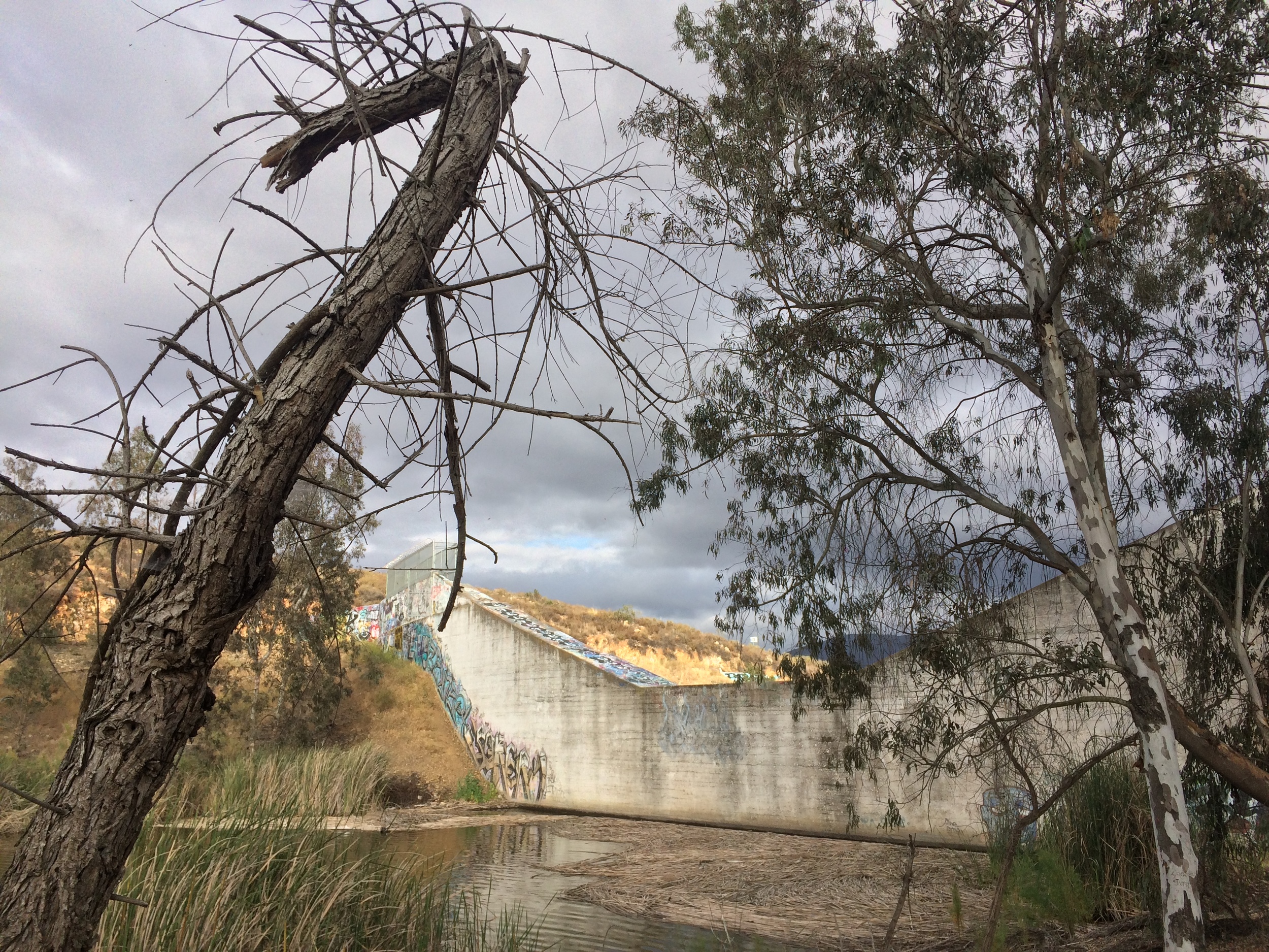
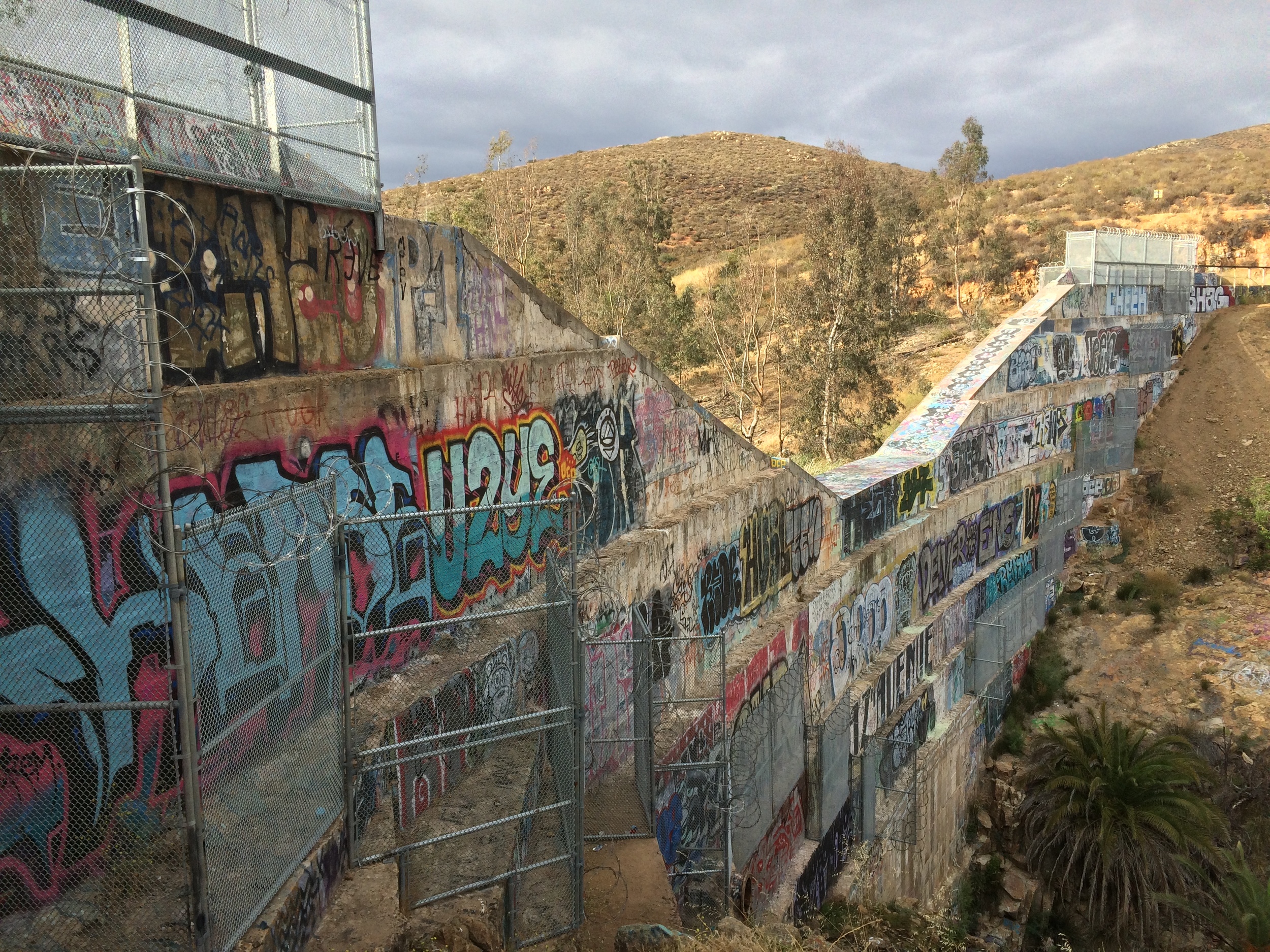
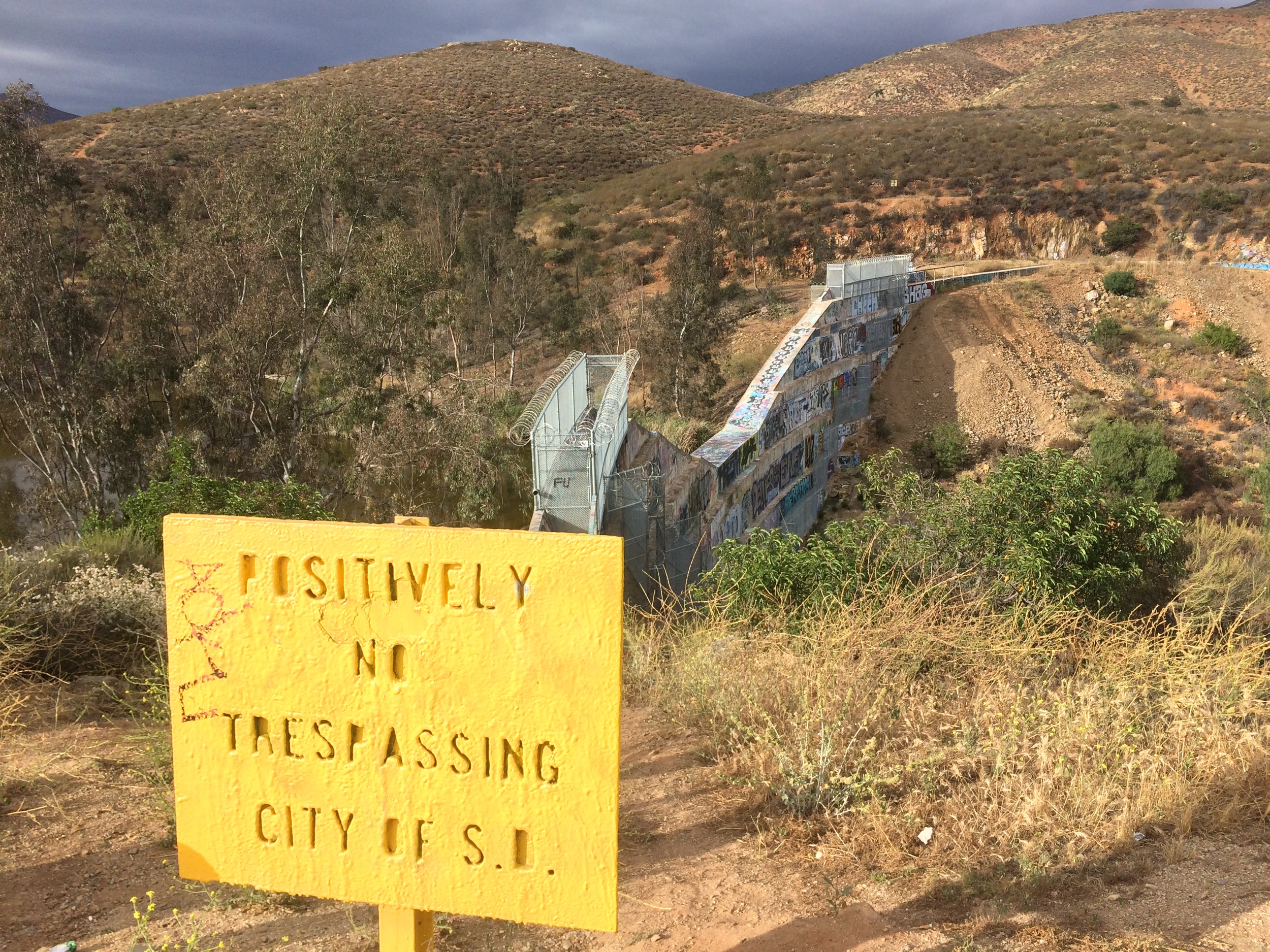
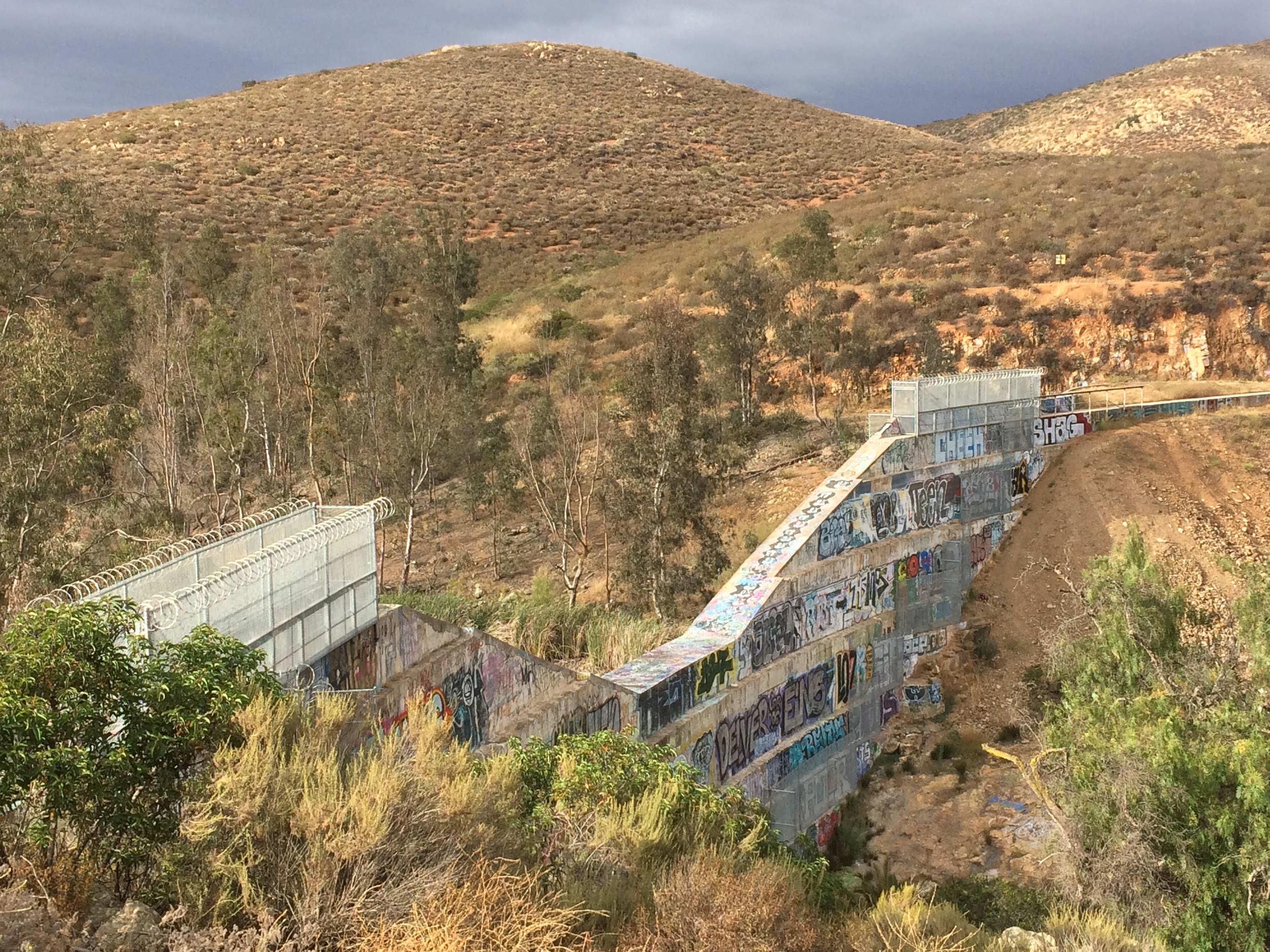
From the parking area/trailhead, Lower Otay Lake is visible on the south side of the road, and a visitor would not know that an additional lake even existed in the area. From this point, the only item that is visible is the south side of Upper Otay Reservoir, which appears to be an abandoned, dry, flood control structure. For the first tenth of a mile (.10), the trail to Upper Otay Lake ascends up toward the Upper Otay Reservoir, which is covered with varying types of paint, old and new. The slope is moderate, and as a fire access road, is accessible for all levels of fitness. At .15 miles, the trail slightly levels out at the Upper Otay Reservoir, and provides a number of great views of this structure and depending on one’s perspective, the modern art on it, or the graffiti defacing it. There are a number of signs also present from the City of San Diego, noting that access is restricted on the structure; having said that, there are also a number of foot trails that allow one to get an up close and personal view of the dam without breaking the law, which is fairly interesting.
Upper Otay Reservoir
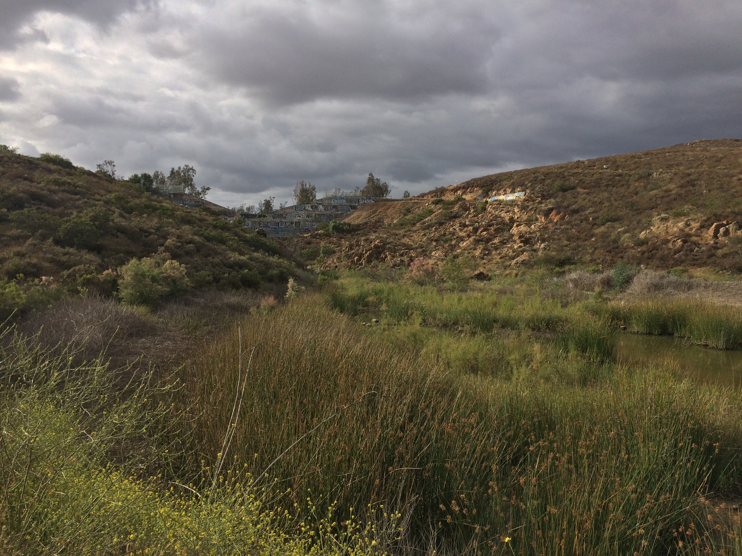
Once one has looked at the dam from a distance – or from up close, the trail heads down into a slight stand of trees that surround the southeast side of the lake. From here, one can return to the trailhead after admiring the lake and dam for an easy, out-and-back roundtrip walk of a half mile, or can continue on around the lake for an easy roundtrip loop that is slightly over two miles (2.2 miles total). The back end of the loop exits on the other side of the dam, and from there, one can follow Otay Lakes Road back to the trailhead with minimal distance and effort. This is a great spot for solitude that provides good views of Otay Mountain, Lower Otay Lake, and the wilderness regions in South County San Diego, and overall, is rarely busy despite the relative ease and distance of the trail.
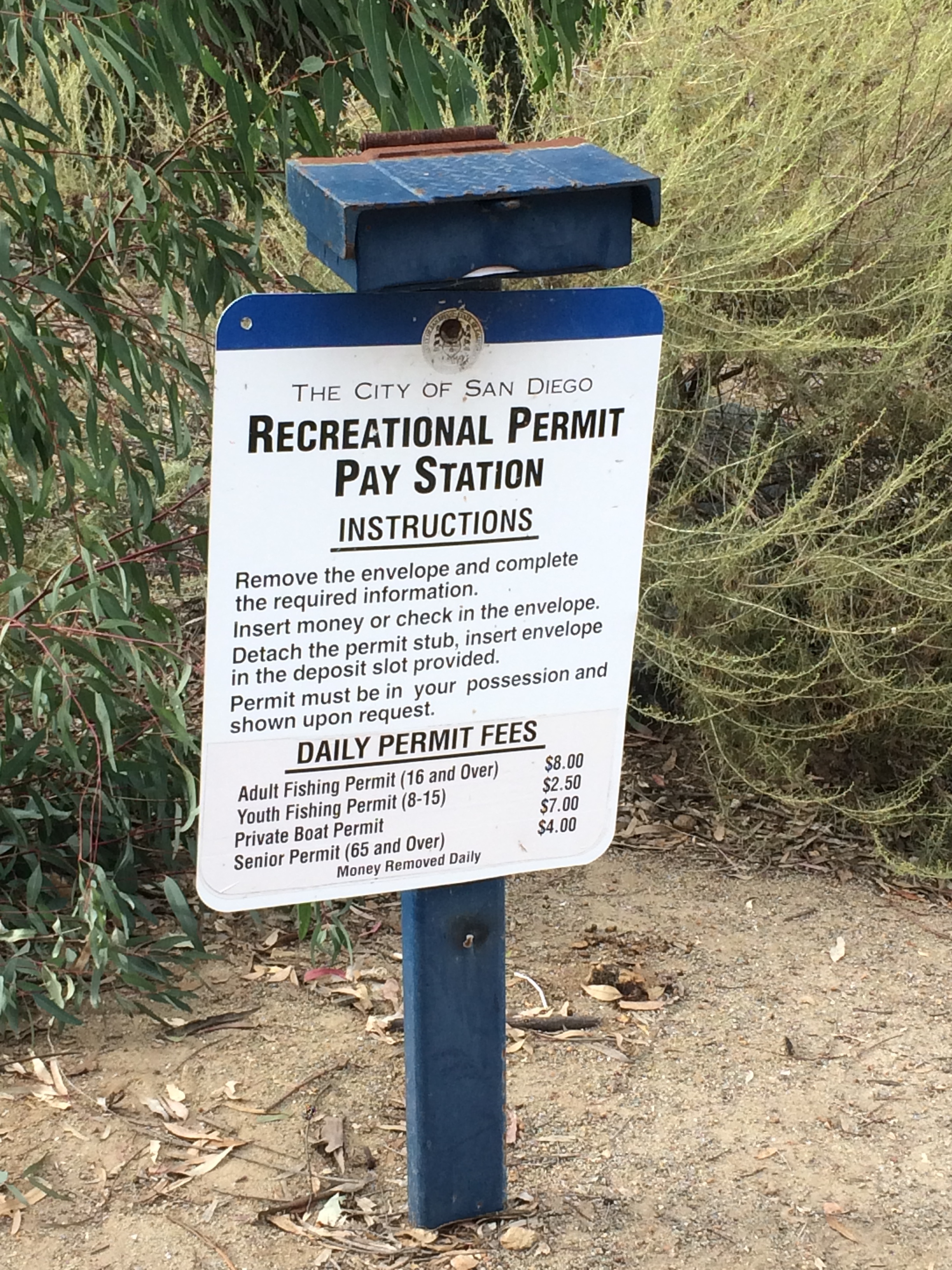
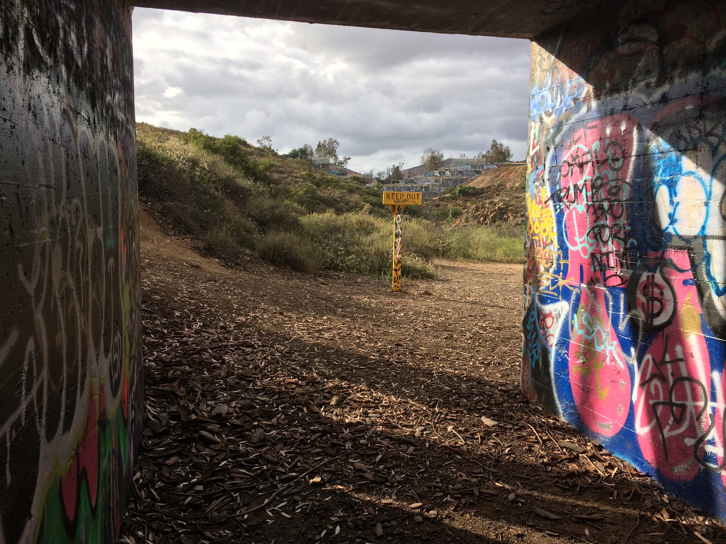
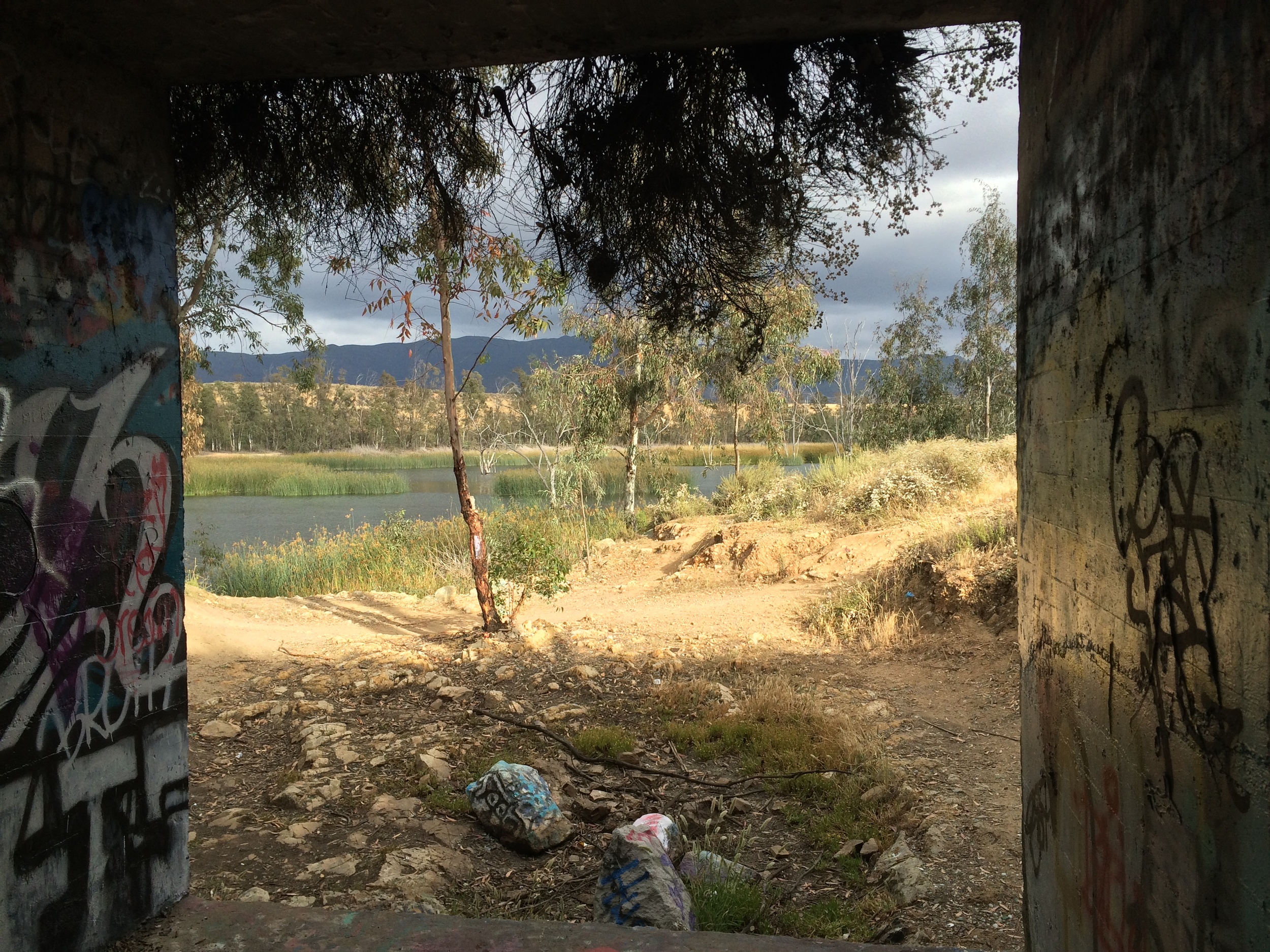
Tips: In addition to the trail around the lake, catch and release fishing is allowed by the City of San Diego for visitors; and visitors above sixteen years of age must have a valid California State Fishing License. Near the trailhead, a slight bridge crosses Otay Lakes Road, and underneath the bridge, there are two flood tunnels for the Upper Otay Lakes spillway. These tunnels can be used to access the south side of the road safely, and can also be used as an interesting photographic opportunity.