Mt. Whitney Trail

Lone Pine Lake

Lone Pine Lake

At 14,505 feet, Mount Whitney is the tallest mountain in the continental United States, and one of the most popular spots to hike and climb. In addition to these things, it also has a number of high alpine lakes located nearby (such as the Meysan Lakes), and a number of lakes located along the trail to the summit - such as Mirror, Consultation - and Lone Pine Lake. While Lone Pine Lake is technically not on the trail to the summit, as it is off a short spur trail, it is a great short hike for beginner backpackers and hikers, and for those parties looking to take more than one day to summit Mount Whitney. 

How to Climb Mt. Whitney

How to Climb Mt. Whitney

So, you’re looking to climb Mt. Whitney? If so, you’ve come to the right place. I’ve climbed Mt. Whitney a number of times – without snow, with snow, on the mountaineer’s route, on the Mt. Whitney trail, under sunny skies, and under cloudy skies with thundersnow. I’ve seen bears, lots of marmots, and all sorts of hikers, mountaineers, and climbers. While I’m not going to say that I’ve seen it all, I’ve seen a lot, and I’ve written a lot, so this is a great time to recap all of the resources that are present on this site (and off this site). So, without any further ado, if you want to know how to climb Mt. Whitney, here’s what you need to know!

Current Conditions, Mt. Whitney Trail, April 8, 2013

​First "serious" snow, near Lone Pine Lake, Mt. Whitney Trail, April 8, 2013

​First "serious" snow, near Lone Pine Lake, Mt. Whitney Trail, April 8, 2013

Every year, I like to take a trip up to Mt. Whitney, either to climb the mountain, or to hike around the general region, as it is stunning. This year, I had to make my trip a little earlier than usual due to a combination of factors; but also to get in some ice axe and crampon practice for my upcoming climb of Mt. Rainier, which my climbing and podcast partner, Matt Mills and I will be climbing the first week of May. If you’ve ever read my blog, you know that I always have additional commentary about things that I think about while hiking, which I’ll reserve for tomorrow; but for today, just the facts regarding trail conditions as of Sunday, April 8, 2013.

Trail Conditions: The road up to Whitney Portal is almost completely clear of all obstacles. There were some small rocks/boulders in the middle of the road; and there were some fresh rocks that fell onto the road during the day; but overall, the road is currently in excellent shape for this time of year. I didn’t get the early alpine start that I had originally planned, but I did get on the trail slightly before 6:00 a.m. At that point, it was around ~35 degrees at the portal, with intermittent wind gusts that were around 20-25mph.

​Uphill section near/at treeline, slightly above Mirror Lake, April 8, 2013

​Uphill section near/at treeline, slightly above Mirror Lake, April 8, 2013

As I headed up, I noticed that the trail is clear from the Portal to just before Lone Pine Lake. While there are drifts of snow in places before that point, the trail is exposed, and easy to follow. Both the creek crossings – Carillon Creek and the North Fork of Lone Pine Creek are flowing; but are not flowing high at this point, and are very easy to cross. Based on my observations and my altimeter, I’d say that what snow there is at the lower elevations is patchy coverage that starts around 8,800 feet, and it is melting fast during the day, and re-freezing at night. Other than a few drifts here and a few drifts there, there’s not really much for me to say about these lower sections, as they are in good shape.

Just past the trail junction for Lone Pine Lake, the snow goes from patchy coverage to what I would call 75%-100% coverage. From the junction, there is a snowfield that is present heading up the slope toward Outpost Camp. Enough people have passed through this area that the trail is readily apparent; although there are some “false” trails that head off to other areas at this point. However, once you enter the meadow that Outpost Camp is located in, the coverage drops substantially and there are plenty of spots to camp. It was at this point that I encountered the only two people I would see all day, who were just waking up. I spoke to them for about five minutes; but unfortunately didn’t get any great information out of them, other than that they had tried the Mountaineers Route the day before, and said that it was “too sketchy”. Unfortunately, they were very reticent to share any other details than that with me about the route, including the particulars of why it was “sketchy”, so rather than risk unknown problems, I elected to keep heading up the main trail.

​Snow Coverage, Mt. Whitney Trail, April 8, 2013

​Snow Coverage, Mt. Whitney Trail, April 8, 2013

​Looking back down toward the Trailside Meadows drainage, Mt. Whitney Trail, April 8, 2013

​Looking back down toward the Trailside Meadows drainage, Mt. Whitney Trail, April 8, 2013

From Outpost Camp, the switchbacks heading up to Mirror Lake are partially covered with snow, but the trail is mostly exposed. Again, enough people have headed up through this area that the trail is readily apparent. At the base of Mirror Lake, the trail is completely obscured, but there is a clear path through the snow past the lake. When I passed through, the lake was completely frozen; but in the afternoon, it had partially unfrozen. From Mirror Lake, the trail is harder to find; and I basically blazed my own way up toward the top of the granite block. As far as I could see, this seemed to be the stopping point for 99% of most day hikers, and a good portion of climbers not familiar with the area. From the granite block/treeline area toward Trailside Meadows, there was near total coverage of solid snow/ice. So, for anyone keeping track at home, I would say that if you are wondering where the real snow/ice is an obstacle, I would say exactly at treeline – between 9,500 – 9,600 feet. While there was snow before that as I noted, it was nothing that really slowed or hindered my progress. From this point, to Trailside Meadows, I was able to follow the “trail” based on a couple of markers; and my knowledge of the area. While there were not too many tracks, I left a clear set heading up.

​Frozen Consultation Lake, Mt. Whitney Trail, April 8, 2013

​Frozen Consultation Lake, Mt. Whitney Trail, April 8, 2013

At Trailside Meadows, I elected to head pretty much directly up the drainage toward Trail Camp; and while I did follow some of the trail, overall it was more expedient for me just to head over the snow/ice in this area as it was very solid in the early morning. It is worth noting that I wished that I had brought snowshoes, which I did not have, as they would have definitely helped my pace in the early going, and been a huge asset on my descent in the afternoon. Atop the drainage, I was able to pick up the trail heading into Trail Camp; and had some great views of the fully frozen Consultation Lake. As far as I could tell, there were no tracks heading through Trail Camp, so, unless it snowed Sunday night, mine are basically the sole set heading up toward the switchbacks. While there are some spots that a tent could be pitched in Trail Camp, overall, the snow coverage was pretty good.

​Mt. Whitney Ridgeline, April 8, 2013

​Mt. Whitney Ridgeline, April 8, 2013

​Heading up the chute, April 8, 2013, Mt. Whitney

​Heading up the chute, April 8, 2013, Mt. Whitney

Once past Trail Camp, I could see that while portions of the switchbacks are slightly exposed, the overall trail is still impassable due to the snow and ice that remains. Based on this, I elected to head up the chute next to the switchbacks, which I have done many times before. Slightly past Trail Camp, I put on my crampons, and was using my ice axe, which I would say are absolute necessities if you are attempting this traverse within the next six weeks. It was at this point, when I was heading up the chute that the lack of an alpine start came back to bite me in the butt. Despite the intermittent 25-35mph wind gusts coming from the West, the direct mid-morning sun on the chute made it an absolutely brutal slog. I made it approximately 75% of the way up the chute; and I imagine that had I not had to make it back to the Portal by a certain time, I could have made it to Trail Crest; but, I would strongly suggest that if you are attempting to summit via this route anytime soon, that you get an alpine start to avoid this problem.

At that point, due to my time constraints, I elected to turn back around, and was able to glissade part of the way back down the chute in uneven snow conditions; some slushy; some solid. I made good time back to Trail Camp; but from Trail Camp to about Lone Pine Lake, I was stuck in bad snow conditions, where I was postholing step after step. Again, this is where a pair of snowshoes would have really helped me out. Due to the soft snow, and frequent postholing, it took me a fair amount of time to cover this short distance that is not technically challenging or dangerous. While this portion of the climb was a little frustrating, it was a great hike/climb under mostly perfect conditions for this time of year. I was surprised to see so few people on the mountain; but this is something that I am sure will change quickly.

Summary of Conditions: patchy snow from 8800 feet on up; mostly total coverage from 9600 feet on up. Snow is solid in most places during the early morning, turning into soft/slushy bad conditions in the mid to late afternoon. I expect there will probably be one late season storm that rolls through, but overall, the melting season has begun, and the trail is starting to clear for what will no doubt be another busy summer!

​Looking up toward Trail Crest, April 8, 2013, Mt. Whitney

​Looking up toward Trail Crest, April 8, 2013, Mt. Whitney

Permits, Good Karma, and other thoughts about climbing the Mt. Whitney Trail in 2012

Trailside Meadows, 5/28/12

Permits: As you may or may not know, you need a permit to climb Mt. Whitney. If you don’t know that, then I’d suggest that you read any of the posts I’ve written about Mt. Whitney, as you’ve been required to have a permit for a very long time. What is new is that the Forest Service has gone to an electronic permit issuing system from recreation.gov. With respect to this development, I say, “Well played, Forest Service, way to enter the 21st century”. Seriously. This is a good thing. Gone are the days of when you would – gasp – MAIL your permit application in and wait – gasp – WEEKS – to find out whether you had a permit. Likewise gone are the days of the faxed application. The online application allows you to know what days are available and when you can get a permit immediately. As compared to the old system, the new system seems like magic.

However, there is a teeny tiny dark side to the new system that I have to warn you about. No, it isn’t that you might not get a permit for the 4th of July for your group of fifty people. That wouldn’t have happened under the old system either. It’s that under the new system, things are a little more stringent. Under the old system, things were a bit relaxed: I remember picking up permits at the old ranger station in Lone Pine, from the mailbox after hours, and no one ever really cared when you arrived to get your permit. (And now I’ve made myself sound old…”back in the day, before cell phones…”). Under the new system, the Forest Service does care when you arrive.

Case in point: when I went to get my permit on Sunday for my hike on Monday, I arrived at 2:30 p.m. No big deal, right? Wrong. The computer said that I was supposed to pick up my permit by 12:00 p.m. I was therefore two hours late. A big deal? Not a huge deal, but enough of a problem in that I had to tell the Ranger I was delayed by traffic, which he then put in the computer so it would release my permit. The lesson here is as follows: if you are like me, and you are used to arriving whenever to get your permit, because you’ve always done that, know that you now actually have to pick up your permit at a reasonable time. (More Info about permits here: https://fs.usda.gov/Internet/FSE_DOCUMENTS/stelprdb5333235.pdf, http://www.recreation.gov/permits/Mt_Whitney/r/wildernessAreaDetails.do?page=detail&contractCode=NRSO&parkId=72201)

Mt. Whitney, as viewed from Trail Camp, 05/28/12

Bonus Tip about permits: While you have to have a permit to hike Mt. Whitney, it is not as hard to get a permit as you think. The toughest months to get permits are the following: July and August. That leaves ten other months during which obtaining a permit is not that difficult. Obviously, the longer you wish to stay on the mountain and the larger your group, the more difficult obtaining a permit will be. If you are flexible on dates, and willing to climb the mountain outside of those two months, you probably will be fine. This year, I obtained a permit for Memorial Day a week in advance – and there were plenty of other permits available for day use up to 5/28/12.


Trail Crest, 05/28/12 

Good Mountaineering Karma: Pass it On. In my opinion, there are two types of mountaineers in this world: 1) the type that attempts to summit no matter the cost; and 2) the type that is willing to help their fellow climbers. Personally, I think that Type One climbers are a bit ridiculous at their best; and at their worst, are reprehensible for not helping their fellow man. Obviously, no one should place themselves at life threatening risk of death in order to help another, but aside from that, I feel that mountaineering is a team activity, even if you are climbing solo, and that one should provide support to the best of their ability to other climbers when they can. This is a policy I’ve lived by for my entire mountaineering time, and personally, I’d like to see more climbers adopt it. When I was on Mt. Whitney on Monday, I encountered a patch of ice that realistically, you needed an ice axe and crampons to traverse safely (http://lastadventurer.com/last-adventurers-fieldnotes/2012/5/29/current-trail-conditions-on-the-mt-whitney-trail-may-2012.html). While it was theoretically possible to bypass this area (even though a steep drop-off was around it), as a practical point, it was basically impassable for novice climbers without the proper gear.

 Good Mountaineering Karma: Pass it on and reach the summit!

When I saw this, I first analyzed it to see how I could traverse it safely, and after doing so, looked up at the climber immediately behind me. He did not have an ice axe, nor crampons. I did not know him, in fact, I don’t even know his name now. Directly behind him? A couple that I didn’t know either, also without equipment. All of them were staring at this segment of ice with dismayed expressions. The summit? It was a mile away. That’s right: all of these people had hiked and climbed 10 miles up to potentially be stopped by this obstacle. How do I know they could have been potentially stopped? I heard them discussing it. Now, if I was a Type One climber, I would have: a) not listened to this conversation, because I would have already been down the trail; and b) not cared. 

Since I’m a Type Two climber, what did I do? I cut steps for them to descend. It took me maybe ten minutes. Then I lent two of them my axe as they descended so they could have extra security. The result? All of us reached the summit. If I hadn’t been there, they wouldn’t have reached the summit on that day. The Lesson: good mountaineering karma: pass it on – who knows when you’ll need help to see something amazing. (As an additional aside, I saw plenty of other people using those steps on my descent as well!)

Summer Conditions. 2012 has been a dry year for the Sierras. As I said yesterday, the current snow conditions are what I would expect to see in August normally. This means that in the next couple weeks the remainder of the snow will melt off, and the seasonal flows will disappear. If you are climbing Mt. Whitney this year from this point on, I would strongly recommend that you have enough water for your climb (good advice any year), as there may not be any sources for you to filter water from. This will also aid you in avoiding dehydration and altitude sickness as well. And as always, enjoy the 97 switchbacks and the hike, and don't forget your wag bags!

Current Trail Conditions on the Mt. Whitney Trail, May 2012

Hikers consider the cables on Mt. Whitney, 05/28/12

Alright, just the facts about the Mt. Whitney trail today, I’ll get to my thoughts about the hike tomorrow.

Trail Conditions: The conditions are good for hiking. As I have said innumerable times in 2012, California has had a dry winter, and nowhere is this more evident than in the Sierra Nevada mountain range right now. This is the fourth consecutive year I’ve been on Whitney (2012-2009) around the same time (May to mid-June), and this is the least amount of snow and ice I’ve seen on the mountain in a long time. There is a dramatic drop off from the amount of snow that was present in 2011 and 2010 and I’d say that the amount of snow on Whitney and in the Sierras as a whole is more emblematic of early August than late May!

Yesterday, May 28, 2012, I hiked the Mt. Whitney trail from Whitney Portal to the summit. I got an early start, leaving the Portal at around 4:00 a.m. from the overnight hikers campground, and I was carrying the gear that I discussed in Thursday’s post. (http://lastadventurer.com/last-adventurers-fieldnotes/2012/5/24/gear-list-for-a-single-day-ascent-of-the-mt-whitney-trail-sp.html). From the Portal, the trail is clear of snow, ice, and mostly all debris all the way through Trail Camp and up past the first section of switchbacks ascending Mt. Whitney. (There are some small deadfalls on and around the trail, but there are trail crews out and working on these areas, and these spots are nothing to be concerned about). From what I saw, I would say that the snowline is currently running at approximately 10,000 feet or higher, although some very very small patches of snow do exist between 9,000-10,000 feet. The standard creek crossings prior to Outpost Camp are flowing, but due to the dry winter, such crossings are low, and likely to subside within the next couple weeks.

The remaining snowfield on the chute, 05/28/12

Since there were no obstacles or other problems, I rolled through Trail Camp at around ~7:35 a.m. At that point, most of Trail Camp was stirring, and I took the opportunity to climb up the first section of switchbacks to where the snowfield from the Whitney “chute” stopped. My plan was to climb the chute as I had done in 2010/2011 in order to avoid six miles of hiking on the switchbacks. However, even though it was a cool morning (at that point it was around 30 degrees, with a steady 10-15mph cool breeze coming from the West, off the mountain), the snowfield next to the switchbacks was already fairly soft and sloppy. I traversed approximately fifteen feet into the snowfield to satisfy myself that the snow was indeed slushy, and not just melting by the edges; and I found that it was very sloppy, slushy, and the consistency of a slurpee pretty much throughout.

At this point, it was around 8:00 a.m., and I knew that it would only be getting warmer in the chute and on the snowfield with the sun shining directly on it for the next several hours. As I had no desire to repeat my experience of 2011, when my group and I slogged up the chute in molasses-like conditions, I elected to continue up the switchbacks. At that point, 8:00 a.m., there was a team of climbers leaving Trail Camp who had the gear to ascend the chute (ice axes and crampons) and elected to take the chute rather than hike the switchbacks with me. By the time I reached Trail Crest, I could see them only a quarter of the way up the chute; and they eventually elected to turn back to Trail Camp as they were exhausted from attempting to traverse the sloppy, slushy snow of the chute.

View from Trail Crest, 05/28/12

It’s also worth noting that there are many exposed rocks and boulders in the chute at this point in time, as well as other unseen hazards that are likely lurking underneath the surface.  While all of this discussion about the chute is likely academic, as the remainder of it will probably melt off within the next two weeks, I would not recommend that anyone attempt it at this point in time unless they are climbing it while it is still frozen – i.e., before 8:00 a.m. I did speak to one climber who summited yesterday who did take the chute – but he traversed it at 6:00 a.m., and walked back down the switchbacks. As far as I’m aware, he’s the only one who made the summit yesterday who did take the chute.

As for the switchbacks, the first third of them are completely snow and ice free and are in good condition. The place where snow and ice becomes an issue is at the cables. While the first section of the cables has snow against the mountain, they are passable. However, the last section of the cables and trail is blocked completely by a mass of ice (and some snow)(as pictured). Due to the steep drop off next to the cables, this is a bad spot for a large mass of ice and snow to be. At this point, there were a number of people surveying the situation, with most parties electing to turn around rather than risk a fall. There were a number of people (myself included), who elected to proceed around the cables as best as possible. Even though I had crampons and an ice axe, I decided not to use them at this point as I saw them as being of no benefit in that situation. Instead, I managed to lever myself around on the cables before proceeding up the trail. This seemed to be the popular approach to the problem; but obviously, judge the conditions and your skill level accordingly before attempting to pass. Again, I imagine this is an academic discussion, as this obstacle is melting out and should be completely passable within the next two weeks, I would think.

Final snowfield near Whitney summit, 05/28/12

The remainder of the switchbacks and Trail Crest were also mostly free of snow and ice. From Trail Crest to the summit, there are a couple of patches of ice and snow; and there was one problem area near the “windows”. This problem was a four foot by three foot block of compressed ice lying up against the mountain on a downhill section of trail. Directly past this area was a drop off of twenty to several hundred feet. At this point, even though it was a short distance – four feet, maximum, I elected to use my ice axe and crampons. The ice in this block was very solid. Once I was back on the trail, I cut steps in the ice for the three climbers behind me in order that they could safely continue their ascent. While I’m not sure if a fall from this spot would be immediately fatal, it certainly seemed more treacherous than the segment by the cables to me. I also think that this obstacle will remain on the trail for a longer period of time, given that it is solid ice in shadow at a high elevation. From the windows to the summit, there were a few sections of snow on the trail, and a last snowfield (also slushy in the mid-afternoon) that was thirty feet across.

The summit itself was nearly completely snow-free, and I summited at around 11:15 a.m.(http://youtu.be/j364VWB-rPA) Due to the wind, slushy chute, obstacles near the cables, and other standard mountaineering issues, there weren’t many people on the summit yesterday. I passed four people coming down on my ascent, and was joined on the summit by five other people. At the time of my descent (~12:00 p.m.), I passed four people who had a reasonable expectation of summiting, leaving the mountain with an unofficial summit total of 14 people, somewhat low considering there was a lack of snow on the trail. Nevertheless, it was a great hike, and I’d say that within two weeks, there will be no need to carry ice axes or crampons, as there will be no snowfields or other snow related obstacles.

Gear list for a single day ascent of the Mt. Whitney Trail, Spring 2012

Note: The gear in this photo is not the gear talked about below!

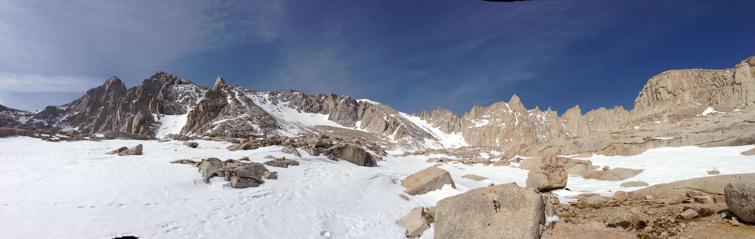
Back by popular demand, it’s the list of gear that I will take up Mt. Whitney in a few days. As always, know the conditions and do not follow my recommendations blindly. Equally as important, know your own body, which will help you determine which items are best for you to keep your core temperature in the proper range during the ascent. As I noted yesterday, the weather on the mountain can change rapidly; and you will need to have the clothes to withstand such climactic changes. Chances are, unless you are some sort of alien, your body will go from cold to hot and back to cold during the hike, which means you will need to layer appropriately to avoid heatstroke or hypothermia. Last, just because I reference a piece of gear in my list that I am using does not mean that you need to have the exact same piece of gear – certain manufacturers make similar gear; some gear I am using may (gasp) be several years old, but reliable; and some gear from other parties may fit you better. Use your best discretion in utilizing this list as it is a mere guide, not the end-all-be-all of gear lists, but you can also be assured that I do know what I’m doing as I’ve been up this mountain 11 times, and summited 7 times, in addition to all of the other mountaineering that I’ve done. So, without further ado, here’s the gear I’ll be taking:

Mandatory (Meaning, I have to have it for the climb in May 2012, and if you are going in May 2012, you should probably have it too):

1)      Backpack: I run a slightly larger Arc’teryx daypack that I’ve been using for several years now. I’m not sure what the model is, but it’s served me well, and I like how Arc’teryx gives you comfortable padding on the shoulders/back/hipbelt. Whatever backpack you are bringing, I suggest that it has a spot to either strap on your ice axe or a loop to attach it. 

2)      Ice Axe/Crampons: At this point in time, there is snow/ice on Whitney, and if you are looking to ascend and descend safely, you will need these tools and the knowledge of how to use them. Both my ice axe and crampons are made by Black Diamond, but there are other solid brands out there. Make sure that the ice axe is sized for your correct height, and the crampons fit your boots ahead of time.

3)      Water: I carry a full four liters, mainly because I like to stay hydrated, which helps with the altitude, and because I hate stopping to filter water. I also like to have extra in reserve for emergencies, and as a bonus tip I’ll admit that I actually carry five liters, in that I’ll probably drink a liter before heading up the trail.

4)      Clothing (to wear): I’m going to be wearing a set of breathable hiking pants; hiking socks (good socks, almost as important as good boots); mid-weight fleece long underwear top; and I’ll bring a soft-shell fleece jacket that’s heavy for two reasons: 1) no need to carry an additional waterproof shell; 2) it will keep you warm when you do stop/protect you from the wind. Chances are I won’t put on my jacket until I get to Trail Crest; at which point I’ll also change my top despite it being a wicking fabric. I will also bring a pair of gaiters, because no one likes snow inside their boots.

5)      Clothing (reserve): Since you don’t want to carry much weight on a one-day climb, you want to keep your reserve clothes to a minimum; while leaving you with room for margin should you need them. Since I carry a soft-shell fleece, I don’t carry an additional jacket. What I do carry is a set of long underwear bottoms, and an extra long underwear top to wear from Trail Crest down. That’s it. The only way I would consider carrying extra clothes than that is if I knew the conditions called for extreme cold or weather, in which case, a lot of things would be different.

6)      Hats: I carry a fleece hat for cold; and a brimmed hat for sun.

7)      Boots: I will be using my set of Asolo Mountaineering boots that fit my crampons. The only good piece of advice I can give you about boots is that you should never take a brand new pair of boots on this hike that have not been broken in. Other than that, it’s personal preference.

8)      Food: Again, for a day climb, you shouldn’t be looking to eat gourmet meals. This again is a personal preference area, but you have to eat. For starters, you are going up 11 miles, and ascending 6,000 feet – you will be burning calories at an amazing rate. If you’re not eating, chances are you’re not going to make it because your body will run out of energy. I personally take energy bars and other high protein sugar fare, and munch through the day, knowing that I can have a good meal the night before and the night after. If you want to take sandwiches/cook food, know that you will be either: a) carrying extra weight; b) taking extra time. If it’s in your timeframe/plan, good for you; I pretty much only stop at Trail Crest and the Summit. Also, as another bonus tip: watch out for marmots when you do stop, because they are looking for food and quite aggressive, and will chew through packs, tents, and other items if you aren’t attentive.

9)      10 Essentials: Some of these are covered above – food, water, clothing. The ones that aren’t – such as matches, water purification tablets, emergency blanket, knife/multitool, map/compass (or GPS), sunscreen, sunglasses, and first aid kit, to name a few, you should have on your person. Even though Whitney is a popular trail, you should always be prepared.

10)  Wagbag/TP: Everyone poos. Chances are you will need to use it. Best bonus tip you will get: bring an extra bag to put the wagbag in, in case of leaks/spills and to cut down on the smell.

 The infamous "Wagbag" - everyone poos!

Optional Gear (You might want it; then again, you might want to save the weight).

1)      Camera: I’ve been to Whitney a lot, so at this point, I rely on my iPhone to get the shots/video. It works great and saves weight.

2)      Trekking Poles: I hear these save knees, but I’m not quite ready to sign up for a set just yet.

3)      Additional Clothes; additional food; additional water; or anything else that you think you need/want in particular. If you think you’re packing too much: you might be – don’t be like this guy here: http://youtu.be/ZzUDr3wdOac, and like me, enjoy your hike/climb!


Going for a Two Day Climb? Check out this list here: http://lastadventurer.com/last-adventurers-fieldnotes/2007/12/10/the-las-list-of-gear-for-whitney-october-19-20-2007.html

Mt. Whitney Trail (Whitney Portal to Summit)

Snowfield in Consultation Lake drainage, June 2011

At 14,505 feet, Mt. Whitney is the highest peak in the continental United States. As the “highest peak”, it carries a certain amount of mountaineering cache. How much mountaineering cache? Well, that depends on what kind of a mountaineer one aspires to be; and when one climbs the mountain. Some mountaineers dismiss the peak as a “walk-up” because in July and August when the snow melts, a summit attempt only requires hiking eleven miles to the summit and eleven miles back down to the trailhead, which requires no technical climbing skills at all. From late fall to mid-summer, when the trail is covered with snow, the peak is not a mere “walk-up”, and technical skills are required to traverse snowfields safely while climbing up to the summit. I’ve been on the peak – and on the mountain a number of times, and what I can say about the mountain is this: there are prettier mountains; there are uglier mountains; it can be a place of mystic serenity; and it can be a place of brutal despair; but even though I’ve summited it seven times, I keep going back because it’s there, and because I like to go to the mountains to seek their tidings for my own inner peace.

But let’s talk about the facts about Mt. Whitney. Assuming you are taking the Whitney Portal Trail – the most popular trail, and the one that is run by a lottery, you are talking about over 6,000 feet of elevation gain to the summit; and 6,000 feet of elevation loss from the summit. You are talking about a total distance of twenty-two miles roundtrip. While these numbers won’t confuse anyone with the distances and the elevations gained and lost in the Himalayas, they’re nothing to take lightly either. This is to say nothing of the other hazards that you will encounter on the mountain: acclimatization issues, heatstroke, dehydration, hypothermia, weather, bears, and yes, marmots. (http://lastadventurer.com/last-adventurers-fieldnotes/2007/11/21/las-guide-to-summiting-whitney-part-v-minor-to-major-potenti.html).

 The "chute", June, 2011

As I mentioned above, I’ve been on the peak a number of times (11); and I’ve summited seven times – this may seem like a lot, until you realize that other, more experienced climbers have been on the peak many more times than you (26 weeks in a row consecutively; 10 times in a week). The best things to know about Whitney are to know your limits and be prepared. What is the best resource for information about Mt. Whitney and current conditions? The Mt. Whitney Portal message board. Every time that I’ve climbed Mt. Whitney (in the internet age), this board has provided me with invaluable resources about conditions and what to expect. This information is crucial, because conditions vary on the mountain from day to day, and month to month. In 2001, when I summited Whitney, it was 95 degrees on the switchbacks – and it felt like 120 in the direct sun. In 2005, I couldn’t make it past Trail Camp in early May because I had no snowshoes, and was breaking trail the whole way. In 2007, when I backpacked up with a group, we had 50-70 mph winds ripping through our camp at Trail Camp all night before our summit bid the next day.

In 2009, I got off the summit just before clouds rolled in and the thundersnow began. In 2010 I got my group off of the summit and trail crest just as it began to snow on the day of the summer solstice. This is to say nothing of what happened in 2002, or any other year. In order to summit the mountain, you have to know the conditions, and be prepared for the conditions, as well as know your own physical condition and limits. Last year, in 2011, when I led my group up in mid-June (when all of these pictures were taken), there was still quite a bit of snow. In fact, there was more snow than when I had taken my group up on June 20, 2010. (Pictures here: http://lastadventurer.com/last-adventurers-fieldnotes/2010/7/1/mt-whitney-portal-to-summit-june-21-2010-part-two.html).

Looking back down the chute, June 2011

Like 2010, we had decided that we were going up the mountain in one day, and we were taking the main trail. Unlike 2010, however, we ran into snow covering the trail from a point just beyond Lone Pine Lake. At that point, it was no problem – since we had the proper gear and knowledge, we traversed firm, packed snow through the drainage of Consultation Lake up toward trail camp. We arrived at Trail Camp at around ~9 a.m., which we assumed would give us plenty of time to traverse the snow covering the “chute” to Trail Crest. However, unlike 2010, the snow in the chute was already warm and slightly sloppy at that time of day. The result? We spent a brutal two hours slogging through knee high soft snow to Trail Crest in the direct sun, which totally destroyed our energy levels.

After a rest, we headed out toward the summit along the backside. While my two climbing partners were still in good form, I was dragging. Even worse, having been up the summit seven times, I knew I was dragging. And this is where the first lesson about Mt. Whitney comes in: know your limits. In the 11 times I have been on the mountain, I have seen all sorts of crazy things, mostly involving people not being prepared, and not knowing their limits. Now, there’s a fine line here: as a mountaineer, you want to push yourself to accomplish your goal; but you also want to be safe. As Sir Edmund Hillary noted, a successful climb of any mountain involves descending. On Whitney, like any mountain, you have to know your limits, especially when risks like altitude sickness do exist. You have to know that when you are on the summit you are only halfway done with the hike. Think about that: on Whitney, when you are on the summit, you still have to descend 11 miles safely, which, like in 2011 and 2010, may be treacherous due to snow and ice. You have to apportion your energy accordingly, and know your limits.

 West Side,Mt. Whitney Trail, June 2011

As for me in 2011, I sat down on the crest within a quarter mile of the summit (how do I know it was ¼ mile or less? Really? After being there past there 7 times, you know) and waited for my friends to come down. Could I have made it to the summit? Sure, I could have made it. Did I have to make it? No. Would anything bad have happened to me on the descent had I gone for it? Probably not. But stopping to rest; take in the view; and the mountain was the right decision and one that I would make again. (More on that here: http://youtu.be/Up-KyPn5Y8g). Was it easy? Nope, I am a very competitive person, and having been to the summit seven times before doesn’t make me less competitive, especially knowing how close I was. Still, it was the right decision, and next week I’ll be going back – and stay tuned to see where I end up on the mountain. But if you are considering attempting to summit, be prepared – and know your limits!

Current Conditions for 2012: There was not much snow this year in the Sierra, so from what I hear, the trail is pretty clear to Trail Camp. However, check back in next week for my report on the trail conditions. At this point, it still appears that you will need an ice axe, and crampons. 

Whitney Portal Message Boards: http://www.whitneyportalstore.com/forum/ubbthreads.php?ubb=postlist&Board=1&page=1