Volcanic Tablelands Petroglyphs

Volcanic Tablelands Petroglyphs

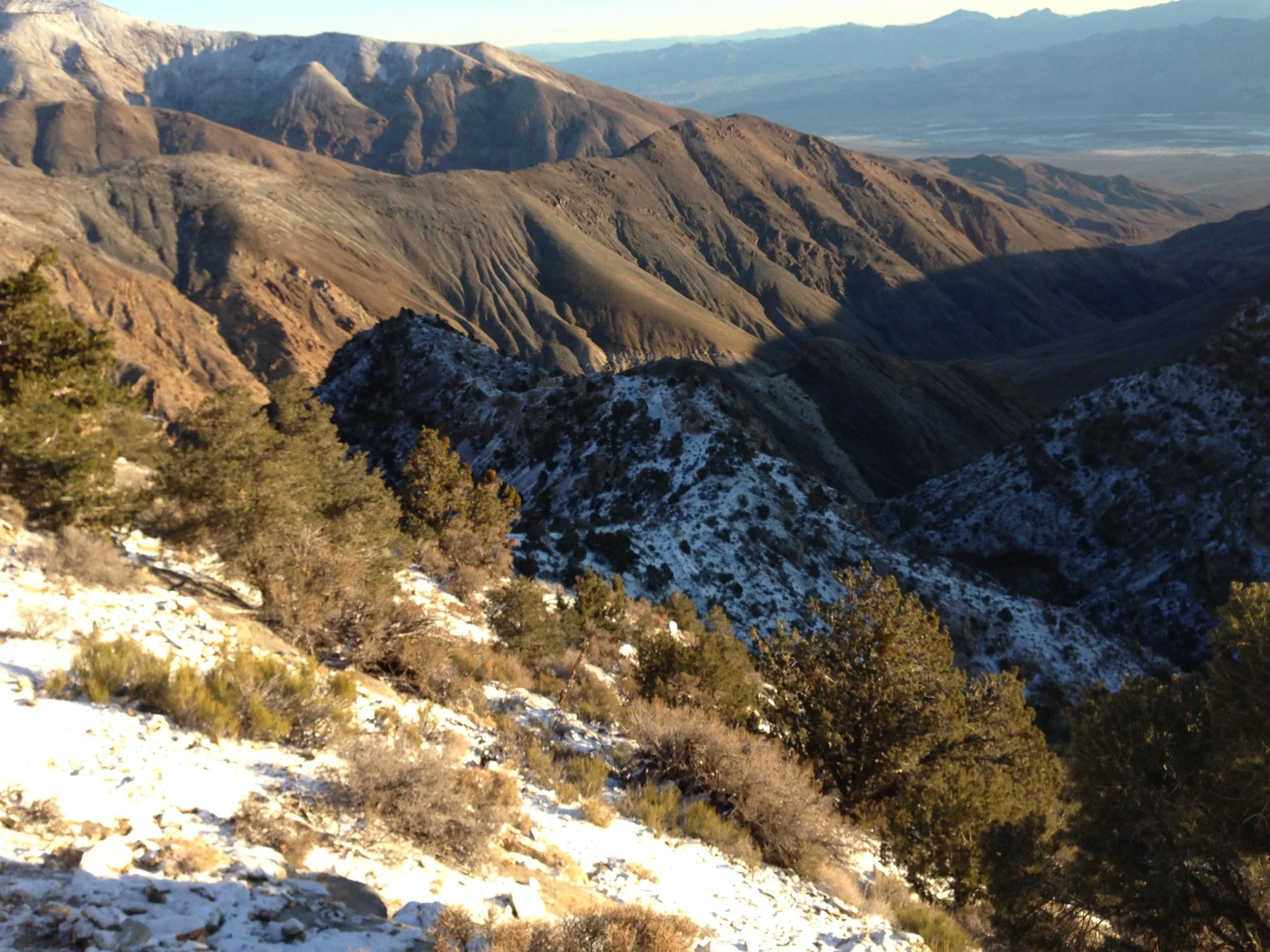
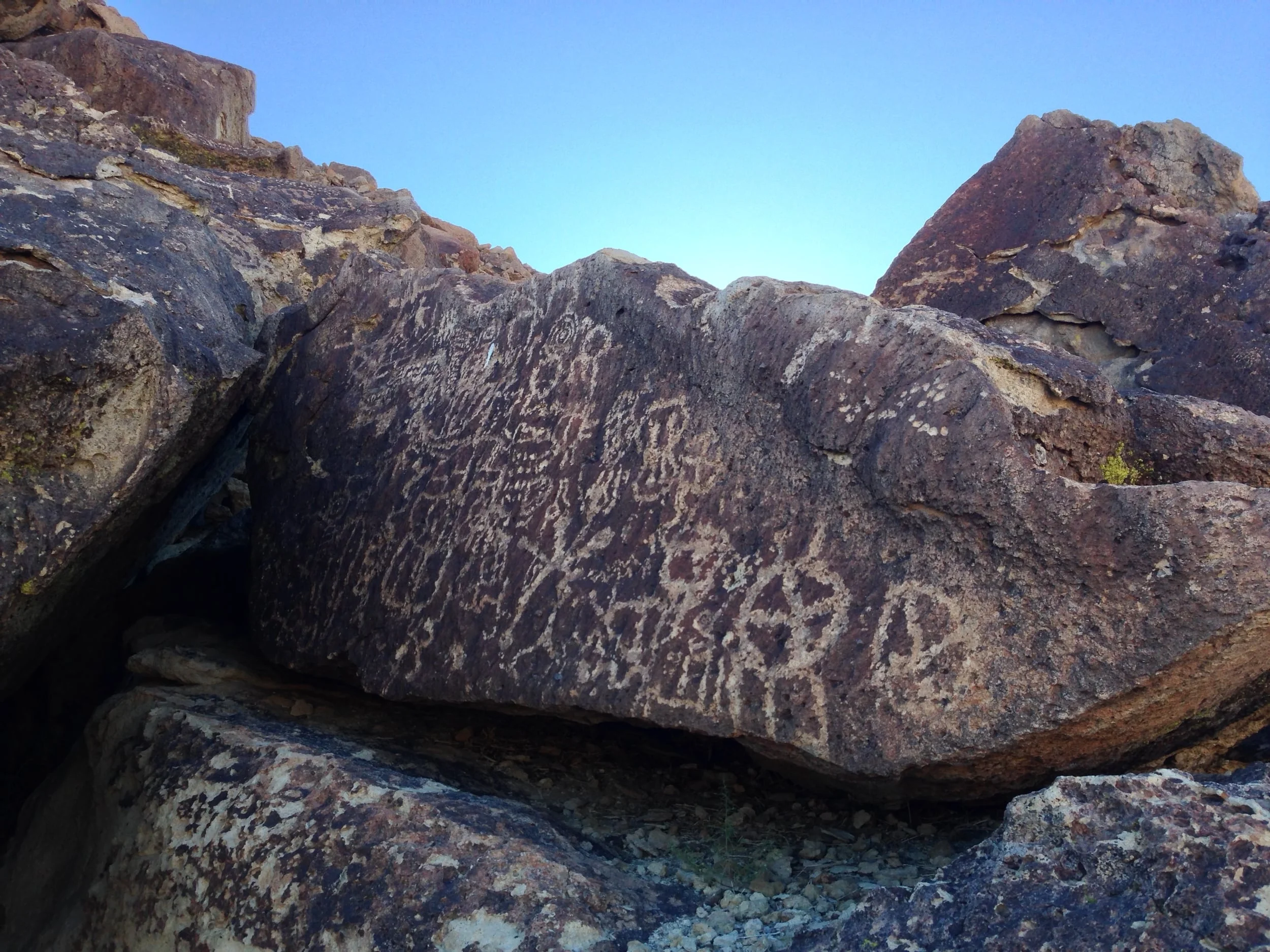
In the case of the Volcanic Tablelands petroglyphs, my decision on whether to provide directions was fairly easy. The Volcanic Tablelands are an area outside of Bishop, California that was formed over 700,000 ago by the Long Valley caldera. In more recent times, the Paiute-Shoshone Indians resided here and created a great deal of rock art – petroglyphs – throughout the Tablelands. Although there are petroglyphs throughout the area, there are a number of large – and stunning groupings in certain specific areas. Even though this land is public land – managed by the Bureau of Land Management – and a protected area, it is a large area that cannot adequately be patrolled by the BLM.

Cathedral Lakes

Cathedral Lakes

The Tuolomne Meadows portion of the park is commonly known as “the high country” of Yosemite, and the reason for this is that this area is above 6,000 feet of elevation. During the winter months, this area is also inaccessible to visitors, unless they have skis or snowshoes, as the main access route – the Tioga Pass Road – becomes snowed in, and is not plowed by the National Park Service. It is also an area that is chock-full of beauty. There are high alpine lakes; there are high mountains that are part of the Sierra Nevada range; there are waterfalls; there are wildflowers; and there is wildlife. It is a stunning portion of the park, and one that every visitor should take the opportunity to visit; and it is also an area that is far from the crowds of Yosemite Valley. While there are many great hikes in the region, one of my favorites is the Cathedral Lakes hike.

Top 5 Things to do in Sequoia National Park

Top 5 Things to do in Sequoia National Park

Sequoia National Park is one of my favorite National Parks. From its tall, majestic trees, to its secret underground caves, and its high lofty mountains, it is a National Park that has almost everything an outdoors aficionado could want. Unfortunately, it is located next to a number of other fantastic National Parks - Kings Canyon, Yosemite, Devil's Postpile; and a number of other great wilderness areas. As such, many people who visit Sequoia have a limited amount of time to see the park before they head onward to their next destination. If you're one of the people who is on the Sierra Nevada park circuit, this list and itinerary is for you; but let me say that if you do have the time, Sequoia is a great spot to spent an extra day or two at. But, without further ado, here's my list of the top five things to do at a day in Sequoia National Park!

General Sherman Tree

General Sherman Tree

In this life, some things just have to be seen to be believed. One of these things is the General Sherman, the largest tree by volume in the world. I realize that statements like the “largest tree by volume in the world” provide no context, so let’s talk hard facts about the General Sherman. First, the General Sherman is a Giant Sequoia (Sequoiadendron giganteum) that was named for General William Tecumseh Sherman, one of the famous generals of the American Civil War. In terms of essential information, it is 275 feet tall from its base to its top; the circumference of its base is 102.6 feet, its maximum diameter at its base is 36.5 feet, and its estimated total volume is a whopping 52,500 cubic feet!

Suicide Rock

Suicide Rock

One of the things most people don’t realize about Southern California is that while we do have beaches and deserts, we also have mountains – and those mountains have a number of great spots for hiking. Idyllwild, California, is a small mountain town that is close to both Los Angeles, and San Diego; it is located on the Western side of Mount San Jacinto, and can be utilized as a jumping off point to climb the mountain; and is also a great spot to go day hiking in or around the city year-round. While I love climbing San Jacinto, and have done so many times, it is a strenuous climb, and is one that is not for everyone. Fortunately, in this case, you don’t have to be a climber to get a great view of Idyllwild, and the surrounding portions of San Jacinto State Park and the San Jacinto – Santa Rosa National Monument as these views can be seen from the best day hike in the area, Suicide Rock.

Mystery Mine, Panamint Mountains

Mystery Mine, Panamint Mountains

One of the many things that I like about Death Valley National Park is its enormous expanse of open terrain. Its enormous swath of desert and mountain wilderness ensures that you will have solitude to appreciate the park's many amazing geologic features; and it also ensures that you will have the opportunity to have an adventure, and if you're lucky, the chance to discover things that have been lost. For example, earlier this year, when thepeakseeker and I were attempting the Shorty's Well Route (Trip Report here) to the top of Telescope Peak, we came across an abandoned mine. While abandoned mines are common in Death Valley due to the park's mining history, the location of this mine was unexpected. We had backpacked into the Panamint Mountains from the Badwater Basin; and had passed Shorty's Well, and Shorty's Mine. From the mine, we had followed a foot trail which had gradually become steeper deep into the mountains. At the end of the first day of backpacking, we had traveled ten miles from the nearest "road"; and were truly off the grid.