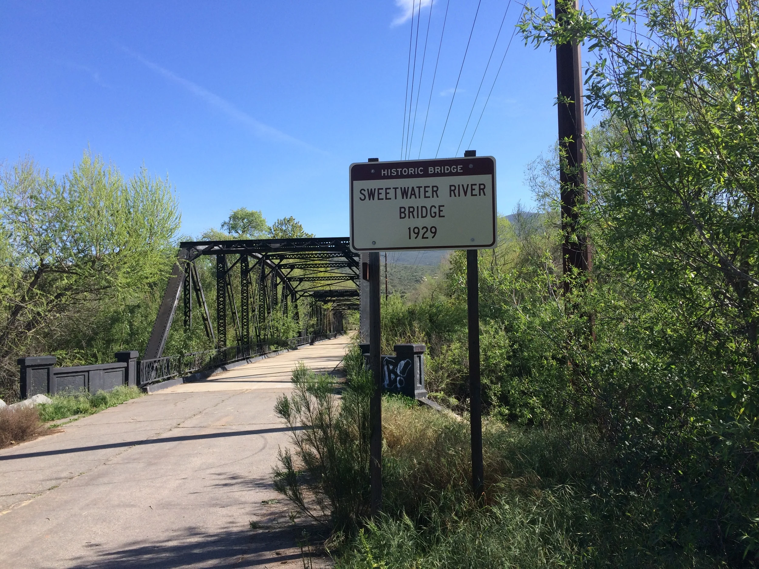
One of the more unique items to be found out in the East County of San Diego is a bridge that is not connected to a road, and at times, does not cross water. The Sweetwater Bridge was built in 1929 to bridge the Sweetwater River, and at the time connected both ends of Highway 94. While it may appear imposing at four hundred and sixty feet in length, and twenty-two feet in width, it was in actuality, a narrow bridge in 1929, and a narrow bridge through its eventual retirement in 1987. In 1987, the road was re-routed slightly and a new, modern bridge was built right next to it on Highway 94.
Farewell Spit
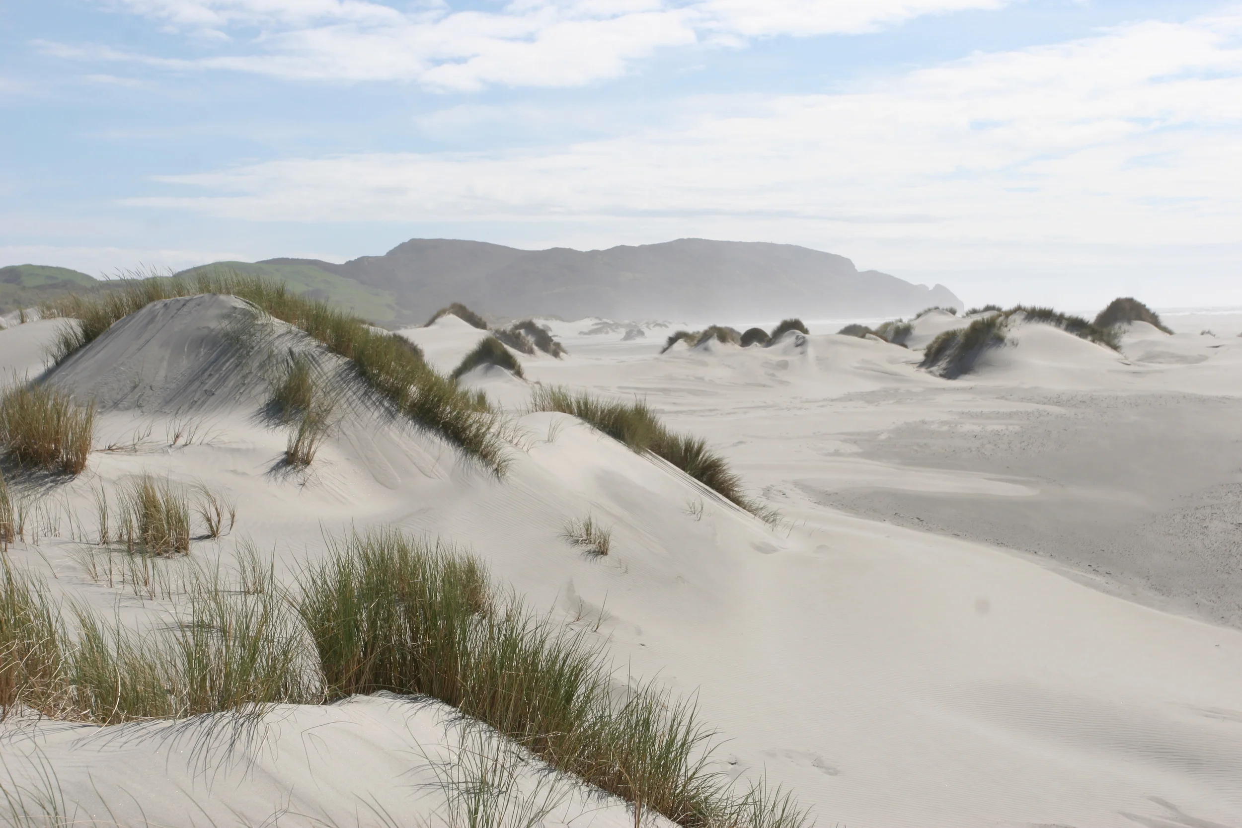
After all of the Lord of the Rings movies, and the Hobbit movies, much is made of New Zealand being exactly like Middle Earth, with rolling green hills, high snow-capped mountains, and lush forests and roaring rivers. While New Zealand has all of these things and more, it also has an area that appears to be lifted straight from the Sahara, or from one of the deep deserts of the world. That place is the Farewell Spit, a fifteen mile (25km) stretch of land that extends from the northern section of the South Island of New Zealand. And for those willing to explore it, the Farewell Spit features sand dunes, blowing sand storms, long stretches of sandy coast, wildlife, and hidden pools of water.
How to Explore Tortuguero
Tortuguero is a town and a National Park on the Caribbean coastline of Costa Rica; and it is also one of the best destinations to visit in the country, as it provides a plethora of unique wilderness experiences for all levels of visitors. While all of Costa Rica’s national parks are stunning, Tortuguero National Park is perhaps the country’s most pristine national park. Tortuguero National Park has an enormous amount of biodiversity including mangrove forests, beaches, swamps, lagoons, and of course, tropical rainforests. While the park protects many species of animals and plants, the main species (and attraction) that is protected is the Green Sea Turtle, which nests on the beaches of the park from July to October.
Badwater Basin
Of the fifty-nine National Parks in the United States, Death Valley is the most infamous, and the least well known. Most people assume that Death Valley is an inhospitable wasteland, with nothing of interest to see or do. However, outdoorspeople, geologists, and adventurers know that Death Valley is a location with interesting geologic features, mining history, tall mountains, sand dunes, volcanic activity, historic structures, and much more. Even if it did not have all of these things and more, Death Valley is a notable location to visit because of Badwater Basin.
Bridge to Nowhere
For the majority of the United States and the world, Los Angeles is many things, including an urban mecca. And even though it may not seem like it, Los Angeles is also a hiking mecca as well. Like most of Southern California, Los Angeles has a variety of terrain types ranging from beach, to alpine, to desert, and almost everything in between. Although there are many great hikes in the city of Los Angeles, and the greater Los Angeles area, there is only one hike that leads to an abandoned bridge in the middle of the San Gabriel Mountains. Over the last twenty years, this hike has become known as “the Bridge to Nowhere” hike, and is perhaps one of the most popular hikes in the city, if not the most popular.
Current Winter Conditions 2016, Mount San Jacinto
Out of all the continental United States, Southern California offers some of the greatest variety in terrain. What it does not offer on occasion on certain trails is serenity, and solitude. While popular trails face heavy traffic nation-wide, popular trails in Southern California sometimes resemble a human version of the region’s congested roadways. Despite these problems, hikers of all skill levels in the region – especially in 2016 – know where to go and when to go to avoid crowds, thanks in part to the internet, and thanks in part to a greater interest in hiking generally. One of the routes in the region that has always been popular has been the Aerial Tramway to San Jacinto summit, due in part to the moderate distance (11.5 miles roundtrip), moderate elevation gain (2,190 feet), unique aerial tram ride experience, and possibility of summitting one of Southern California’s highest mountains (unofficially now known as the “Six Pack of Peaks”).
High Point Trail
Although it is hard to pick the absolute best thing about Torrey Pines State Reserve, one of the top things about the park is its fantastic views. While it is nearly impossible to find a bad view in the park, one of the best views to be found is from the High Point Overlook, which is located near the center of the park. The High Point Overlook is located at the end of the park’s shortest trail (the High Point Trail), and is also the tallest point in the reserve.


